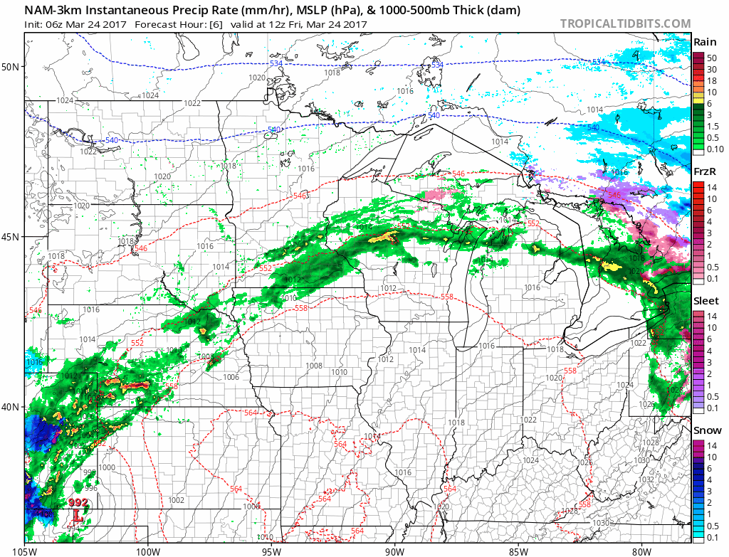
Synopsis: Good morning and thanks for checking out the zone 9 blog! In today’s update, we are tracking an area of low pressure to our south dragging a warm front through southeastern South Dakota, southern Minnesota, and southern Wisconsin. This active regime will continue through the next two weeks with plentiful rainfall and temperatures well above normal across the south. Northern areas will be under the influence of drier high pressure, keeping these areas slightly drier than normal.
The warm front today will focus showers and even a few thunderstorms from southeastern South Dakota to southern Wisconsin through tonight.
This area of low pressure will hang around southeastern areas through the day Saturday with some showers. Further west across the Dakotas, some sunshine and temperatures in the 50s and 60s will be common.
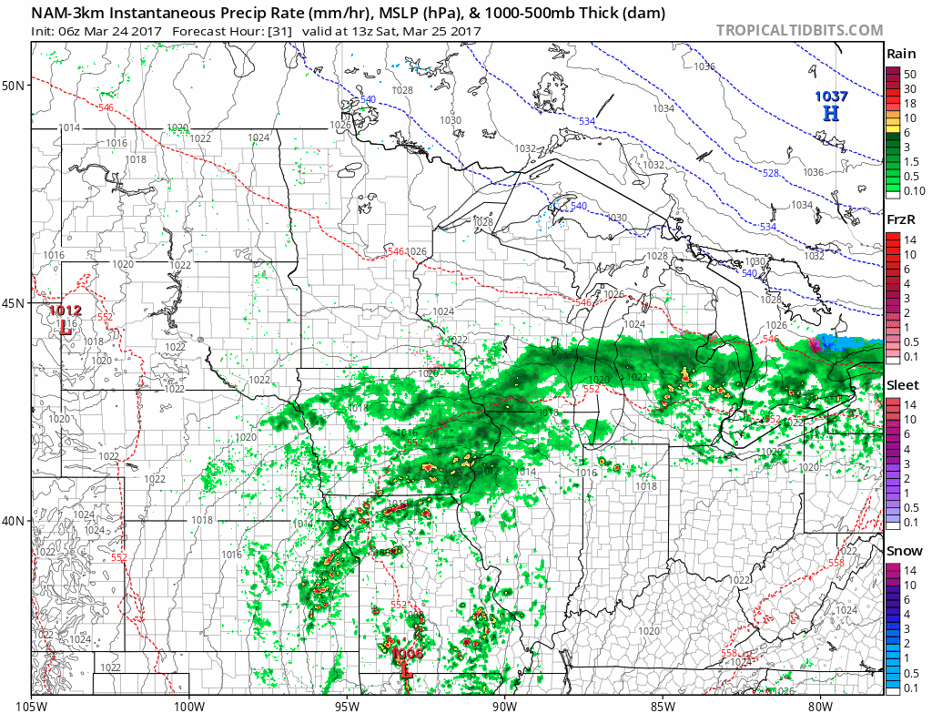
A few showers will occur across the western Dakotas Saturday night into Sunday, but won’t add up to much more than 0.10-0.25″. Showers will also continue across southern Wisconsin and Minnesota, with even some light freezing rain across central Minnesota Sunday morning.
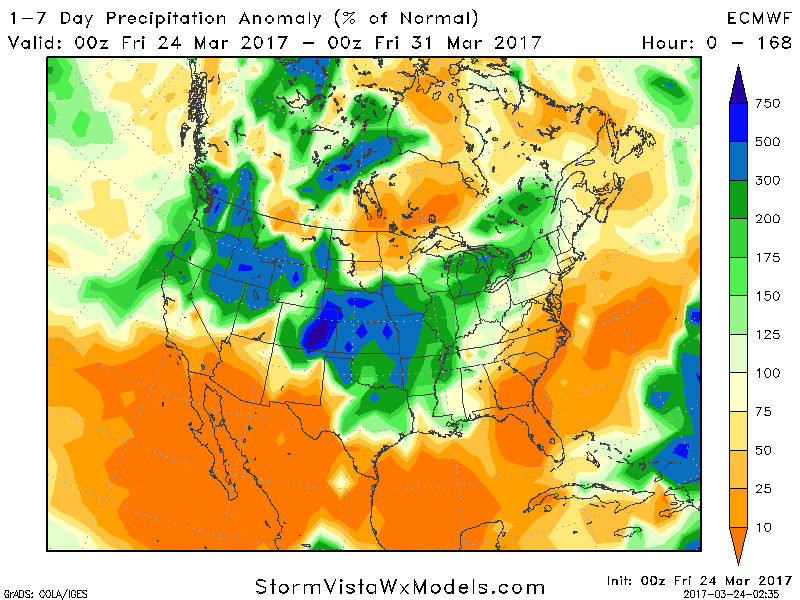
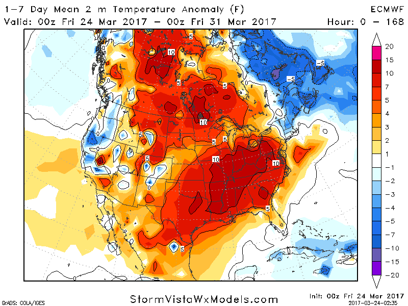
Precipitation over the next 7 days looks a bit below normal across northern areas, with southern areas well above normal.
Temperatures will run 4-8°F above normal region wide during that same timeframe.
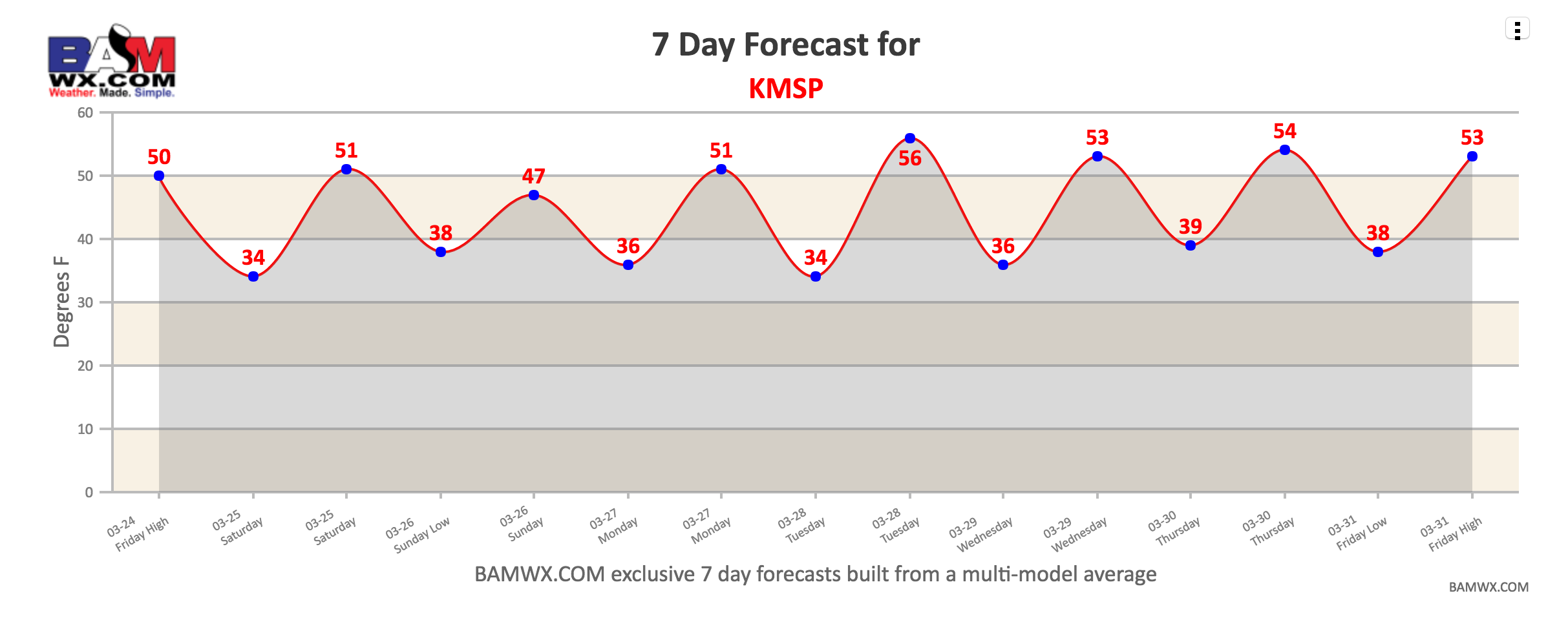
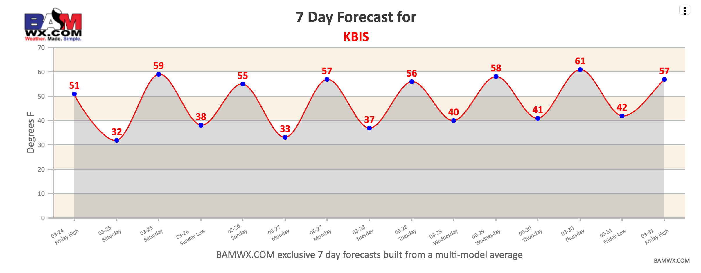
Here’s a look at our exclusive 7 day forecasts for Bismarck, ND and Minneapolis, MN. Again, you have access to these under the “zones” tab, then click on “7 day forecasts”.
Confidence and Risks:
- Above average confidence in wet conditions persisting in southeastern areas through the next week while northern areas run a bit below normal.
- Above average confidence in temperatures well above normal through the next week.
The video below (7 min) breaks it all down. Have a great weekend! ~Ed