#NDwx #SDwx #MNwx #WIwx Wet and Stormy South, Dry and Warm North Through The Weekend.
Synopsis: Good morning! We continue to watch the storm track being mainly shunted to our south this week with warmer than normal temperatures for this time of year. This looks to continue over the next 2 weeks, with best rainfall chances found across southern Minnesota and Wisconsin. We also launched a new “QuickCast” product today, giving the forecast information in an easy to read format for on-the-go viewing. Here it is!
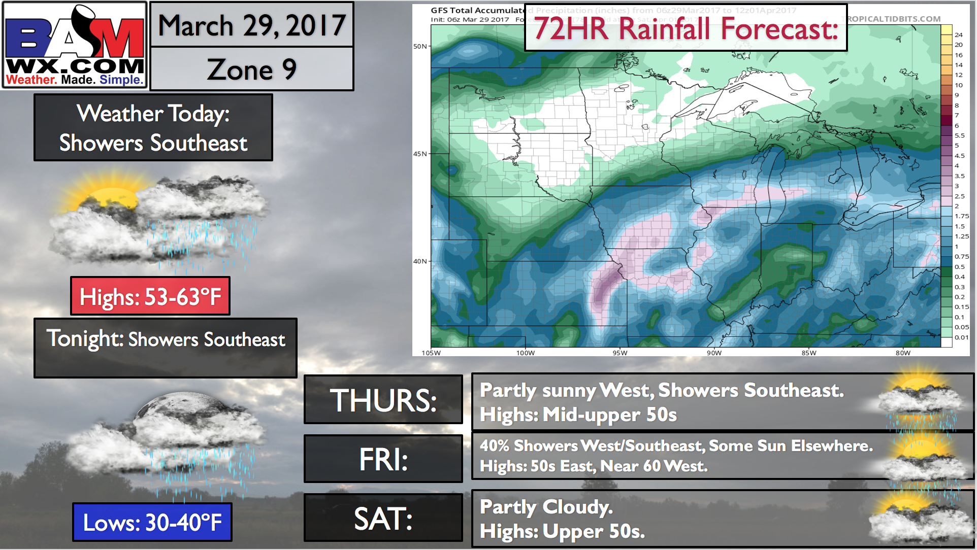
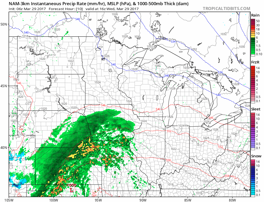
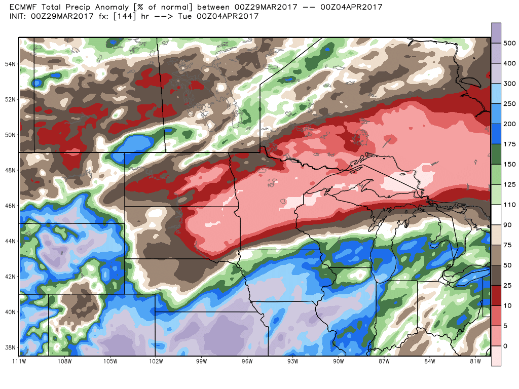
A storm system will move southeast of the region this afternoon into Thursday bringing some appreciable rains to extreme southeastern Minnesota and southern Wisconsin. As shown above, this will bring 1-2″ rain for most in those areas while the Dakotas and northern MN/WI remain dry.
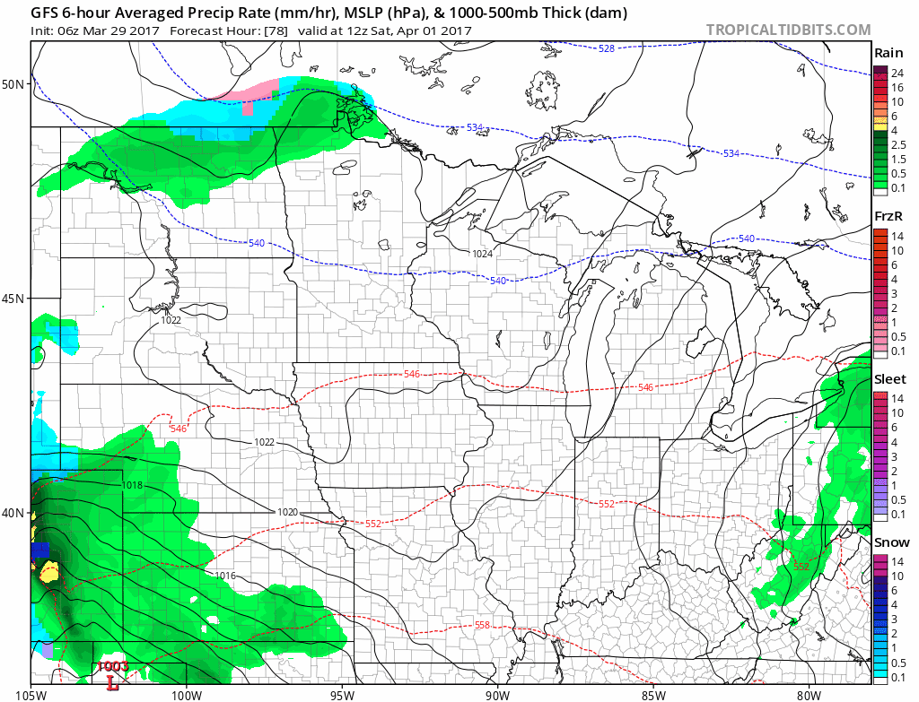
Through the weekend, some light showers are possible across northern areas Saturday, then another system will pass to our south through Sunday night.
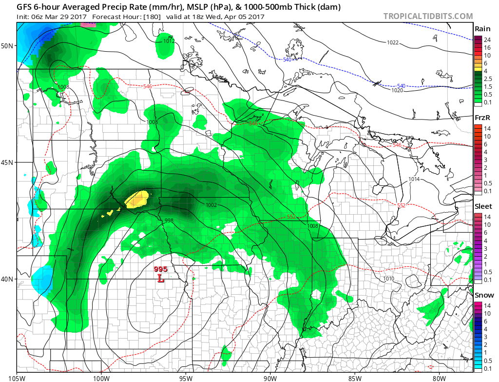
A more significant system is possible by midweek next week with more widespread rains, but uncertainty remains high on timing and track of this system.
Before we get to any system midweek, precipitation anomalies (percent of normal) will be VERY low in northern areas, between 0-25% of normal. It will be near to above normal in far southeastern areas.
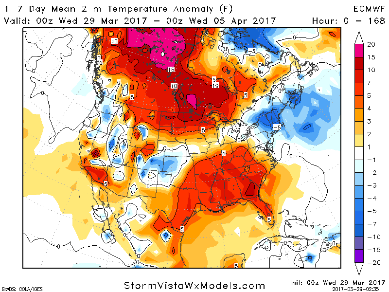
Temperatures for the next 7 days look quite warm compared to normal, especially north.
Risks and Confidence:
- Above average confidence on dry conditions across northern portions of the forecast area through early next week.
- Above average confidence on wet conditions in extreme southern Minnesota and southern Wisconsin through next week.
- Above average confidence on warmer than normal temperatures over the next 1-2 weeks, especially north.
- Low to average confidence on a storm system midweek next week. Still some uncertainty as to track and intensity.
Today’s video (5 minutes):