#NDwx #SDwx #MNwx #WIwx Largely Dry and Warm Week, Wetter Trend Into Next Weekend? E.
Key Points: May 30, 2017
Synopsis: Good Tuesday morning! We hope you had a wonderful holiday weekend! We continue to track a cool pool of air aloft that will lead to some afternoon shower and thunderstorm chances through today across Minnesota and Wisconsin, while the Dakotas remain mainly dry. A drier and warmer pattern is likely to start the week west as a ridge of high pressure controls the pattern. As this ridge moves east late week, it will allow storm chances to return to the Dakotas Friday into the weekend. Have a blessed day!
- The pattern this week will depend on where you are located across the northern Plains. The Dakotas look drier and warmer while eastern areas look to have a better opportunity for spotty showers and storms.
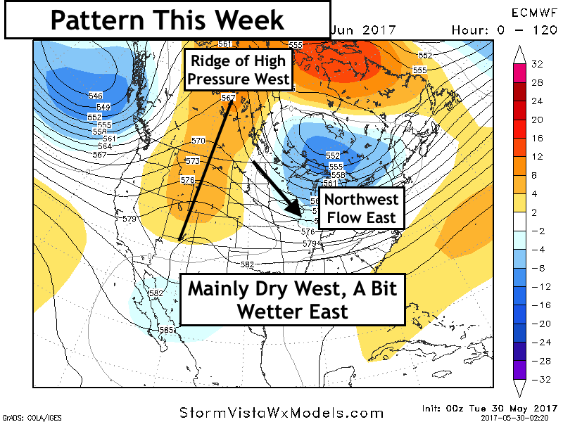
- Temperatures this week look rather warm across the Dakotas thanks to that ridge of high pressure. Cooler temperatures are expected further east. Our week 1 forecast is below.

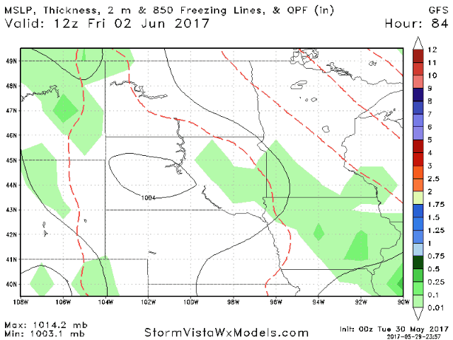
- Toward the weekend, the ridge of high pressure looks to break down, increasing the risk for rainfall across the region. Here’s the latest GFS model.
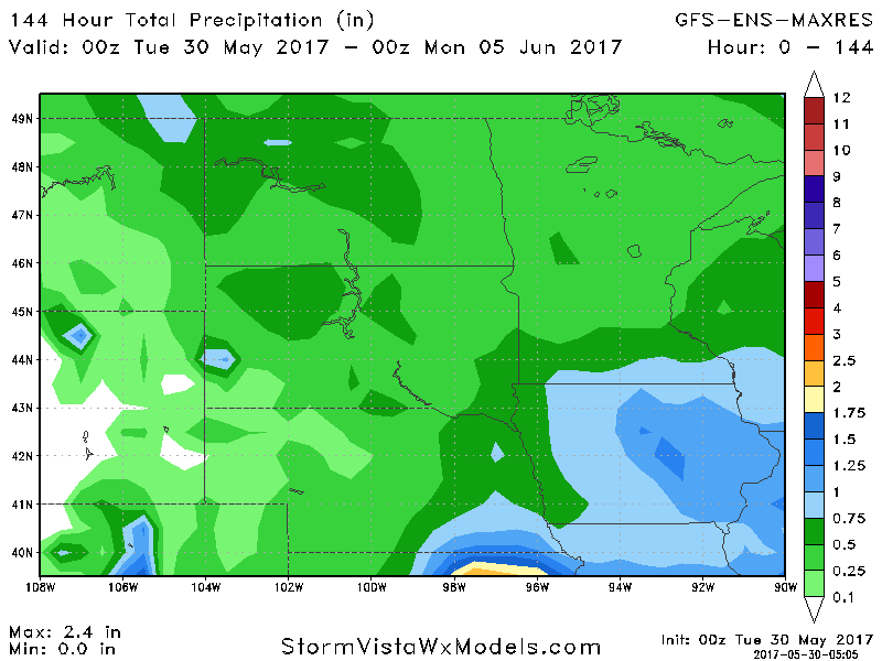
- Total rainfall through the weekend will be storm dependent, which will get refined as move closer. Here’s an idea of what may occur – a general 0.25-0.75″ possible.
- Beyond this, we are watching the Pacific Jet to ramp back up into week 2. This likely will lead to wetter risks, especially across the eastern portion of the forecast area. The Dakotas still have a dry risk moving forward.
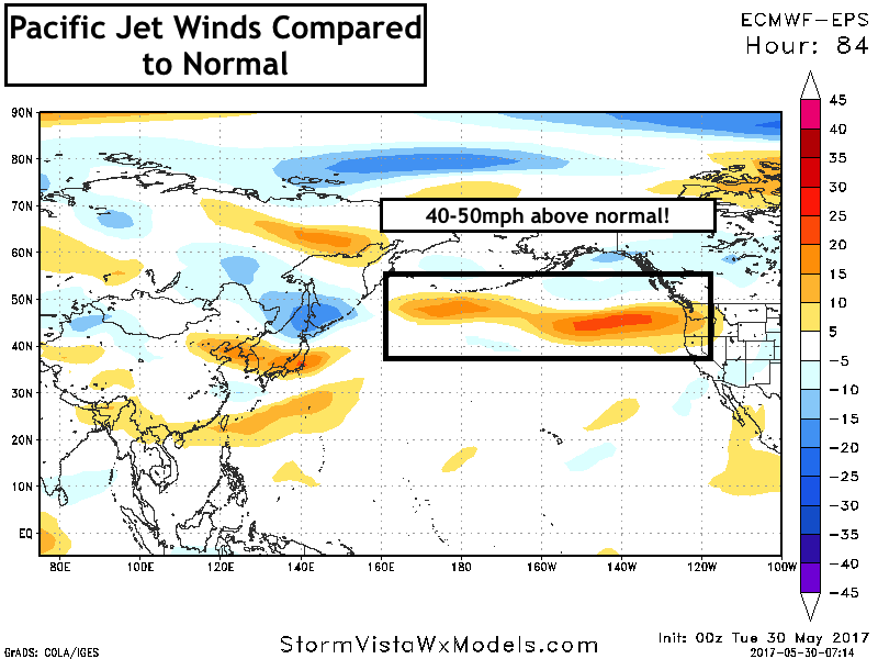
- This is shown well in our week 2 precipitation forecast. Note the Dakotas could go either way, leaning drier.

Confidence and Risks:
- Above average confidence in a warm, dry start to the week across the Dakotas, with shower and storm chances mainly focused east.
- Increasing confidence in some rain chances across the entire region by the weekend as high pressure breaks down. Exact placement of rains will be ironed out as we get closer.
- Above average confidence in a wetter than normal regime continuing east thanks to an active Pacific jet stream.
Today’s Video (7 minutes):