Good Monday morning! A front will bring the risk for a few t’storms over the next couple of days, then a larger system looks to move through the region Wednesday into Thursday bringing the threat for more widespread showers and storms, and possibly some severe weather. All the details in today’s video below. Have a great day, and let us know if you have any questions! N.
Today’s Video (6:42):
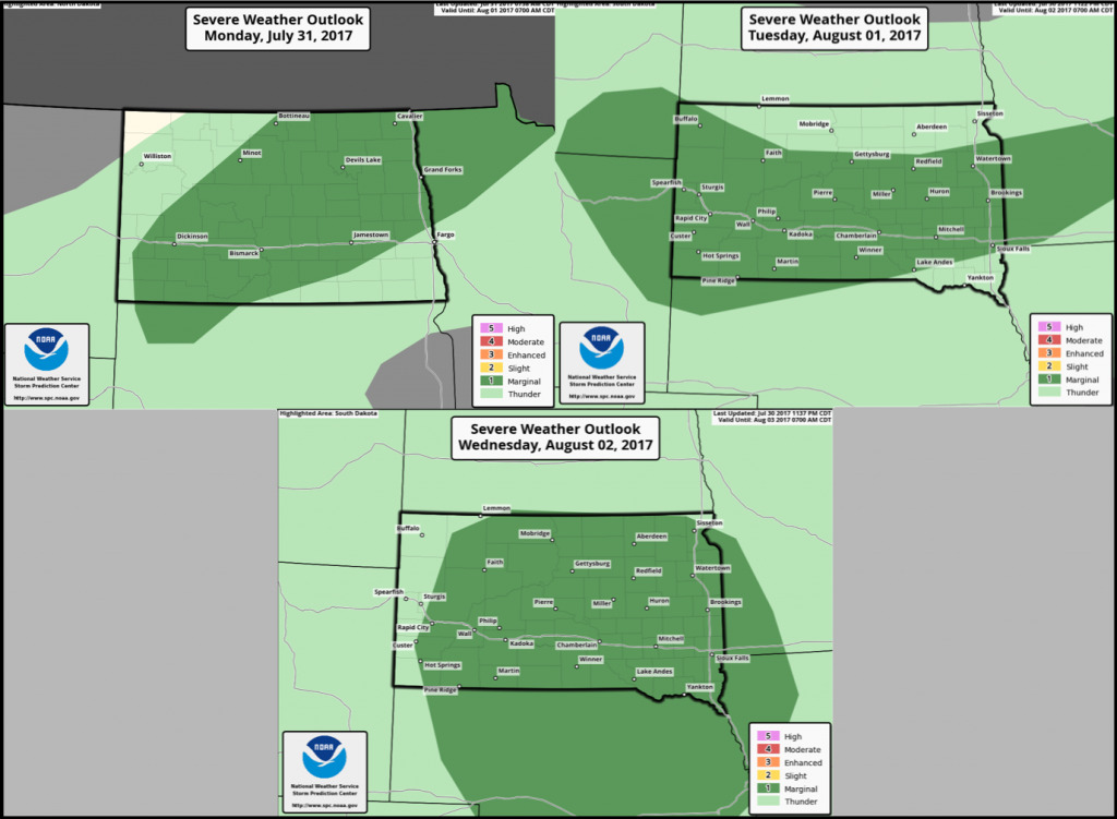
Here are the severe weather outlooks into mid-week:
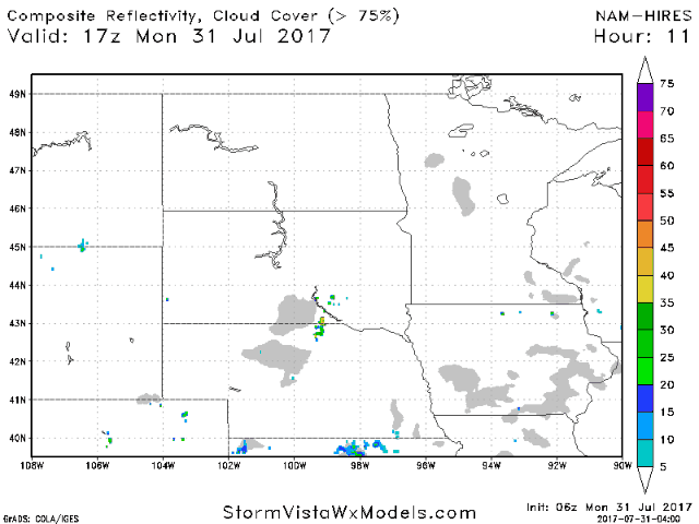
A front will spark storms late this afternoon into tonight across North Dakota. Wind and hail are the main threats with these storms. Below is an animation of the hi-res NAM going into tonight.
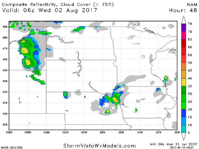
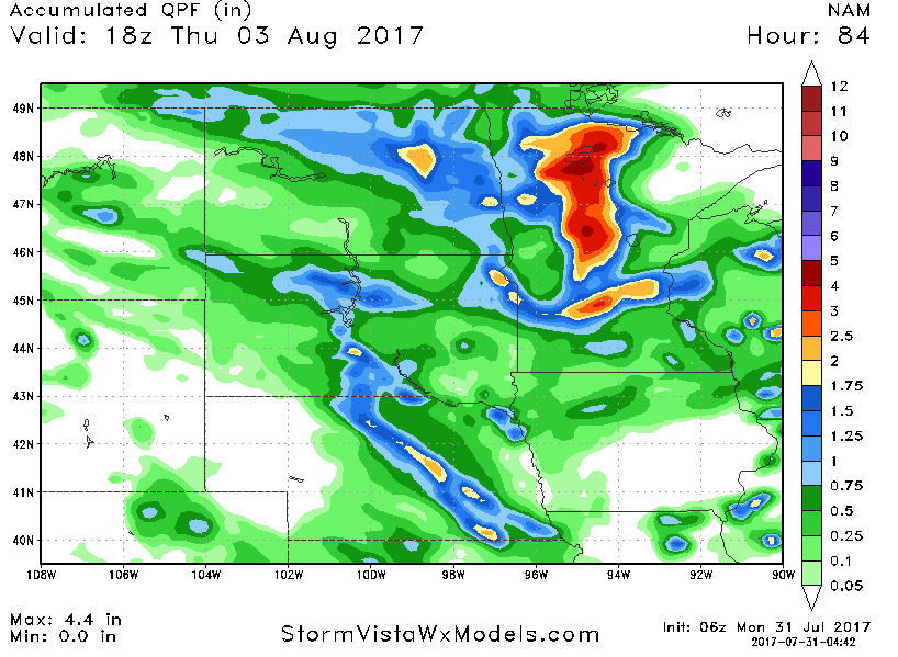
A potent system will move across the region Wednesday into Thursday, bringing more widespread showers and storms. Check it out on the NAM model below.
Some areas could cash in on heavy rain totals as well.
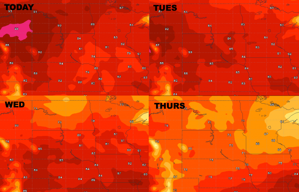
Here are the forecast highs over the next 4 days. Once the mid-week system passes, a big cool-down is in store late week!
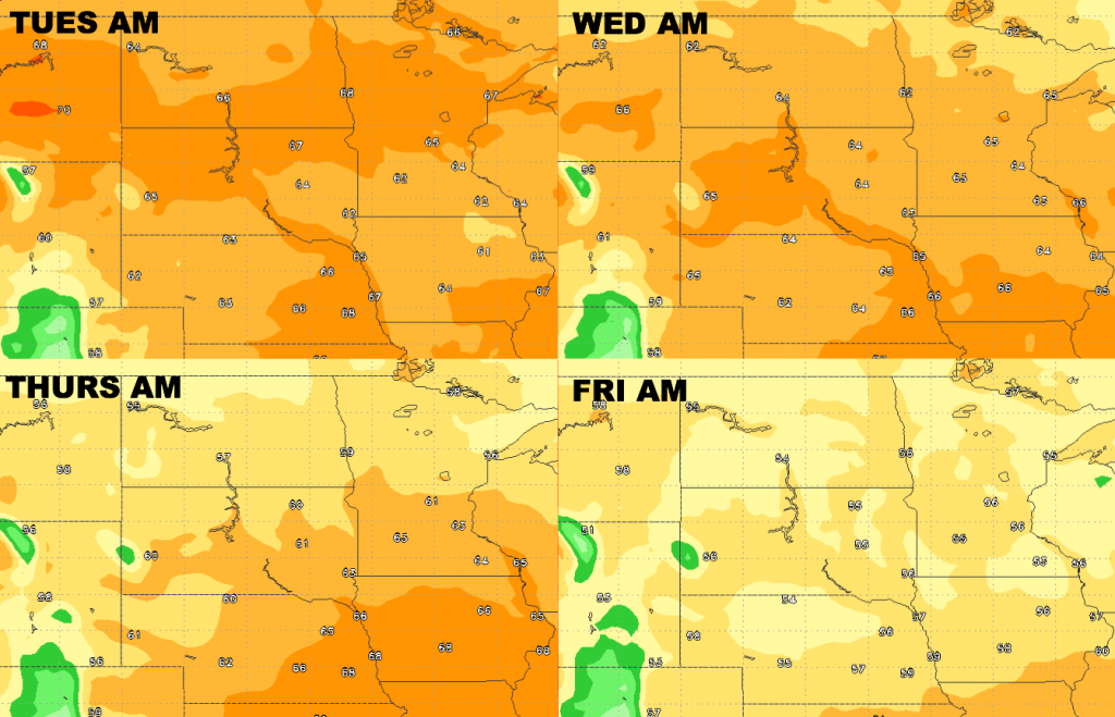
Low temperature guidance through Friday morning is shown below.
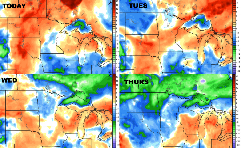
Here are the dew points from normal over the next 4 days.
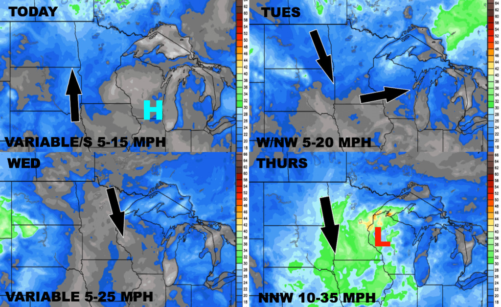
Here is the wind forecast over the next 4 days. Thursday is looking to be the windiest day this week.