Key Points – April 19, 2017:
Synopsis: Good Wednesday morning! We continue to have a growing concern for some planting delays across Zone 9 with the continued heavier rains and cold shots forecasted ahead every ~4-5 days. Heavy rainfall pushing off to the north and east that will expand in coverage today across the Dakotas, Minnesota into Wisconsin later today as well. Next more robust system that moves in is not going to come in until early next week ~Monday afternoon and then another rain chance moves in by mid-next week. We continue to have concern for overnight lows dropping into the 30s even 20s late week into next week, this is a concern we have heading into May as well which certainly doesn’t help the preparations for planting. Have a blessed day!
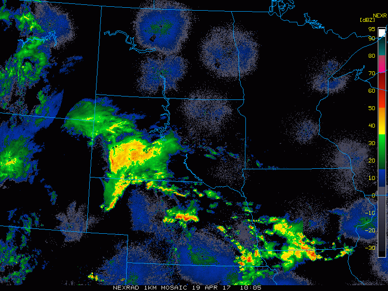
Current radar:
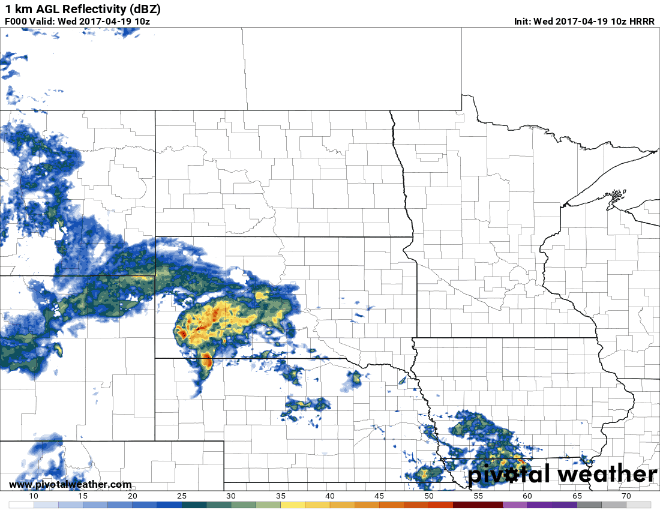
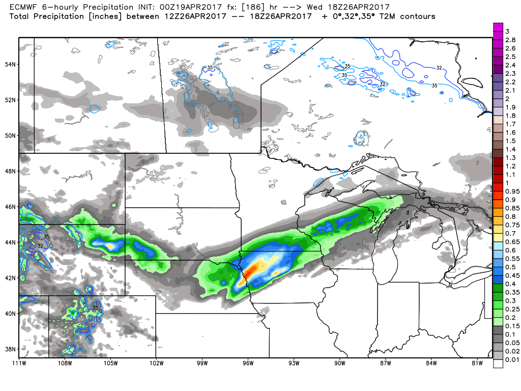
Simulated radar via the HRRR model as we go throughout the day the rain expands across the Dakotas into Minnesota later today and into Wisconsin by later tonight.
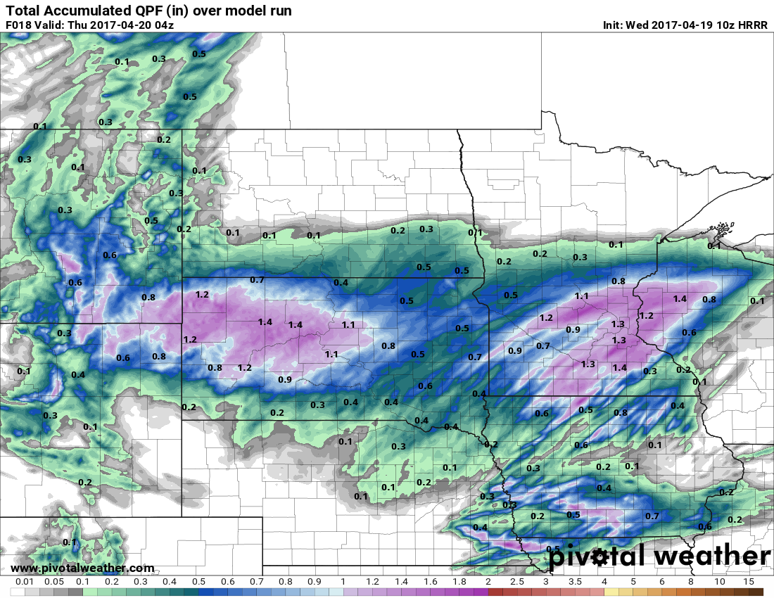
Total rainfall from this system is going to be between 0.5-1.5″ as the wave tracks east today through Thursday morning.
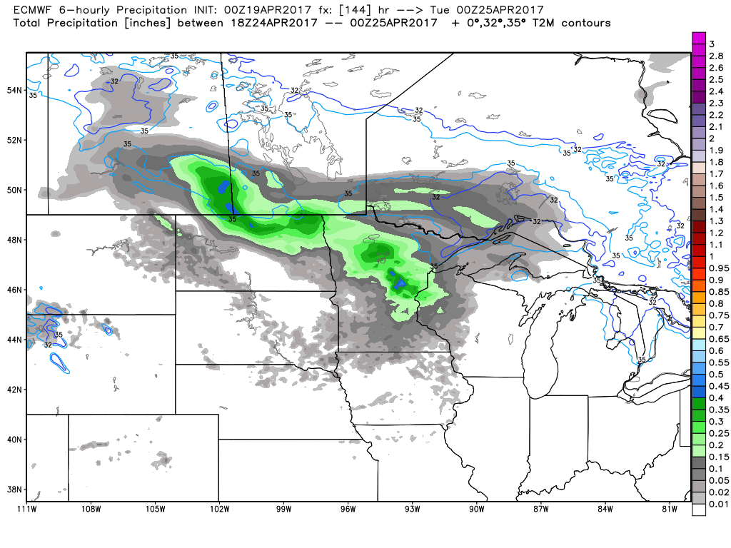
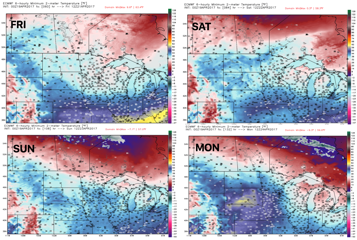
Next chance for more widespread rains doesn’t come until early next week ~Monday afternoon as a disturbance tracks west to east seen well by the European model. Otherwise, we are fairly dry and clear through the weekend.
Another system is forecasted to track through Zone 9 next Wednesday into Thursday especially across southern South Dakota and southeastern Minnesota.
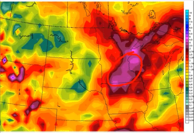
10-day rainfall totals from the GFS with a concerning look from Minnesota getting into Wisconsin advertising over 3.0″+ possible. Certainly not lacking any rain over the next week and a half.
Still continue to have frost on vegetation concerns late week getting into next week with overnight lows forecast in the 30s to even 20s at times…we think this threat is legitimate across Zone 9 into May as well.
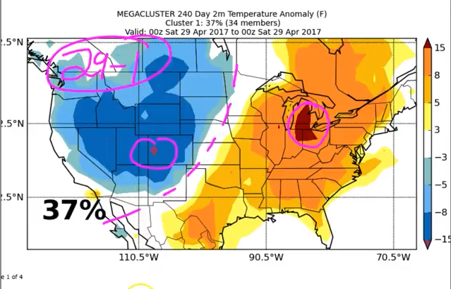
Something to also watch, targeting a big system ~April 29-May 1 as we have a big clash of air masses being forecasted by our mega cluster data.
Confidence and Risk:
- Above average confidence heavier shows trek east today across the Dakotas, Minnesota into Wisconsin getting into later today.
- Average confidence our next storm system following this doesn’t come through until next Monday afternoon.
- Average risk for heavy rainfall especially across Minnesota and Wisconsin over the next 10 days.
- Average risk for frost potential on vegetation late weekend into early next week as temps are forecasted to get down into the lower 30s and upper 20s even at times.
Today’s video (7 min):