Key Points – Tuesday, April 18, 2017:
Synopsis: Hey good Tuesday morning! We discuss the showers and t’storms, even some snow showers working in across portions of Minnesota which is incredible given it’s mid-April! The bulk of the heavier showers move off to the east by early afternoon today, however some gusty winds over 40mph will be possible. Our next chance for heavy rain comes on Wednesday into Thursday morning as showers and storms move along the warm front, not out of the question for some locations to see 1.5-2.0″+ of rainfall over the next 3 days. Dry time settles in Thursday into late weekend before our next rainmaker moves in Monday into Tuesday. We also discuss in the discussion and in the video how the frost/freeze threats remain alive with temps in the northern Zone locations still seeing 30s even upper 20s into late month. Have a blessed day!
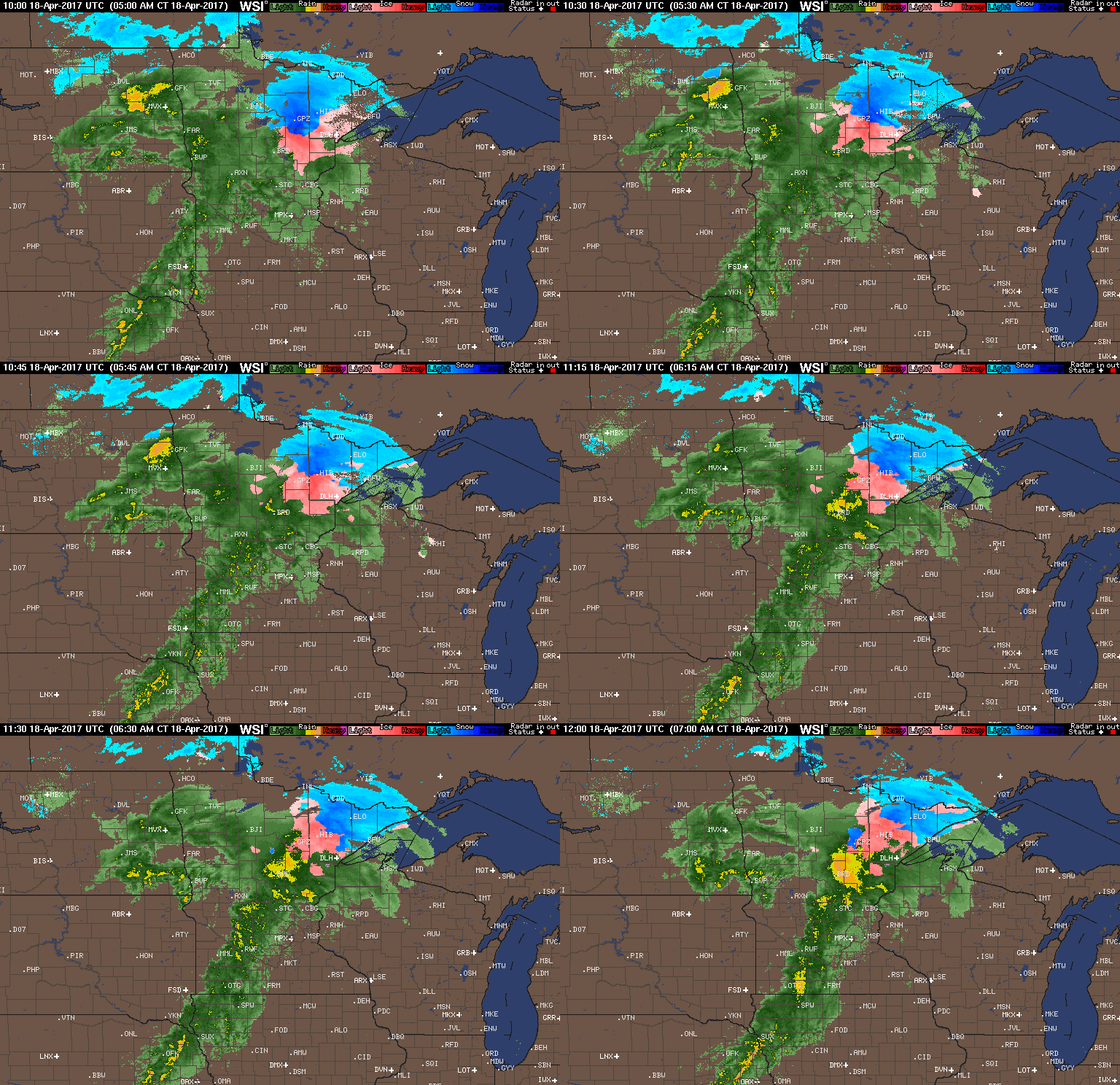
Current Radar with some wintry precipitation working in across northern Minnesota this morning, heavier showers working west to east further south.
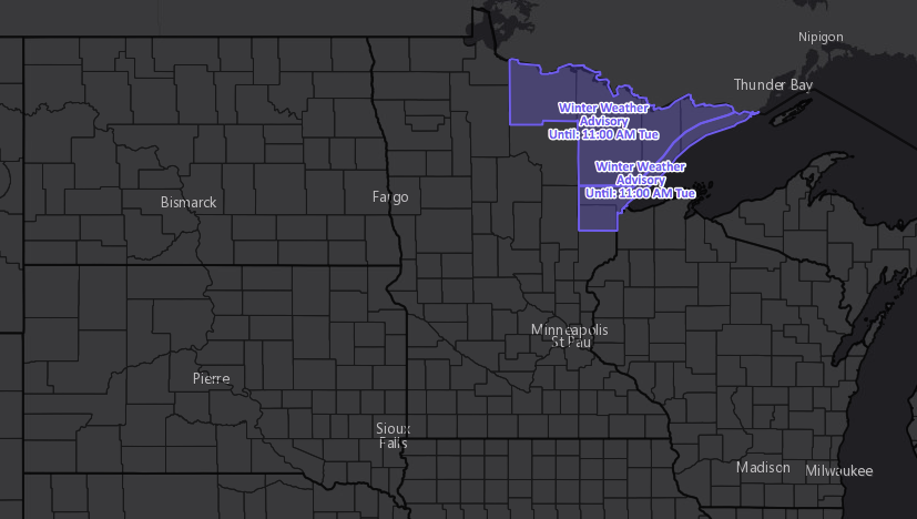
Current winter weather advisories across Minnesota through 11am this morning.
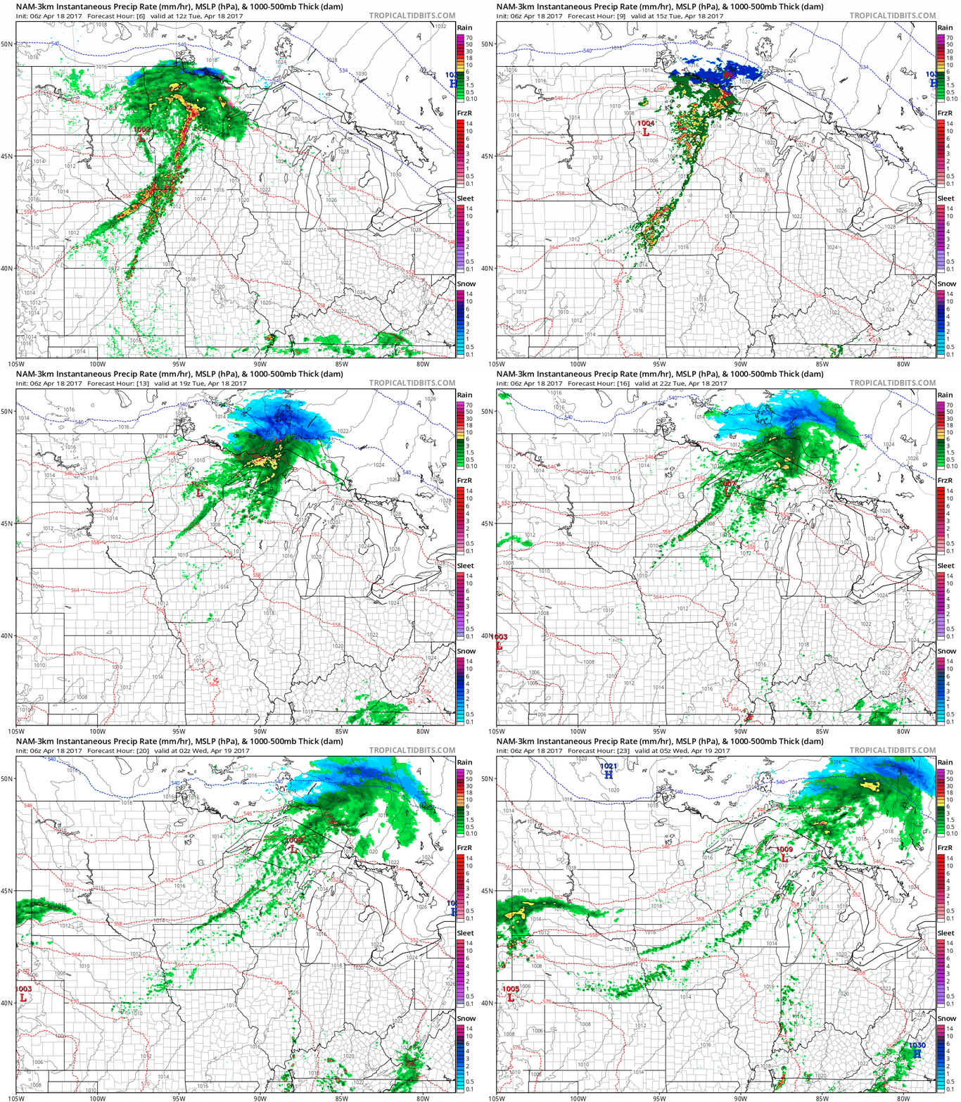
Simulated radar for today…the bulk of the heavier showers push-off to the east by about 1-2pm today.
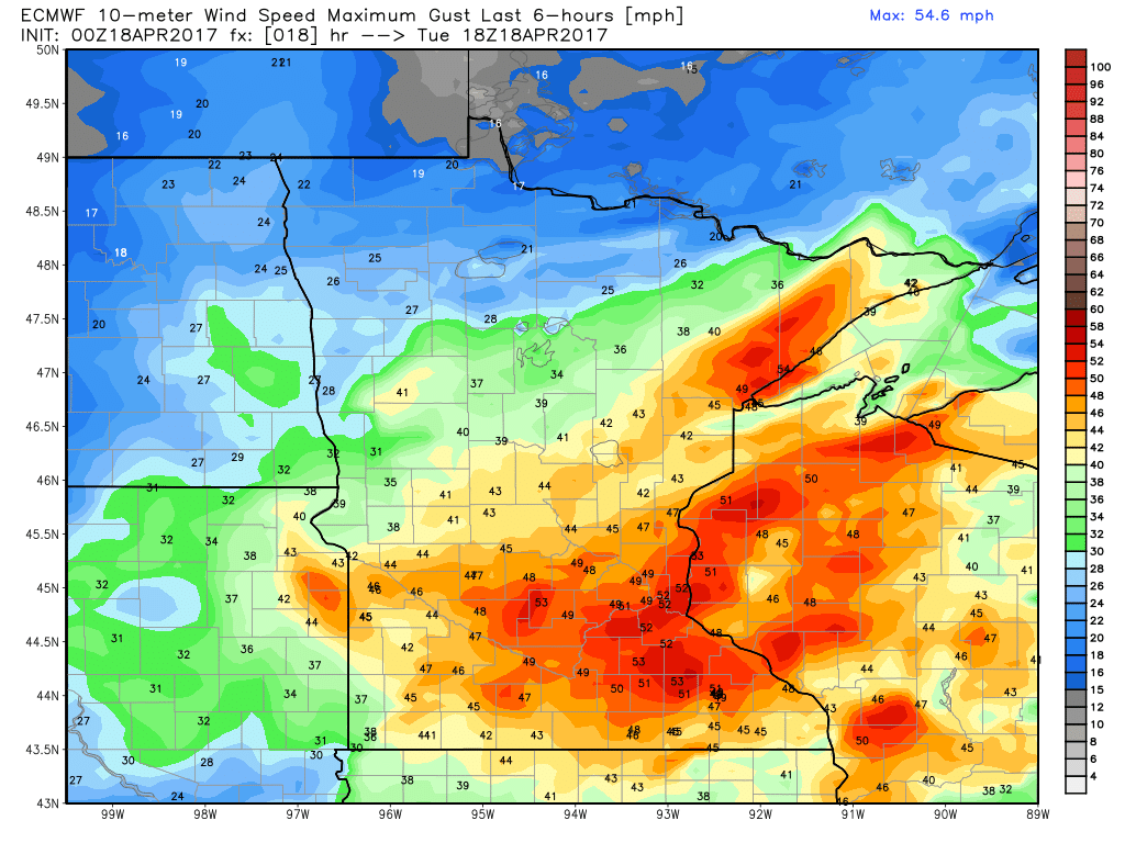
Some gusty winds will be possible across portions of Minnesota getting into Wisconsin as well over 40mph+.
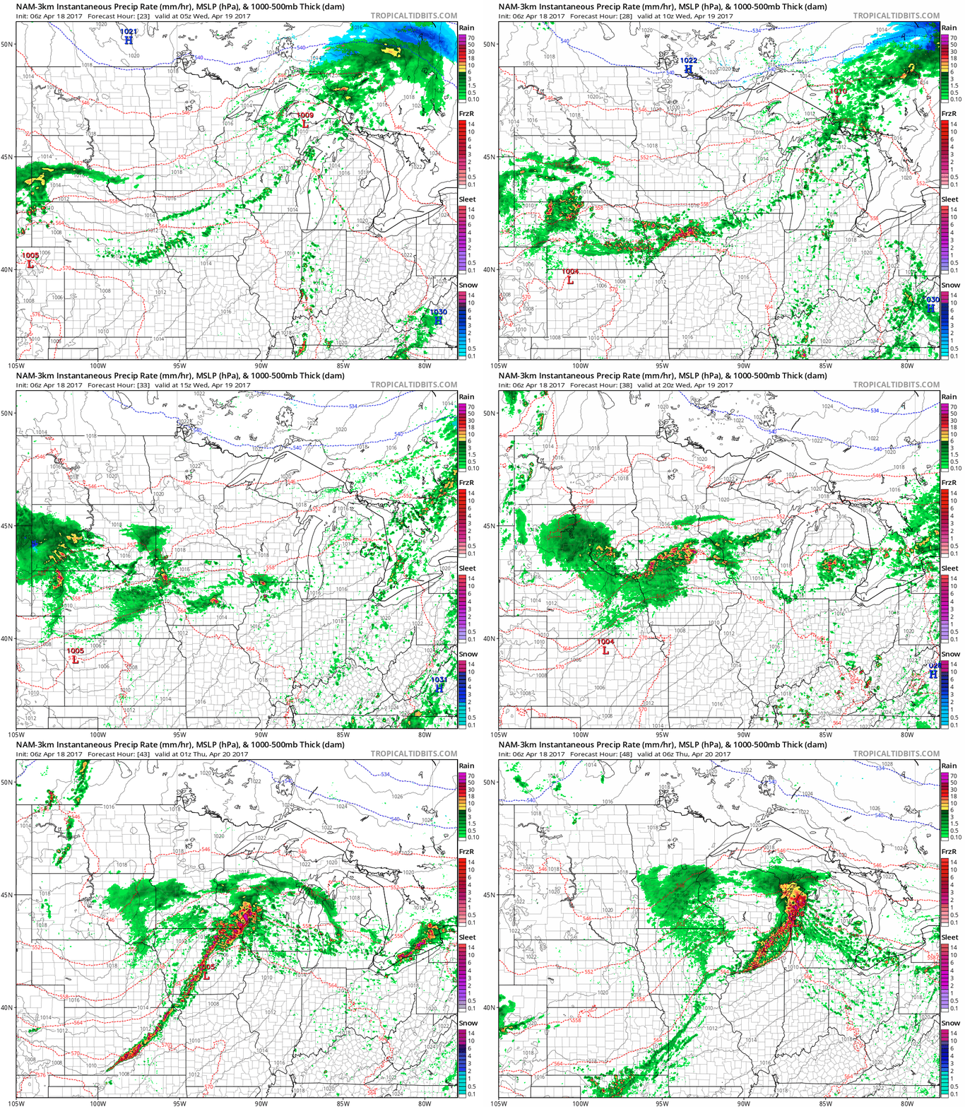
Another rainfall threat moves into Zone 9 by Wednesday from west to east, impacting South Dakota locations throughout the morning hours along a warm front, shifting east throughout the day across southern Minnesota into Wisconsin into the overnight hours Thursday morning.
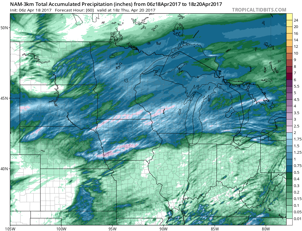
Total rainfall from the system moving east as well as on Wednesday via the latest NAM-3km…expecting heavier rainfall expected across much of the Zone with the exception of the northwestern locations in North Dakota. Wouldn’t be shocked to see totals at 1.5-2.0+ across portions of southern Minnesota into the southern half of Wisconsin through Thursday morning.
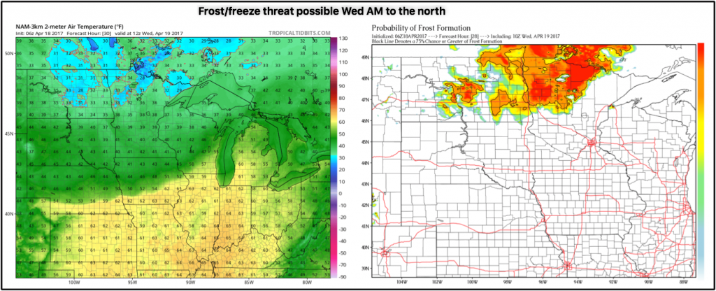
Can’t rule out some frost/freeze threats on Wednesday morning as well, as temps dip down into the lower 30s even upper 2os will be possible across northern Zone 9 locations. The map on the right is the probability for frost on vegetation. The brighter the colors the higher the probability for frost…so there’s a solid potential here.
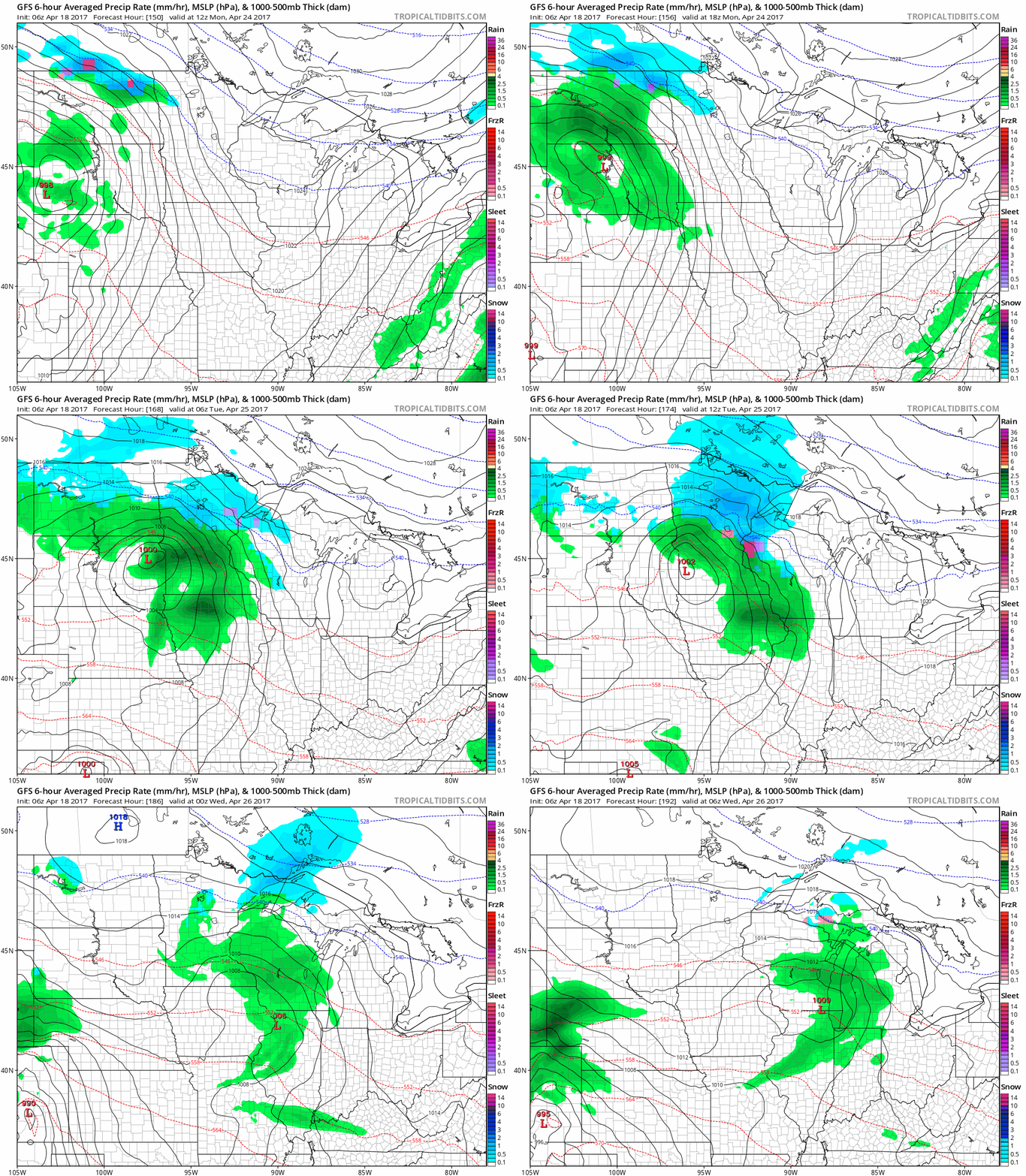
Between Thursday into the weekend we are fairly dry across Zone 8. Our next chance for rain comes Monday morning into Tuesday…can’t rule out some wintry precipitation mixing in at times…although confidence on these details is on the lower end at this time.
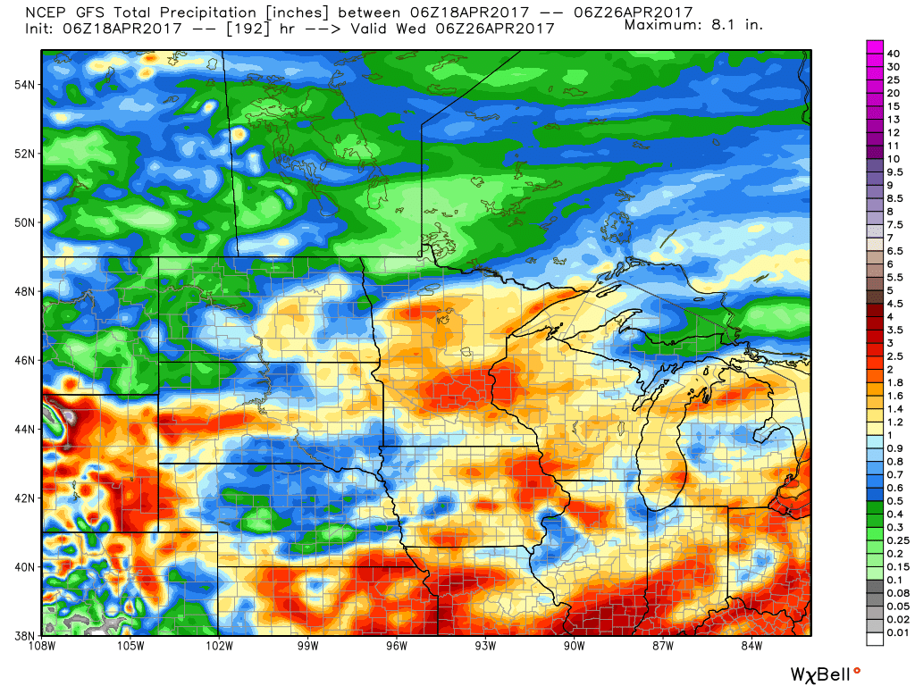
Total accumulated precipitation from the latest GFS over the next week, expecting 1.0-2.5″ from South Dakota east through Minnesota and Wisconsin. Lesser amounts with drier times expected across western North Dakota into extreme northern Minnesota.
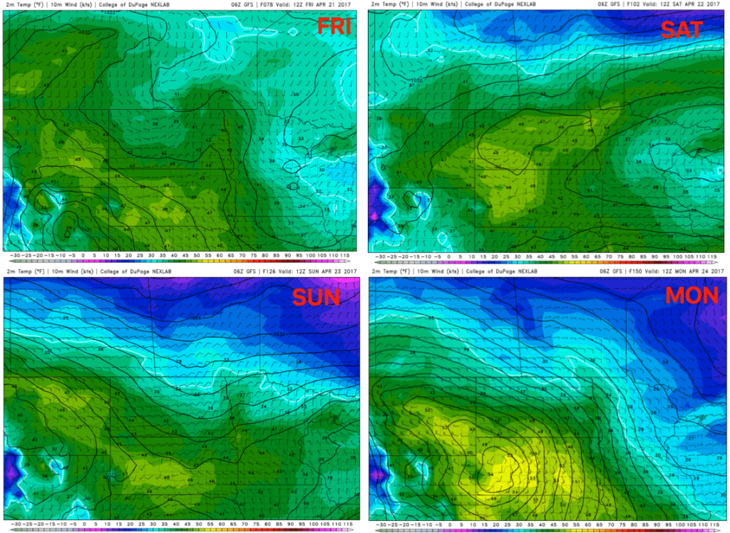
We get chilly Fri-Mon mornings, with some locations across the northern parts of the Zones still feeling some 30s and frost potential on vegetation getting into late month as we’ve been discussing was possible. We think this threat is even possible into May as well, unfortunately.
In terms of precipitation from normal over the next 2 weeks via our in-house long-range maps shows that Zone 8 locations are well above normal with precipitation getting into May.
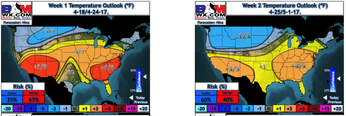
With respect to temps from normal over the next 2 weeks via the same in-house long-range maps updated this morning shows the colder anomalies settling in here into early May. So the frost threats remain unfortunately, as well as the above normal precipitation. This will make things difficult to consistently get into the fields going forward.
Confidence and Risk:
- High confidence showers and storms continue to advance east throughout the morning before exiting by the afternoon hours east of the Zone.
- Above average confidence showers and storms move along the warm front on Wednesday morning through Thursday morning, bringing heavy showers across portions of South Dakota east through Minnesota and Wisconsin.
- Increasing confidence we have a dry stretch from Thursday through late weekend.
- Above average confidence the frost/freeze threats remain across the northern Zone locations into late month.
- Above average confidence we see overall above normal rainfall throughout the Zones over the next 2 weeks.
Today’s video (time):
