Key Points – Monday, April 17, 2017:
Synopsis: Good morning and thanks for checking out the latest update. Targeting an early week rainmaker as discussed since last week tonight into Tuesday morning, as well as additional rain chances Tuesday night into Wednesday and Wednesday night into Thursday. The pattern has continuously turned more active across Zone 9 whereas prior we were drier than normal. We have a growing concern for below normal temps in the 6-10, which is reflected in the data as a couple clipper systems move across the northern tier of Zone 9 this weekend into next week mixing in potential snow showers; the frost/freeze threat remains alive here as well. Have a great week, if you have any questions please let us know!
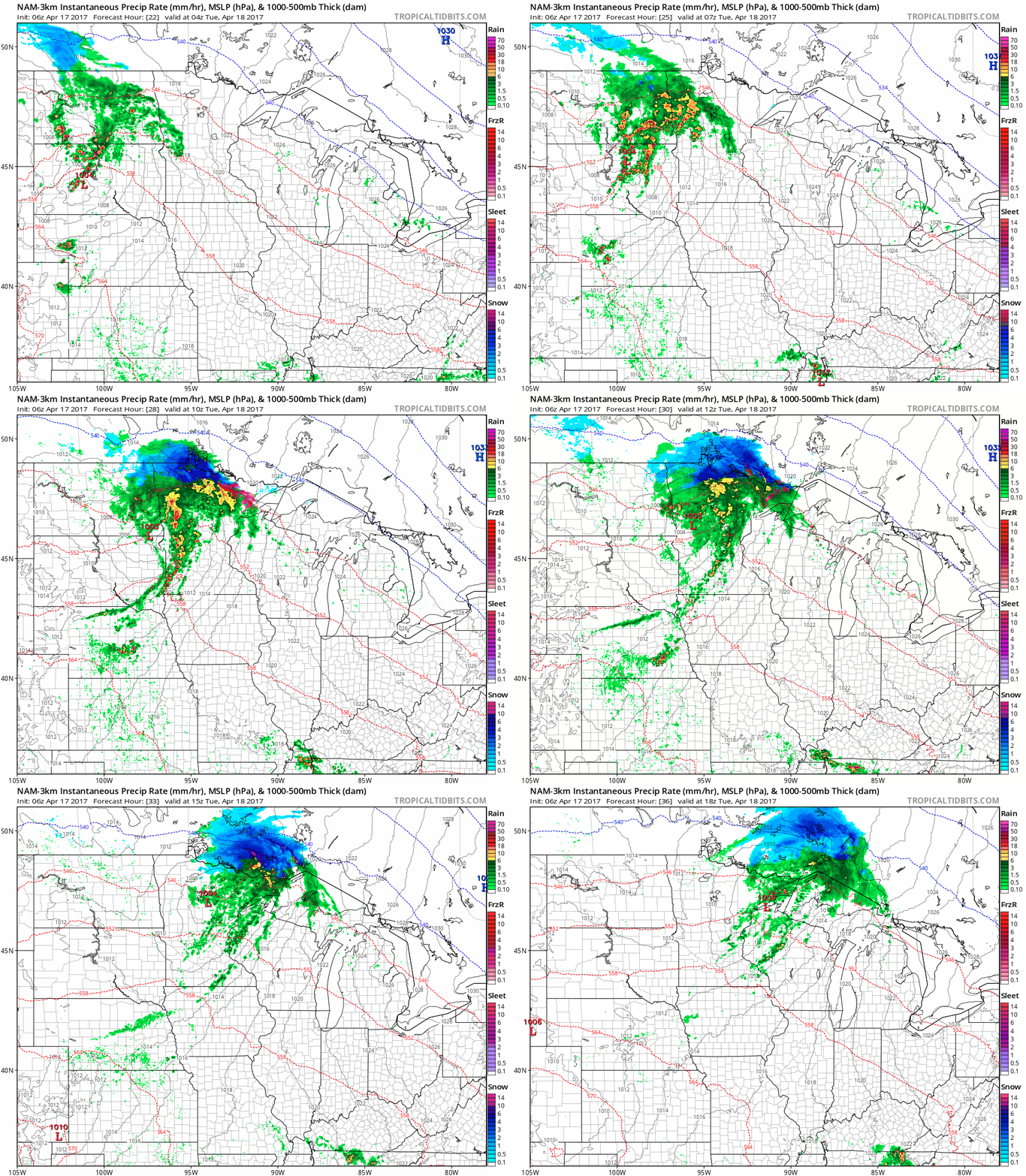
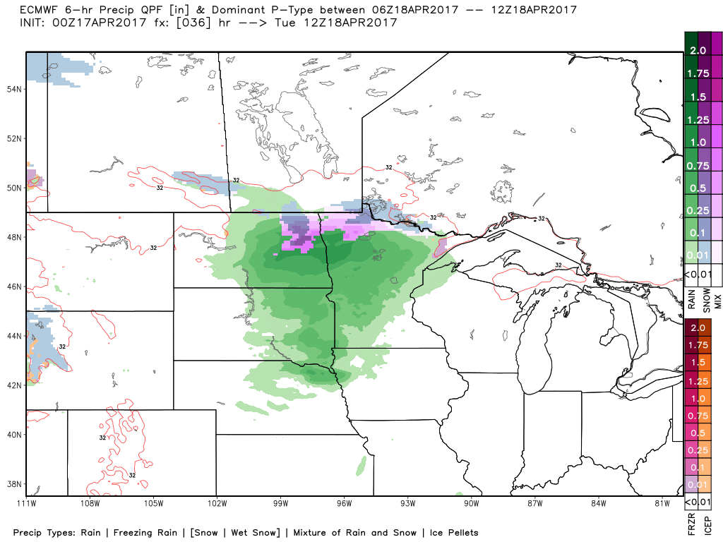
Rainfall starts ~midnight/1amCDT Tuesday morning heading further east throughout the morning hours.
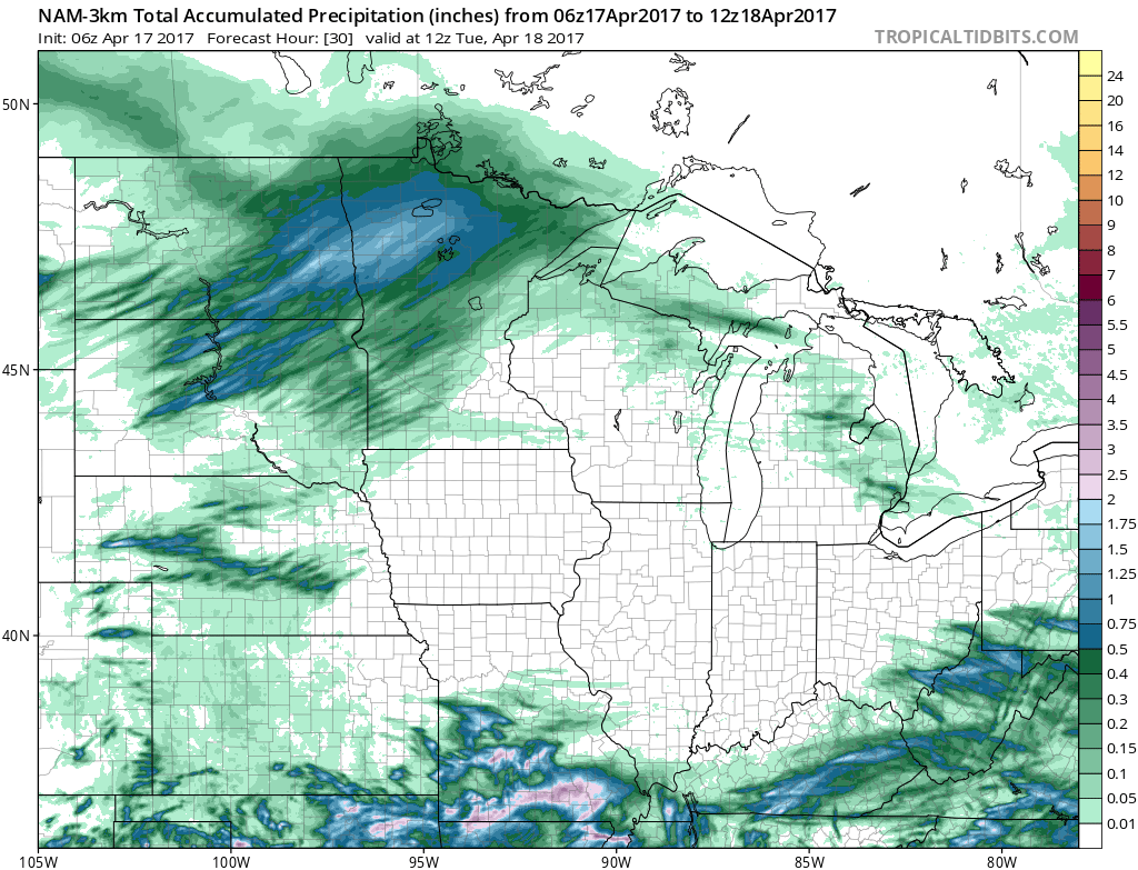
In terms of total rainfall, 1.0-1.5″ will be possible eastern northern South Dakota, eastern North Dakota into the northern half of Minnesota.
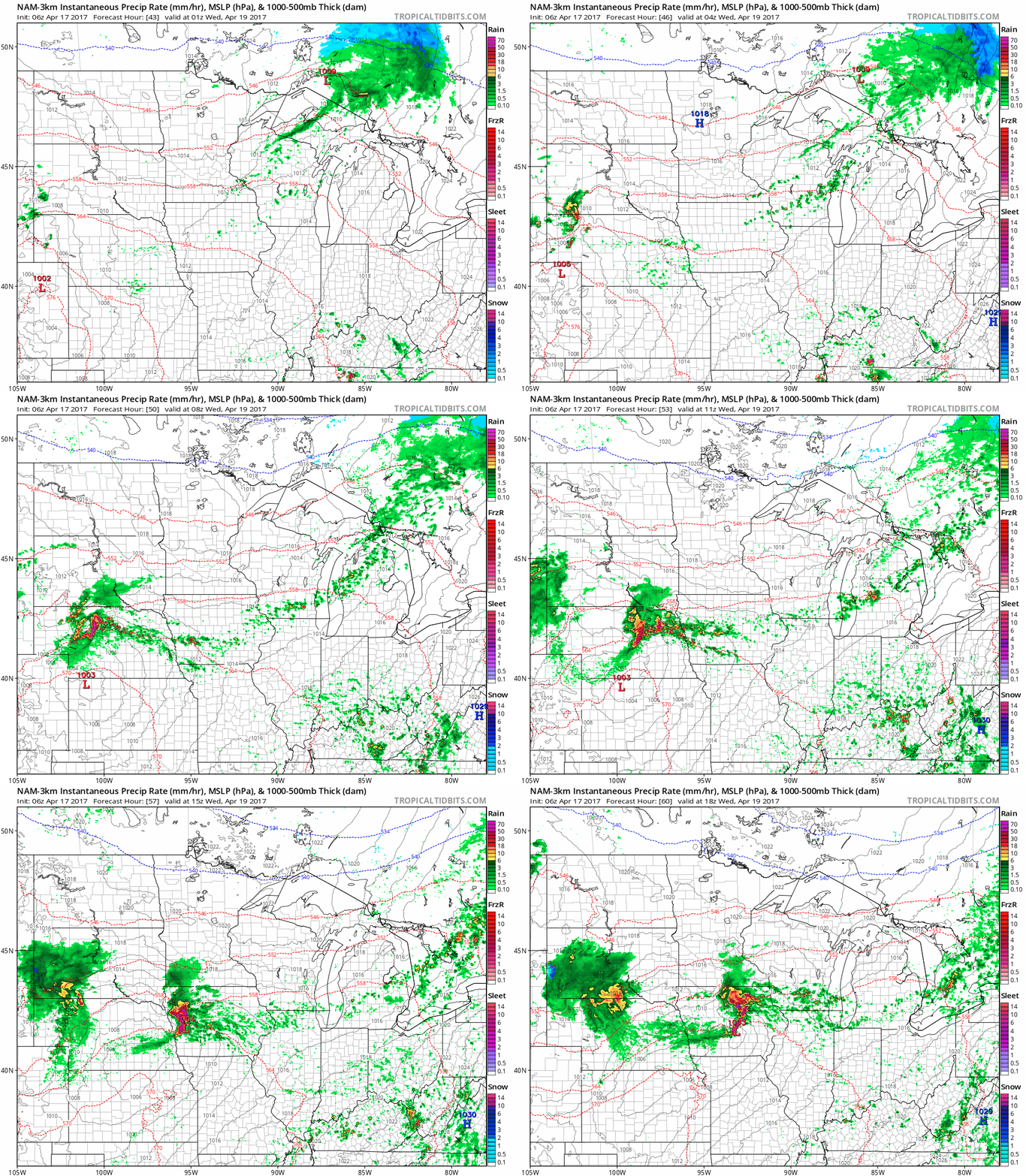
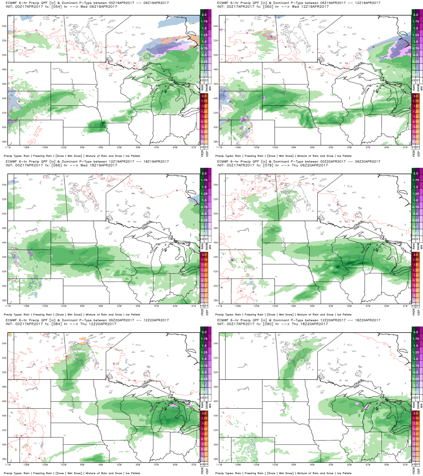
Following right on the heals of this system is another disturbance that tracks further south later Tuesday into the day on Wednesday further east.
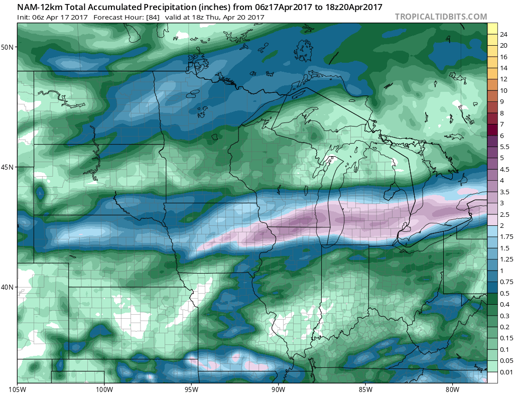
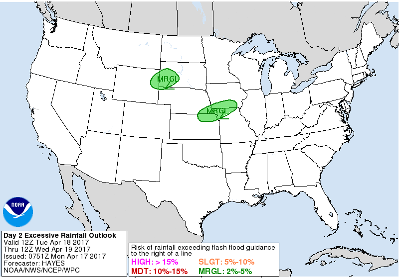
Rainfall totals here from southern South Dakota east through portions of Iowa and southern Wisconsin are pretty robust over 1.0″+ possible along the warm front.
That same area across southwestern South Dakota for some localized heavy rainfall.
Can’t rule out a few snowflakes mixing in Tuesday morning across northern North Dakota into northern Minnesota as well.
Wednesday night into Thursday issues in the next shower chance across Zone 9 especially south as a surface low tracks across portions of Zone 8 and brings some moderate to heavy rainfall especially across South Dakota to southern Minnesota into Wisconsin.
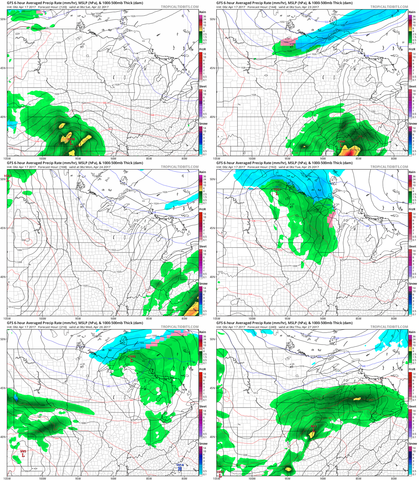
The northern stream remains active, which is pretty incredible given how late in the year we are. We continue to see shots of cold air, even wintry precipitation mixed in this coming weekend into next week.
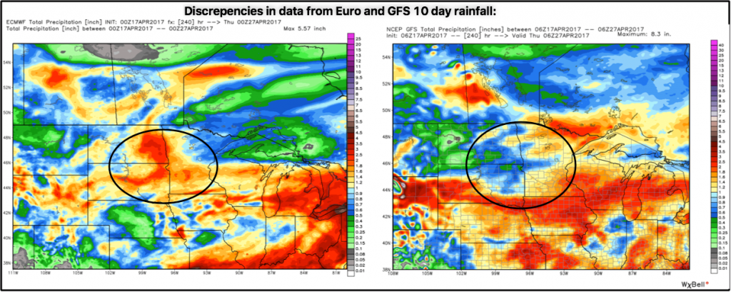
Discrepancies in the data in regards to the 10 day rainfall totals…we have to continue to sift through the data in the coming updates because the GFS takes the weekend system further south while the European keeps it further north. Check back often.
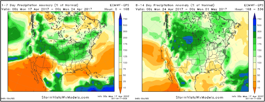
Precipitation from normal over the next 2 weeks…the takeaway here is Zone 9 locations are right in the center of the above normal rainfall pretty consistently…so the active pattern will continue to ramp up, growing concern for saturated fields late April into early May.
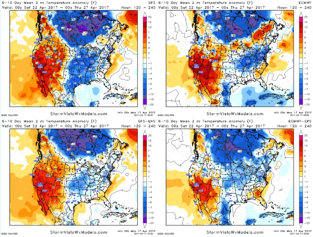
Temps from normal in the 6-10…a risk for much below normal temperatures further south that what previous data has suggested. The threat for frost/freeze remains.
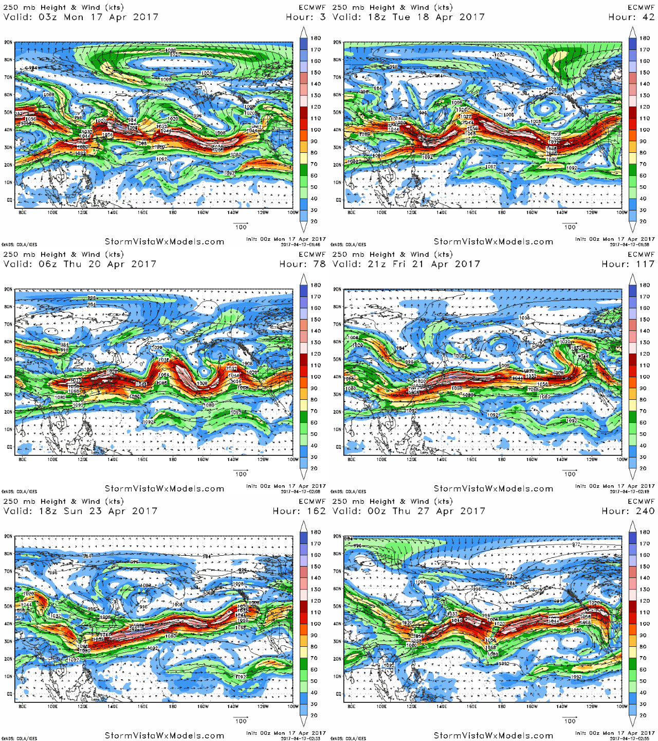
Lastly, we discuss in the video how the Pacific jet extension continues over the next 10 days…if you’ve been watching the videos for a while, you know that this means our pattern will remain very active in the Ag Belt.
Confidence and Risk:
- Above average confidence showers and storms possible across the northern half of Zone 9 late tonight into Tuesday morning.
- Average risk for a few snow showers mixing in Tuesday morning as well as cold air mixes in to this system.
- Above average confidence additional showers and storms move across the southern portions of Zone 9 Tuesday night into Wednesday from west to east.
- Average but increasing confidence another round of showers possible Wednesday night into Thursday as a low pressure tracks across the Ag Belt.
- Below average confidence on the coming weekend system as we have large discrepancies in the data…check back often.
Today’s video (7 min):
