#NDwx #SDwx #MNwx #WIwx Active Through Tuesday, Dry Time Much of Next Week! Details Here. E.
Synopsis: Good morning! We are tracking our next significant system across the central Plains this morning with rains south of the forecast area. This system will move into the forecast area Sunday and persist through Tuesday, especially across the eastern half of the forecast area. Beyond this, frost and freeze threats persist through the middle of next week before a warm up toward the end of the week. Overall, much of next week looks drier than past weeks across the forecast area along with a slow warming trend starting first in the west, and spreading eastward. Have a wonderful weekend!
- Current radar shows rains to the south of the forecast area.
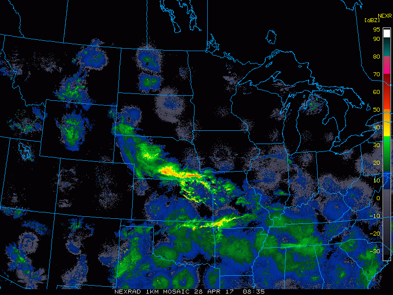
- Moving forward, a developing storm system will deliver widespread rains and some wet snow across the eastern two thirds of the forecast area late Saturday night through Tuesday. The Dakotas will escape the worst of the rains once again.
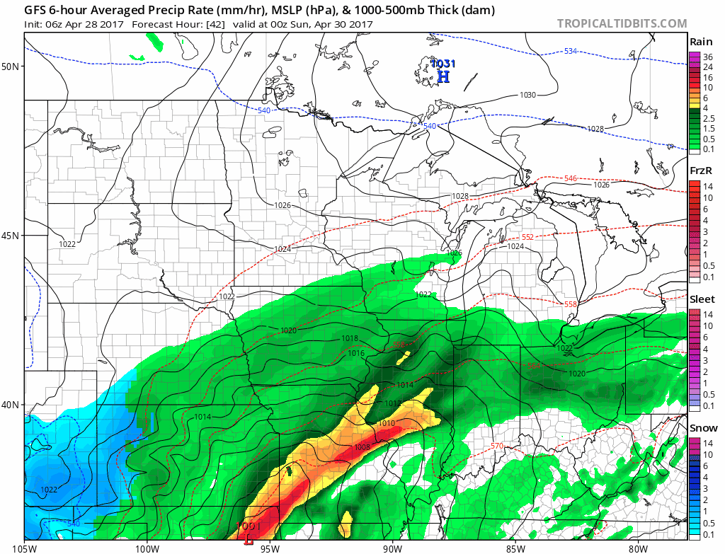
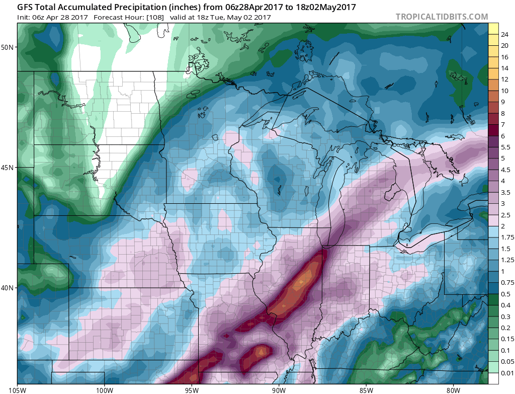
- Total rainfall from this system will be significant in eastern areas, ranging from 1-3 inches. Some places in the Dakotas may not see a drop of rain! Given surface temperatures, we think snow will have a tough time accumulating significantly.
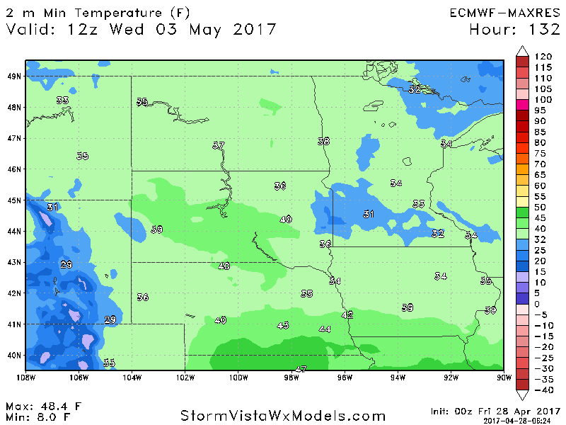
- Behind this system, frost and freeze threats will continue across the Dakotas, Minnesota, and northern Wisconsin through mid week once again slowing any thoughts of planting. Here’s a look at low temperatures Wednesday morning.
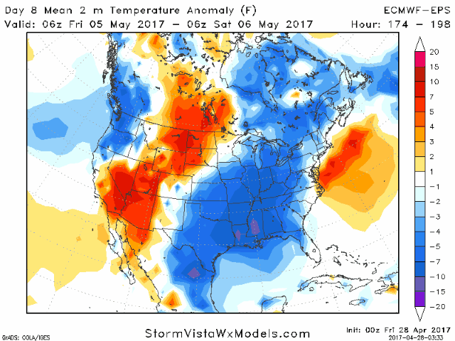
- A warmer regime will develop toward the end of next week, at least temporarily. Here’s the daily departure from normal temperatures late next week into the following week. Warm colors are above normal.
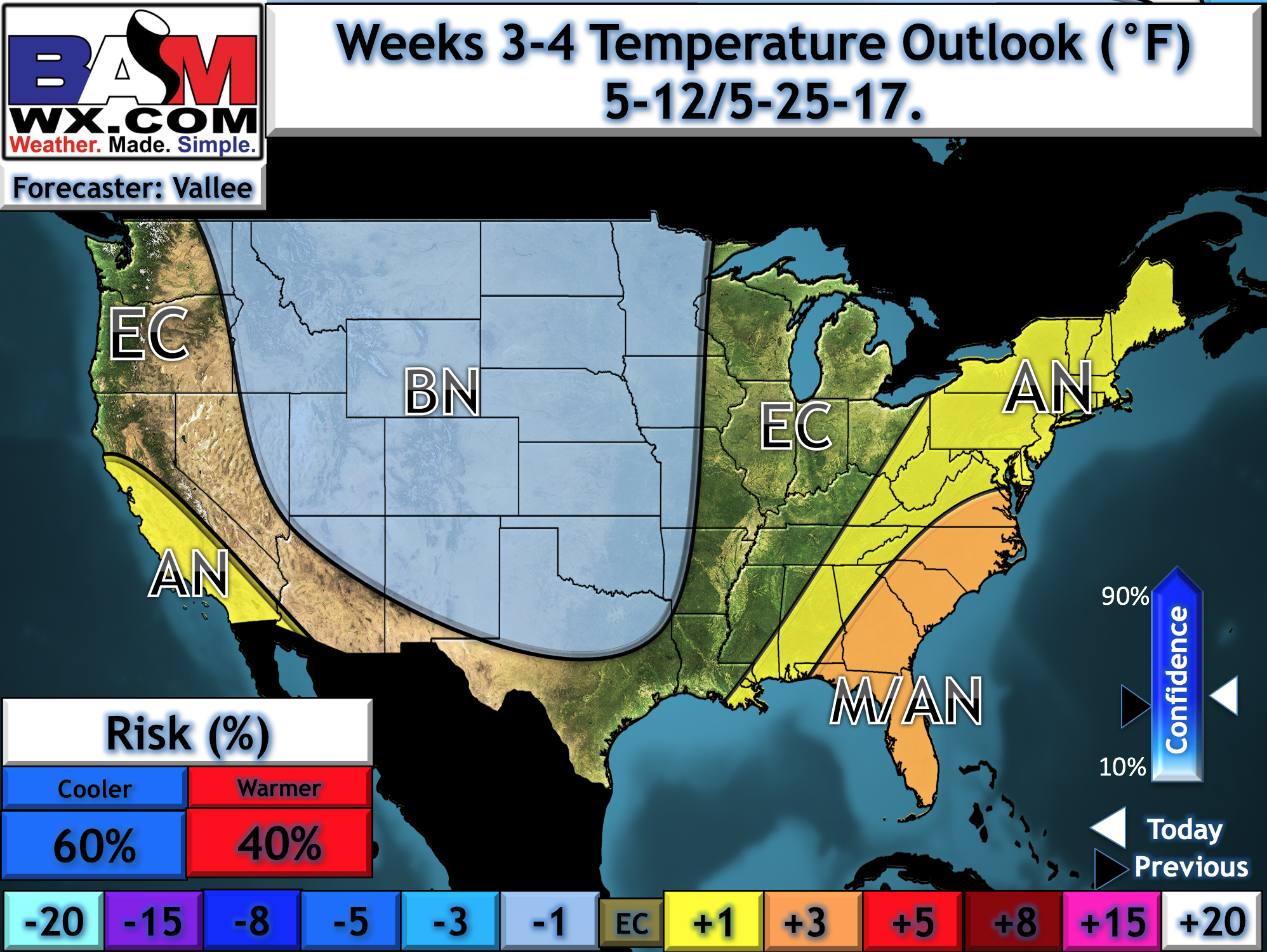
- This should help soil temperatures get to an appropriate temperature for some field work in week 2. However, we continue to think some cooler risks exist for May. Here’s our updated week 3 and 4 outlook, highlighting some cooler than normal chances.
Risks and Confidence:
- High confidence in heavy rains and some wet snow in eastern areas Saturday night through Tuesday.
- Average confidence in where this system tracks. In the eastern Dakotas and northern Minnesota, the northwestern fringe of the storm will be very sharp. Any small shifts will make a big difference here!
- Increasing confidence in warmer temperatures and some dry time by the end of next week into next weekend.
- Below average to average confidence in cooler conditions developing in weeks 3 and 4. Some uncertainty in the extent of this and whether we see some warming by week 4. Definitely keep with us on this one!
Today’s Video (5 minutes):