#MNwx #WIwx #SDwx #NDwx Active Next Few Days, Drier Weekend, More Rain Chances Next Week? E.
Key Points: May 9, 2017
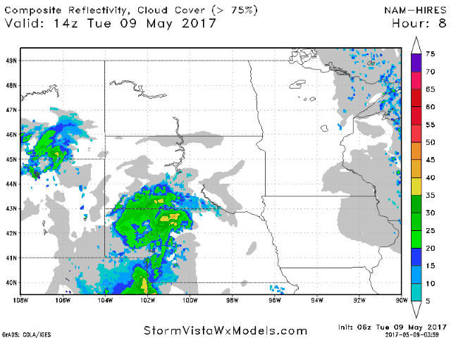
Synopsis: Good Tuesday morning! We are tracking a few showers across southern South Dakota, otherwise it’s a rather quiet morning out there. Those showers will move northward and eventually eastward through the day as a cold front slowly pushes through the region. These showers will last into Wednesday before pushing south of the region toward the end of the week. Warmer than normal conditions likely continue into week 2, especially across eastern areas. Some cooler conditions along with active times may make a comeback to end week 2 and enter week 3. Have a great day!
- Current radar shows a few showers pushing into South Dakota this morning.
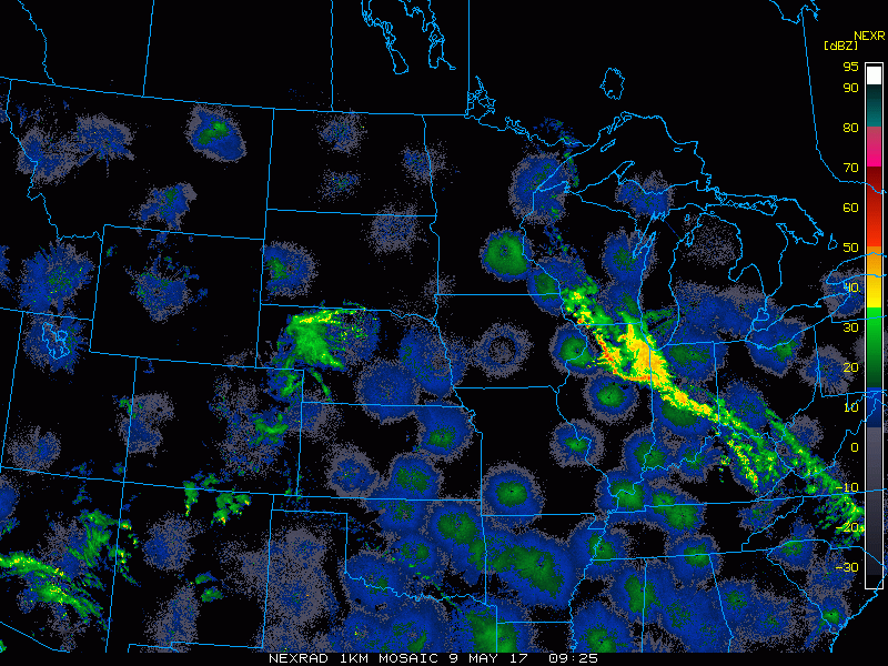
- Moving through today and into tomorrow, rain chances will arise ahead of a slow moving cold front, mainly across SD, MN, and WI.
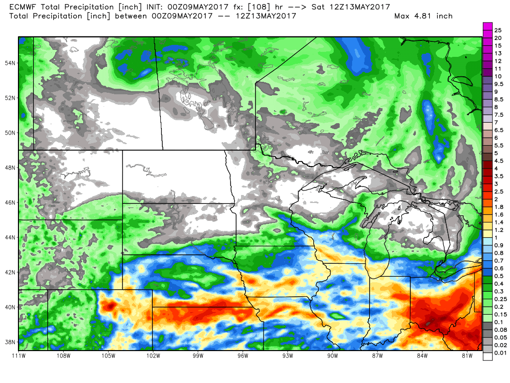
- Total rainfall through the end of the week will be heaviest in southern portions of the region, with North Dakota and northern Minnesota remaining largely dry.
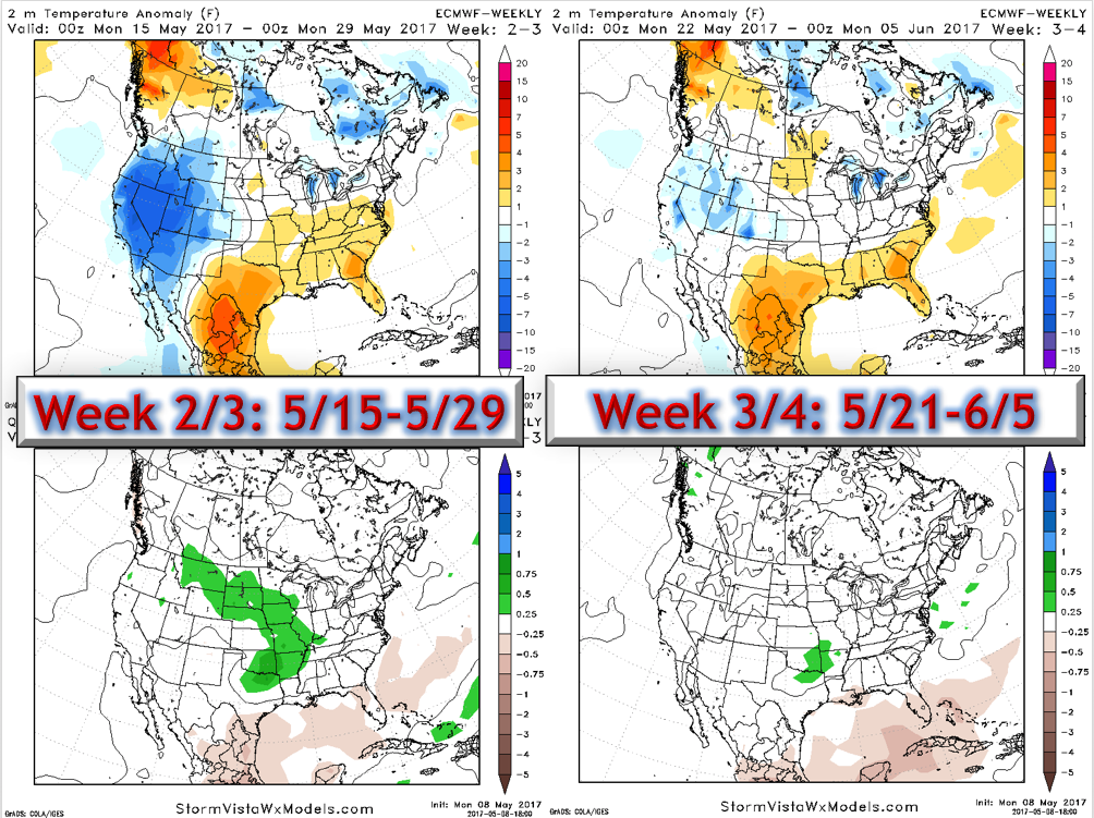
- The active pattern looks to continue into week 2 with warmer than normal conditions giving way to cooler conditions especially across western areas.
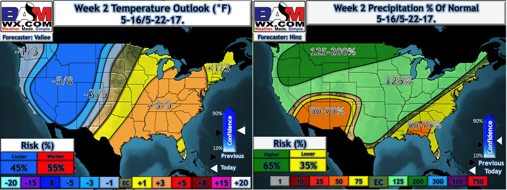
- This regime likely lasts through the end of the month per the latest European weeklies that came out last night as well.
Confidence and Risks:
- Above average confidence on rains this week mainly across southern areas as the front moves south.
- Above average confidence on a drier, warmer end to the week and into the weekend.
- Increasing confidence on an active pattern continuing into week 2 along with a gradual cooling trend west and warming trend east.
- Average confidence on active times and a similar temperature regime to week 2 continuing through the end of May.
Today’s Video (5 minutes):