#MNwx #WIwx #NDwx #SDwx: Storm chances shifting east…briefly cooler late week. N.
Synopsis: A storm system will continue to track eastward across Minnesota and Wisconsin today, with surface high pressure building in from the north over the next couple of days. This will lead to quiet weather for late week along with a jab of much cooler/drier air. Heat will quickly ramp back up in the Dakotas Friday, with heat/dry risks continuing into next week across the western half of the area. More information in the video at the end of this post.
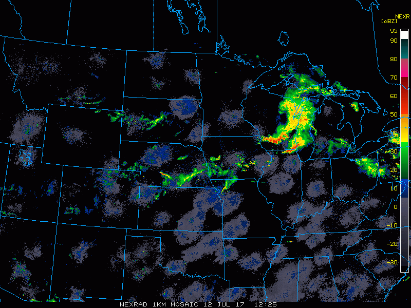
Heavy rain and thunderstorms continue to shift southeast across Wisconsin, with some of those storms being on the severe side. More scattered showers are pushing east across South Dakota.
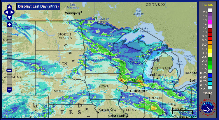
Here is a look at rainfall totals over the past 24 hours. Heavy rain amounts fell in a swath across central Minnesota and into Wisconsin.
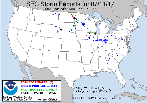
Here is a look at storm reports over the past 24 hours. Several tornado reports in eastern North Dakota along with wind and hail reports spanning across central Minnesota and across portions of South Dakota.
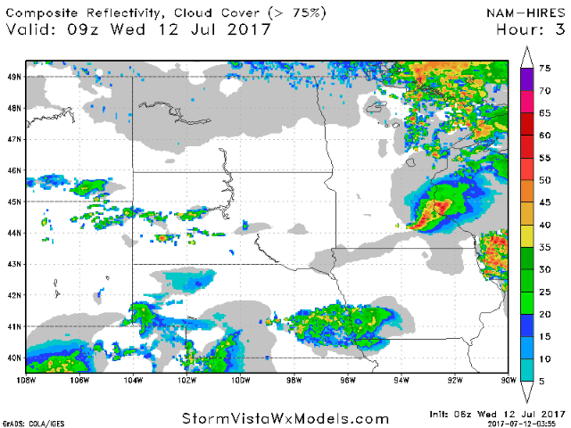
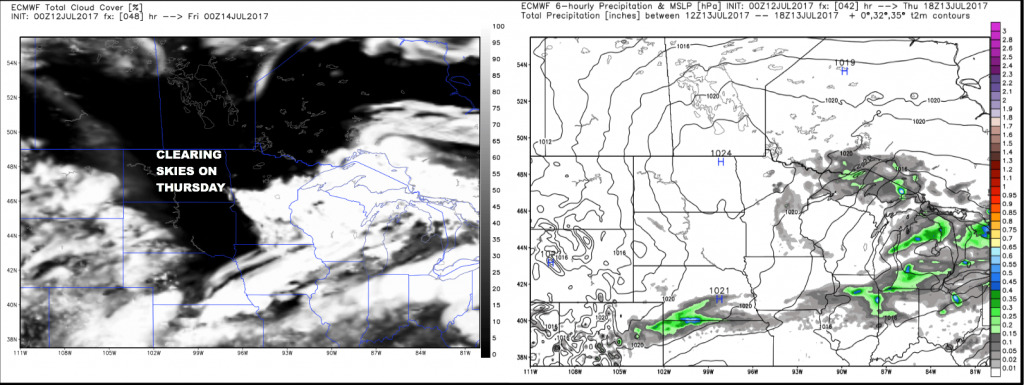
Here is an animation of future radar from the hi-res NAM. Scattered shower and t’storm risk will continue mainly over Minnesota into Wisconsin and portions of South Dakota, with North Dakota staying mostly dry.
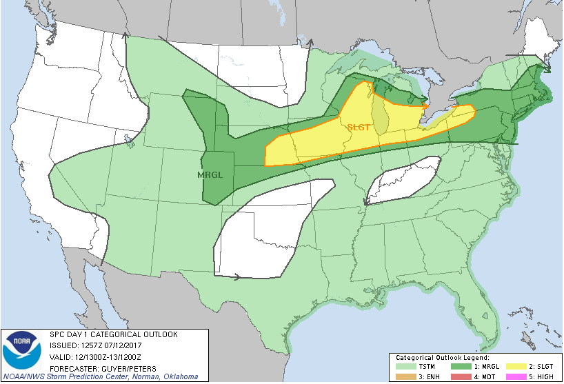
The Storm Prediction Center has placed a SLIGHT risk over central/southern Wisconsin with a marginal risk including far southeast Minnesota and western South Dakota.
The weather looks rather quiet on Thursday and Friday with surface high pressure building in leading to increasing sunshine along with a refreshing air mass settling in.
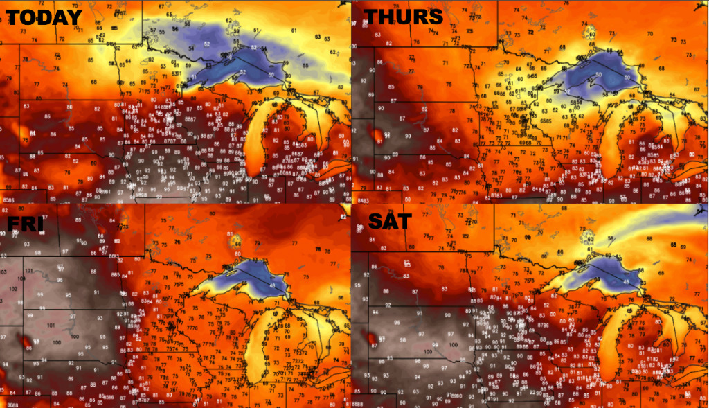
Here is a look at temperatures over the next 4 days. Note the cooler air building in from the north today and Thursday, then the heat ramps up over the Dakotas Friday and spread across central/southern Minnesota Saturday ahead of a frontal boundary.
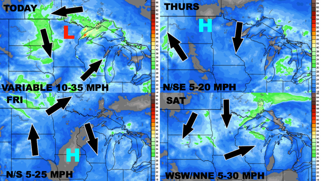
Here is the wind forecast over the next 4 days.
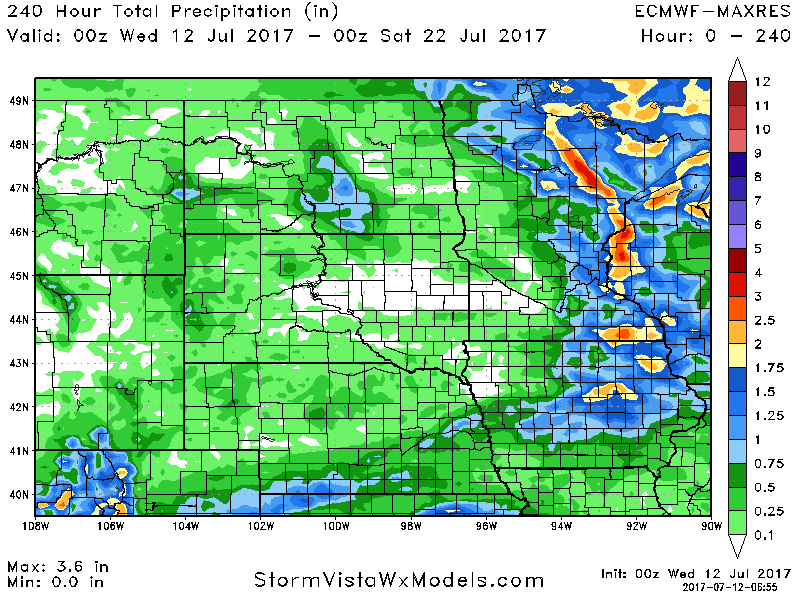
Here is the precipitation accumulation over the next 10 days. Dry concerns continue across the Dakotas, with some change in the pattern possible toward the end of the next 10 days which could bring better opportunities for rain.
Confidence and Risks:
Above average confidence in the short term with the storm risks shifting south and east with high pressure building in leading to dry conditions.
Above average confidence on hot and dry pattern building this weekend into early next week across the western half of the area with a ridge of high pressure building in.
Increasing confidence on a pattern change heading into late July that may introduce better rain chances across the region.
Today’s Video (8 min):