#MNwx #NDwx #SDwx #WIwx Widespread Rains Coming Midweek. E.
Good Tuesday! We are tracking a cold front moving southeast through the region today leading to some spotty showers and storms this afternoon. Some storms will be strong across South Dakota with damaging winds and large hail. A bigger system comes into tomorrow morning into Thursday across the entire zone with widespread rain and storms. Spotty rains and cooler temperatures are expected into next week. All the details are in the video below. Have a blessed day!
Today’s Video (5 minutes):
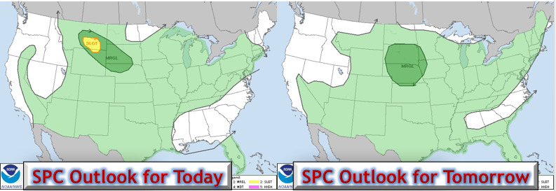
SPC outlooks for today and tomorrow highlight storm threats.
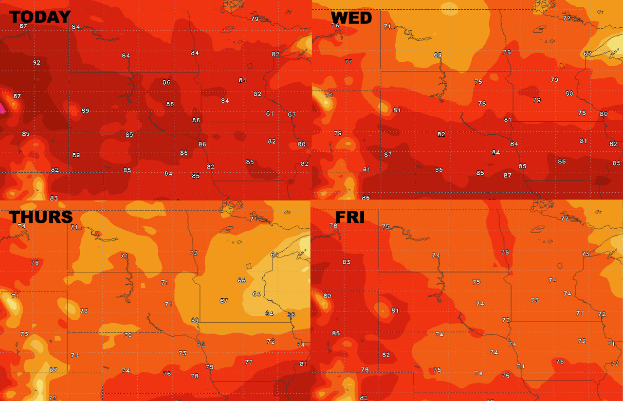
High temperatures over the next 4 days.
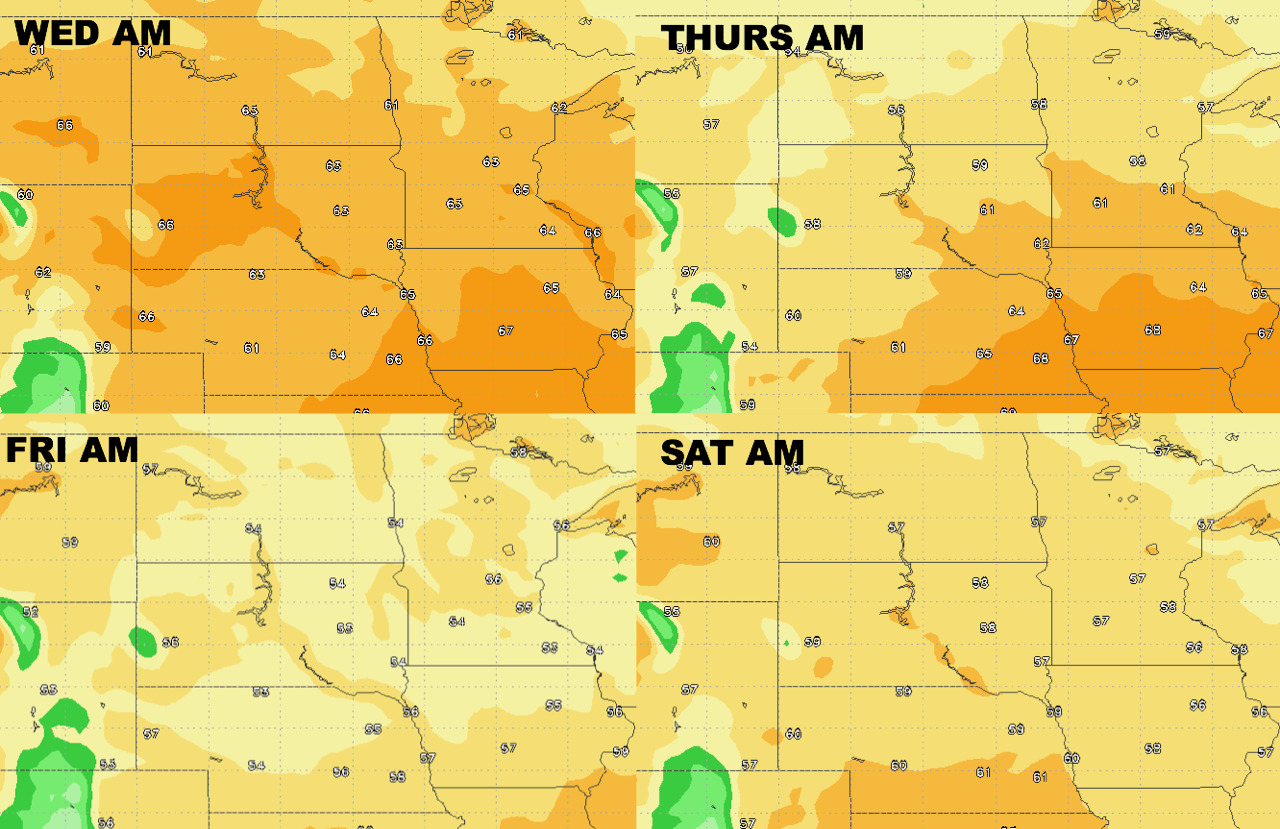
Low temperatures over the next 4 days.
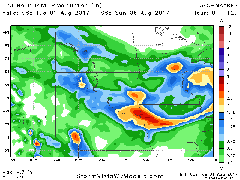
Total rainfall looks to target southeastern SD into portions of MN through Friday.