#MNwx #NDwx #SDwx #WIwx Severe Risks and Heat Into Next Week. E.
Key Points: June 9th, 2017
Synopsis: Good Friday morning! We are tracking some showers and thunderstorms across North Dakota this morning with the rest of the region rather quiet this morning. By this afternoon, showers and thunderstorms will erupt across the Dakotas. Some of the storms will be severe with all modes of severe weather possible. This is on the leading edge of very warm air developing across the region. Additional opportunities for showers and thunderstorms will arise through early next week and temperatures slowly return toward normal for this time of year. Have a blessed weekend!
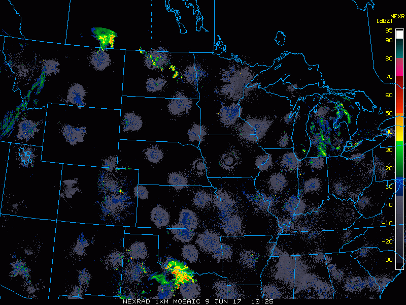
- Current radar shows an area of showers and storms across North Dakota.
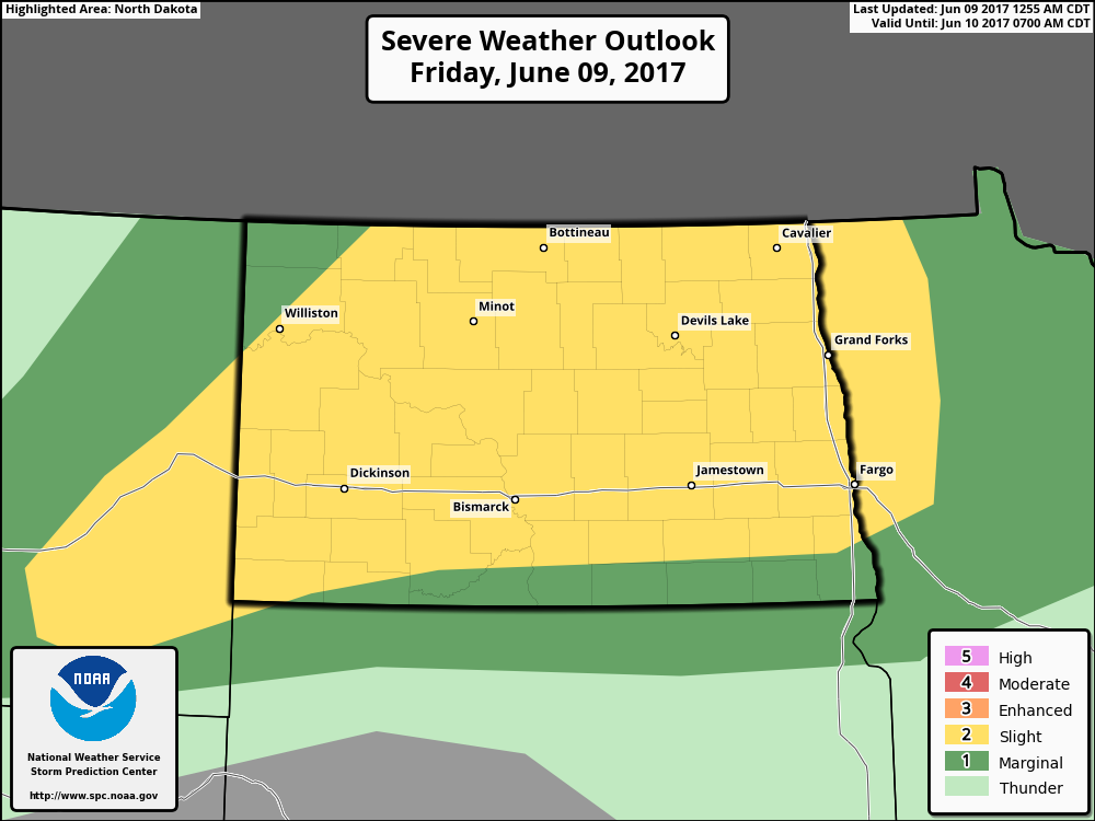
- As we move through today, severe risks will increase across North Dakota. The SPC day 1 outlook is shown below.
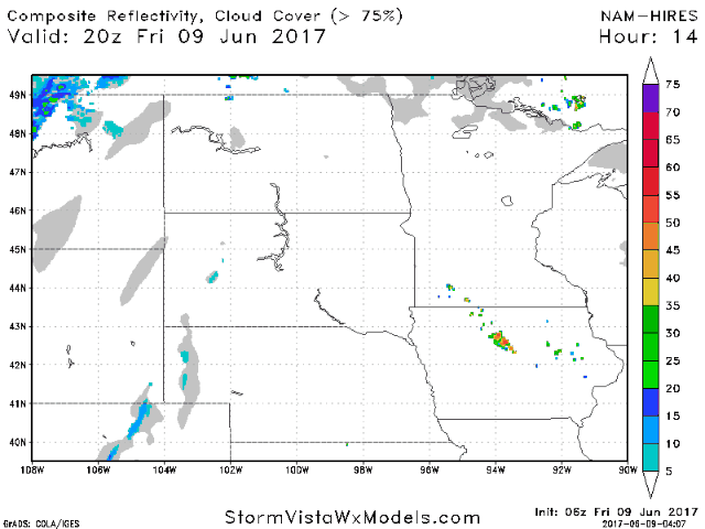
- Here’s a look at how things will evolve this afternoon into Saturday. The video covers the timing and impacts in greater detail.
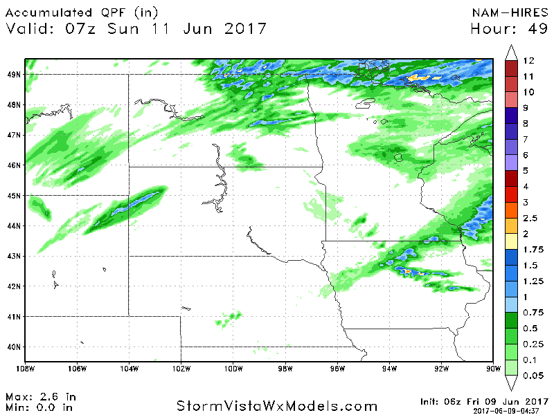
- Total rainfall through Saturday night will be very storm dependent.
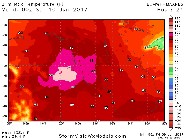
- Temperatures will be hot this weekend into next week, especially south.
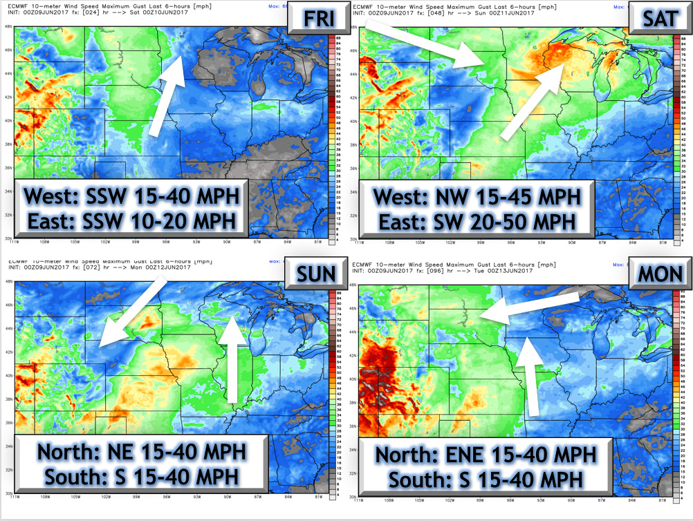
 The next 4 days of wind is shown below. It will be quite gusty, especially west.
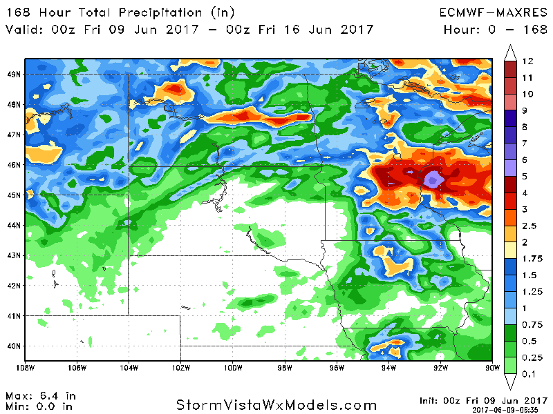
- I’ll time out rain chances in the video below, but it does appear to be quite active across the region outside of possibly South Dakota. Total rainfall through next Thursday is shown below.
Confidence and Risk:
- Above average confidence in severe risks through the weekend and into early next week. There will be haves and have nots.
- Above average confidence in heat this weekend, with cooler risks north as we move through the week.
- Average confidence in cooler conditions developing in week 2 and possibly beyond.
Today’s Video (7 minutes):