Key Points – Monday, October 9, 2017:
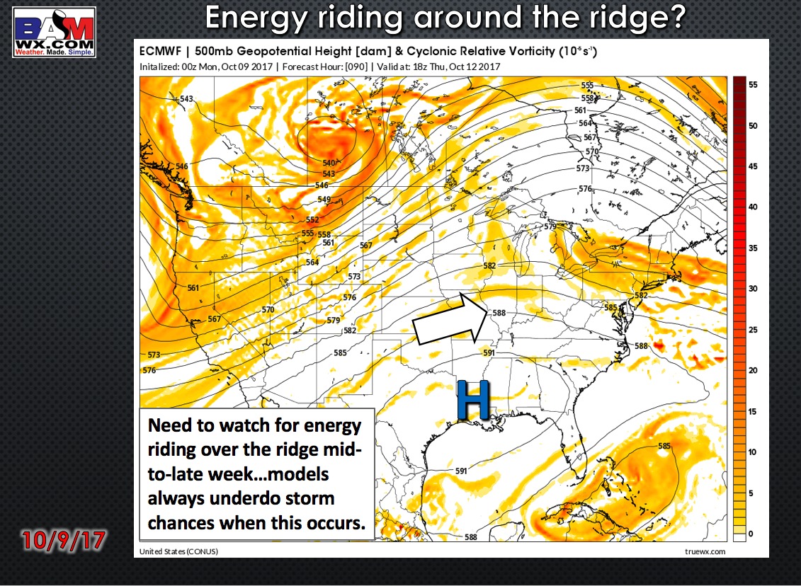
Synopsis: Good Monday morning! Today we focus in on the additional rain and storm chances working southwest to northeast today into Tuesday across Missouri, some of these being gusty to strong in nature with localized heavy rainfall. The overall pattern remains “drier” Wednesday into late week, however, we mention in the video how oftentimes energy likes to ride over the top of the ridge, so can’t full rule out an isolated storm chance. If you have any questions please let us know, have a blessed week! -Kirk
Today’s video (6 min):
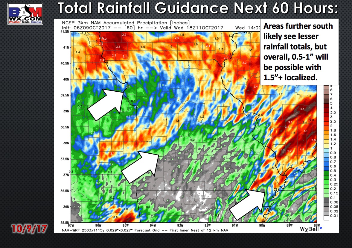
Total rainfall guidance over the next 60 hours:
Pattern Wednesday into early weekend is overall “dry”…in the video we mention energy riding over the top of the ridge so can’t full rule out an isolated chance for storms here:
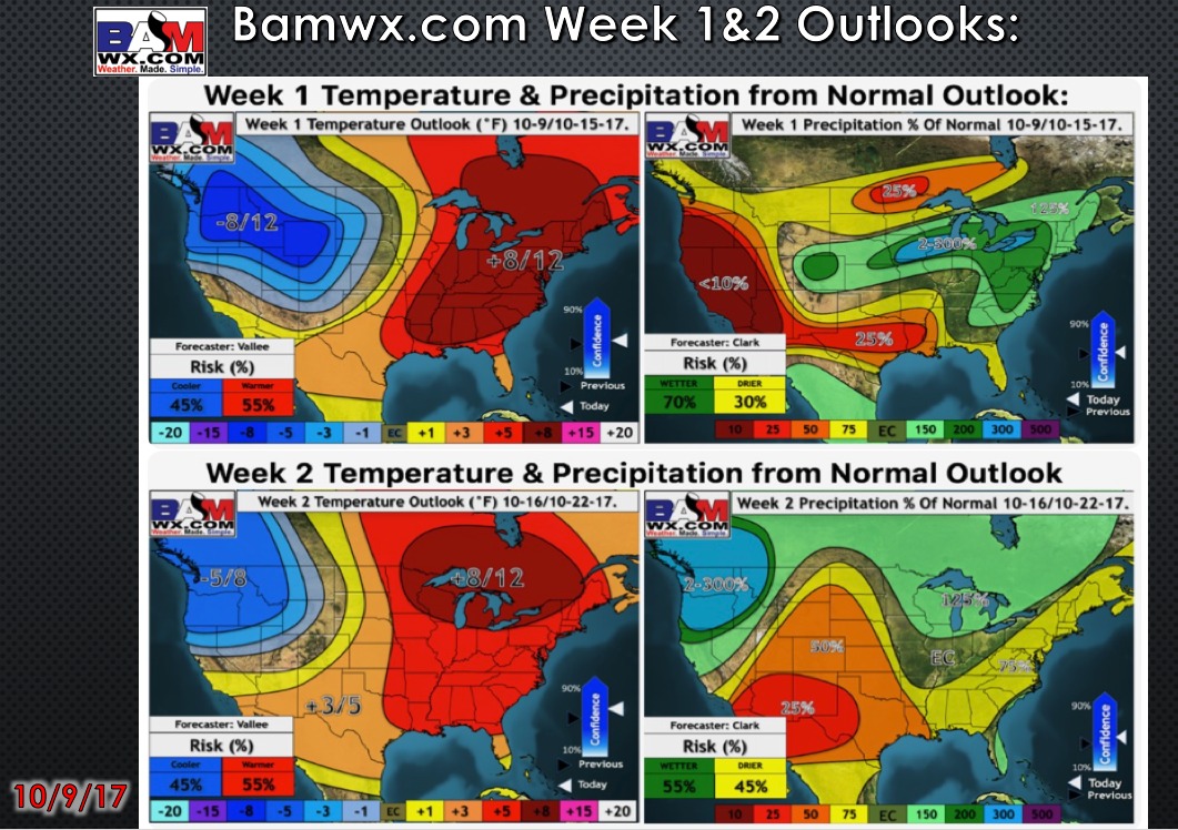
Weeks 1-2 temperature and precipitation from normal outlooks:
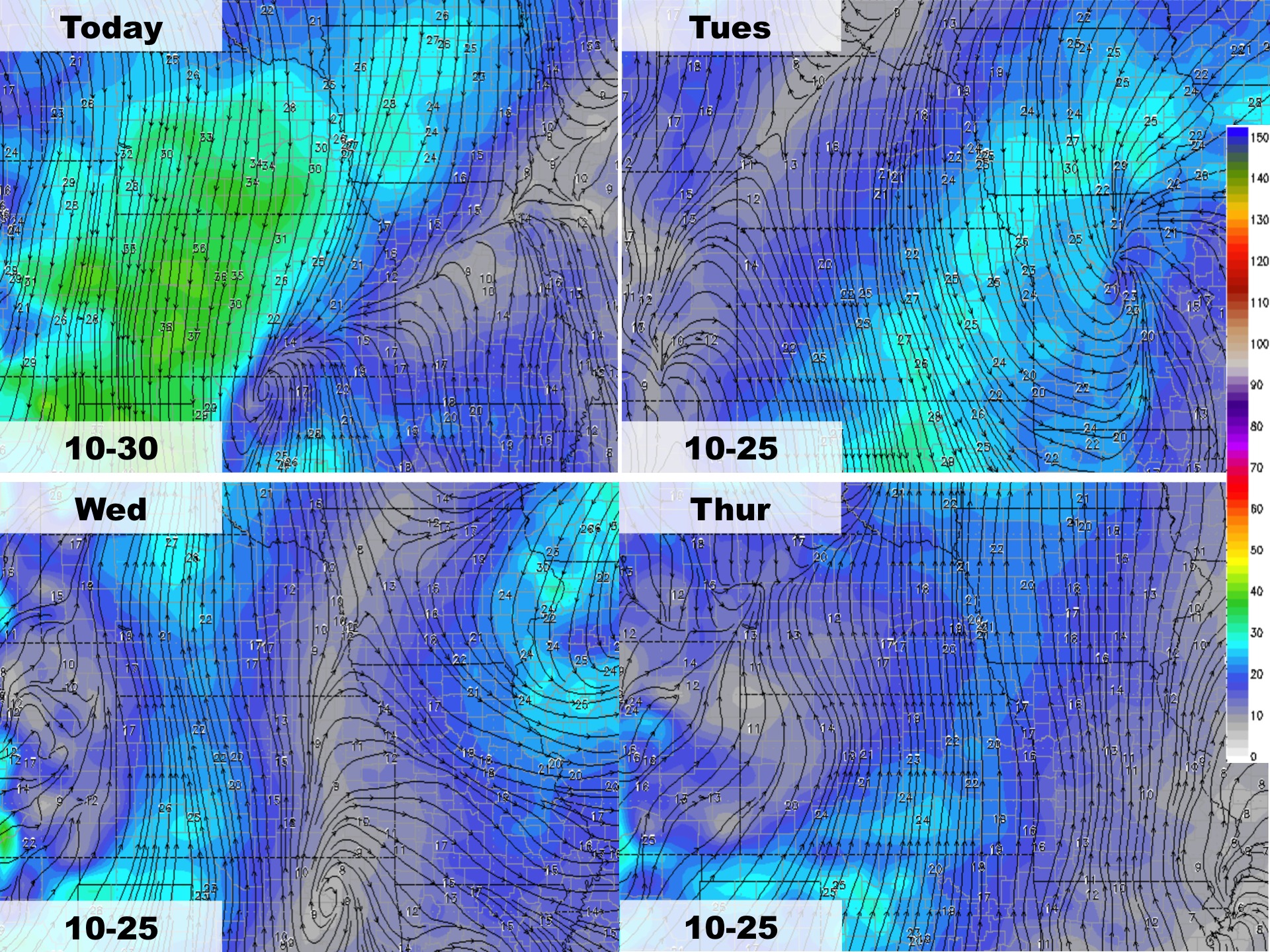
High temperature guidance over the next 4 days:

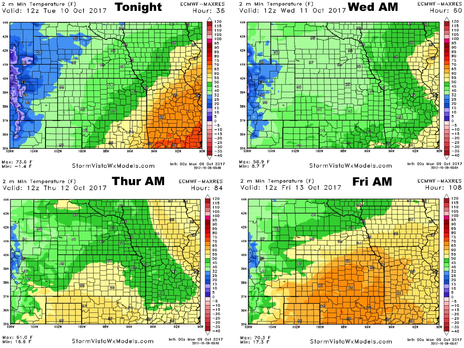
Low temperature guidance over the next 4 mornings:
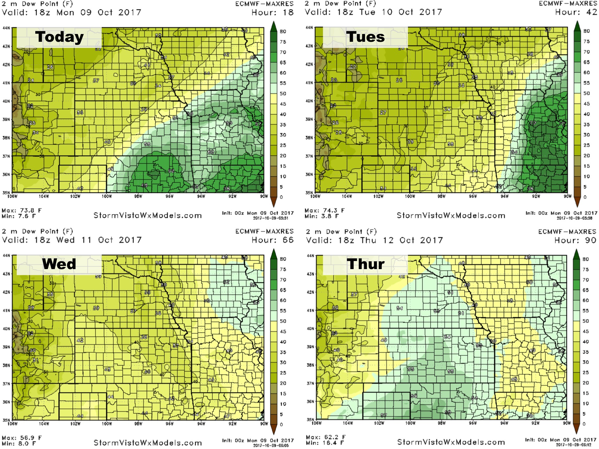
Dew point temperature guidance over the next 4 days:
Wind forecast guidance over the next 4 days: