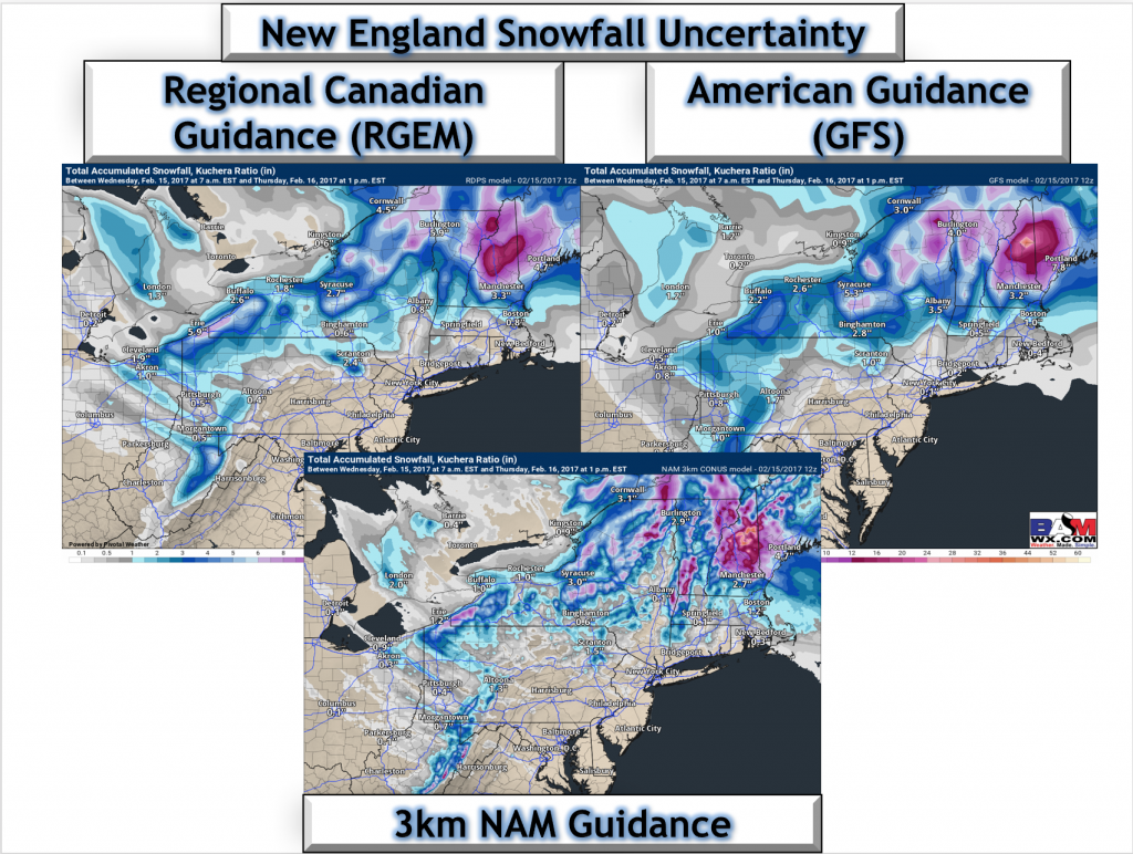
Good afternoon! Quick update for you guys on the expected snow across central New England as well as northeastern Ohio and northwestern PA over the next 24 hours. Some uncertainty remains, but we are finally starting to see some similarity in guidance this morning. Here is a look at total snowfall through tomorrow afternoon on guidance.
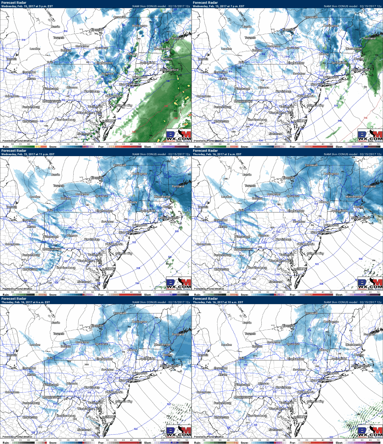
Notice the cutoff in northeastern Massachusetts and southeastern New Hampshire remains quite tight from 6+” to 1-3″ over a very short distance. This will become a nowcasting situation as it develops. Snow showers will also impact western areas with some accumulations as well. Here’s the latest simulated radar through the overnight.
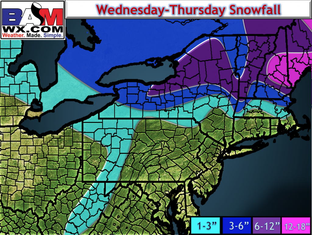
Latest snowfall forecast has been fine tuned a bit, with snowfall winding down tomorrow morning across both western areas as well as a northeastern Massachusetts. Here’s the latest.
Have a great day! ~Ed


