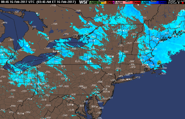
Good morning! We are tracking a developing storm off the coast of Maine still spreading some snow across eastern Massachusetts this morning causing slippery morning commutes. Here’s the radar as of 5:50 AM.
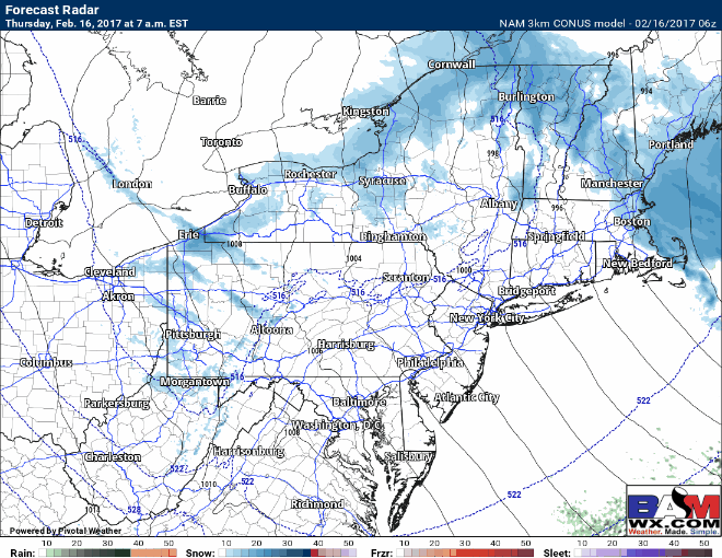
Snow will continue early this morning before tapering off quickly. Elsewhere, incoming high pressure will promote some sunshine region wide, especially east. Here’s the radar through the day.
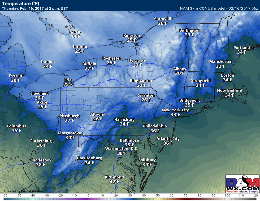
Temperatures will be chilly today, with many inland in the 20s. Some places near the coast will be into the 30s. Here’s an idea of high temperatures today.
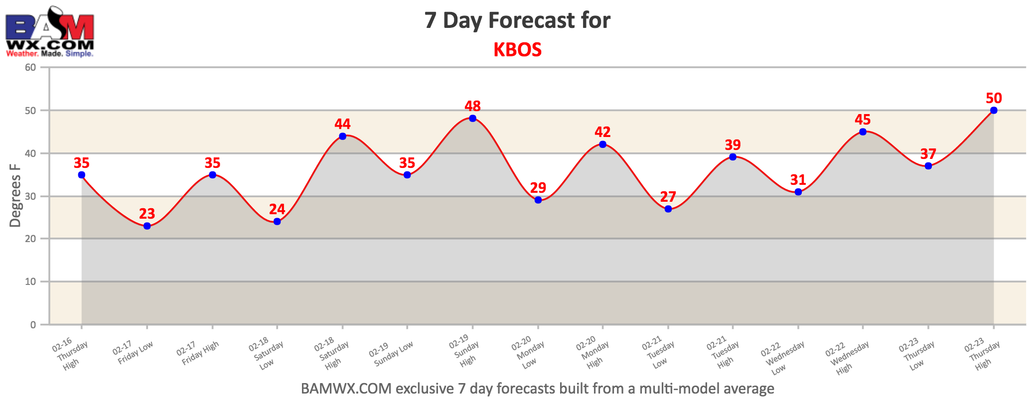
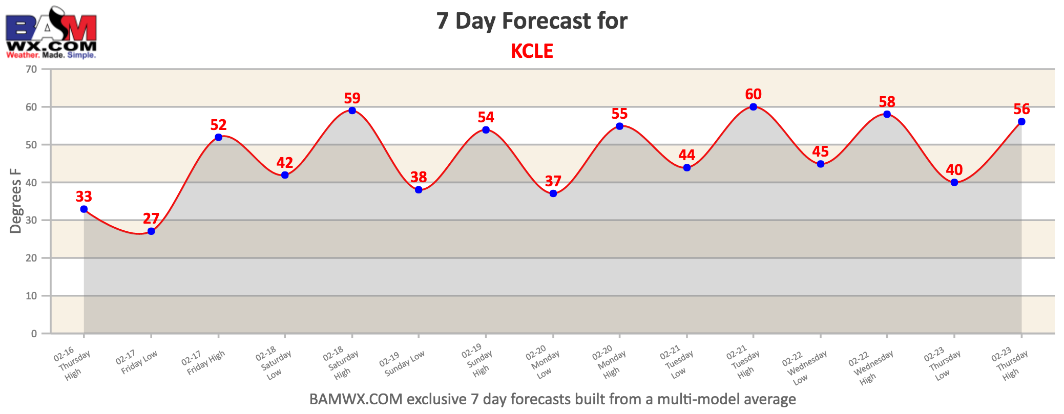
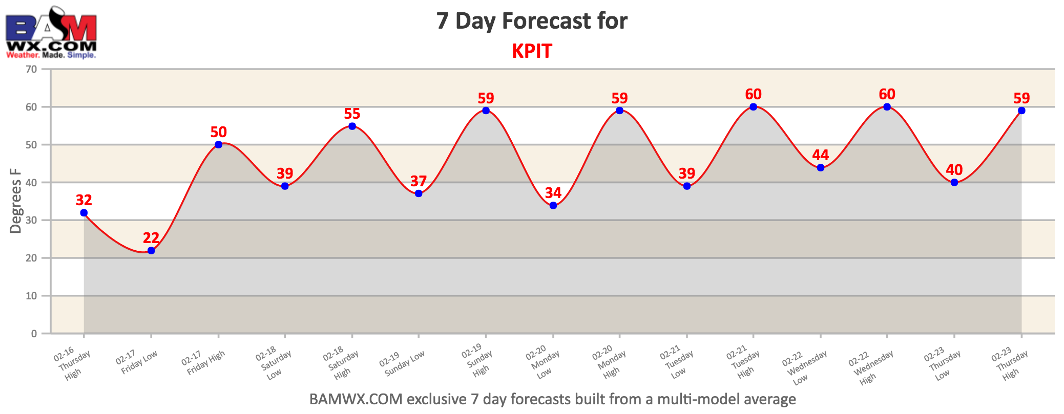
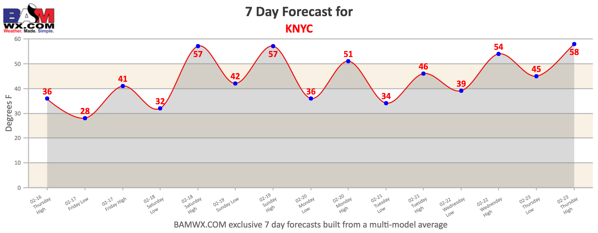
A warming trend will take place Friday into the weekend with each day getting progressively warmer. Here’s some 7 day temperature forecasts around the region, showing the warmup. You can access the airport closest to your house by clicking on the “zones” tab, then clicking “7 day forecasts”.
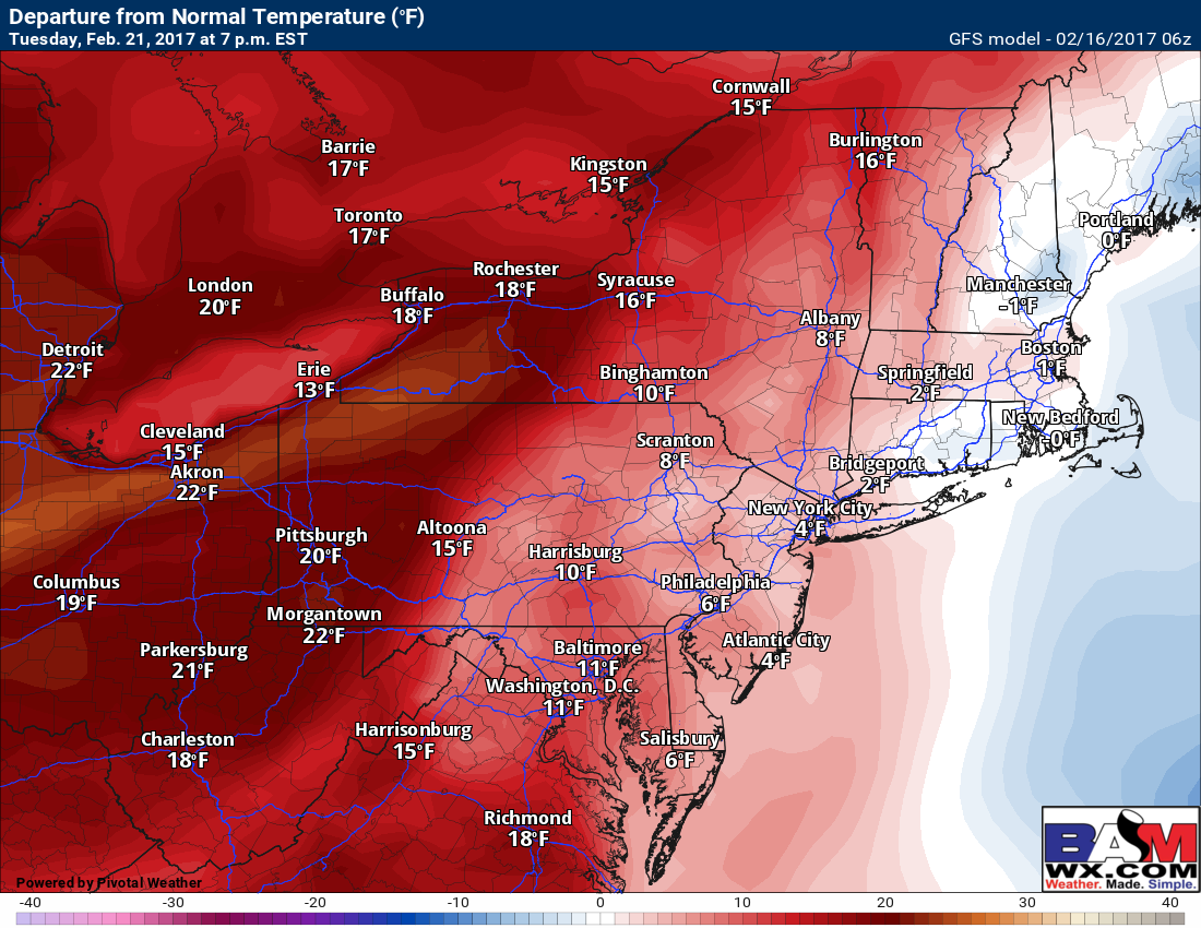
Dry conditions look to continue into the middle of next week before another cold front moves in. We are also watching a fast moving backdoor front Monday night into Tuesday across New England which will briefly knock temperatures down. The temperature anomaly map shows this well. Notice New England is near normal Tuesday while the rest of the Northeast is well above.
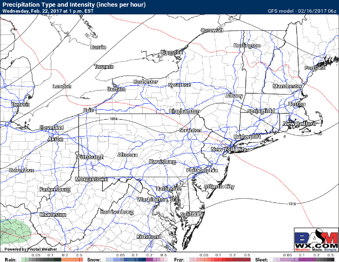
Timing is a bit uncertain with most models pinpointing Wednesday or Thursday. Here’s an idea from the GFS of when it may come through, and as of right now, it does not look like much.
Confidence and Risks:
- High confidence on a cold day today, but a warming trend through the weekend.
- High confidence on a dry period through early next week.
- Moderate confidence on a back door cold front stifling warmth across New England Monday and Tuesday.
- Low confidence on timing and precipitation impacts from a cold front mid to late week next week.
Today’s video covers it all (4 min). Have a great day! ~Ed