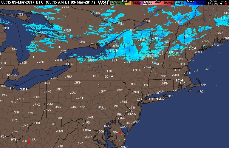
Good morning! We have a quiet day upcoming today with relatively warm temperatures ahead of our next snow maker. Here’s the radar as of 5:50 AM.
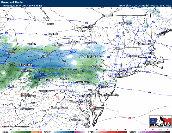
A fast moving disturbance will ride along an Arctic front tonight into Friday bringing accumulating snowfall from northeastern Ohio through southern New England. I’ll cover start times and end times in detail in the video below, so make sure to watch. Here’s the latest 3km (high res) NAM from this afternoon through Friday afternoon timing out the snow.
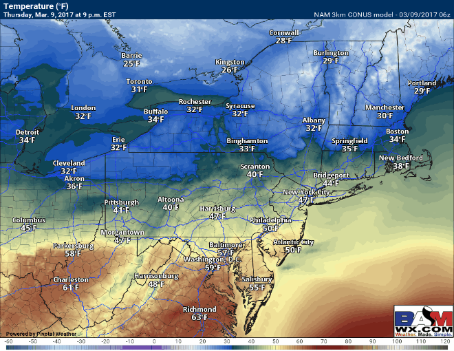
Temperatures will initially start warm this evening as snow (or perhaps a snow/rain mix to start) begins in western areas. This will spread east overnight and temperatures will fall to near or below freezing shortly after the snow begins. The initial warmth still may help melt some snow on pavement initially, but the pre-dawn start time should still allow for some to accumulate on pavement when its coming down in the morning. Temperatures once the snow ends Friday will spike into the mid to upper 30s causing some melting. Temperatures Friday evening will crash back into the 10s and 20s, creating a flash freeze threat.
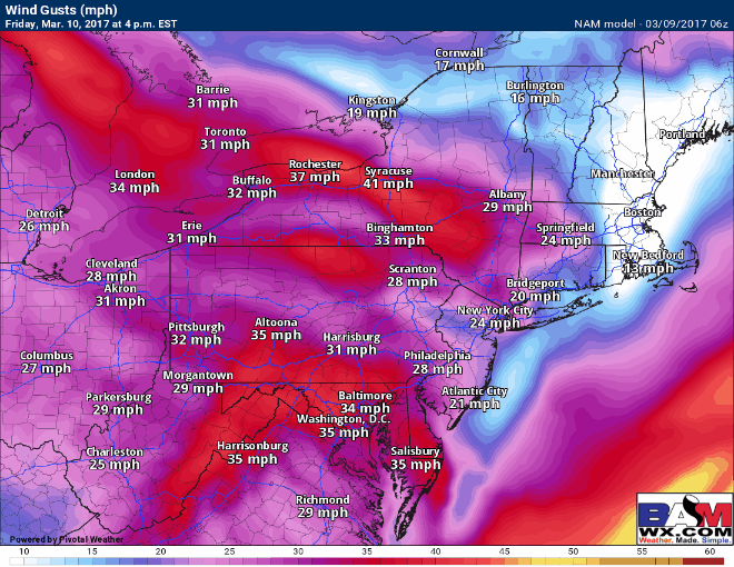
The only saving grace will be some wind that may limit this threat.
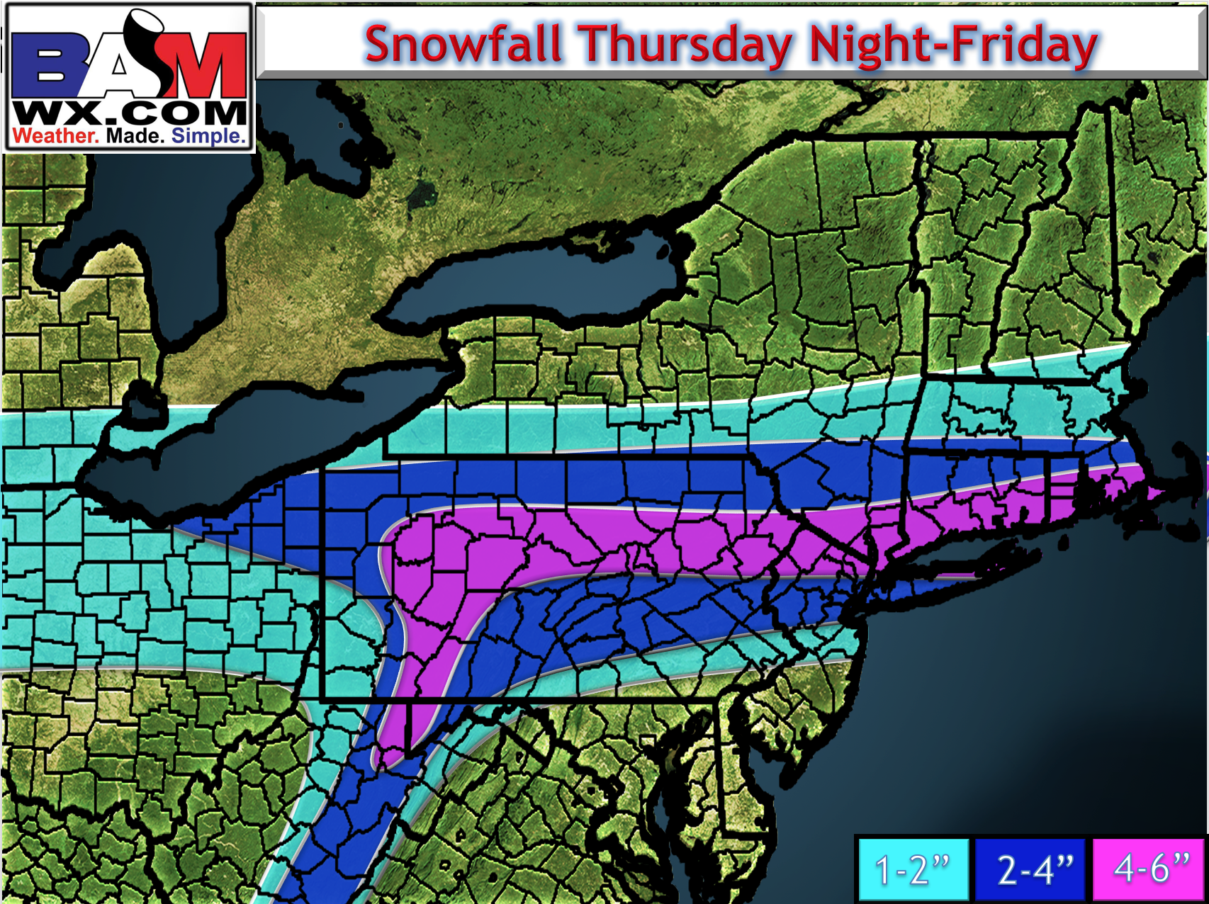
Snowfall has been tweaked to highlight possible areas of heavier snow. Notice the heaviest areas are now pretty much where I discussed yesterday, right along I-80 and into southern New England. There is a 4-6″ band, but I think 4-5″ amounts are most likely with some isolated 6″ amounts. With temps near freezing, this will be a wet snow.
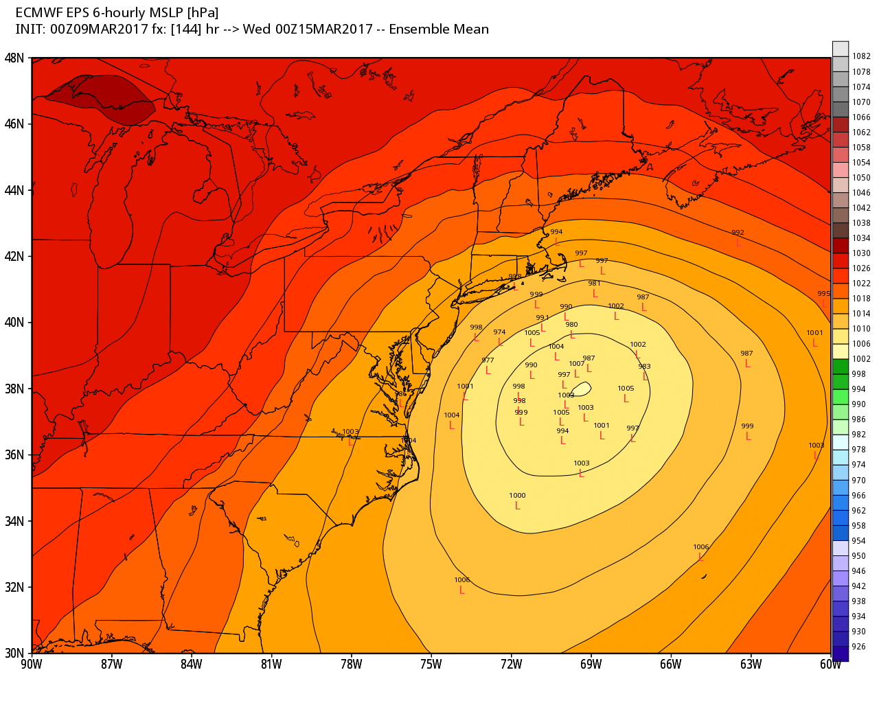
The weekend looks dry and cold, but we then look to Tuesday for our next coastal storm threat. Here’s the latest plot of the European ensemble members. Quite a bit of uncertainty remains but most members have a storm threat that we need to continue to monitor.
Confidence and Risks:
- Moderate to high confidence on storm track, snowfall amounts and intensity Friday. Some wiggle room in amounts remains, which I will update this afternoon.
- Moderate confidence that a storm forms near or off the coast early next week.
- Low confidence on the track of the storm for early next week as it depends on how the weekend pattern shapes up.
The video analysis below breaks it all down. I’ll have an update out this afternoon. Have a great day. ~Ed