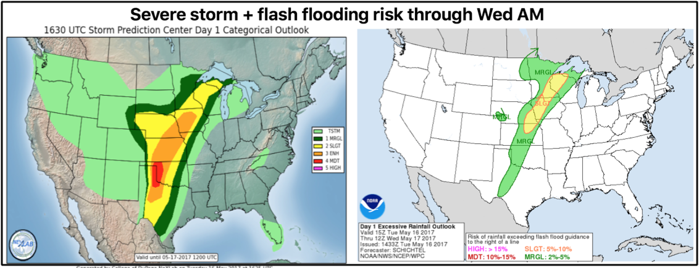
*Update*: Discussing Severe storms & excessive rain potential next 2 days across the Plains. K.
Synopsis: Highly recommend giving most of your attention to the video as severe storms and heavy rains will be possible across the central to northern Plains next 48-60 hours.
Current risks for severe storms and excessive rainfall spanning across the central to northern Plains locations with that exception of parts of the Dakotas through Wednesday.
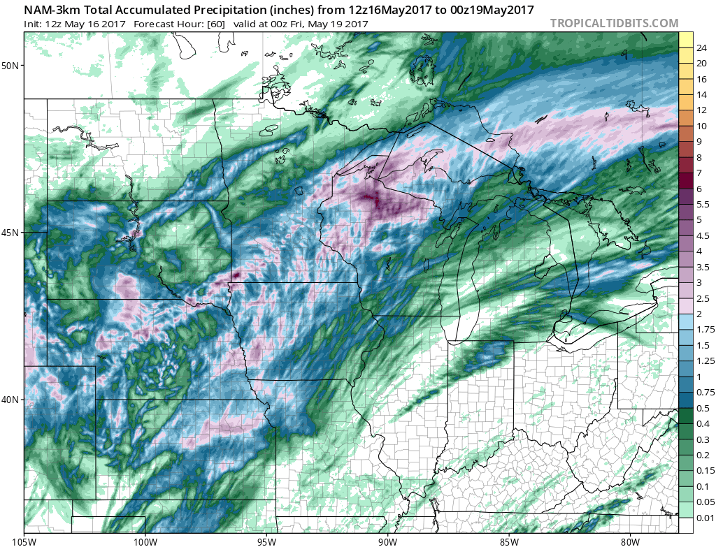
Total rainfall next 60 hours…2-3″+ amounts will be possible spanning from parts of Kansas, Nebraska, NW Missouri, Iowa, parts of South Dakota, Minnesota into Wisconsin. Honestly, wouldn’t be shocked to see a few 4″+ reports as well where the strong storms may stall out. Locations further east into the Midwest, with the exception of parts of northern Illinois largely stay unaffected by widespread rainfall here.
Confidence and Risk:
- Average to above average confidence of strong storms moving across the central Plains tonight into the overnight.
- Average risk for damaging winds, large hail and isolated tornadoes as well in this location.
- Average risk for heavy rainfall in excess of 2″ across the parts of the central Plains into Wednesday and into the northern Plains through Thursday.
- Average risk for stronger storms across the western and northern Midwest Wednesday into Thursday.
Today’s video (7 min):