Key Points – Wednesday, May 17, 2017:
Synopsis: Good Wednesday morning! In today’s discussion and video we target the storm threat increasing on Thursday, the windy conditions today and the stormy forecast through the weekend…also discussed is the cooler pattern into next week. Have a blessed day!
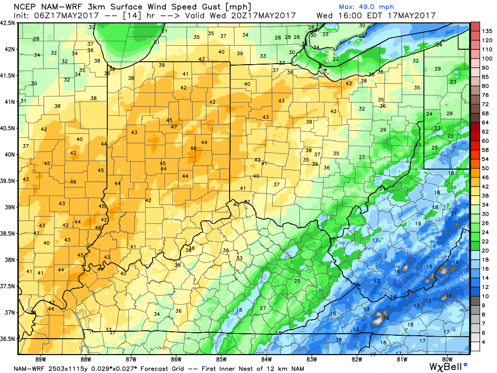
Current Wind Advisories across the Midwest…definitely feel like these advisories need to be pulled further east across most of Indiana and Ohio today.
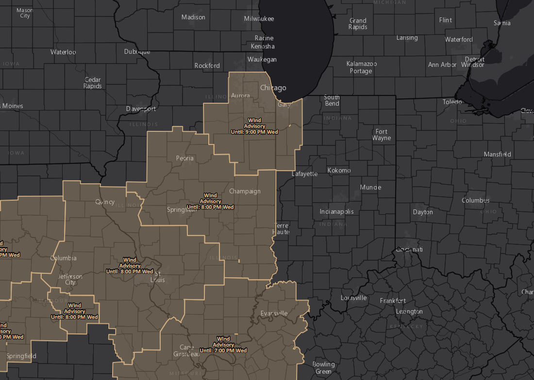
Winds will be out of the south-southwest today at 15-20mph, gusting at times over 40-45mph…will be very windy at times.
It will be quite warm today with most locations getting into the 80s…as we go throughout the day on Thursday it’ll be another day full of sunshine, but this will allow for energy to build in the atmosphere. By tomorrow evening ~6-7pm across northern IN/OH moving south storms look to fire along a frontal boundary. Although the risk is low, can’t rule out a strong storm here.
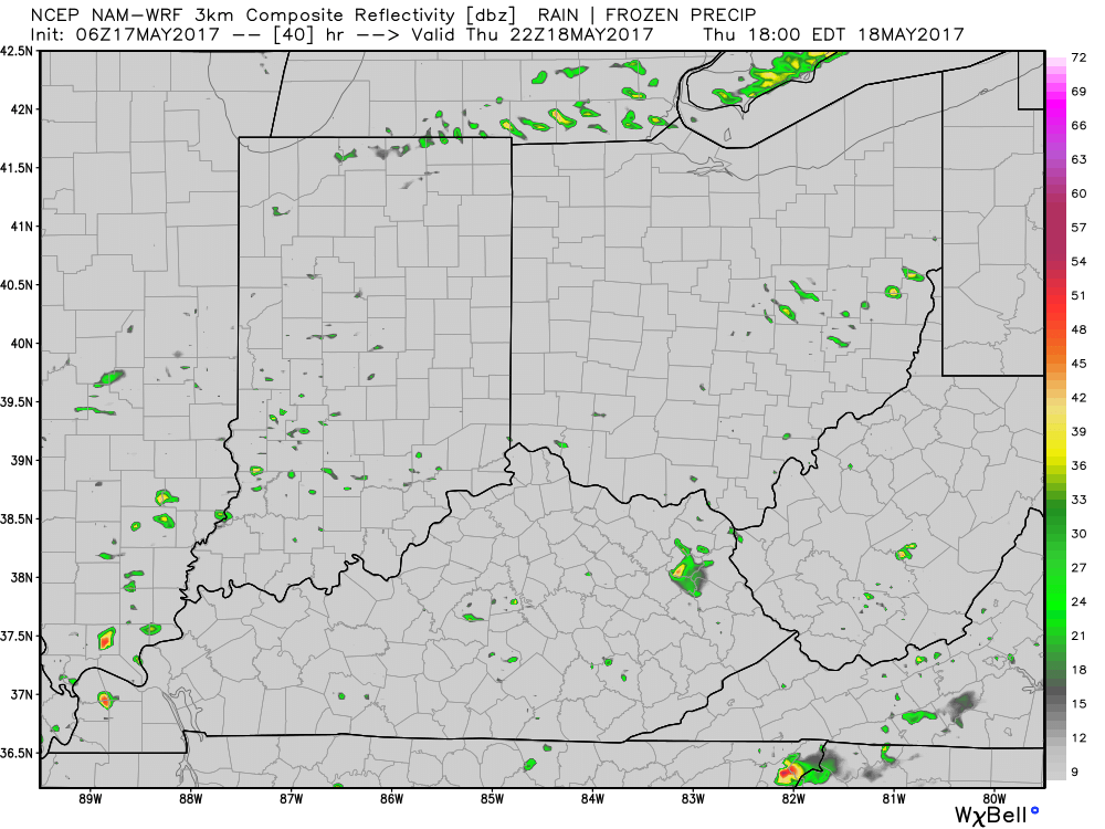
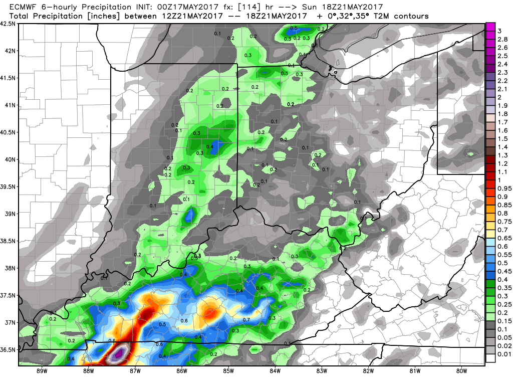
Glancing at total rainfall, under those heavier storms can’t rule out 0.5-1.0″. Not everyone gets in on these storms, they will be scattered in nature.
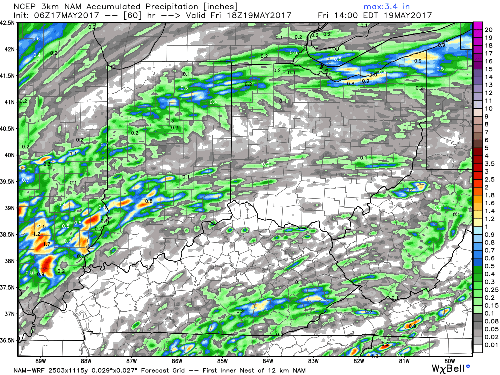
Next more widespread rains come later Saturday through Sunday across IN/OH as a cold front swings through and shifts east Monday morning.
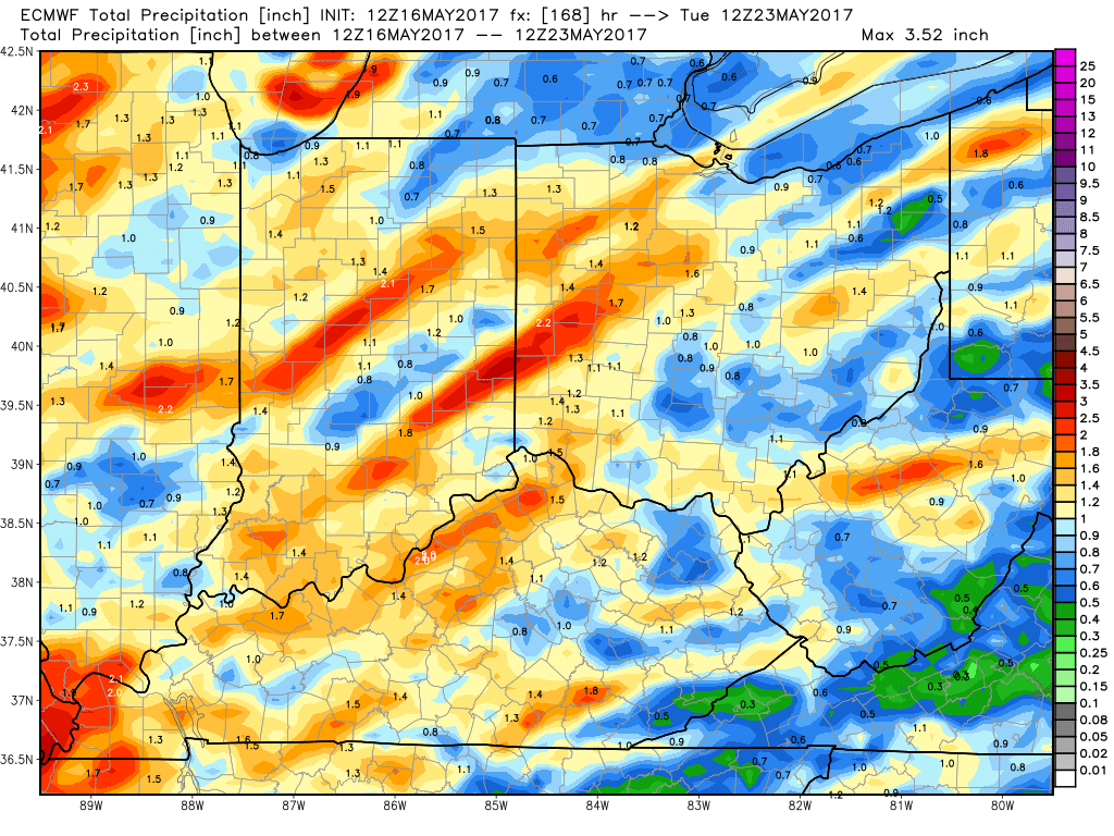
As discussed in the video, we are targeting a storm system every ~3-5 days at this time which means it’s tough to stay dry for a prolonged period of time. Here’s a glance at rainfall totals over the next week from the European model.
The warmth doesn’t look to last, getting more into next week we see the cooler pattern take shape across the Midwest…below is our updated week 2 outlook for temperatures from normal.

Confidence and Risk:
- Average risk for wind gusts over 40mph across IN/OH periodically.
- Average confidence we are watching a line of showers move south to north along a front tomorrow evening.
- Above average risk for a strong storm…confidence is lower for this.
- Above average confidence showers and storms move east along a cold front late Saturday into Sunday and exiting east Monday AM.
- Average confidence a cooler pattern starts to set in with below normal temps starting next week.
Today’s video (8 min):