Key Points – Wednesday, May 31, 2017:
Synopsis: Good Wednesday morning! Today we discuss the nice weather the next couple of days followed by multiple storm threats Friday with a cluster of storms from the northwest, then a warm front and low pressure system sweeping into the Midwest Saturday into Sunday…some strong storms will be possible here as well. It’ll be the haves and the have-nots, some folks will get in on a lot of rain and some will not…but we know with a northwest flow there will be storms in the area despite models keeping things dry. Have a blessed day!
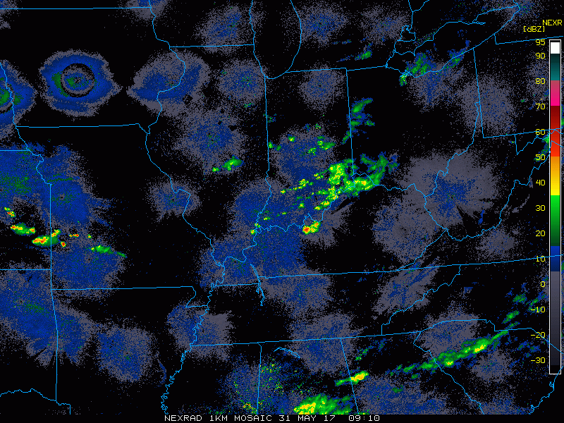
Current Radar…some scattered showers continue east across southern Indiana into Ohio this morning…these will clear out for a nice day, overall!
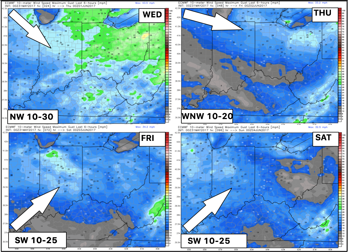
Backed by popular demand, we will be providing wind forecasts now with the daily updates…here’s the next 4 days. Thank you for the feedback!
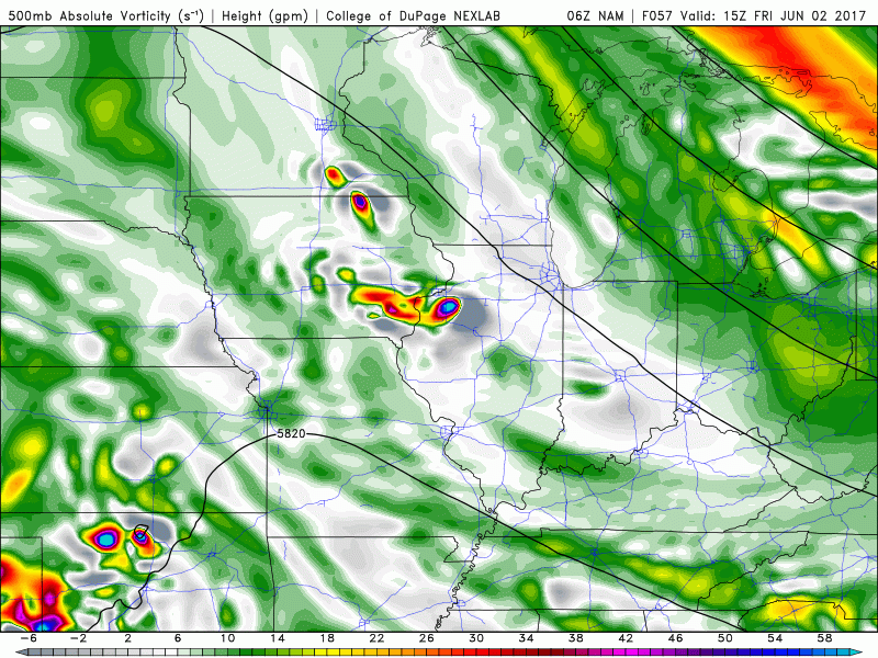
Overall, today and tomorrow will feature plentiful sunshine with highs in the low to mid-70s. Our next wave of showers and storms looks to come Friday afternoon into Friday evening into early Saturday where we need to watch a storm cluster move northwest to southeast (also called an MCS – mesoscale convective system). Can’t rule out a strong storm risk as well as seen below.
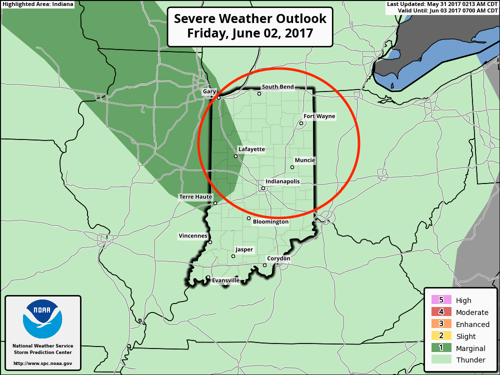
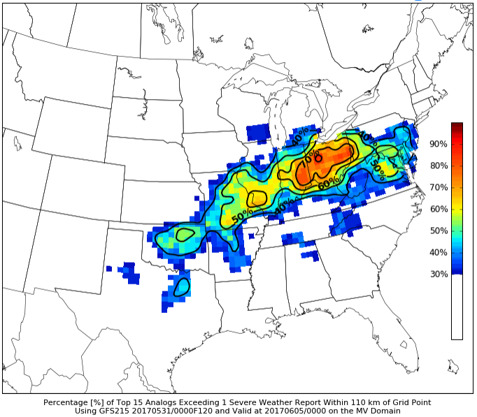
Here’s the latest strong storms risk for Friday as well…we think it needs to come further east, wouldn’t be shocked for an upgrade to a slight risk as well with the main threats being damaging winds and large hail.
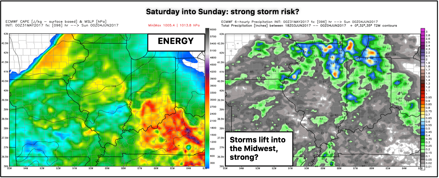
Right on the heals of this event is a front that lifts into the Midwest Saturday into Sunday…looking at historical guidance (previous days that were similar in set up) tells us we need to watch this weekend for potential severe storms.
European with plenty of energy and lift Saturday into Sunday as a warm front lifts into the Midwest and low pressure system sweeps east. Needs to be noted that there will be some sunshine possible here as well in between the storms this weekend.
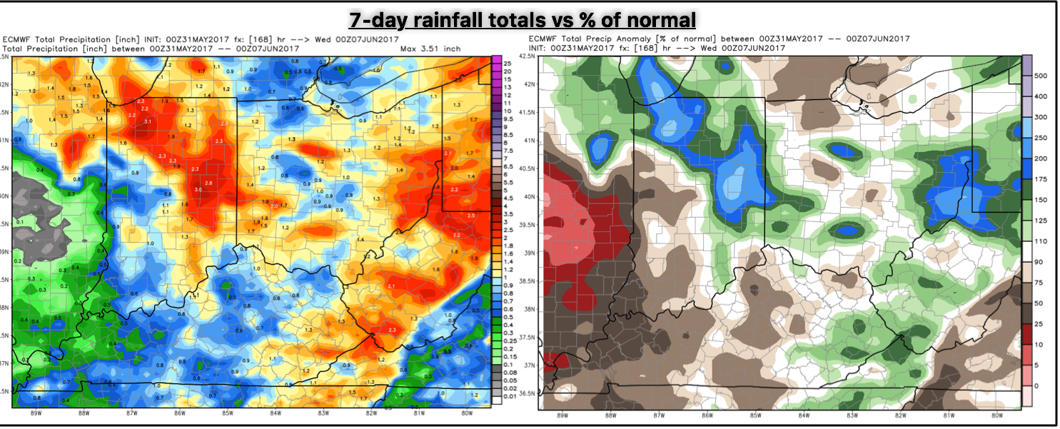
Total rainfall next 7-days vs percent of normal…some locations likely seeing an additional 2-3″ with isolated higher amounts possible (~250% the normal).
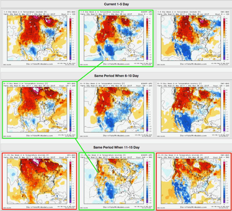
The European ensemble had the right idea in the previous 11-15 day forecast for the next 5 days in regards to temperatures; it was a little too cool in the 6-10 forecast, but right now we are eyeing more seasonal temperatures through the first few days of June.
Confidence:
- Above average confidence the next 2 days feature plentiful sunshine and seasonal temperatures (with some wind).
- Average confidence of an MCS event moving in from the northwest later on Friday into Saturday morning (some could be strong).
- Average confidence of additional storms on the day on Saturday into Sunday as a low pressure moves into the Midwest (some could be strong here as well).
- Average confidence we are overall seasonal in our temperatures from normal over the next 5 days.
Today’s video (8 min):