Key Points – Tuesday, May 30, 2017:
Synopsis: Good Tuesday morning, we hope you all had a wonderful Memorial Weekend! Mostly clear skies to start the day today, a little breezy with west/southwesterly wind gusts up to 30mph and scattered showers and storms overnight moving east. Outside of these scattered rain chances we will see plenty of sunshine throughout the week for sure. Another wave of energy moves west to east on Thursday that looks to impact our southern zone locations and then a more robust wave of energy will move through this coming weekend that looks to bring more widespread rain chances. Have a blessed week!
Energy moving west to east later today enhanced by daytime heating likely sparks some scattered showers with the threat continuing overnight into Ohio.
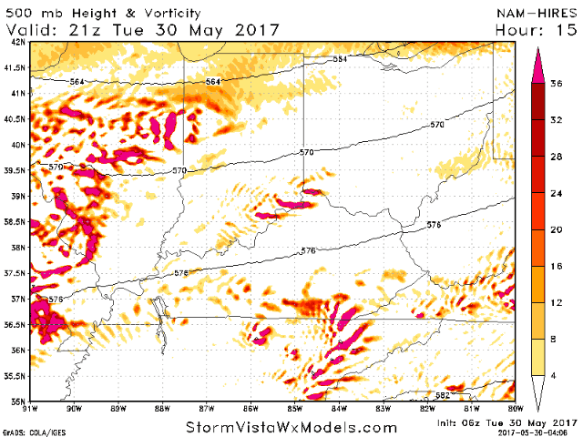
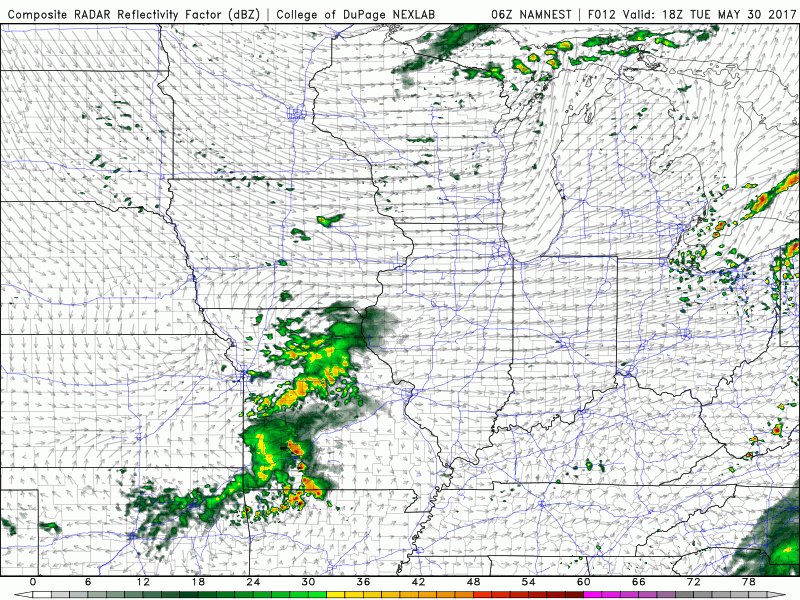
This can be seen fairly well by simulated radar from the 3km-NAM, some scattered showers and storms look to pop around dinner time tonight from west to east. A little breezy today with west/southwest winds gusting up to 30mph at times.
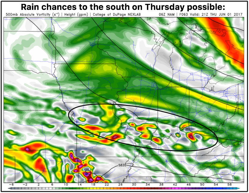
Next rain chance comes to the southern half of the forecast area later Thursday, have to watch if this comes a little further to the north. Needs to be noted there will be ample amounts of sunshine throughout this week, these will be scattered storm threats.
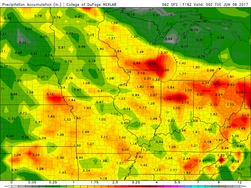
Following this we need to watch for a potential heavy rainmaker to swing through the Midwest Friday into Saturday along a warm front, and then the low pressure system makes its way east Saturday into Sunday bringing more heavier rains.
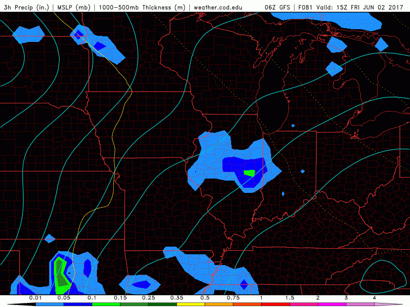
Total rain through next Monday…this will change slightly where the heavier rains set up, but generally speaking 1-2″ is a safe bet at this time. Again, most threats during the week will be scattered so it will be the haves and the have-nots. It’s through the weekend where the more widespread rains move east.
The reason why we think the pattern stays wet into week 2 is one thing: an active Pacific jet stream. In the week 2 outlook we keep things wet for this very reason as seen below.

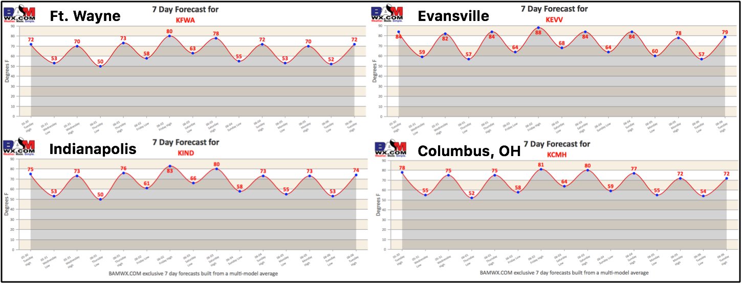
Brief glance around the zone at our in-house 7-day exclusive temperature forecasts…you can access these under the “Zones” option! Will be mainly in the 70s and lower 80s with plenty of opportunity for sunshine the next 4-5 days.
Confidence:
- Average confidence some scattered showers/storms possible this evening through the overnight from west to east.
- Average confidence the southern Zone locations see some storm chances on the day on Thursday.
- Increasing confidence of another heavy rain maker making its way into the Midwest Friday through Sunday as a low pressure system moves east.
- Above average confidence we do get in on some sunshine this week in between the scattered storm chances.
Today’s video (8 min):