Key Points – Thursday, May 25, 2017:
Synopsis: Good Thursday morning! We discuss the remaining showers and thunderstorms today before the low pressure system moves southeast, the multiple waves of heavy/stronger storms moving east later Friday into Saturday morning and then the low pressure system that follows on Saturday into Sunday that could drop additional heavy rains and bring strong storms to the Midwest. Make sure to watch the video through to the end. Have a blessed day!
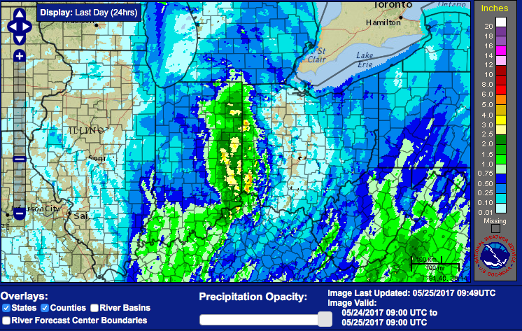
Total rainfall last 24 hours…we mentioned the risks for 4″+ possible with this upper-level low pressure near the IN/OH border…areas across eastern Indiana and western Ohio have seen 5-6″ of rainfall, with rain still falling.
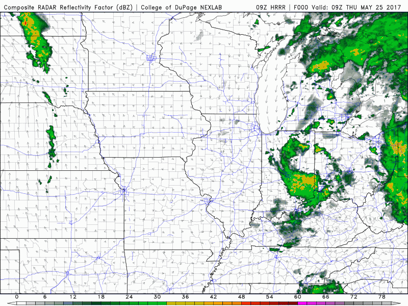
Simulated radar for the remainder of the day today…showers slowly creep east today, some isolated storms possible across Ohio later today as we get in on some daytime heating.
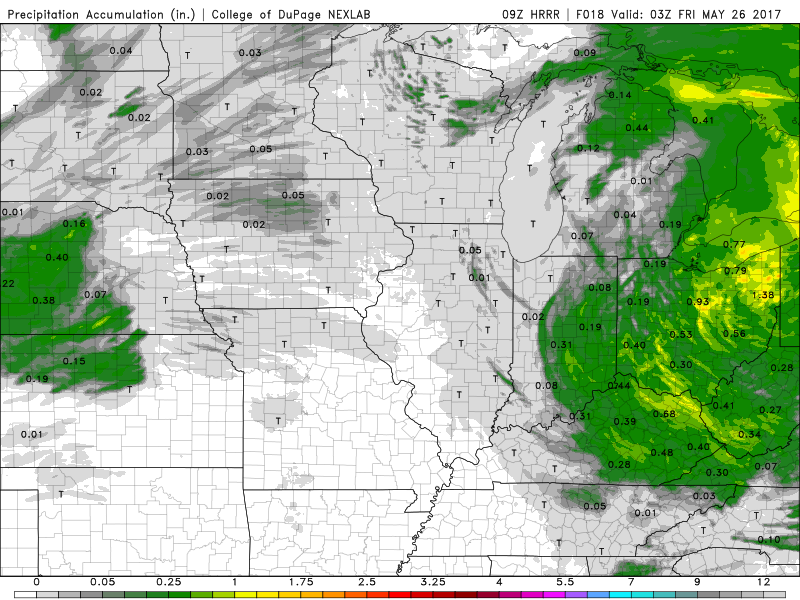
An additional 0.5-1.0″ is possible…although the model doesn’t show it, wouldn’t be shocked to see isolated 1.5″ amounts as well working into Ohio.
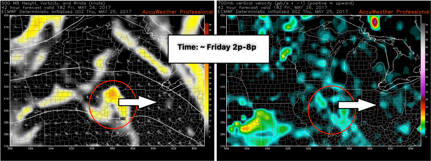
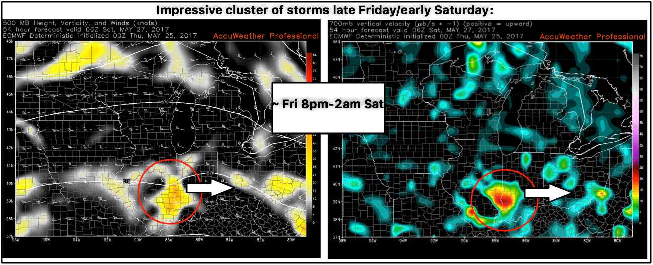
What’s interesting is it appears we have 2 separate waves of energy move west to east Friday evening and Friday overnight into Saturday morning, both having the potential to sweep through a cluster of storms bringing additional heavy rainfall/gusty winds. The first wave we are watching comes through ~Friday 2p-8pm.
The next comes later Friday night into Saturday morning for another round of showers and storms ~Friday 8pm – Saturday 2am.
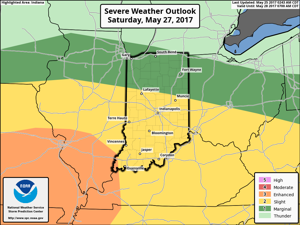
Strong storm threat on the day on Saturday becoming increasingly possible, we feel that the enhanced risk (orange color) could potentially be pulled further east into Indiana given the impressive set-up…right now, all modes of severe weather are on the table.
The progression of the weekend system moving through is seen well by the European model below later Saturday into Sunday as a warm front lifts first and then a cold front sweeps east. It’ll be pretty difficult to find a good amount of dry time here.
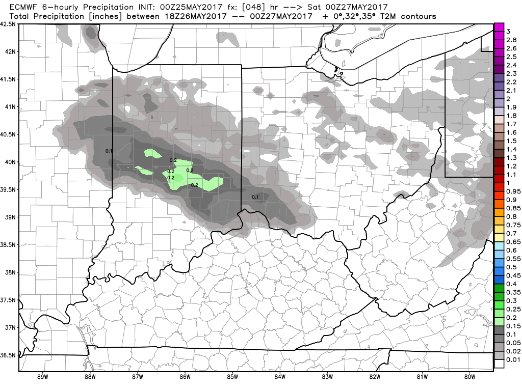
Total rainfall from the European out to 7 days…likely the model is under-doing rainfall totals given the 2-3 waves of potential heavy rainfall that’ll work in Friday through Sunday…confidence is growing we see more widespread 3″+ totals when it’s all said and done.

Confidence:
- Above average confidence some remaining showers and a few storms possible today as the low pressure departs to the south and the east.
- Average confidence on a multiple wave event Friday into Saturday morning for IN/OH locations.
- Increasing confidence these will produce some heavy rainfall and gusty winds as well.
- Increasing confidence for the potential for some strong storms Saturday into Sunday with a warm front working in then the cold front sweeping east on Sunday.
Today’s video (7 min):