Key Points – Friday, May 26, 2017:
Synopsis: Good Friday morning! First and foremost, today’s forecast is highly volatile, we’d consider it more of a real-time forecast because our best data is changing run-by-run and not matching up well with how current storms are developing to our west. We will definitely have a short-term update posted later today, we need to watch for a southeast dive of a cluster of heavy/strong storms later this afternoon into tonight across Indiana and Ohio, the warm front lifts into the Ohio Valley on Saturday into early Sunday then the cold front sweeps east later on the day on Sunday bringing another wave of storms. All-in-all, there’s 3 waves of storms yet to go, so if even one of them is off or incorrectly modeled, things will change. Thank you for your patience, and have a blessed holiday weekend!
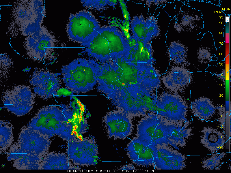
Current Radar:
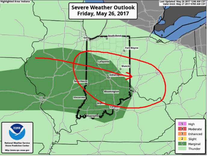
Current strong storm risk today…we think the current marginal risk should be pulled further east and south to include more Ohio locations for strong wind gusts and isolated hail…plus some heavy rainfall is possible.
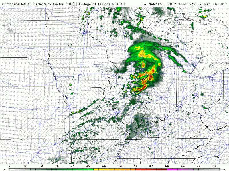
Simulated radar from the 3km NAM…we think right now it has a decent handle on diving storms to the southeast ~5pm crossing into Indiana and heading east throughout the evening and overnight. Most of Saturday will be partly sunny, there is a scattered storm threat across the southern half of IN/OH later in the afternoon as well.
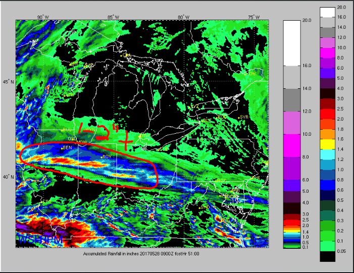
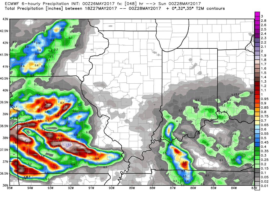
Total rainfall thoughts…1-2″ definitely isolated higher amounts possible in the red circled area, and also think locations closer to the river see 1-2″ as well. Notice in the middle there’s some locations that may not see any rain at all…it’s very storm dependent here.
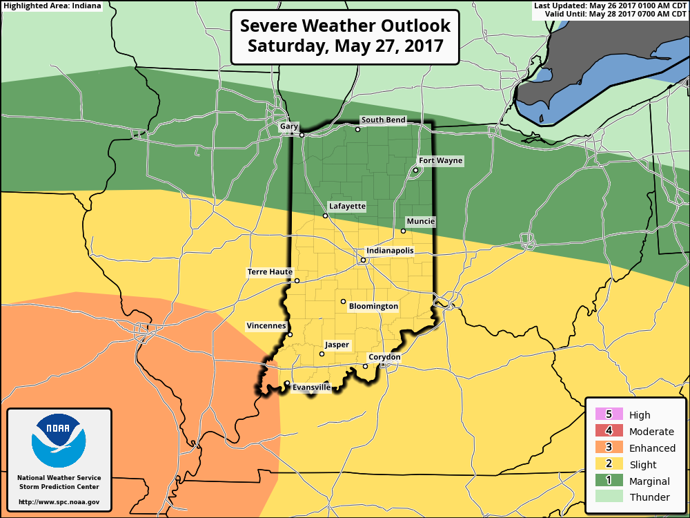
Day 2 risk: all modes of severe possible on Saturday as the warm front lifts into the Midwest…wouldn’t be shocked if the enhanced risk pushes further east into Indiana to cover the risk.
Warm front lifts into the Midwest later on Saturday, increasing chances for strong storms into Sunday morning…here’s a look at what the European model has. Waking up Sunday morning most of Indiana into Ohio will be covered in storms, some being strong. Right on its heals the cold front will sweep through after lunch east bringing gusty winds and more heavier rains. Partly sunny skies are expected for Memorial with an isolated storm chance north.
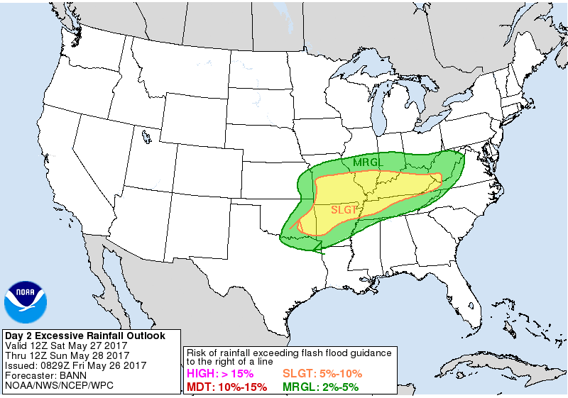
There is an excessive rainfall risk issued for Saturday into Sunday for potential flash flooding as well…where the warm front sets up there will likely be some times of heavy rainfall.
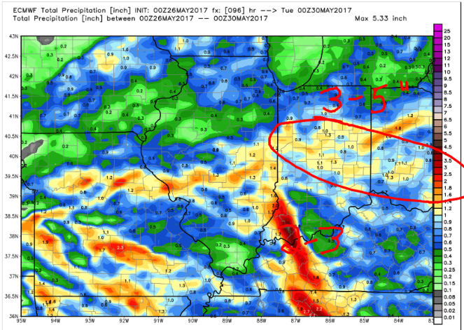
Total rainfall next 96 hours from the video…the red circle is just a rough area, and the “2-3″ stands for how many waves are still yet to come just through the weekend. The model is definitely underdone, we do think 3-5” will be possible in some locations overall…question is exactly where. Below is our best forecast at this time.
Here’s our latest thoughts on temperatures from normal over the next week…slightly cooler, but overall relatively seasonal for late May…meaning more time spent in the lower 70s.
Confidence:
- Lower confidence on exactly how the cluster of storms develops later this afternoon from west to east.
- Average confidence on a strong storm threat today mainly being gusty winds, heavy rains and isolated hail.
- Average confidence Saturday features partly sunny skies with isolated storms across the southern half of the Zones areas later Saturday.
- Average confidence of the timing of when the warm front lifts in the Midwest later Saturday into Sunday morning bringing a heavy rainfall/strong storm risk.
- Above average confidence that models are under-doing total rainfall over the next 96 hours…we think 3-5″ is on the table for some locations here.
Today’s video (7 min):