Key Points – Tuesday, May 9, 2017:
Synopsis: Good Tuesday morning! Today we discuss the heavier rain and strong storm threat over the next few days…models tend to do a poor job with handling storms riding the edge of high pressure and along stationary boundaries so we discuss the risks as well. The active pattern continues through the end of the month shown well by the latest European weeklies, we will discuss more on this in today’s long-range later this morning, have a wonderful day!
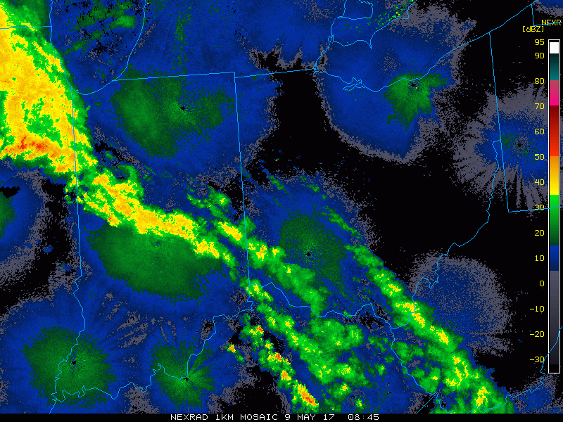
Current Radar:
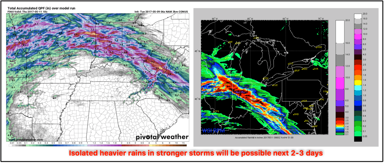
Heavy rains possible next few 60 hours…especially if getting under a stronger storm, can’t rule out 2″+ here.
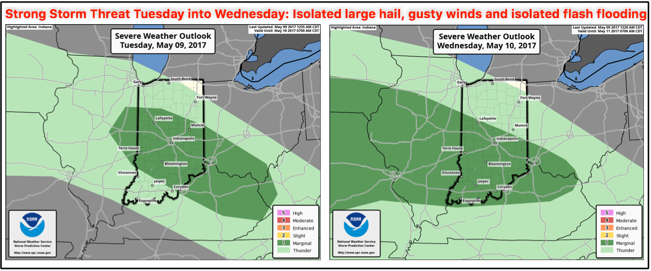
Some strong storms today into Wednesday with isolated large hail, some gusty winds and some isolated flash flooding will be possible. Would not be shocked to see Wednesday’s risk pulled slightly further north.
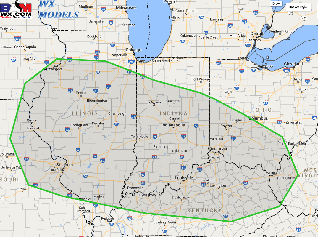
Still believe this is the area where we will be targeting some stronger storms and isolated flash flooding next 3 days:
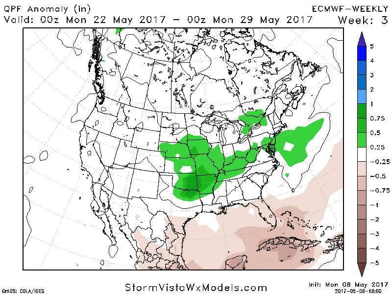
New European Weeklies came in, will discuss more in the long-range today but remember how we discussed a stormy, active end of the month? It’s definitely starting to pick up on these trends:
Confidence and Risk:
- Above average confidence showers and storms continue to push south and east this morning across portions of Indiana and Ohio.
- Average to above average risk for stronger storms today as well.
- Average risk for additional storms firing along the stationary boundary later tonight into the pre-dawn hours of Wednesday we need to watch as well.
- Average confidence in the timing and specifics of additional showers and storms Wednesday into Thursday.
- Above average risk in the exact placement of the frontal boundary this week as models continue to shift the axis further north (not surprised).
Today’s video (7 min):