#ILwx Severe Weather Expected Both Today and Saturday. Details Here! E.
Key Points: May 26, 2017
Synopsis: Good Friday morning! A jam-packed update today with multiple rounds of severe weather expected today and tomorrow. The first wave is occurring now across Missouri and will move into western Illinois this morning. A complex of storms is expected across the state this afternoon with gusty winds, heavy rain, hail and an isolated tornado possible. These systems are “nowcast” type systems that can change paths very quickly, so confidence is low to moderate on the track of these storms discussed in the video. Another severe threat is expected tomorrow afternoon and evening especially south as another disturbance moves through. Quieter weather with only a few spotty showers is expected for the remainder of the holiday weekend. Have a blessed day!
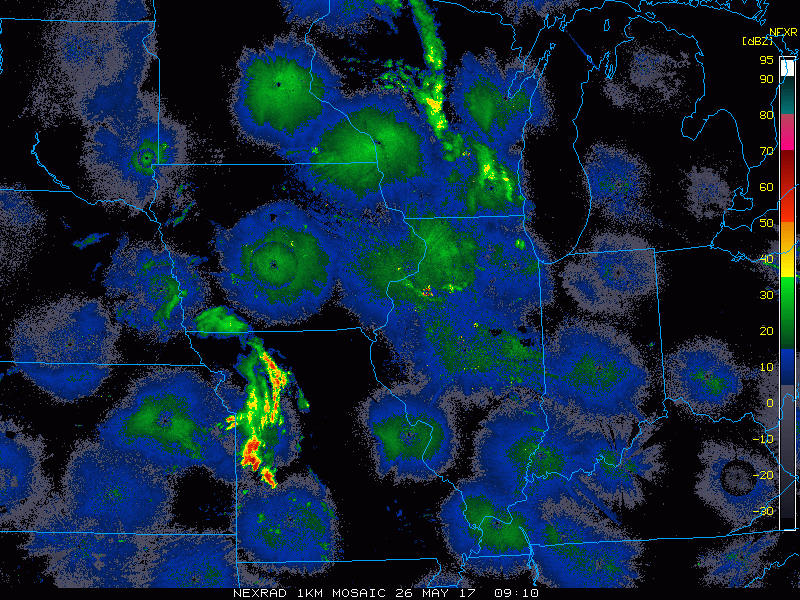
- Current radar shows the complex moving toward western Illinois early this morning.
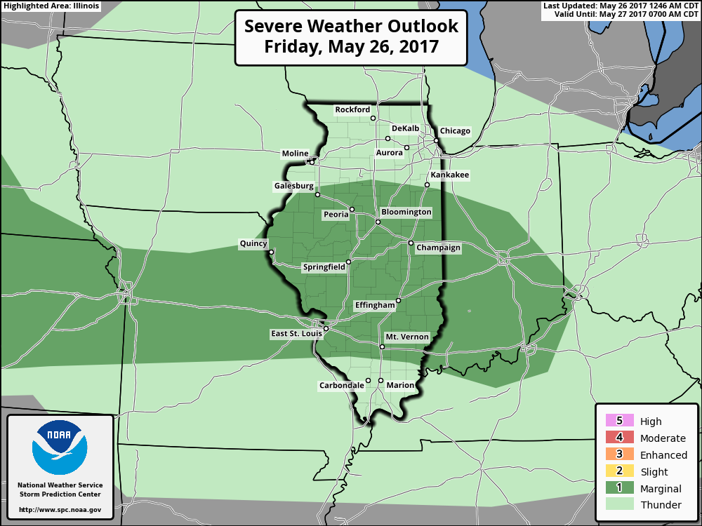
- Here is the SPC day 1 outlook, highlighting a risk for severe weather. I’d even argue a slight risk is possible in central IL.
- Through today, a complex of storms will move into western areas early on, then intensify and dive southeastward through the afternoon. Notice how models are struggling with current activity in Missouri.
- Total rainfall will likely range from 0.50-1.50″ for any area that sees this complex of storms.
- Another disturbance will push into the Midwest Saturday brining another threat for severe weather, especially south. Here’s the day 2 SPC outlook. I’d again argue a moderate risk is possible in southwestern Illinois.
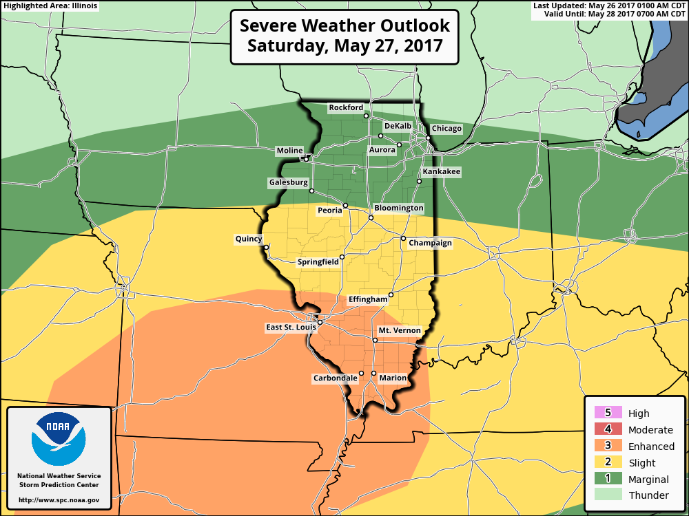
- Atmospheric ingredients will align well for severe thunderstorms capable of producing hail, damaging winds, and tornadoes.
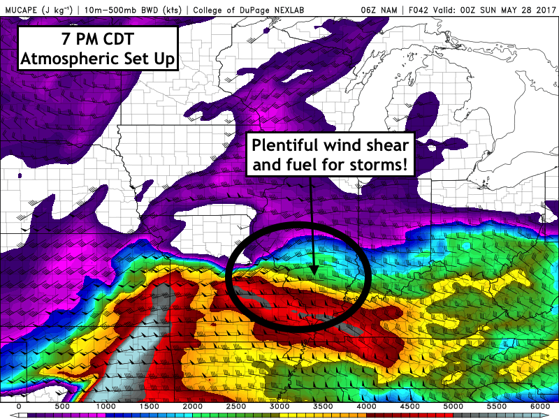
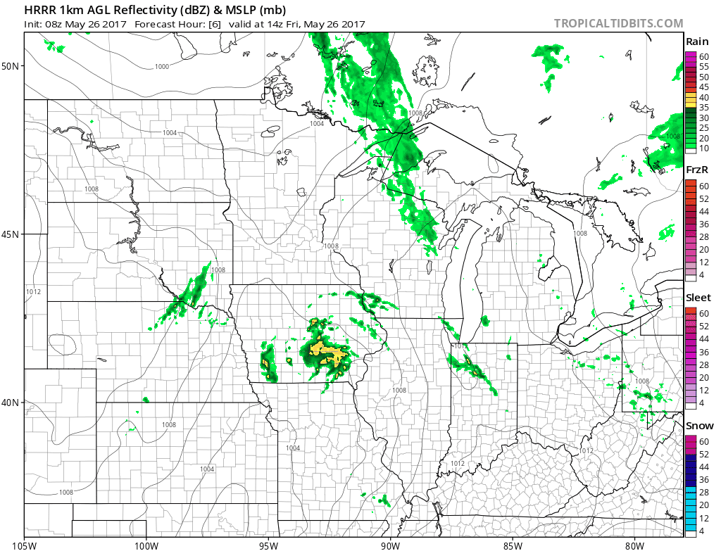
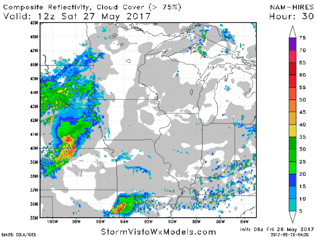
- The highest likelihood of severe weather will occur late tomorrow afternoon into tomorrow evening. Here’s a look at the projected radar.
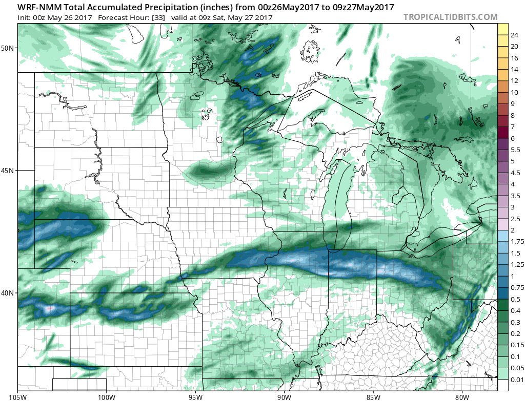
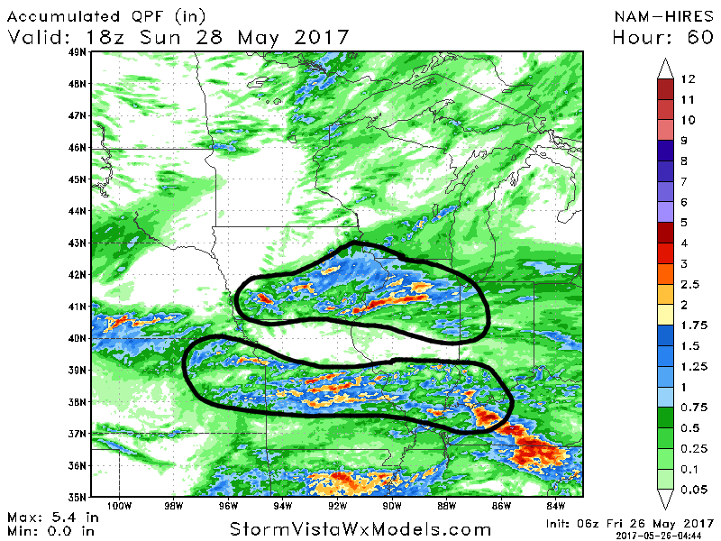
- Total rainfall from both event combined will be impressive, with some picking up 2-4″. Again, these amounts are all dependent on where individual storms track. This is shown well below. Don’t take this (or any) total precip maps as gospel here as exact track is uncertain. But note where storms occur, 2-4″ is expected with much less elsewhere.
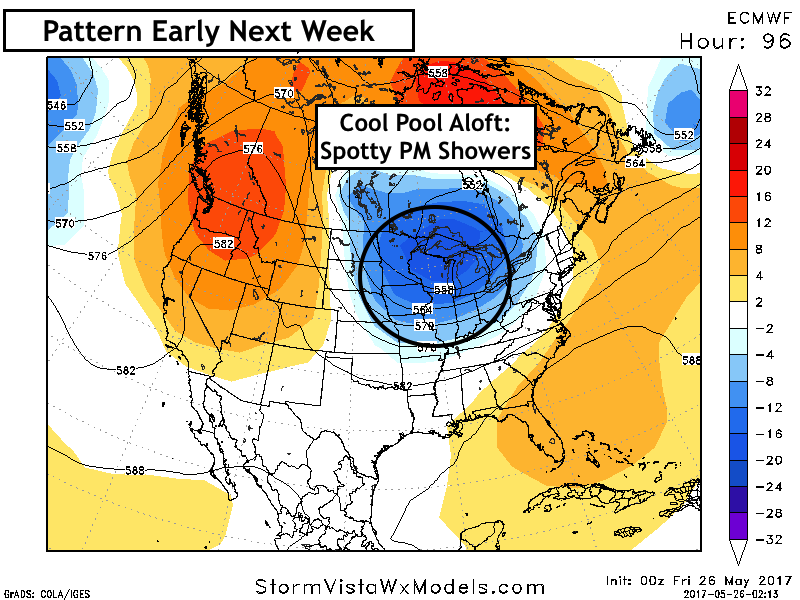
- Beyond this, a cool dome of air will allow for spotty showers and storms to persist into the beginning of next week as well.
Confidence and Risks:
- Below average to average confidence on track of storms through this evening. This will heavily determine who sees heaviest rains.
- Average confidence on severe threat tomorrow focusing south through tomorrow night. Exact placement of storms remains uncertain.
- Above average confidence on a cool dome aloft into early next week promoting spotty afternoon showers especially north.
Today’s Video (9 minutes):