#ILwx Severe Threat This Evening, Active and Trending Cooler Through the Weekend. E.
Key Points: May 17, 2017
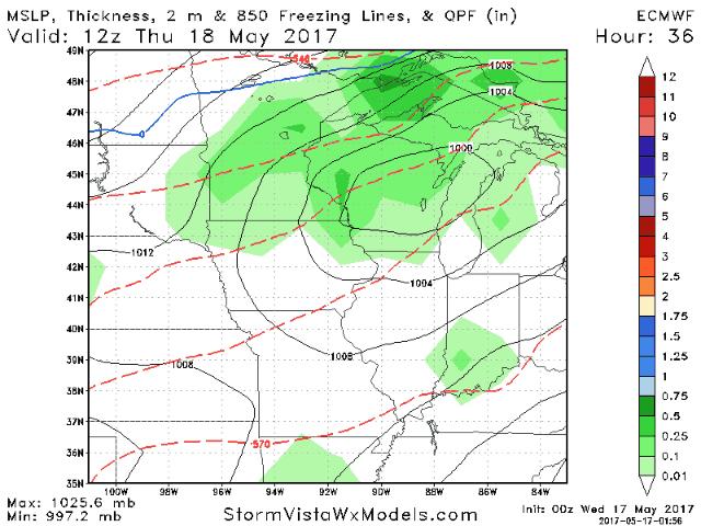
Synopsis: Good Wednesday morning! We are tracking showers and thunderstorms across Iowa and Missouri this morning along a slow moving frontal boundary. These will push into western Illinois this morning with clouds and some rain. Elsewhere across the state will feature some sunshine, gusty winds, and temperatures rising into the 80s. An approaching disturbance from the west will spark strong to severe thunderstorms across Iowa this afternoon that will push into western Illinois this evening. The main threats with these storms will be large hail, gusty winds, torrential rain, and even an isolated tornado. The frontal boundary will sag south tomorrow and while there will be some sunshine, a few spotty afternoon storms are possible, especially south. Additional rain and storms likely come Friday into the weekend ahead of some cooler air arriving for next week. Have a great day!
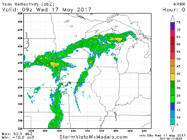
- Current radar shows showers and storms off to our west.
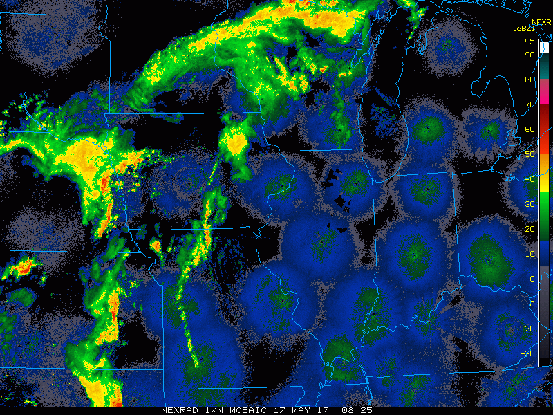
- These rains will push into western areas this morning. An additional severe threat will develop this afternoon and evening across western areas as well.
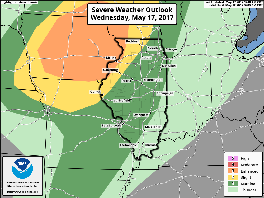
- The SPC has highlighted this threat with an enhanced risk of severe weather across Iowa and extreme western Illinois.
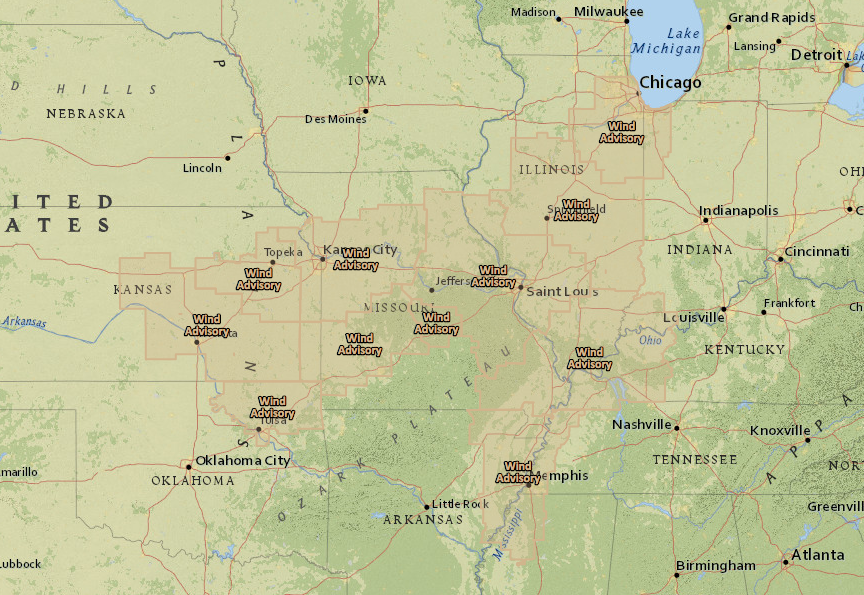
 Winds will also be gusty through the day out of the south. Wind advisories are up for the region in anticipation of gusts past 40 mph.
- An active pattern will continue through the weekend with multiple rounds of showers and thunderstorms.
- There may be some dry time Sunday into Monday, but any dry time looks brief. Another disturbance may bring another round of rain Monday night into Tuesday.
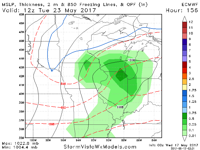
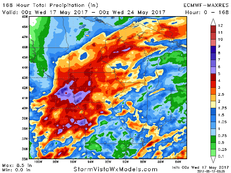
- 7 day rainfall will be storm dependent, but where storms do track, some heavy rain is definitely on the table.
- Active times will continue into next week, but cooler times are likely. Here’s a look at our week 2 temperature forecast.

Confidence and Risks:
- Above average confidence in scattered storms this morning across western areas. A stronger storm threat is expected this evening across western areas as well.
- Above average confidence in active times continuing through the weekend. Timing and exact placement remain uncertain. This will also dictate total rainfall amounts.
- Above average confidence in a cooler pattern developing into week 2 along with continued at or above average rainfall chances.
Today’s Video (8 minutes):