#ILwx Rain and Storm Threat Builds Through This Week, Cooler Into Next Week. Details Here! E.
Key Points: May 16, 2017
Synopsis: Good Tuesday morning! We continue to track a very active pattern just to our north and west, but across Illinois, we remain largely dry as a ridge of high pressure centers itself over the Ohio Valley. A spotty shower is possible in western areas today, but most of the region stays rain free today. This ridge will quickly move east by tomorrow, re-introducing the threat for showers and thunderstorms across the region. I’ll discuss timing and impacts in the video so be sure to watch! Shower and storm chances will persist through the remainder of the week with ~30% risk of activity Thursday and a bit higher threat Friday especially south and west. Cooler conditions are expected into next week, but it likely stays active. Have a great day!
- Current radar shows the active times not too far away from the region this morning.
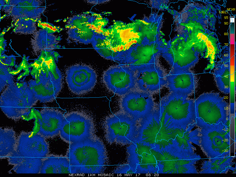
- Through today, most activity stays off to the west, but a spotty shower or storm in the northwestern part of the state is possible.
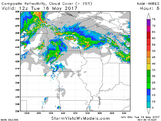
- The threat for a few showers and thunderstorms grows tomorrow and tomorrow night as a piece of energy approaches from the west. Details are discussed in the video!
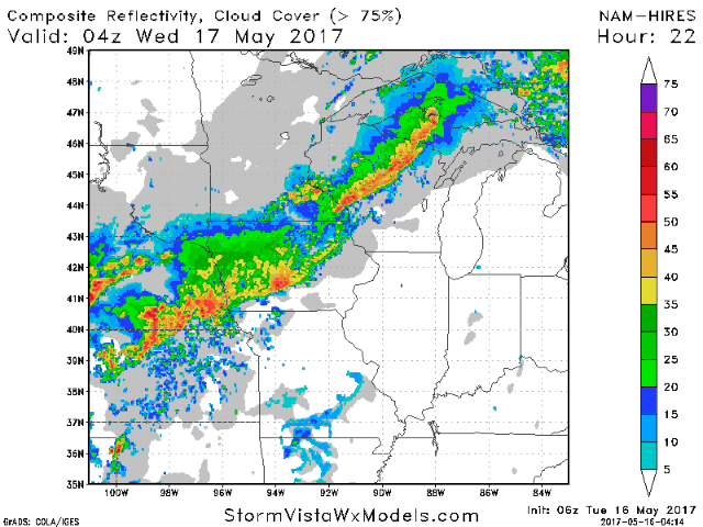
- Active times continue through the weekend as a frontal boundary slowly sags through the region. This will lead to multiple rounds of showers and thunderstorms especially west.
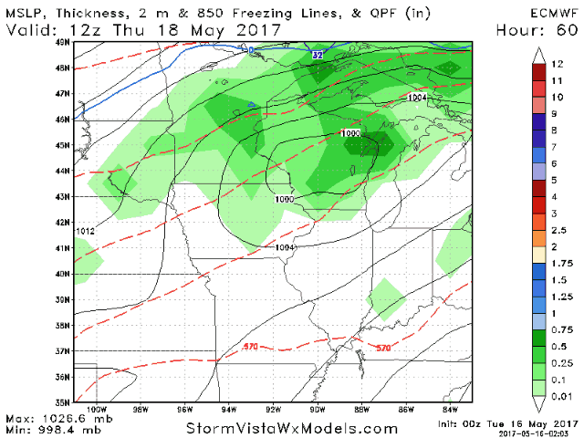
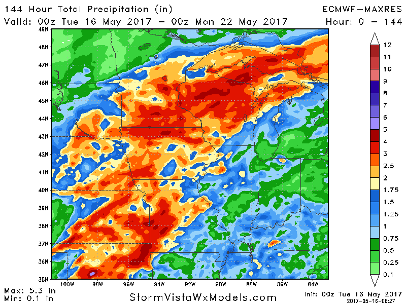
- Total rainfall through Sunday will be heaviest west. Also note the “haves and have nots” in this type of pattern.
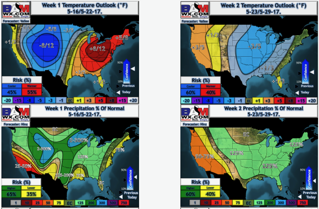
- Temperatures this week will be quite warm, but a trend to cooler with active times continuing is in the cards into next week. Here’s a look at our temperature and precipitation forecasts.
Confidence and Risks:
- Above average confidence in a dry but warm day today for most. A stray storm possible northwest
- Average to above average confidence in scattered storms Wednesday through Sunday. Timing and exact placement remain uncertain. This will also dictate total rainfall amounts.
- Increasing confidence in a cooler pattern developing into week 2 along with continued at or above average rainfall chances.
Today’s Video (6 minutes):