Key Points – Wednesday, March, 8, 2017:
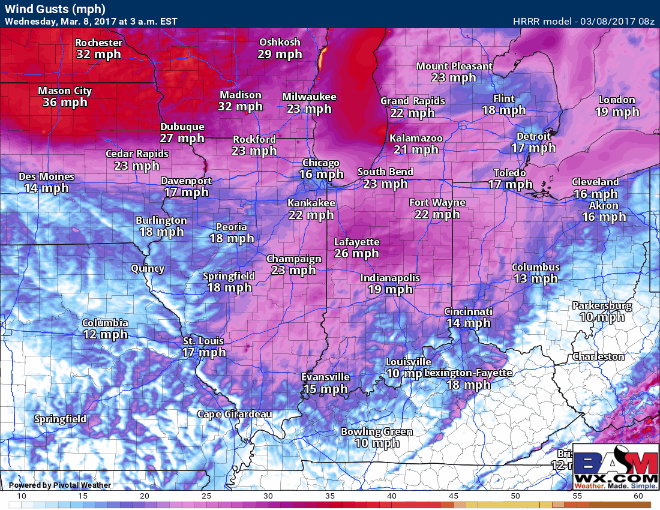
Synopsis: Hey there and welcome to a new forecast update this Wednesday! The main story will be strong winds today out of the west gusting to upwards of 50mph at times, especially north of I-70. Skies will stay mostly sunny with temperatures mainly in the 50s and even a few 60s are possible especially west. We still have a chance for rain mixing with a little snow at times Thursday evening into the overnight as a small wave of energy moves east, but the main story continues to be this weekend and the potential wintry weather. Well, the data continues to suppress the heaviest snow even further south near the Ohio River on Saturday, although snow showers will still be possible mainly south of I-70 during the day. What’s also interesting is all of our major global models are “hinting” at a disturbance moving through early next week that has wintry implications, but the details are still hazy and confidence is on the lower end at this time.
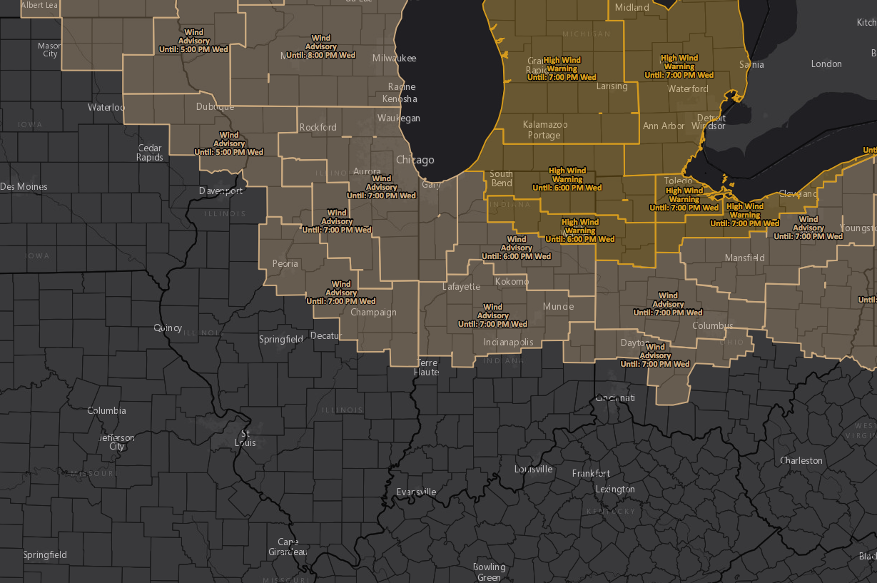
Current Wind Advisories/Warnings across the Midwest:
Here’s a great animation of where the highest wind gusts will be…mainly north of I-70 with gusts upwards of 50mph possible!
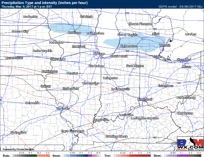
Watching as a small disturbance moves east Thursday night into Friday morning…temperatures will be above freezing so a few rain showers will be possible across the southern half of IL/IN, then as temperatures lower with the wave moving east late Thursday a little frozen precipitation may mix in across Zones 1/2. Generally 0.1-0.25″ of precipitation will be possible. Not expecting this to have much of an impact.
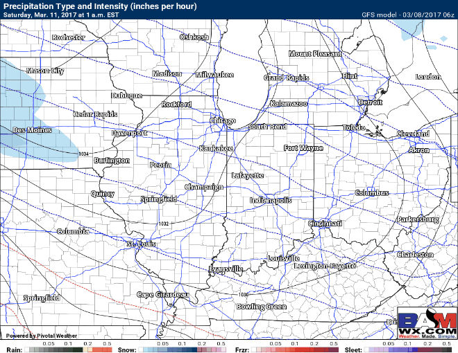
Attention turns to Saturday and the latest details in regards to potential wintry weather. Well, the data continues to trend even further south with the axis of heaviest snow as we are feeling more suppression from the north. The Euro continues to suggest snow showers possible stretching from Davenport, Iowa to Springfield, IL and south of I-70 on Saturday…with that being said, the latest GFS run has suppressed the threat even further south, so confidence…is still below normal even within 4 days of impact.
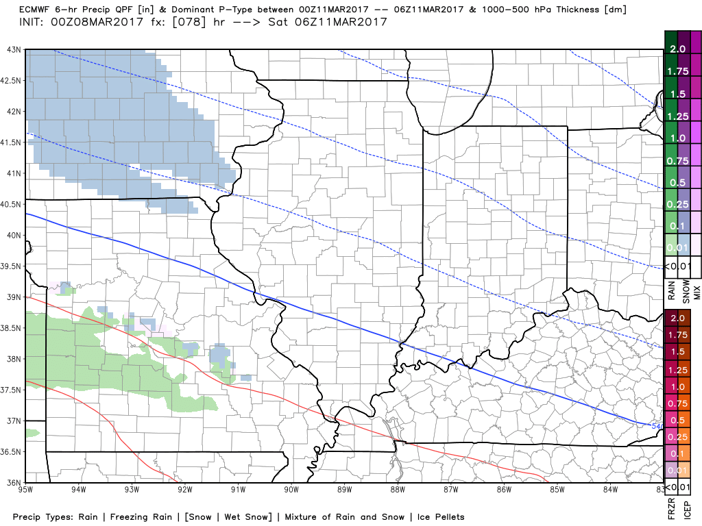
Latest GFS takes the threat even further south than the European…this is quickly becoming much of a “non-event” for most of the Midwest if the data continues to trend in this direction…which it certainly could. Folks closer to the Ohio River still have a decent shot at seeing accumulating snow, it’s something we will continue to watch and update on.
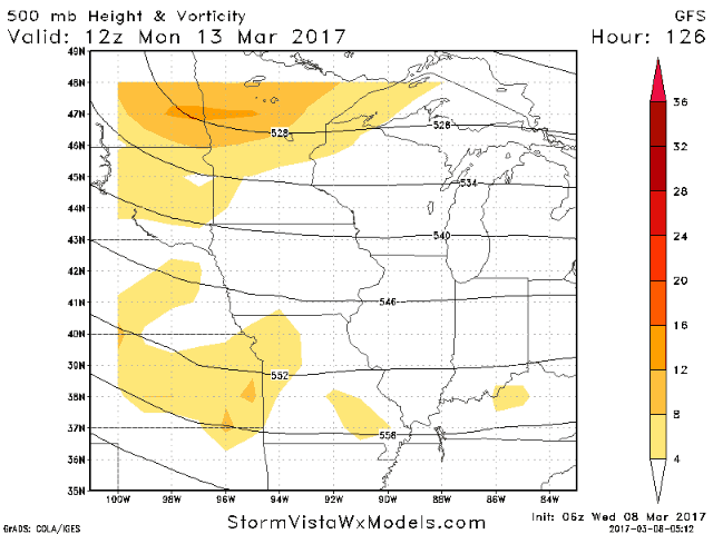
Fresh data early this morning is slightly more excited about a better pronounced wave of energy early next week forecasted to move through the Midwest that we are watching for another shot of wintry mix (all depends on if this thing can phase or not)…but at this distance we need more time and better data to sort out of the details. Keep an eye on this one for now.
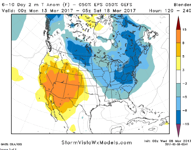
Whether this threat pans out for the Midwest west is to be determined, but it would fit the cooler pattern forecasted in the 6-10 day time period, shown well here by our model blender tool. To put this graphic into perspective, if the Midwest were 5 to 8º below normal next week it would place high temperatures in the 30s to lower 40s.
New seasonal data comes out today, so make sure to check out the long-range video later this morning for and update on the spring pattern going forward!
-K
Confidence and Risk:
- High confidence for strong wind gusts across the norther tier of the Midwest today, upwards of 50mph at times as well.
- Above average confidence of a small chance for showers and a little wintry mix Thursday night into Friday morning, especially across Zones 1/2.
- Below average confidence on the weekend wintry weather threat…latest data continues to push the heaviest snow south near the Ohio River.
- Low confidence on another wintry mix threat across the Midwest early next week…although it’s something we are watching closely.