Key Points – Friday, March 31, 2017:
Synopsis: Good Friday morning and thanks for checking out the latest forecast update! Today we discuss the weekend weather pattern as we have lingering showers ongoing this morning, giving way to solid chance for some sunshine mixing in on the day on Saturday. We also show you our new frost on vegetation tool below, where we are watching for some frost potential across eastern Iowa and northern/western Illinois on Saturday morning. Otherwise, we continue the active them into the late weekend into next week with multiple shower and storm chances, some even bringing heavy rainfall to the Midwest. Latest check on the European Weeklies, a good source for long-range data, and the latest indications are for an active and wet April across the Midwest. Have a wonderful weekend!
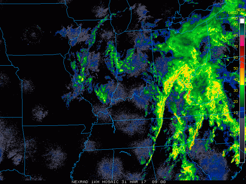
Current Radar across the Midwest shows linger rain showers surround the low pressure that will keep us fairly wet through the first half of the day and chilly staying mainly in the 40s for most locations.
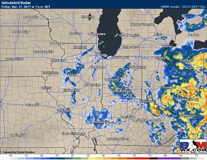
Simulated radar of remaining showers today, they push east through the morning more into Indiana and Ohio through the early afternoon hours before moving out of the Zones. Some mist and low-level clouds are possible given the upper-level profiles even into the evening across the Midwest.
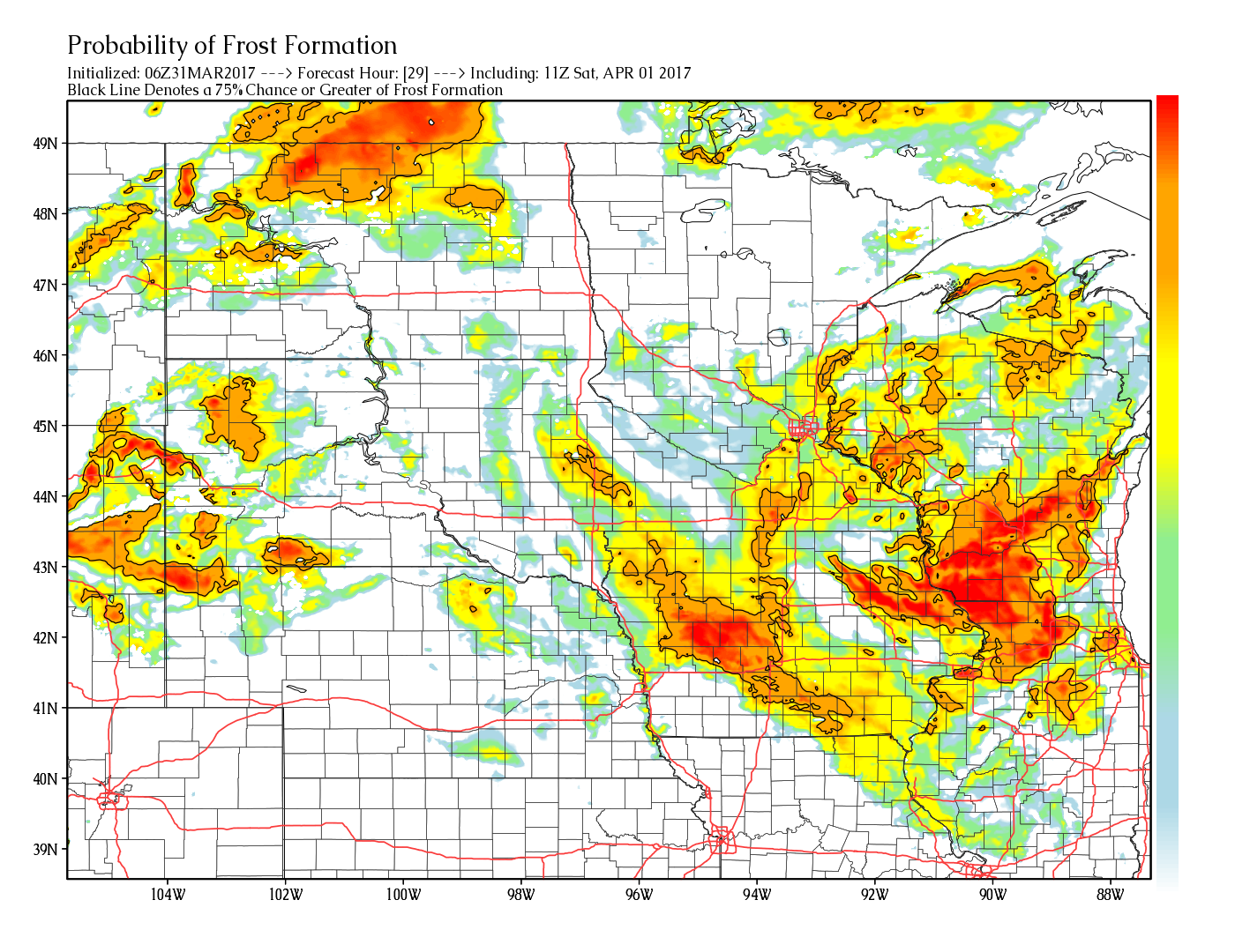
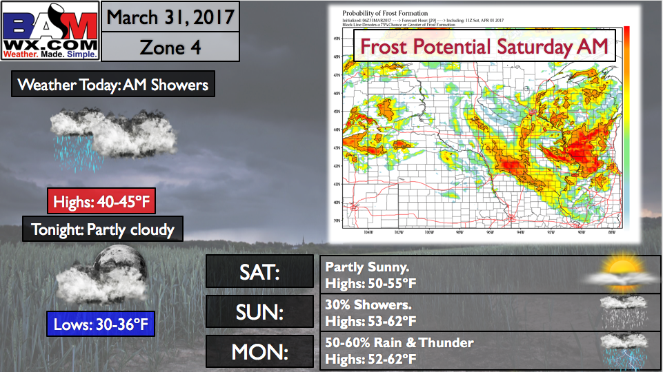
Frost potential Saturday morning across eastern Iowa and northern/western Illinois. The black line represents a 75% probability for frost on vegetation, so the brighter the color the higher the possibility. High pressure sets in Saturday, however, with sunshine working in on the day on Saturday with temps mainly in the 50s.
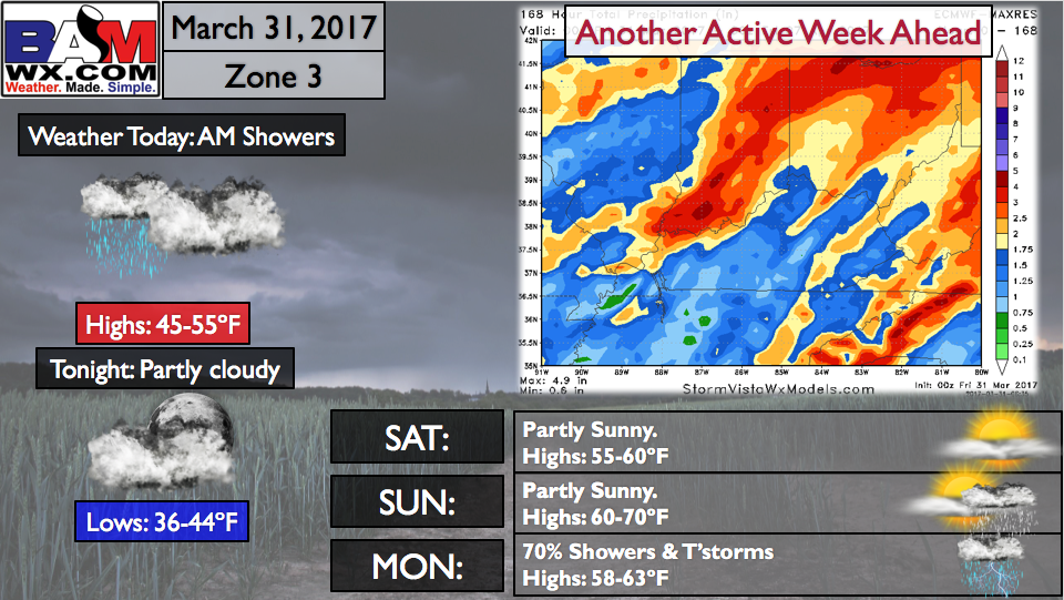
Next chance for showers comes around lunch time Sunday for western Zone locations and heads east Monday into Tuesday morning. We think some thunderstorms are possible across the southern half of the Zone on Monday as well with some energy forecasted present across the Midwest. Some heavy rainfall Monday into Tuesday will be possible as well as shown well by the European model below…a trend we are watching closely.
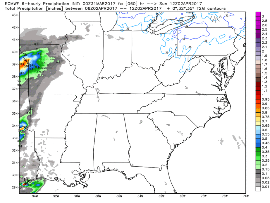
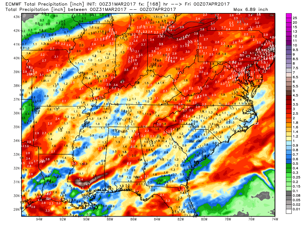
Precipitation totals from the European over the next 7 days…given the fact that there’s about a chance of rain every day next week, we shouldn’t be that surprised to see rainfall totals getting at or above 2.0″+ across the Midwest.
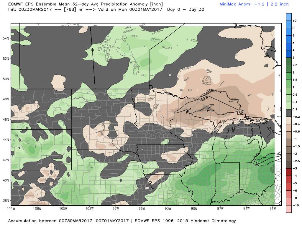
New European Weekly data came in last night with a very similar look as shown previously…overall, April has an active pattern similar to what we are seeing right now.
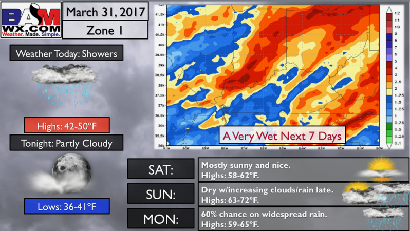
Zone 1 Quickcast…a very wet next 7 days.
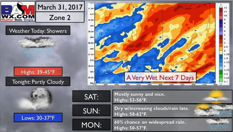
Zone 2 Quickcast, also wet into next week.
Zone 3 Quickcast, plenty of chances of rainfall into next week.
Zone 4 Quickcast…frost potential Saturday morning?
Confidence and Risk:
- Above average confidence showers and mist linger across the Midwest today into tonight.
- Average risk for some frost on vegetation across eastern Iowa into western/northern Illinois Saturday morning.
- Above average confidence a robust system moves into the Zones later Sunday into early next week with heavy rain potential.
- Above average confidence next week as we see multiple rain chances and stay active.
- Increasing confidence our weather pattern stays active into the month of April give the latest data on the European Weeklies.
Today’s video (7 min):