Key Points – Friday, March 3, 2017:
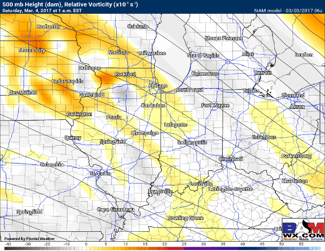
Synopsis: Good Friday morning and thanks for checking out the latest forecast! As we mentioned yesterday, a few scattered bursts of snow are showing up on radar this morning across Zones 1/2, we expect these to clear out throughout the morning hours as the energy moves off to the east. Otherwise, it will be mostly sunny across the Midwest today and a little chillier than what we are used to with highs in the lower 30s across the northeast half of the Zones and upper 30s across the southeast half; the first half of the day will be a little gusty across Zones 1/2 with winds out of the NW gusting up to 25-30mph at times. We are still watching for another wave of energy to move through overnight into Saturday morning to usher in additional snow showers to the Midwest…temperatures warm quickly during the day on Saturday with skies clearing so impacts will be on the lower end. We are watching very intently on another system forecasted to move west to east across the Zones early next week that has the potential of bringing gusty winds, even a couple strong storms are not out of the question right now. We usher back in the 50s and 60s once again next week, so the above normal warmth is knocking on our doorstep once again.
Mostly sunny and a little chillier than normal across the Midwest today…watching another wave move through from west to east overnight that we are monitoring for additional snow showers, even a little accumulation in some spots (mainly north of I-70).
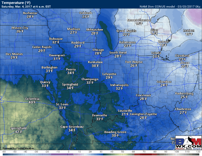
Where the snow falls tomorrow morning temperatures will over in the upper 20s to lower 30s, but as you can see below temperatures rebound very quickly during the late morning and afternoon hours as high pressure to east ushers in warmer air with a southeast wind.
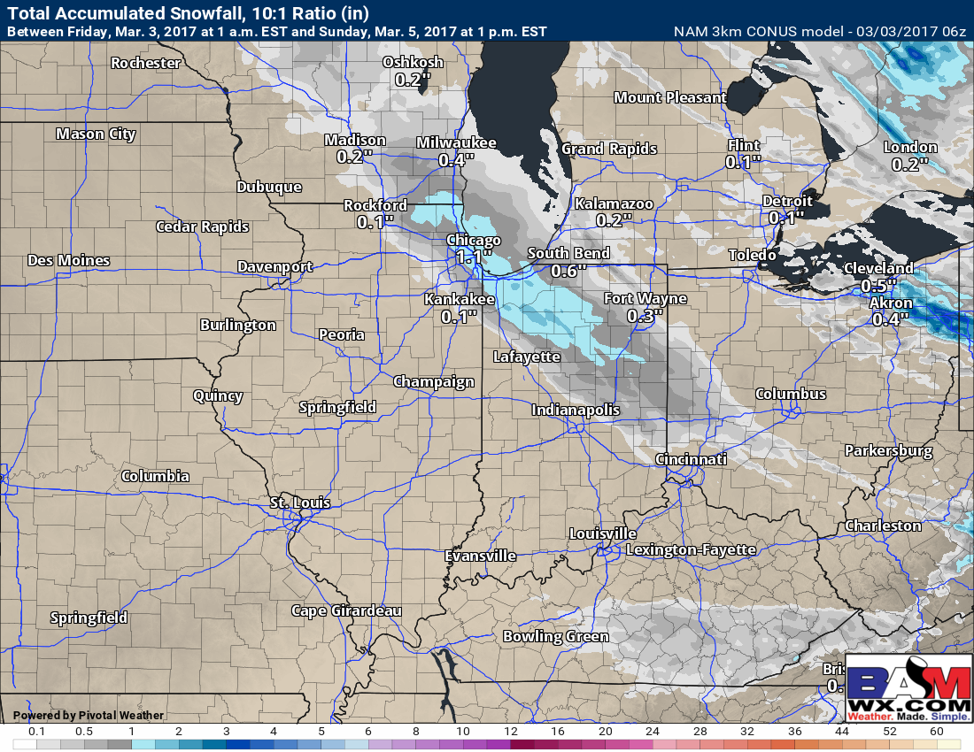
In terms of accumulation, up to an inch of snowfall accumulation from Rockford, IL stretch southeast through Chicago, Lafayette, Ft. Wayne south to Indianapolis is possible. This could cause a few slick spots through the morning hours, but as we discussed above temperatures warm fast so we expect this to melt quickly. If you have a zero tolerance lot a little treatment may be necessary early Saturday morning.
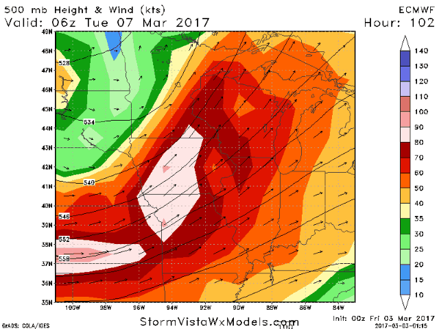
We continue to eye early next week for gusty thunderstorms to move through the Midwest along a long-wave…can’t rule out a few strong storms, something we will continue to monitor as we move through the weekend.
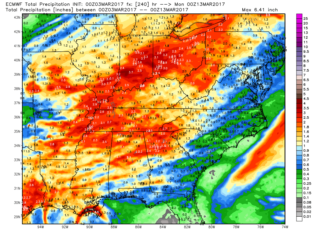
Rainfall over the next 10 days from the European is encouraging especially for folks to the west who desperately need it…we are a little cautious though because models have a tendency of drying up in the short-term.
Confidence and Risk:
- High confidence we see mostly sunny skies today and chillier temperatures across the Midwest.
- Above average confidence of snow showers overnight mainly north of I-70…watching for a few slick spots.
- High confidence temperatures rise quickly on Saturday, allowing whatever snow that does fall Saturday morning to melt quickly.
- Average confidence of gusty storms moving through the Zones late Monday into Tuesday next week.
Today’s video (7 min):