#ILwx #INwx #OHwx Wednesday PM Short-term: Update on strong storms next 2 days. K.
Synopsis: Good Wednesday afternoon, we wanted to provide you with a short-term update breaking down the latest details with the potential strong storm threat today as well as Thursday. If you have any questions please feel free to reach out to us.
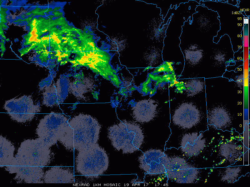
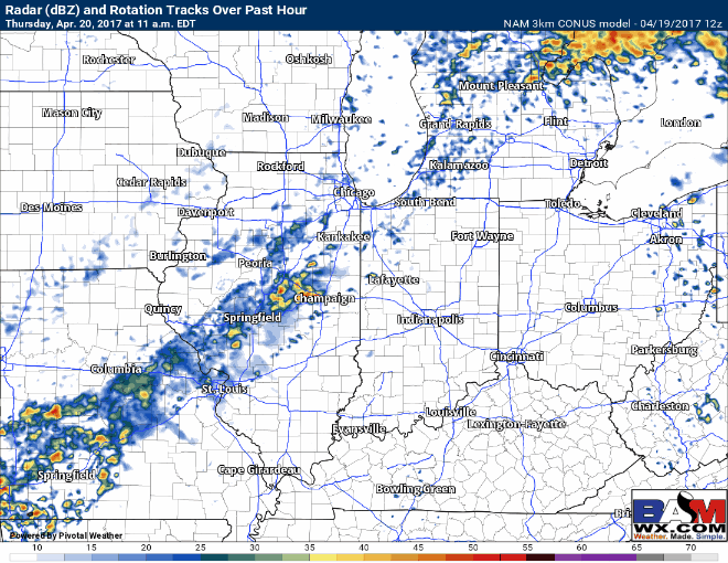
Current radar:
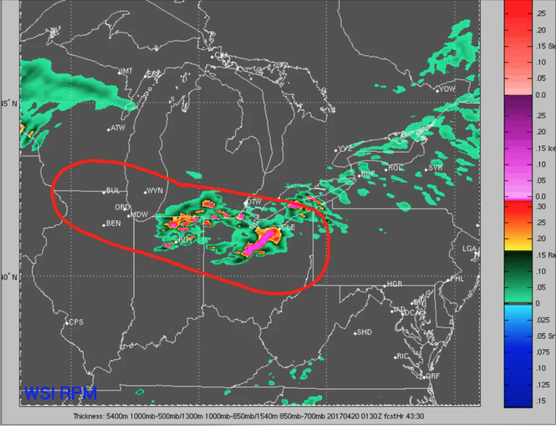
Simulated radar through today and tonight…watching for the scattered shower and storm threat to continue across northern IN, southern MI into northern OH…can’t rule out an isolated strong storm threat here as well as discussed below.
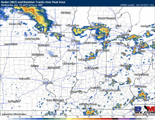
This is the area we mentioned in the video yesterday where we discussed there was potential for some strong storms today via the RPM model…this is the scenario that seems to pan out today.
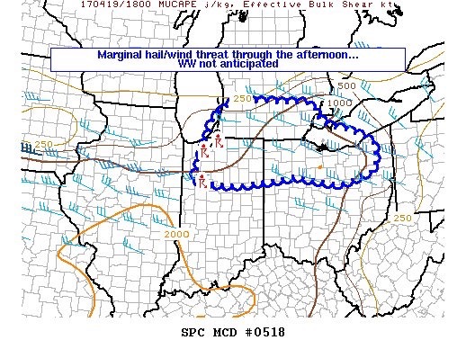
Latest mesoscale discussion mentioning a marginal wind/hail threat this afternoon across northern IN, southeast MI into northern OH. A watch is not expected at this time.
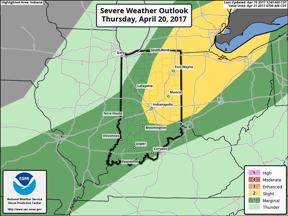
The cold front swings through on Thursday, now there may be times where the showers remain weak especially during the morning hours. But as we get in on some daytime heating during the late morning into the afternoon we expect to see storm activity to intensify between 2-5pm from west to east near the IL/IN border and become more pronounced reaching central IN between 5-8pm and areas east.
Current risk area remains relatively unchanged from this morning’s update…main threats remain to be damaging winds, isolated large hail and a small risk for an isolated tornado although confidence is on the lower end of this.
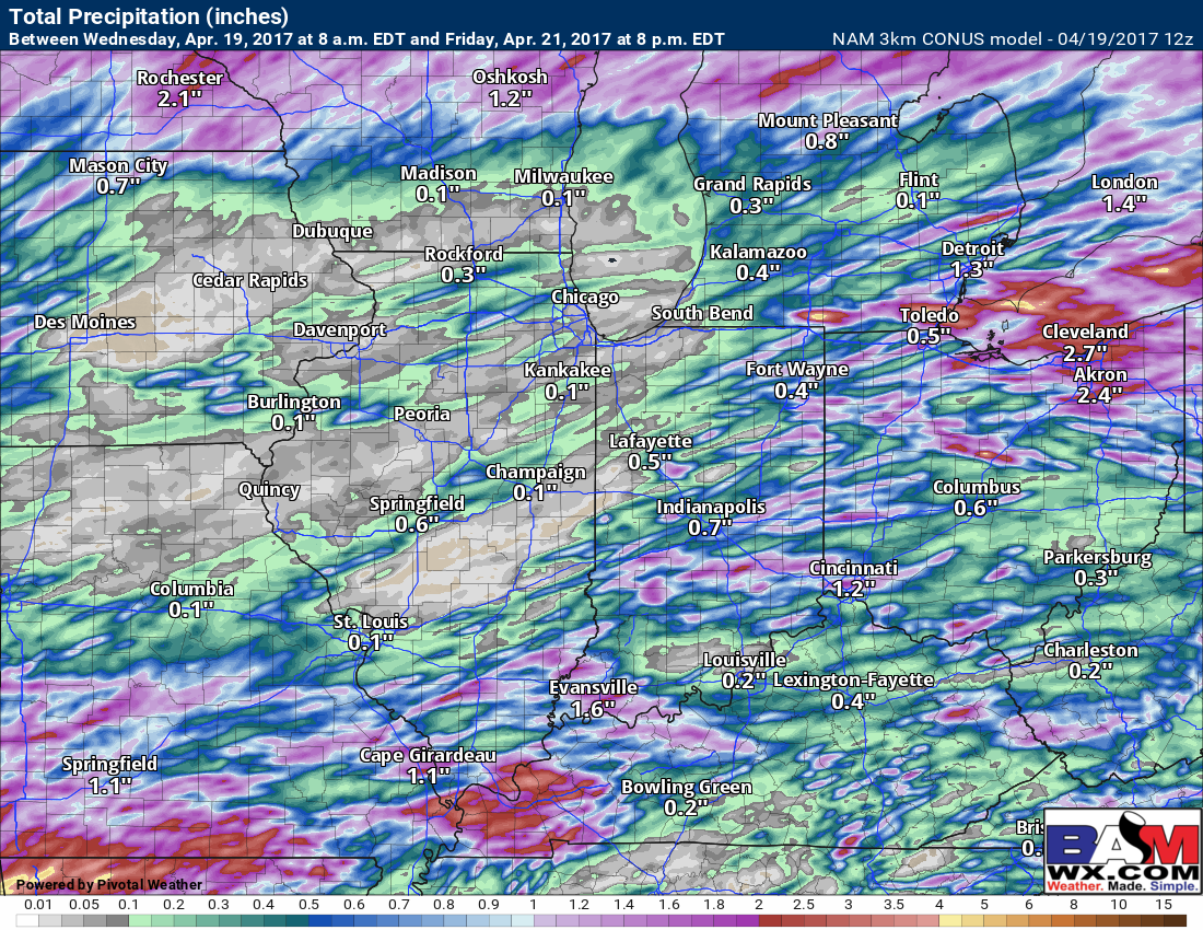
Latest thoughts on total rainfall…the NAM-3km suggests 0.5-1.0″ possible under the heavy storms…areas further west across Illinois likely see smaller amounts due to the cold front being more unorganized during the morning hours.
Today’s video (6 min):