#ILwx #INwx #OHwx Wed Short-term: Update on severe storms and heavy rains through the wknd. K.
Synopsis: Good Wednesday afternoon! Today’s discussion we outline the latest data in regards to what’s still to come today into tomorrow with heavy rainfall and severe weather, as well as the latest on this weekend’s heavy rain and strong storm threat. Have a great day! We included Zone 8 on this update as storms are moving through the far eastern locations including Missouri for reference.
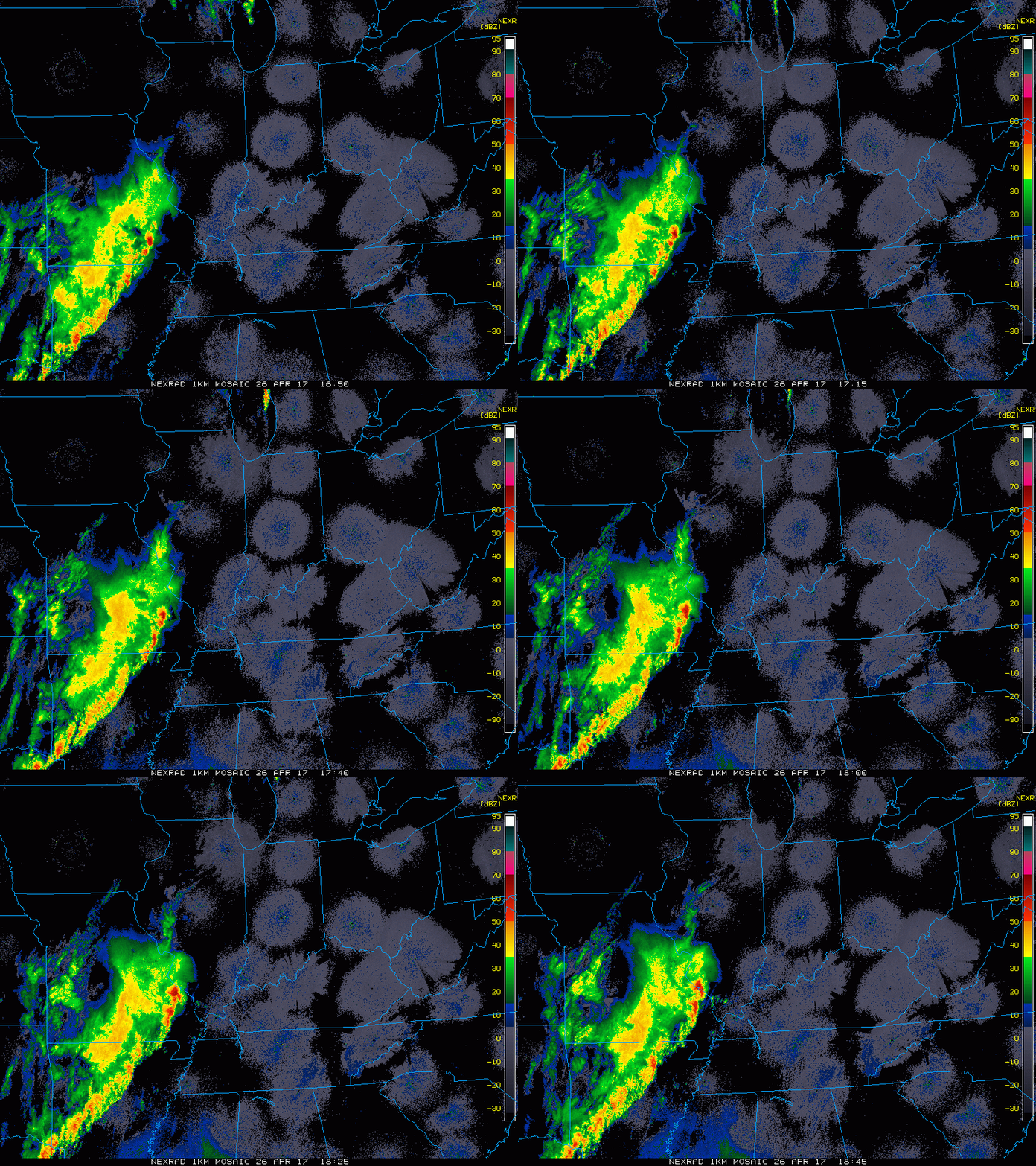
Current Radar…storms moving southwest to northeast from Missouri into the southern half of Illinois currently.
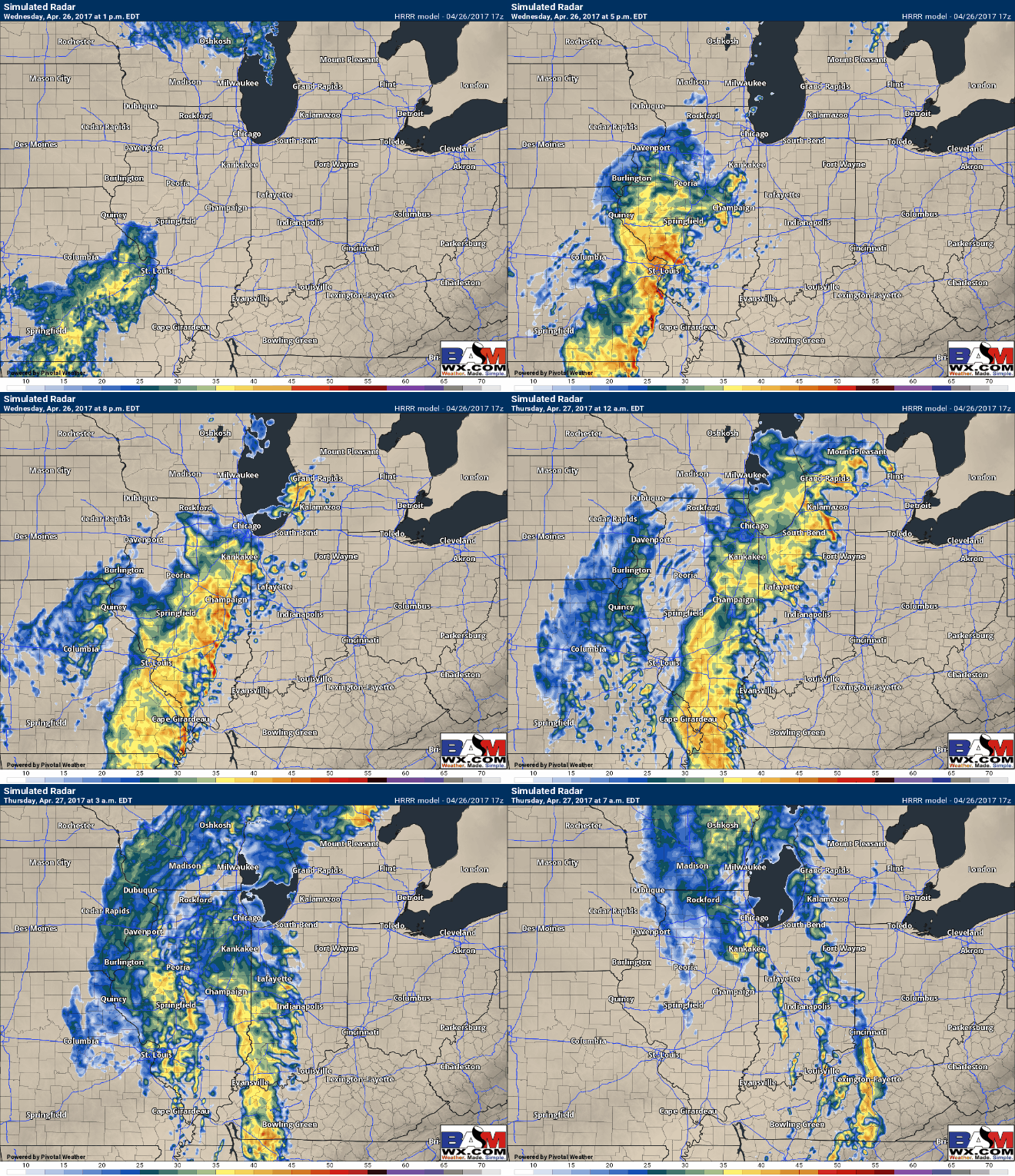
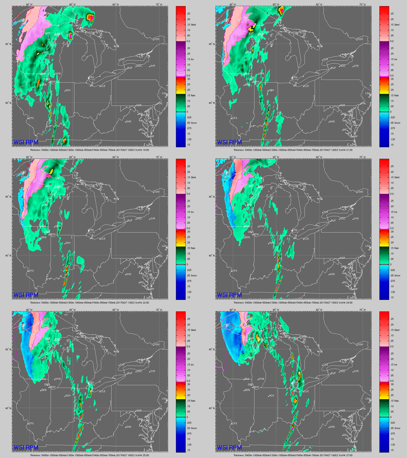
Latest simulated radar today from the HRRR…storms arrive in Springfield to Peoria, IL ~3pmEDT, by 6pmEDT storms move across much of Illinois. Storms move across the border to Indiana by 7-8pmEDT, and look to reach near the Indy metro area to northern Indiana by 10-11pmEDT and spread east slowly.
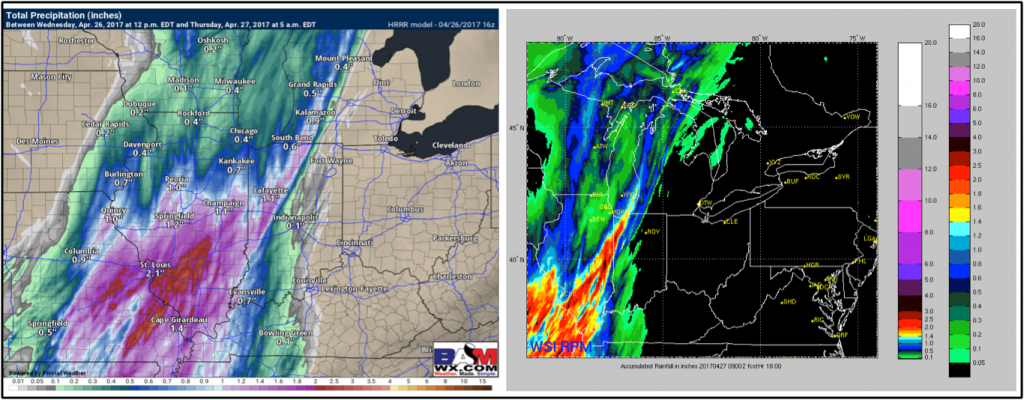
Total rainfall through 5am Thursday morning via the HRRR and RPM…looking at more widespread 1-2″+ south of I-70 in Illinois extending into northern Indiana as well. Wouldn’t be shocked to see some 3″ in some locations across Illinois, can’t rule out localized flash flooding events due to training (storms following each other dumping a lot of rainfall).
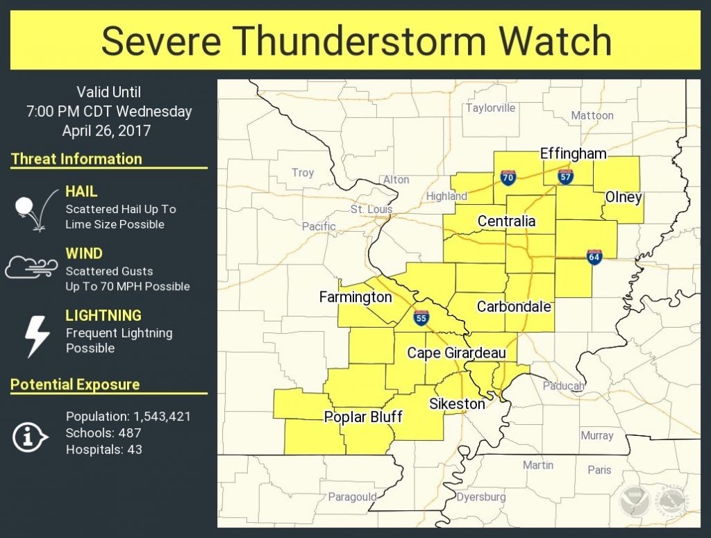
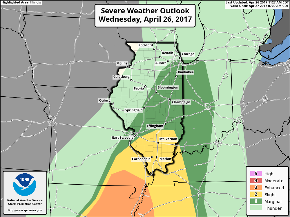
A severe t’storm watch has actually been issued across portions of southern Illinois today through 7pmCDT tonight:
Latest severe weather risk today mainly in the form of heavy rainfall, damaging winds and isolated large hail; we have a low risk for a tornado, but cannot totally rule one out.
Tomorrow’s simulated radar…scattered storms will continue to track east Thursday slowly along the cold front, exiting the Zones by around lunch time.
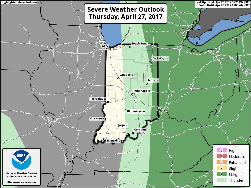
Thursday’s severe risk across eastern Indiana into Ohio still exists with isolated gusty winds and hail possible mainly during the first half of the day.
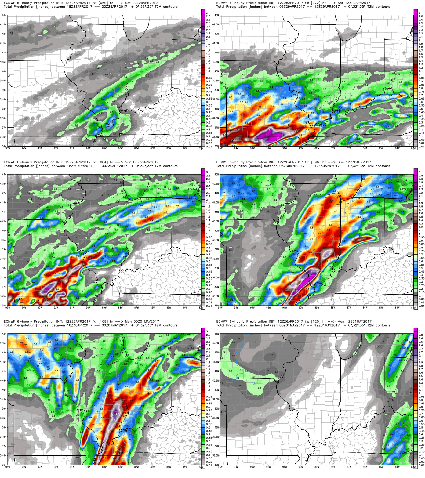
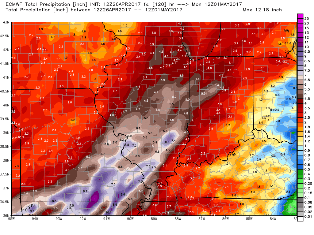
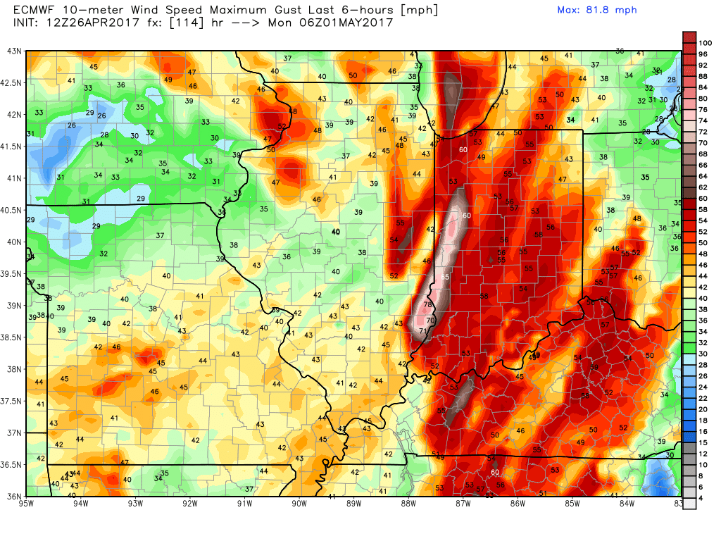
Latest on weekend rainfall…very heavy rainfall lifts north Friday into Saturday from the warm front, we could be talking at times 1-2″ rainfall rates/hr, and then the cold front sweeps east Sunday into Monday morning bringing continued heavy rainfall and gusty winds from west to east.
Total rainfall next 5 days from the European…continues to suggest 5″+ possible across Illinois into portions of Indiana.
Gusty winds possible here out of the southwest at 50mph+ at times along the cold front late Saturday into Sunday.
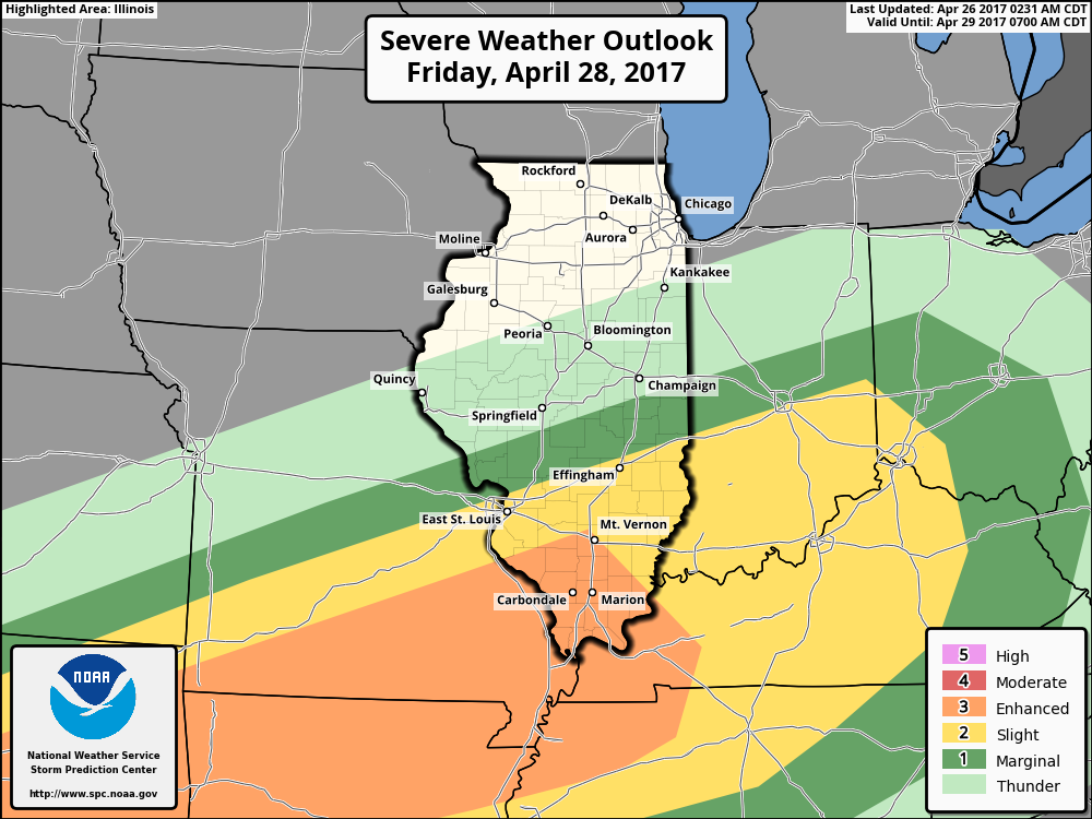
Can’t rule out strong storms later on Friday into Saturday as well along the warm front…all modes of severe weather including heavy rainfall, damaging winds, large hail and isolated tornadoes exists.
Today’s video (6 min):
