#ILwx #INwx #OHwx Wed All Zones:
Synopsis: Good Wednesday afternoon, thanks for checking out our latest all zones update. We cover more of a broad view of the pesky surface low hanging around the Ag Belt and Midwest that’s pushing east. We experience rain showers and heavy thunderstorms from a warm front lifting north and east tonight through early tomorrow as well as near the surface low as it tracks east into the eastern Ag Belt and Midwest on Thursday.
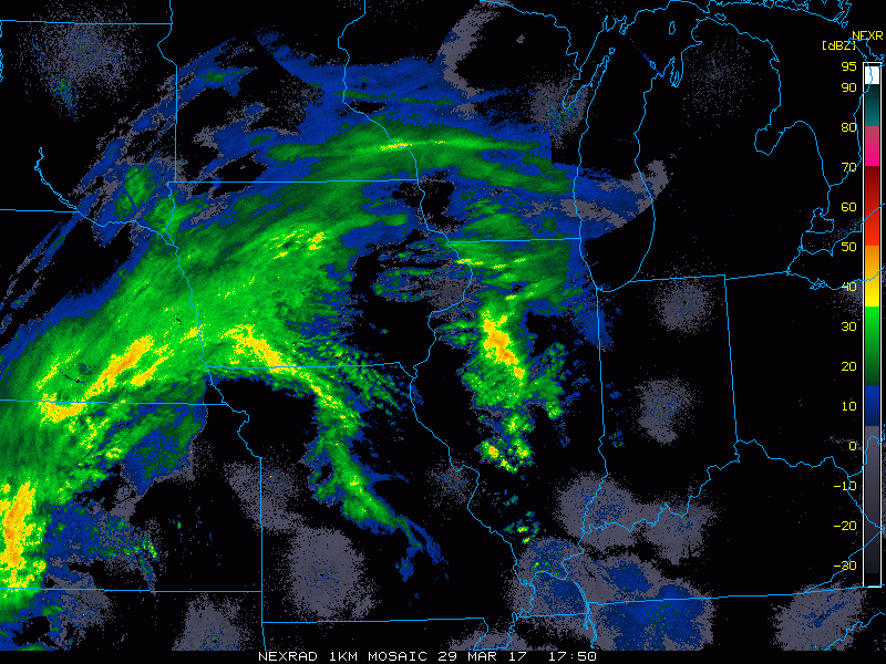
Current Radar…ongoing showers across eastern Nebraska and Iowa into Illinois…you can see some discrete storms popping up across eastern Kansas today as well that we are eyeing very closely for severe storms (all modes of severe weather possible with these).
Hi-resolution simulated radar product as the warm front and low pressure tracks further into the Midwest tonight into Thursday morning. We are watching very closely for severe storms, even isolated tornadoes late tonight as discussed below…some heavy rain showers and flash flooding are possible threats as well.

Strong to severe storm risk tonight into early Thursday…we are watching VERY closely for the potential for isolated tornadoes across eastern Kansas and Missouri…otherwise a damaging wind, isolated large hail and flash flooding threat exists as well.
Here’s where we currently think some flash flooding and heavy rainfall is possible the remainder of today into tonight.
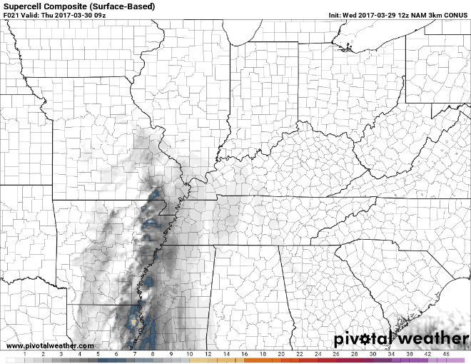
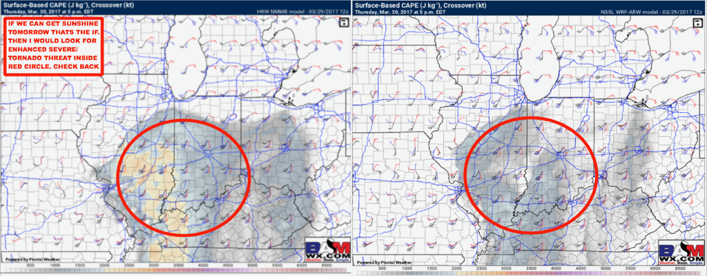
Additional storms move east Thursday…the more sunshine the more we increase the severe weather threat, and vice versa is also possible as we discuss directly below. Here’s a look at the supercell composite parameter, which indicates there is a solid potential for some supercells tomorrow. 97% of all supercell thunderstorms produce severe weather reports.
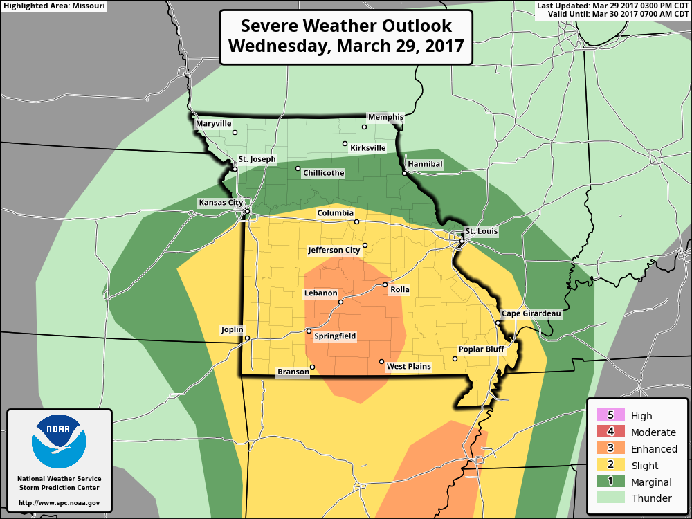
Strong to severe storm risk Thursday with a slight to enhanced threat as of right now for damaging winds, isolated large hail and isolated tornadoes especially across the southern half of the Midwest…some heavy rainfall is also possible within these strong storms. So, again, all modes of severe weather are still on the table.
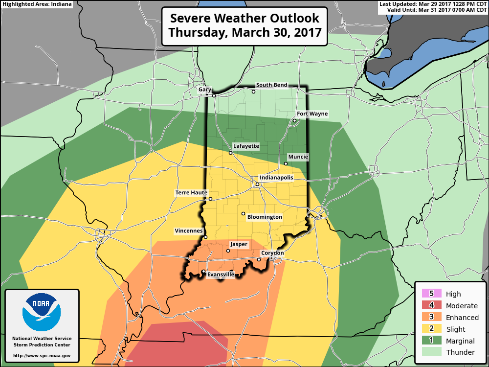
If we can get additional sunshine on Thursday (that’s a BIG IF), then we could see the severe risk area shift further north including the red circle…this would include tornadoes as well. If it’s cloudy tomorrow, we can see a BIG-TIME reduction in the severe threat…so confidence is still below average on this.
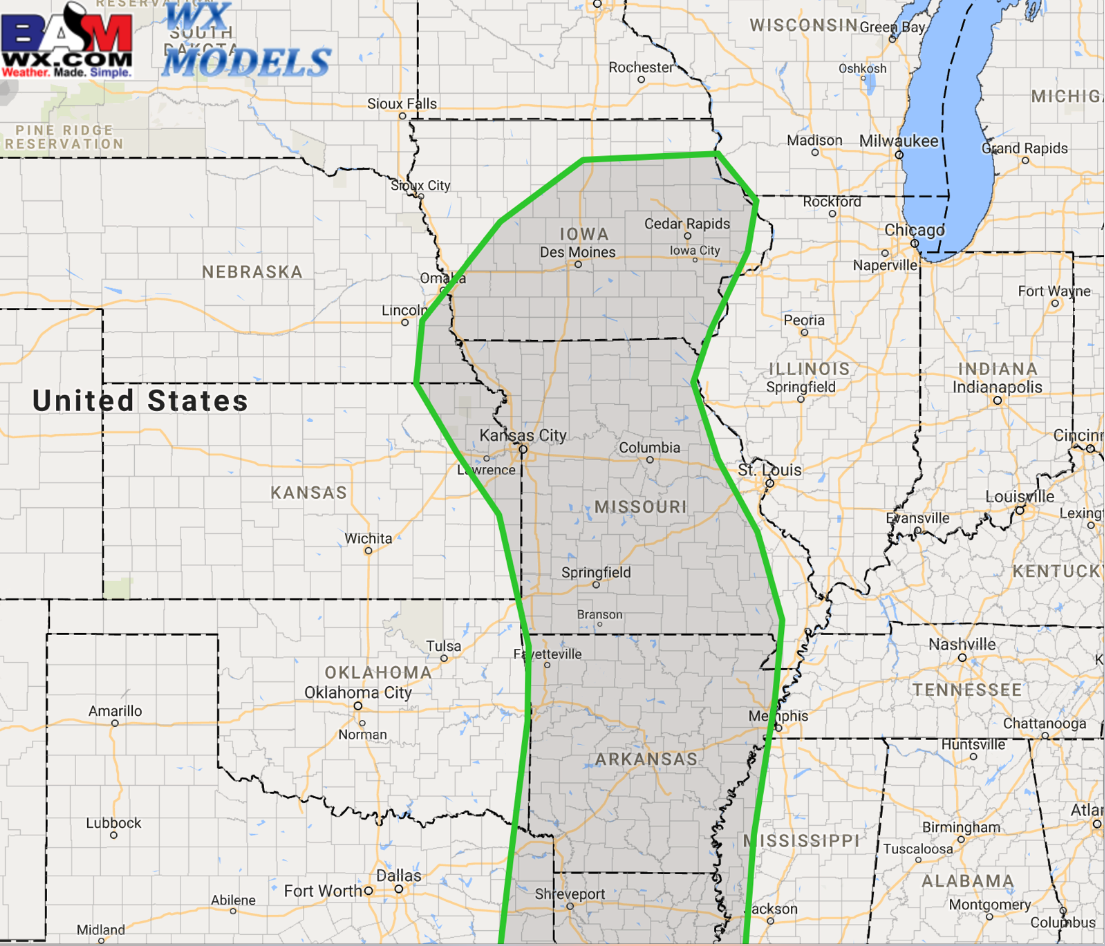
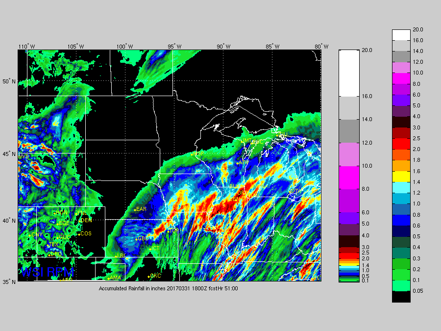
Rainfall totals throughout this event…some heavier showers are definitely possible especially in the supercells and storm clusters…cannot rule out isolated 2.0″+ amounts especially across Missouri, Iowa, Illinois and portions of Indiana.
Confidence and Risk:
- High confidence showers and thunderstorms (some strong) continue to track east tonight into Thursday.
- Average risk for severe storms including tornadoes across eastern Kansas into Missouri later tonight into early Thursday as well.
- Below average confidence on the severe weather threat specifics across the Midwest tomorrow…as we are still largely dependent how much sunshine we receive to fuel these storms.
- Above average confidence some heavy rains (some in excess of 2.0″+) will be possible as this low pressure moves east tonight into Thursday.
Today’s video (6 min):