Key Points – Wednesday, February 15, 2017 – long range
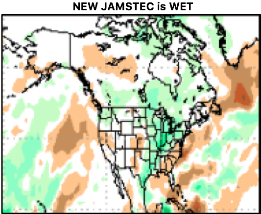
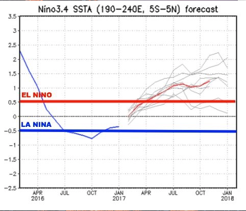
Synopsis: Good Wednesday morning! Another day of plentiful sunshine expected across the Midwest, a little cooler across the northern Zone locations mainly staying in the 30s, spreading into the 40s the further south you travel; winds will be out of northwest ~10mph, higher wind gusts likely across Zones 1/2 up to 25-30mph. The latest hi-res NAM still trying to put down a little bit of snow across northern IN and southern Michigan from lake effect snow overnight, a few slick spots possible but overall not going to have a major impact. The weather late week into the weekend remains relatively quiet with pleasant weather expected, while temperatures increase in magnitude every day…even near-record warmth possible. Not really anything, still, in terms of precipitation over the next 5-7 days, it’s just simply a nice stretch of weather with a mix of sun and clouds and warm weather ahead. We discuss the long-range in today’s video as well, the new JAMSTEC is in and looks very WET from March-May, even a decent severe weather look as well. The new JAMSTEC also suggests we get into an official El Nino by ~April, and even takes us into potentially a moderate El Nino by summer…we need to monitor this trend going forward. Have a great day!
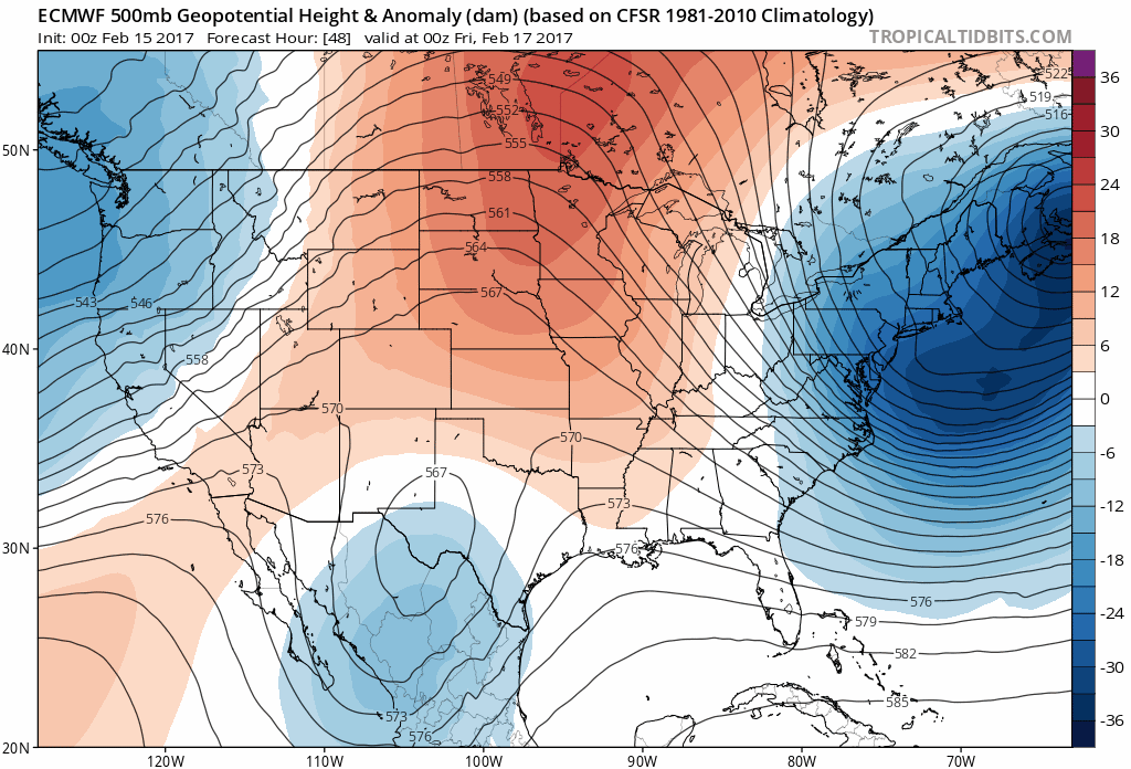
Big time warmth sets in Friday into next week shown well below…as the heights (the red colors) increase and move east, so does the warmth spreading into the Midwest through next week.
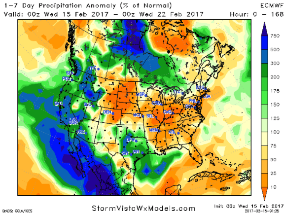
The forecast is still VERY dry over the next week, we discuss in the video our low confidence in rain chances going into this weekend into early next week, but are not impressed by anything that’s forecasted to move east at this time. Below is a precipitation from normal graphic…the yellows, browns and oranges indicated drier than normal conditions.
The new JAMSTEC came out today for its March-May forecast, and as you can see below its pretty wet throughout the Ohio Valley, and active is well.
The new JAMSTEC El Nino index also suggests we enter into an official El Nino by April, it even forecasts us into a moderate El Nino by summer…a trend we need to monitor closely!
Confidence and Risk:
- High confidence most areas see plentiful sunshine today with highs in the 30s to 40s.
- High confidence we begin a pretty significant warming trend starting Friday into next week…wouldn’t be shocked to see some records fall across the Midwest.
- Above average confidence we continue to be very dry over the next week.
Today’s video (4 min):