Key Points – Monday, April 10, 2017
Synopsis: Good Monday morning, we hope all had a wonderful weekend! Today we discuss the potential for strong to severe storms later today, a nice mid-week forecast and then additional scattered shower chances late week into the weekend…we warm up in a big way late week into the weekend as well with a return to the 70s even 80s! However, we do mention in the video we are watching for a return to “colder” risks into week 2, so we are not out of the woods for a frost/freeze threat getting later into the month.
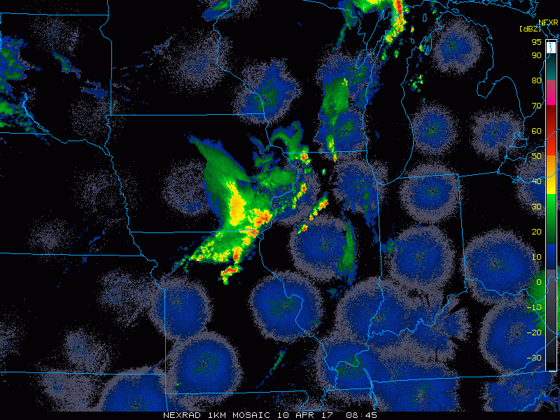
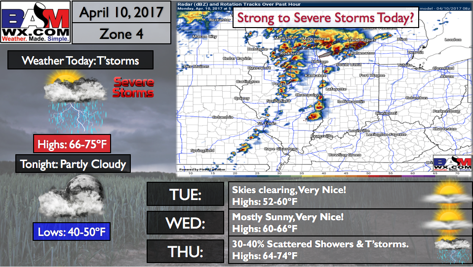
Current Radar…some storms continue east early this morning, but are forecasted to weaken getting further into the morning hours.
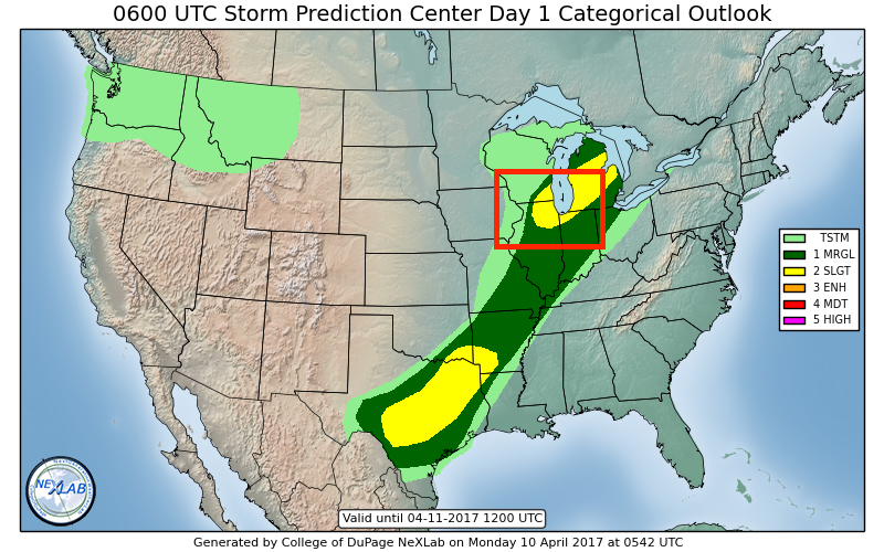
Day 1 severe storms forecast…overall we agree, and we do have some concern even for tornadoes across the northern half of Illinois into northwest IN and southern MI going into tonight. Wouldn’t shock us to see a watch box with this…something we will need to monitor throughout the day. An isolated damaging wind and large hail threat will also be possible, which are common in supercells.
Simulated radar…watching things to get going across eastern IA and western IL by around 12-1pmCDT, models get kind of aggressive putting out supercells even by 3-4pmCDT across central IL headed east, then reaches the IN/IL border by ~5-6pmEDT…the showers look to make it to central IN between the hours of 7-9pmEDT tonight that will be scattered in nature.
Showers and a few storms shift off to the east overnight into southeast Indiana and western Ohio where they linger throughout the morning and early afternoon hours Tuesday.
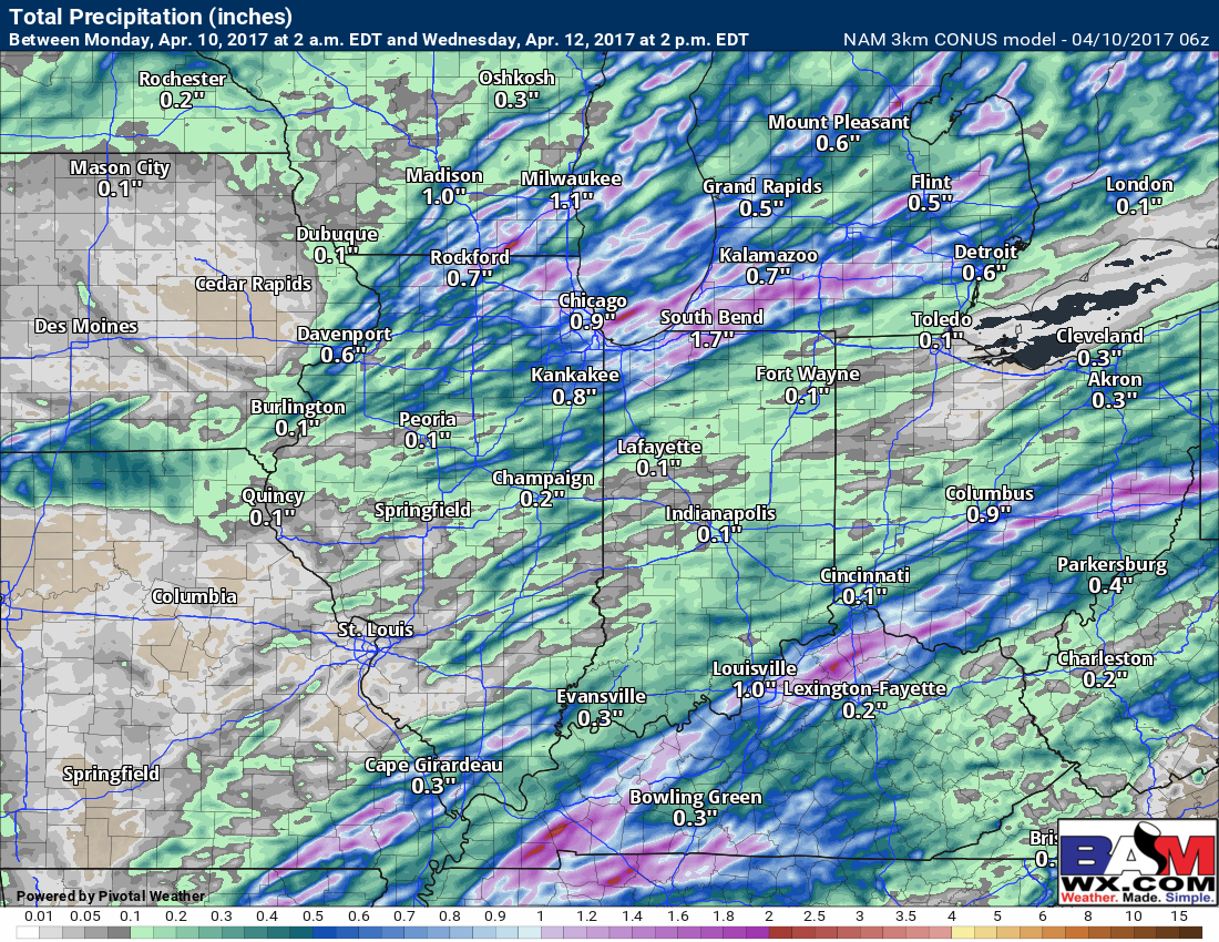
Precipitation totals…there may be a storm that will drop an isolated 0.5-1.0″ in some places, but overall not expecting much widespread rain today into Tuesday.
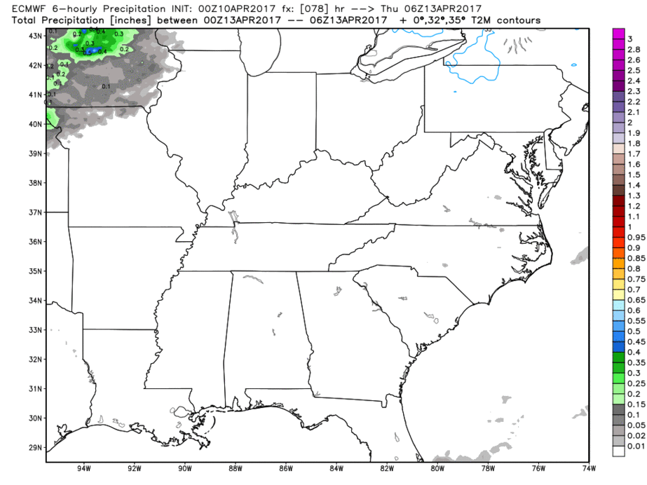
Next chances for showers comes Thursday after calmer weather Tuesday and Wednesday…European isn’t too excited with it, coverage ~30-40% at this time.
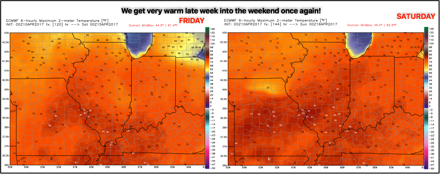
We get very warm once again by late week, with temps surging back into the 70s and even can’t rule out some 80s by Friday into Saturday.
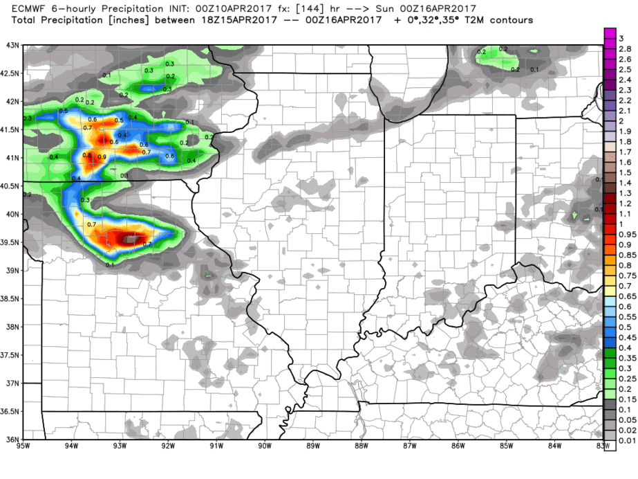
Next more widespread rain chances comes later Saturday into Sunday moving northwest to southeast.
Total rainfall throughout the next 7 days…some locations across the northern half of the Midwest may see 1.0-1.5″ totals, but you can see the further south and east you travel, the lesser them amounts become.
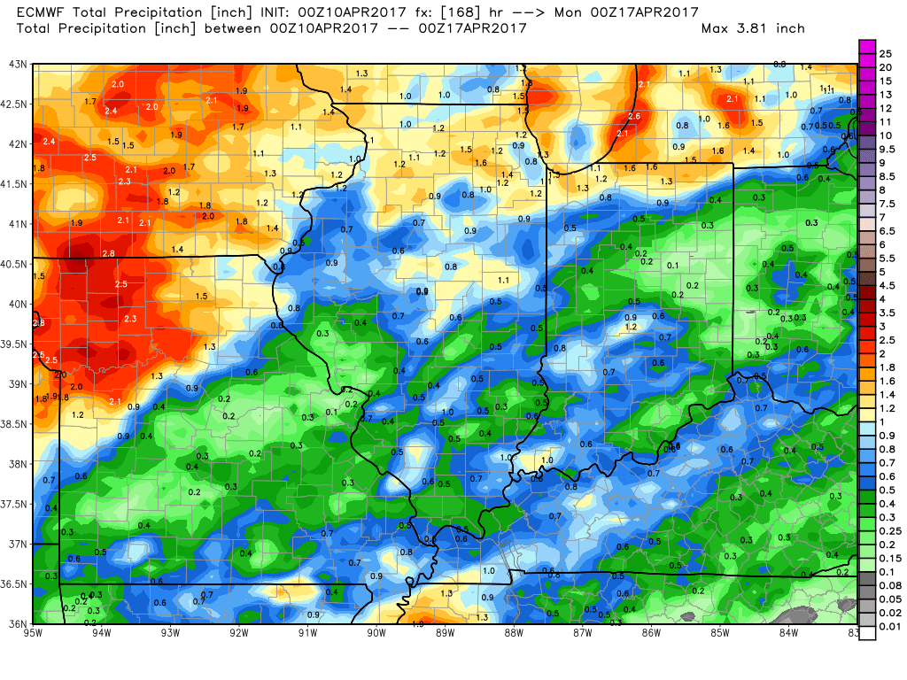
Overall the next 7 days are well above normal across the Midwest…what’s interesting though is getting into week 2, the cooler anomalies start to move back in. This goes to show once again that we are not out of the woods with frost/freeze chances getting later into the month…something to monitor for sure.

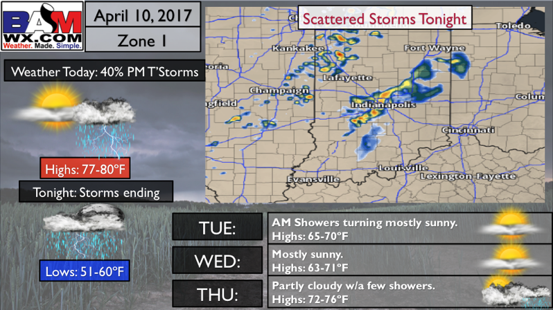
Zone 1 Quickcast:
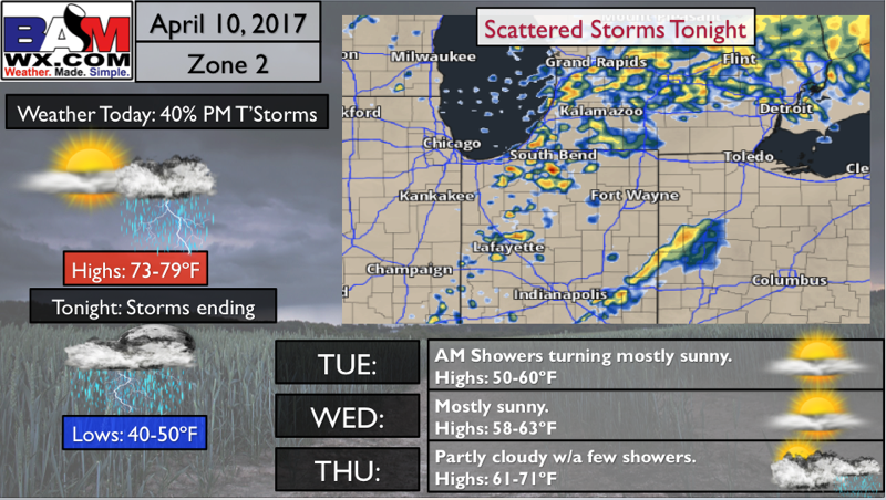
Zone 2 Quickcast:
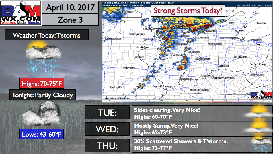
Zone 3 Quickcast:
Zone 4 Quickcast:
Confidence and Risk:
- Above average confidence of scattered showers and storms mainly across the northern half of the Midwest today into tonight.
- Average risk for strong to severe storms as we have some conflicting data on the intensity of these storms…need to monitor and update on this later today.
- Average confidence for scattered showers returning Thursday, the European model is not too excited about this threat at this time.
- High confidence overall the Midwest will be above normal in temps.
- Increasing confidence though we see temperatures take a turn towards cooler into the week 2 forecast.
Today’s video (7 min):