#ILwx #INwx #OHwx Wed Short-term:
Synopsis: Good Wednesday afternoon, we hope everyone fared well with the severe weather last night, it was quite an incredible event especially given the time of the year and the time of day. All showers and storms have since moved east of the Midwest today, we are left with dropping temperatures, cloudy skies and gusty winds for the remainder of the day. Our focus turns tomorrow as we have what appears to be a sneaky little wave of wintry weather forecasted to move through the Ohio Valley during the evening into the overnight. Furthermore, we are watching closely for the potential for snow squalls to form, especially across Zones 1/2 late Thursday night into early Friday morning. Temperatures also dip below freezing into the 20s Friday morning, so a few slick spots where the precipitation freezes on contact will also be possible. All the details are in the video, please let us know if you have any questions!
Windy today with winds gusting out of the W to NW over 40mph at times according to our latest hi-resolution data.
A rain/snow mix is forecasted to move west to east Thursday evening through the heart of the Zones along an arctic front, initially temps will be above freezing especially south of I-70 which will likely keep things as light rain showers. It’s overnight when temperatures start to plummet as the arctic front passes where we are watching for conditions prime for snow squalls, especially across Zones 1/2 into early Friday morning. The threat likely ends by around noon Friday, with even some peaks of sunshine possible during the remainder of the day as the energy moves off to the east.
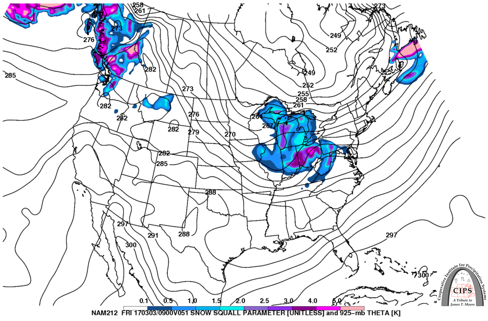
In fact, our snow squall analog guidance is also picking up on the risk for snow squalls across Zones 1/2 late Thursday into Friday morning as shown below. Snow squalls are widely known for producing intense bursts of snow with quickly reducing visibility, so it’s a concern we are watching closely.
In terms of temperatures Friday morning, we are forecasting the entire Midwest to drop down into the 20s, so where the precipitation falls Thursday and overnight could make for a few slick spots Friday morning on untreated surfaces.
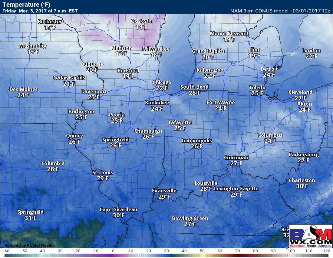
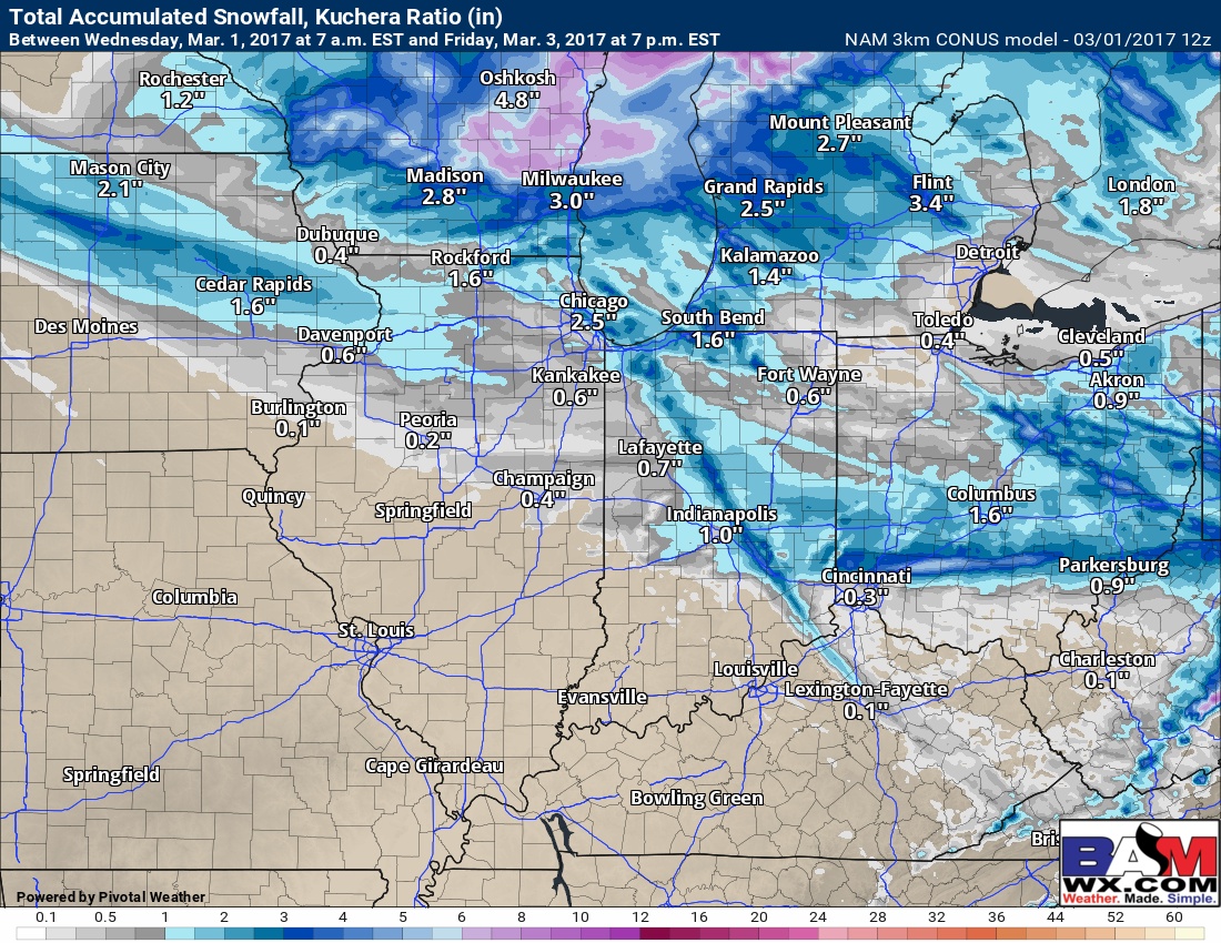
Snow squalls are tricky because not everyone gets in on the snow…below is the 3km NAM which shows the isolated nature of the heavier snow, especially across Zones 1/2. This is something we will need to continue to watch very closely as confidence right now is average, but the confidence on the threat continues to increase.
Confidence and Risk:
- High confidence we remain windy into tonight, with winds gusting out of the W to NW over 40mph at times.
- Average confidence in a wintry mix to even some snow squalls overnight Thursday into Friday.
- High confidence we dip down into the 20s Friday morning, so a few slick spots on untreated surfaces will be possible.
Today’s video (6 min):