Key Points – Friday, April 14, 2017:
***Inserted the video at the bottom***
Synopsis: Good Friday morning, below you will find the latest forecast and the consensus is…we remain very wet and active. The warm front continues to lift north today and will likely rise temperatures into the 80s across the Midwest! We will see a small chance for scattered storms today with daytime heating as well. We turn very windy and warm into the weekend…all eyes are turning to next week with the potential of a stalled out boundary that could potential bring some very heavy rainfall…stay tuned! Have a blessed Easter weekend!
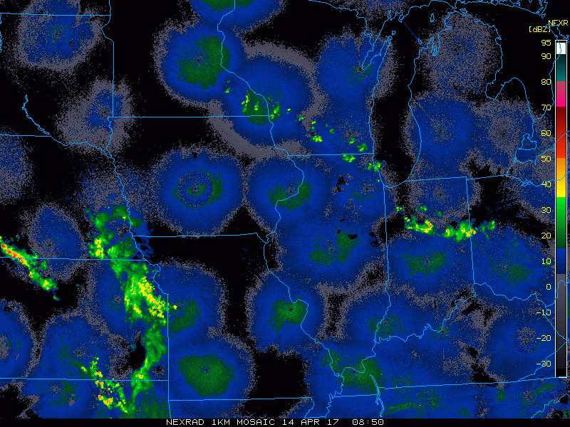
Current Radar:
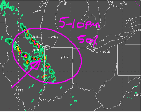
Simulated Radar via the latest RPM with a chance for scattered t’storms throughout the day as the warm front lifts north, growing slightly more numerous between 5pm-12am this evening ~50% coverage. Can’t rule out a few gusty storms with these as well.
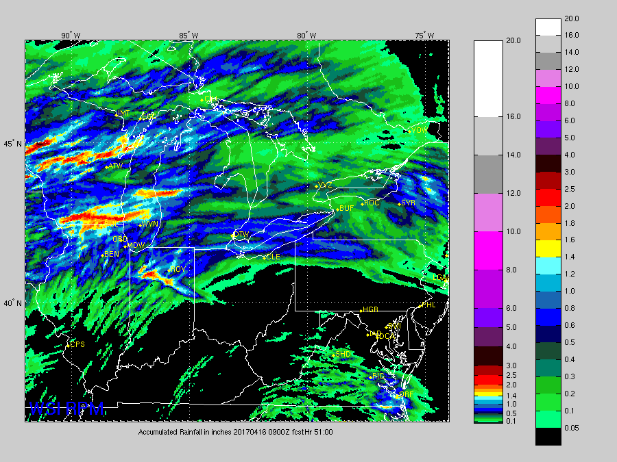
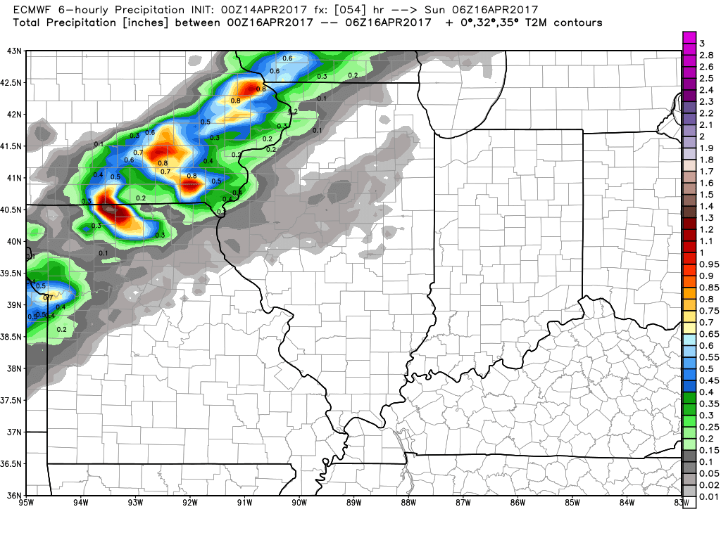
Rainfall totals, ~0.5-1.0″+ possible in the heavier storms.
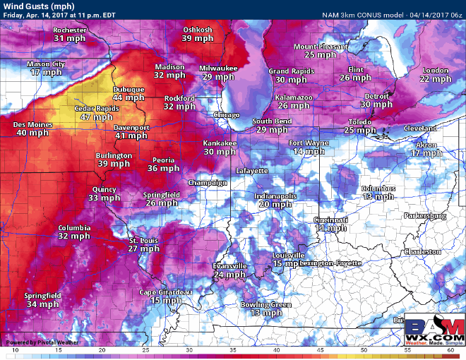
Most of the day on Saturday is dry and very warm getting into the 80s once again, there is a disturbance coming in bringing rainfall chances on Easter as well. First off, check out these wind gusts on Saturday into Sunday morning…wouldn’t be shocked to see a wind advisory if these verify. Could see some gusts up to 50mph at times out of the southwest!
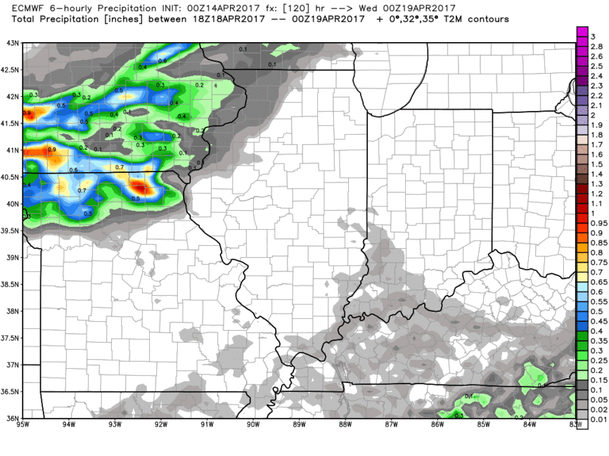
Sunday night into Monday ~50% coverage of showers and storms possible from the northwest to the southeast along a cold front. Could see some localized heavy rainfall especially across the western and southern Midwest.
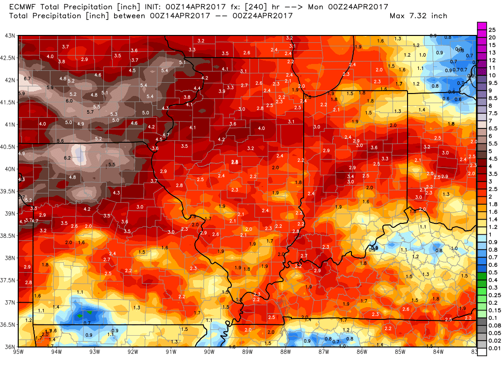
Concern continues to grow for a frontal boundary to stall out across the Midwest mid to late next week that could drop some very heavy rainfall as well…something we need to keep close eyes on given the importance of this time of year.
10-day rainfall totals VERY wet with 3-3.5″ on average across the Midwest, even higher totals to the west could see upwards of 5.0″+ if the system does stall out.
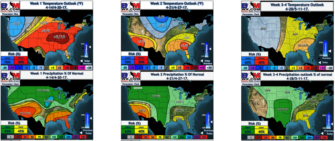
Weeks 1-4 long-range outlooks…we start warm with some cool shots possible getting into week 2 (those frost threats remain deeper into April, even May), and you can easily see the above normal rains continues throughout the next 4 weeks as well.
Confidence and Risk:
- Above average confidence we see scattered t’storms ~50% getting into tonight as the warm front lifts north today…very warm too into the 80s!
- Above average confidence the warmth continues into Saturday with most of the day staying dry.
- Above average confidence Saturday into Sunday morning are very windy with southwest winds gusting upwards of 45mph+.
- Above average confidence a cold front sweeps west to east Sunday evening into Monday morning bringing ~40-50% chance for t’storms.
- Above average risk a frontal boundary stalls out mid-next week…it’s something we are watching very closely for a heavy rain maker keeping things very wet.
Today’s video (8 min):