Key Points – Wednesday, April 12, 2017:
Synopsis: Hey good Wednesday morning! Things starting out clear today and should be a very nice day overall…showers and storms increase into Thursday from west to east across the northern Midwest, as well as Friday into Saturday especially north and west. Saturday we are watching for some gusty winds during the day out of the southwest up to 35-40mph at times, before an interesting looking storm complex moves east across eastern Iowa into western Illinois Saturday night into Sunday morning. Next week starts dry before our next rain chances moves east mid-week. Overall we remain warm and active through mid-April. Have a great day!
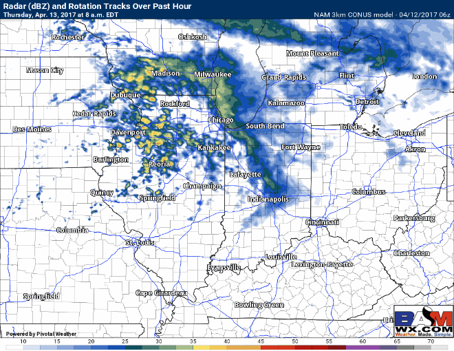
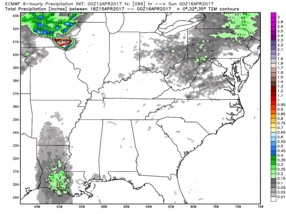
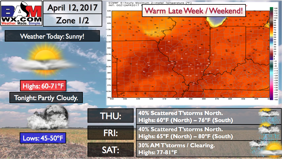
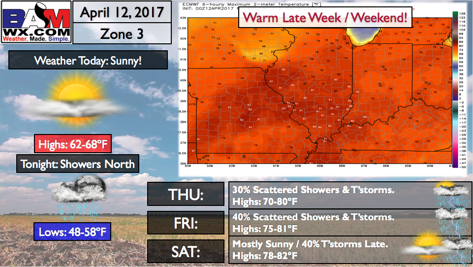
Scattered showers and storms increase early Thursday morning ~2amCDT across eastern Iowa and western Illinois, moving east into northern Illinois by 6-7amCDT and moving east into the northern half of Indiana and northwestern Ohio by the afternoon and evening hours…lingering into Friday morning as well.
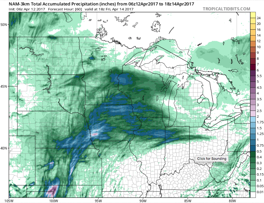
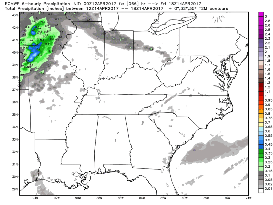
Rainfall expected over the next 60 hours ~0.3-0.4″ with an isolated 0.5-0.6″ will be possible across eastern Iowa, northern Illinois/Indiana into northwestern Ohio. Not a heavy rainfall event, but something to continue to irritate things.
A warm front lifts north late Friday into Saturday across the northern and western half of the Midwest bring additional scattered shower and storm chances.
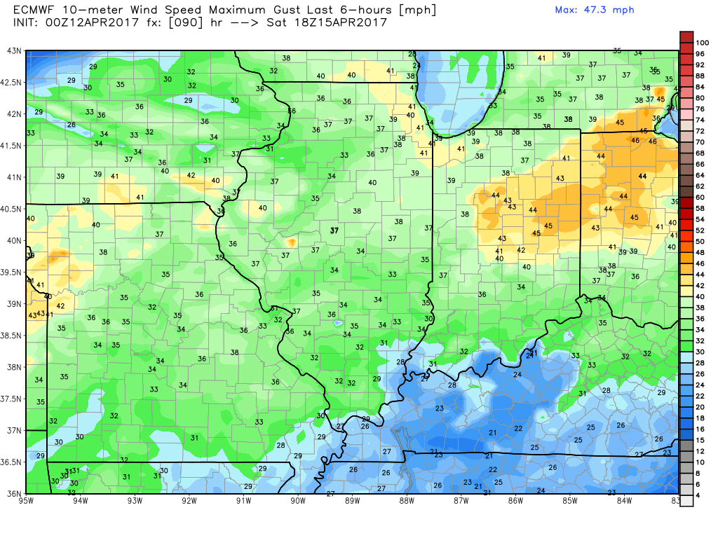
Some gusty winds will be possible on Saturday as well out of the southwest, upwards of 35-40mph will be possible!
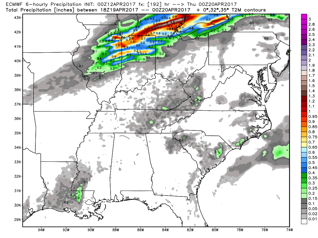
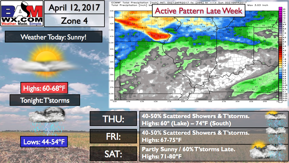
The bigger story is a hefty storm complex targeted to move west to east later Saturday evening through the overnight into Sunday morning across eastern Iowa and western Illinois eastward that looks to bring some gusty winds and heavy rains riding along an area of instability (energy or CAPE) and a boundary (front). These will push east on the day on Sunday across Indiana and Ohio with a scattered storm threat of ~40%.
The nice thing is we start early next dry across the Midwest as an area of high pressure settles in, it’s not really until mid to late next week where our next disturbance moves east bring more showers and storms…some of which could be heavy…confidence on the details of this are still average, continue to monitor this.
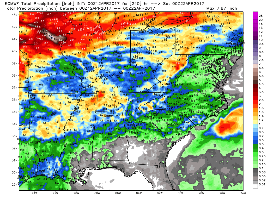
Rainfall totals over the next 10 days…the heavier rains will definitely be focused across eastern Iowa into the northern half of Illinois and Indiana with totals of 2-3″+ possible…meanwhile the southern half of the Midwest likely sees 0.5-1.0″ and stays slightly drier.
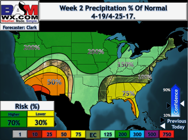
Our updated week 2 forecast is very wet across the Midwest, with up to 200% possible to the west and 125-150% further east…the wet and active pattern continues.
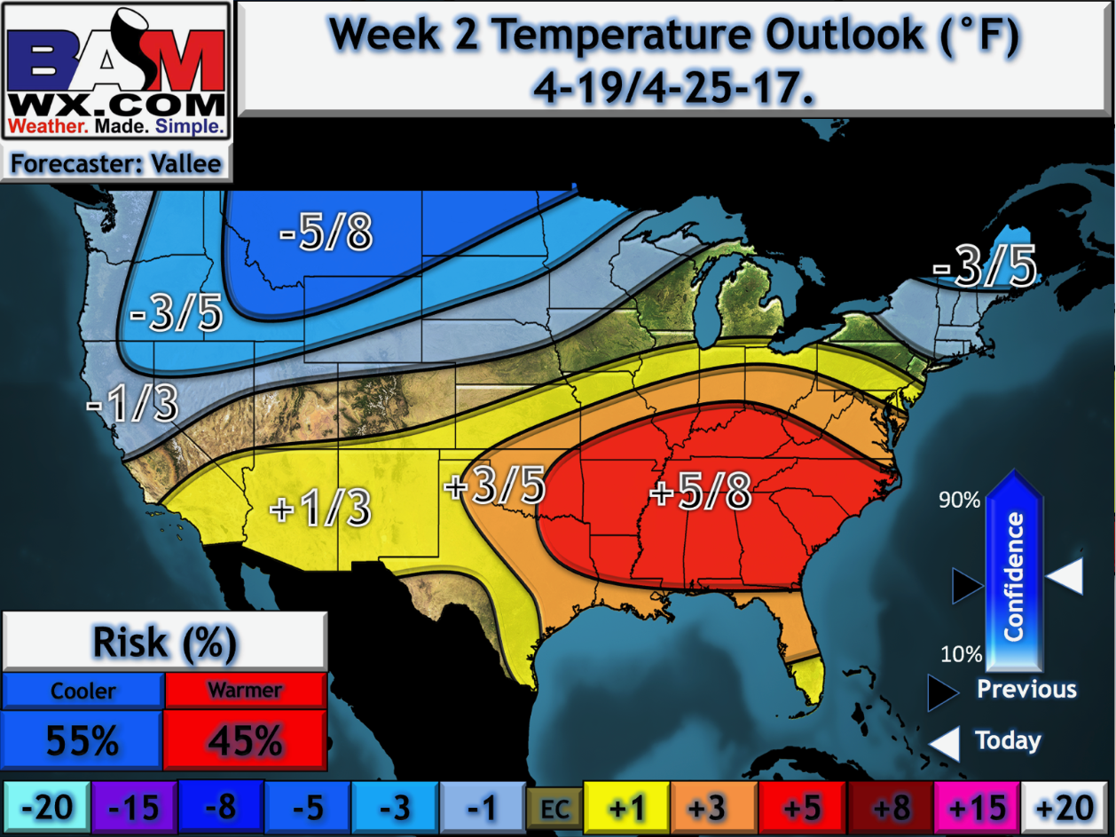
Quickly taking a look at the week 2 temperature anomaly forecast updated this morning shows some slightly cooler risks for the northern Zone locations keeping things seasonal, meanwhile we are still above normal across the southern half.
Zone 1/2 Quickcast:
Zone 3 Quickcast:
Zone 4 Quickcast:
Confidence and Risk:
- Above average confidence on our next chance of showers and storms for the northern half of the Midwest comes early Thursday west into Friday west.
- Above average confidence additional showers and storms especially north and west moves east Friday night into Saturday.
- Average risk in a hefty storm complex moving east across eastern Iowa and western Illinois later Saturday into Sunday morning we are watching closely.
- Above average confidence we start next week nice and dry before our next heavier storm threat moves through mid-next week.
- High confidence we are overall warmer than normal through the next week.
Today’s video (8 min):