#ILwx #INwx #OHwx Update on accumulating snow across the #Midwest into Mon…we discuss the risks here as well. K.
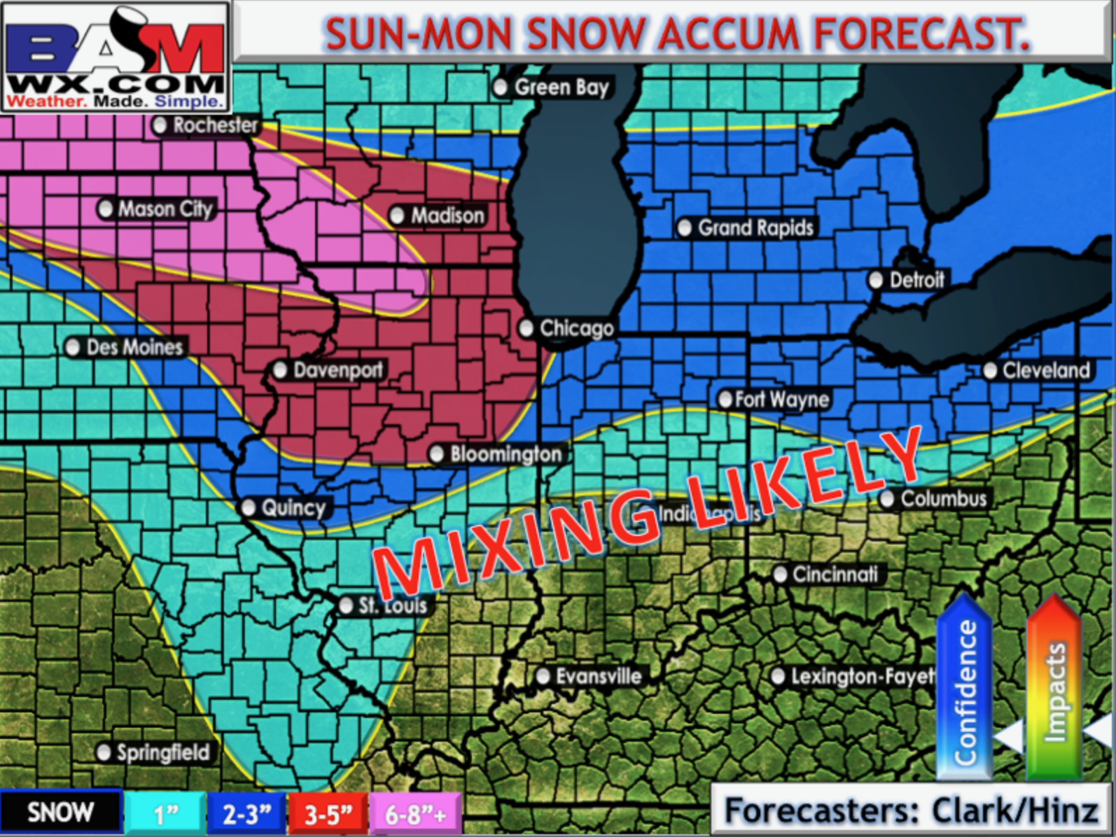
Synopsis: Good Sunday morning! Today we discuss the latest developments and details in regards to Midwest snow accumulations late tonight through Tuesday this week. Largely, our thoughts remain unchanged with the confidence and risks…but we felt it necessary to share with you the latest data so you are covered. (Zone 8 folks, we included you in this update so you can get a feel for the forecasts, and because this event does impact some of the Zone as well).
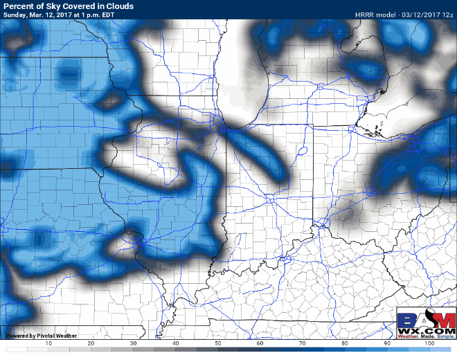
Skies starting largely mostly sunny across the Zones this morning as forecasted with temps lingering in the 20s mostly…increasing cloud cover will start to move in from west to east later this afternoon into this evening as our wintry weather approaches.
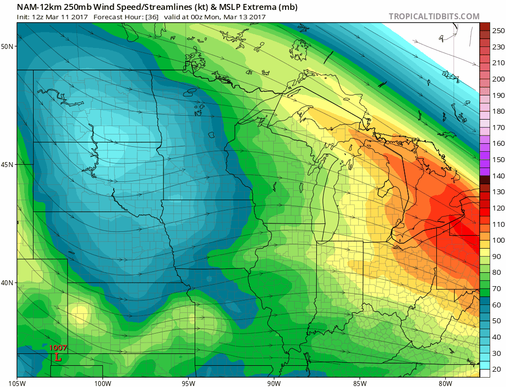
Latest trend has been for the 250mb jet stream to amplify further west and become more intense, which is a trend we just can’t ignore. This would play a bigger impact in terms of snowfall accumulations. Keep in mind, though, as we discuss below and in the video, temperatures will still play a huge role in what can actually accumulate and stick.
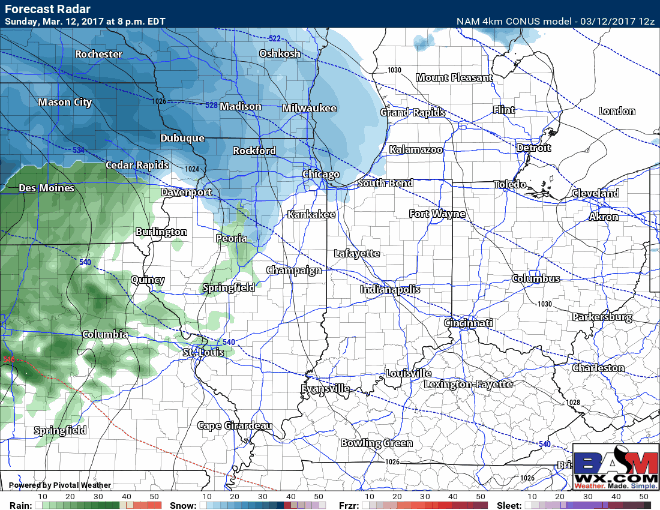
Timing is discussed in full detail in the video, we expect snow showers to begin in eastern Iowa into northern IL 10-11pmCDT, moving east ~5amEDT to northern to central IN; by 11amEDT we start to get a wintry mix as temperatures warm above freezing and continuing throughout the day on Monday.
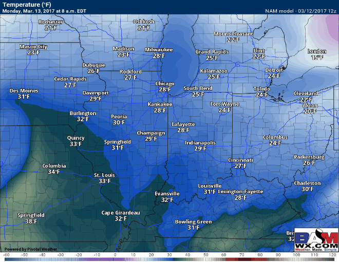
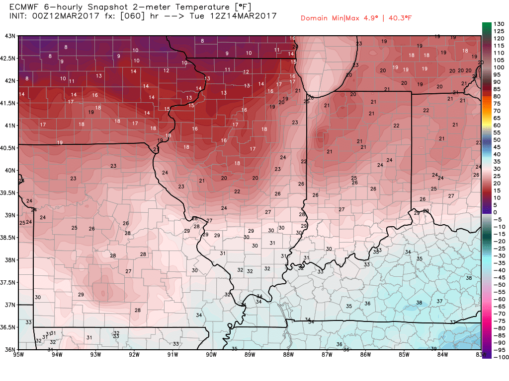
As mentioned above, temperatures will be a big factor when discussing snow accumulations. As shown below, we are well above freezing for most of the day on Monday which will likely eat away at these totals.
Thoughts on accumulation…temperatures at the surface make this forecast very difficult because a lot of this may fall but will not accumulate.
Refreeze potential is quite high Monday night into Tuesday morning as temperatures get into the 20s…so we recommend monitoring your lots closely and applying treatment as necessary.
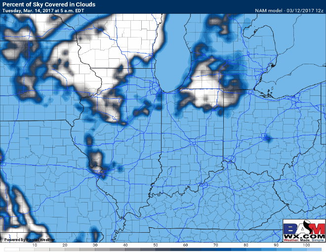
Skies definitely start clear on Tuesday for ample amounts of sunshine as dry air works in, below is an animation from the latest NAM 12km.
Confidence and Risk:
- High confidence we start the first half of the day mostly sunny with increasing cloud cover into the afternoon and evening hours Sunday.
- Above average confidence snow showers move through eastern Iowa and western Illinois later tonight moving east overnight into Monday.
- Average confidence right now in terms of snowfall accumulation…we expect a lot of this snow that falls will have a difficult time sticking giving how warm temps get on Monday.
- Above average confidence on slippery surfaces and a refreeze Monday night into Tuesday given temps falling into the 20s.
- Above average confidence we see sunshine on Tuesday which may help whatever snow is left to melt off.
Today’s video (7 min):