#ILwx #INwx #OHwx Thurs PM short-term:
Synopsis: All the details are packed in the video so please reference that for all of the details. We continue to monitor for very heavy rainfall, flash flooding even strong storms as a warm front lifts north later Friday into Saturday and then a cold front sweeps east later Saturday into Sunday and exiting east on Monday morning. If you have any questions please don’t hesitate to reach out.
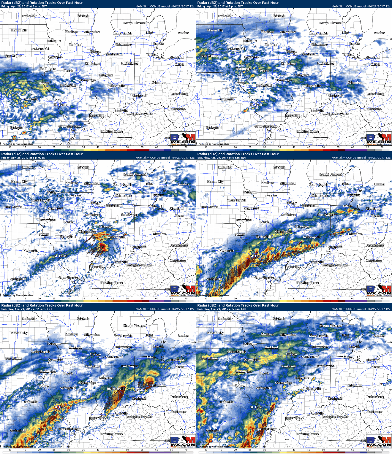
Latest simulated radar from the NAM-3km…40-50% shower coverage on Friday, strong storm potential starts to gear up I-70 south between 5-8pm Friday night through the day Saturday. It’s common with warm fronts to see some sunshine south of the warm front so folks who manage to get passed by the front will possibly see some clearing skies at times Saturday.
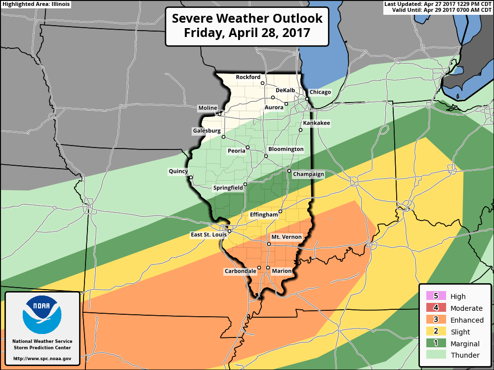
All modes of severe weather will be possible as the warm front lifts slowly north: flash flooding, damaging winds, large hail and isolated tornadoes. Wouldn’t be shocked to see the threat shift slightly further north as it’s common for warm fronts to lift further north than what models indicate here in the Midwest.
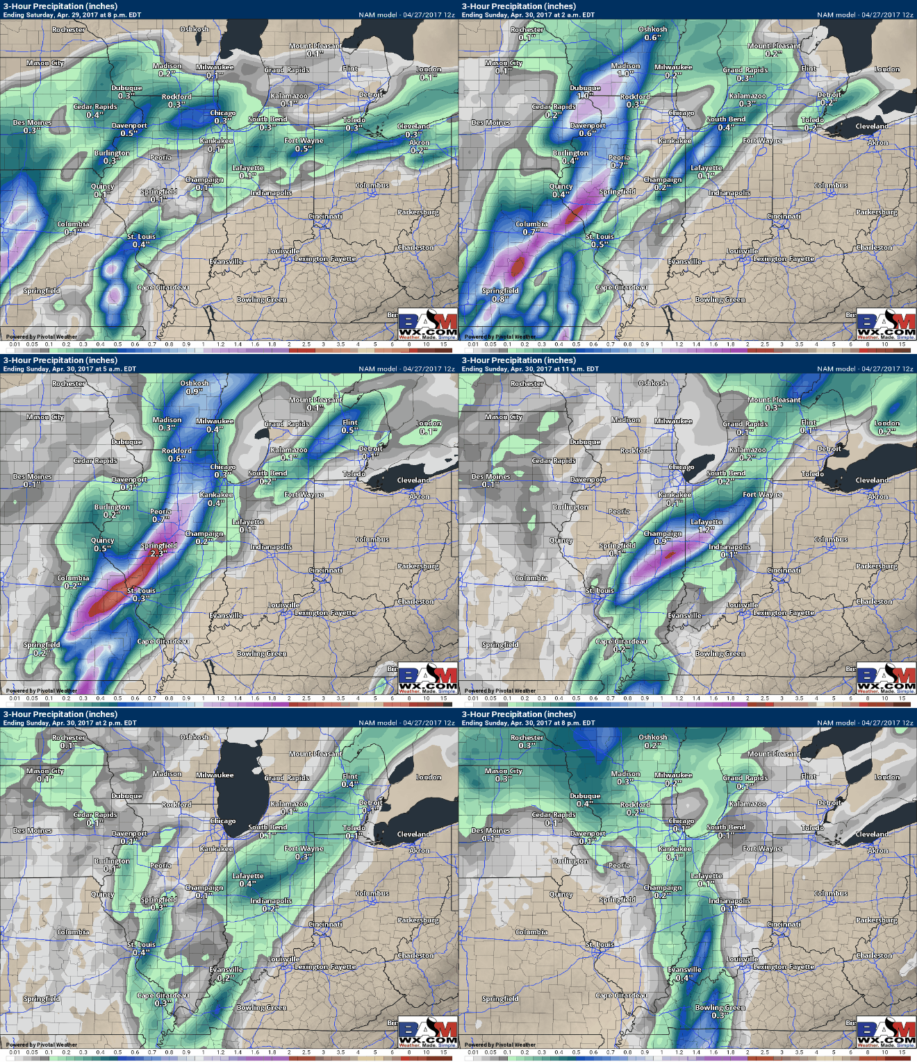
The cold front takes its shape Saturday evening along the area of low pressure situated across Illinois, and as it slowly creeps in some additional very heavy rainfall will be possible into the day on Sunday.
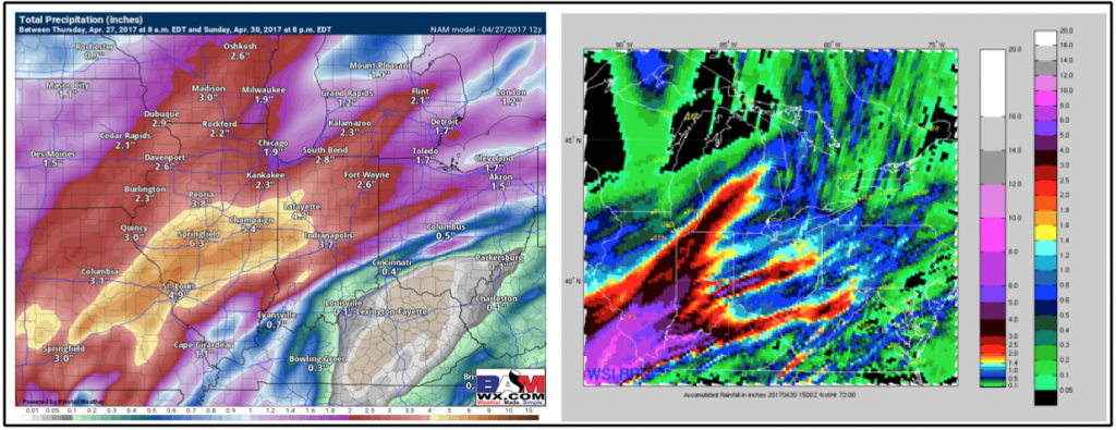
Latest thoughts on total rainfall via the NAM and RPM forecast models. I personally think the totals will be slightly higher than the NAM on the left, the RPM indicates a swath (purple) of 8.0″+ of rain across Illinois into western Indiana. If this system slows down at all I wouldn’t be shocked to see someone see double-digit rainfall totals…although confidence is still low with that solution. Areas further east into Ohio still likely see 1-2″.
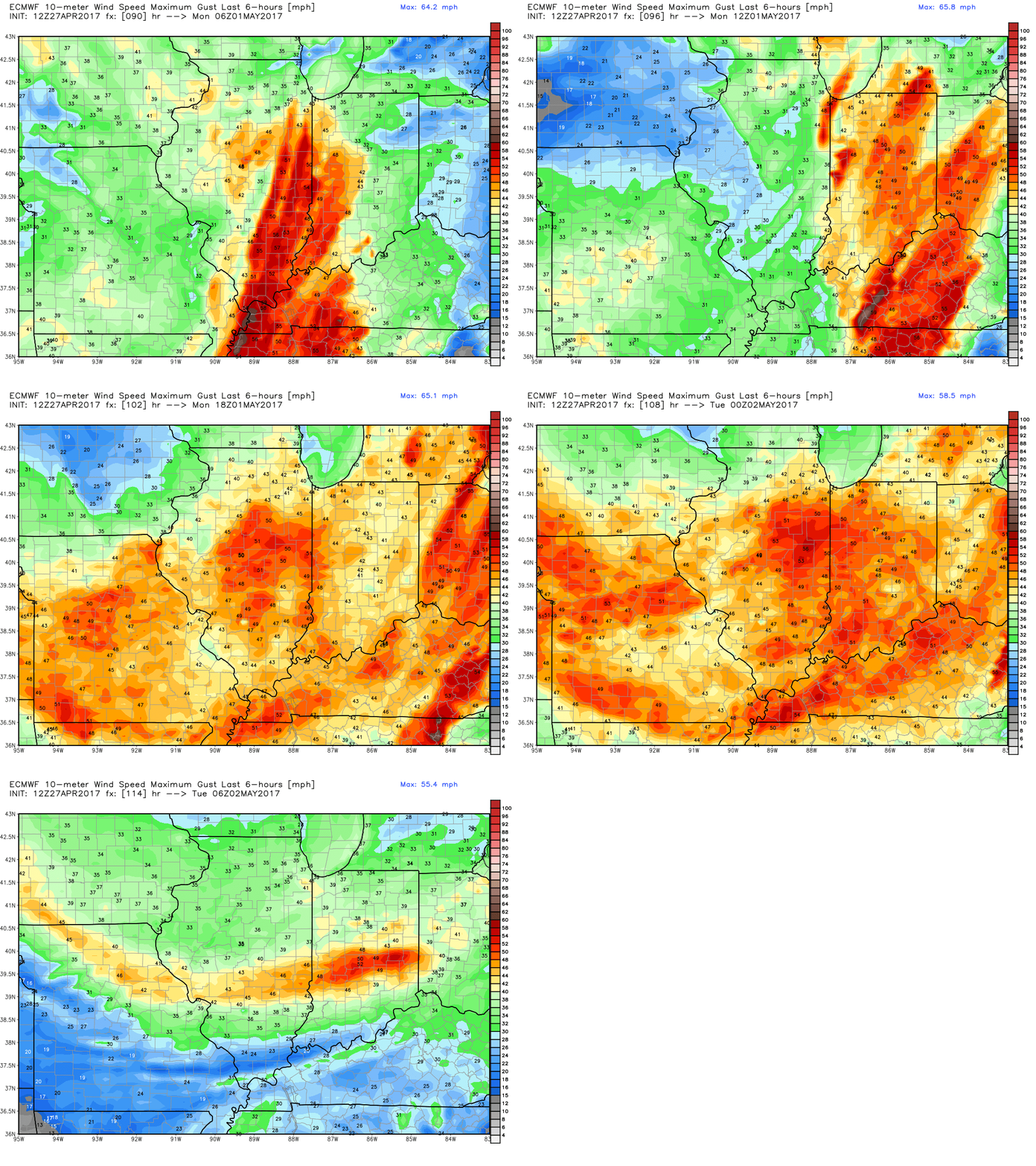
As that cold front sweeps east on Sunday and exits on Monday, some very gusty winds are still possible in excess of 45mph out of the southwest.
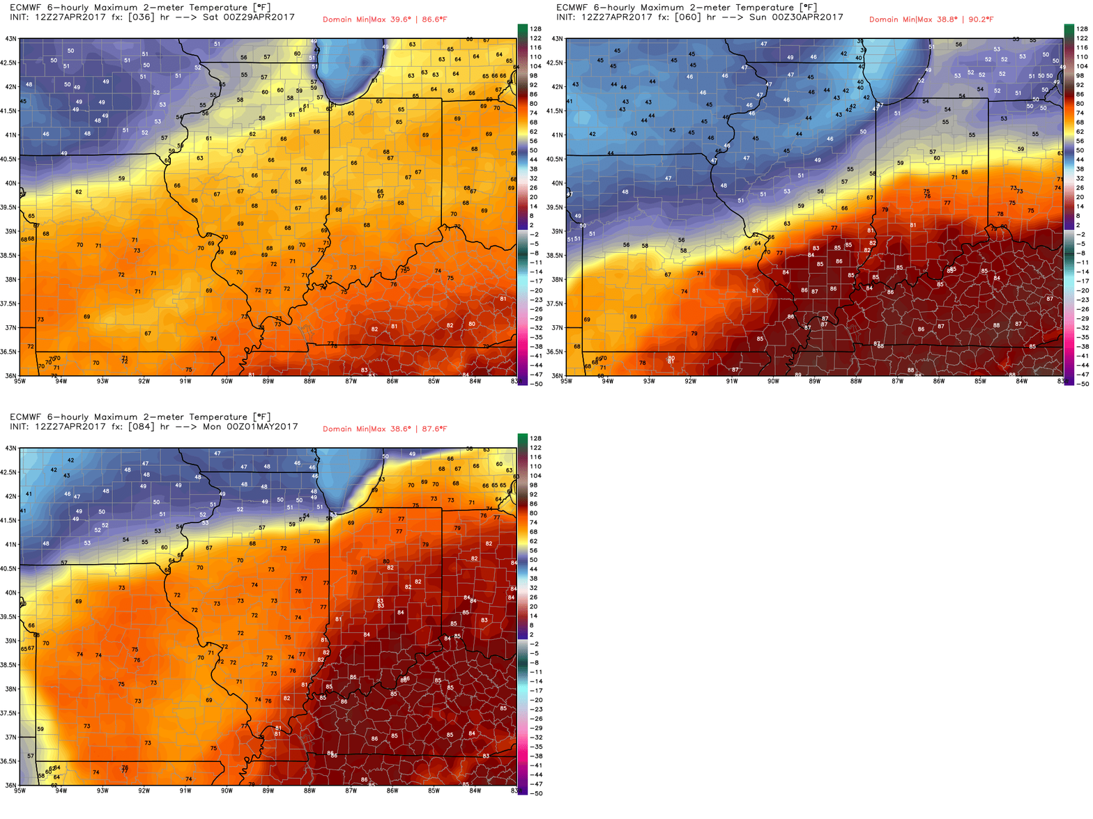
In regards to temperatures, looking at upper 60s for highs tomorrow, maybe creeping into the lower 70s in some spots. Very warm south of the warm front Saturday into Sunday in the 80s…honestly wouldn’t be shocked to see someone hit 90. MUCH cooler north with folks lingering in the 40s…all depends on exactly where this thing sets up.
Confidence and Risk:
- Above average confidence the warm front lifts north on Friday bring scattered showers and storms.
- Above Average risk for severe storms later Friday night into Saturday morning with all modes of severe possible.
- High confidence showers and storms will be present on Saturday and Sunday throughout the midwest as the low pressure system slowly creeps east.
- Average risk for gusty winds topping 45mph along the cold front Sunday and on the backside of the low pressure system Monday out of the southwest.
- Below average confidence still on exactly where the warm front sets up later Friday into Saturday…folks south will see very warm temps.
Today’s video (8 hours):
