Key Points – Thursday, March 30, 2017
Synopsis: Good Thursday morning! Today’s update is focused primarily on the strong to severe weather threat today into tonight across the Midwest. It should be noted first, that the strong storm threat is highly conditional on how much sunshine we receive today. Often times in these situations we don’t have the answers to these questions until only a few hours out, so we will be watching this very closely. Models do indicate some sunshine is possible, but if we stay cloudy the severe threat diminishes. Heavier rains and even flash flooding are potential threats as well. The active pattern continues into next week with multiple shower and storm chances as discussed in today’s video. Have a great day, we will be updating on today’s storms so check back often.
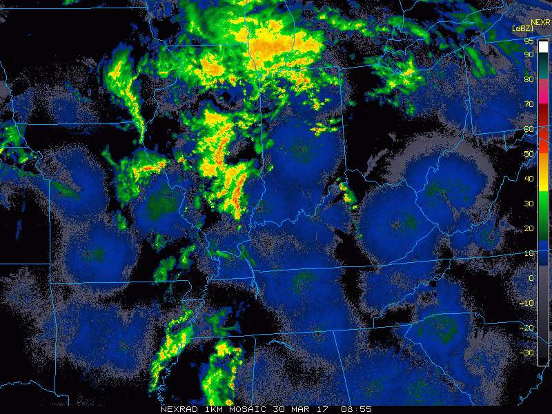
Current Radar…showers and storms ongoing across Illinois, southern Michigan into Indiana and western Ohio.
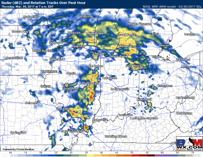
Simulated Radar today via the NSSL-WRF that is handling current storms the best at this time. Central IL/IN lunch time showers/storms possible to the north and east. The main threat we think starts to happen ~5pmEDT, getting into the IL/IN state line by around ~7-8pmEDT that has the potential for embedded isolated large hail and even tornadoes. Wouldn’t be surprised by a watch box issued for this threat as well.
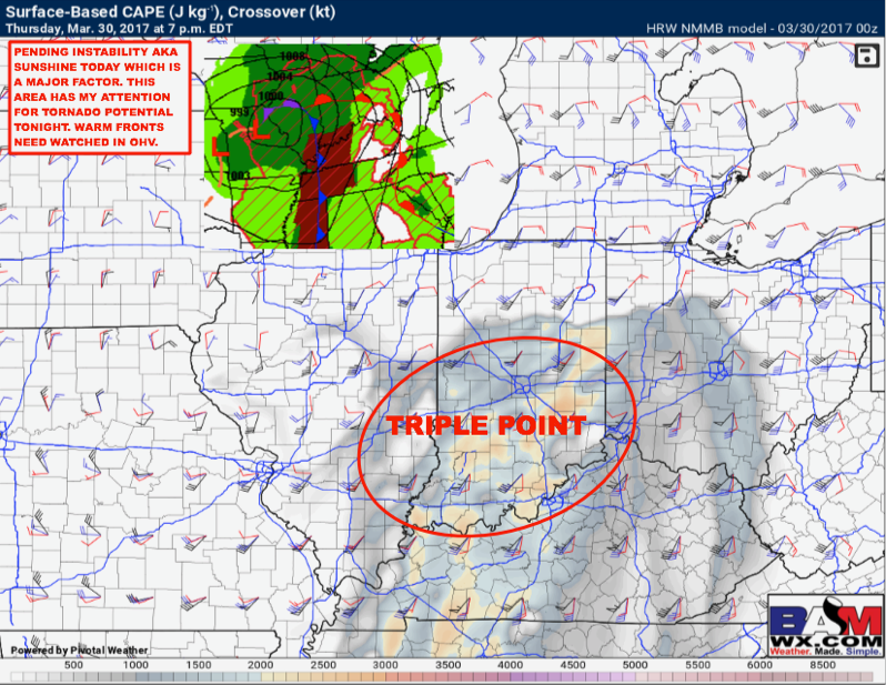
Pending instability (sunshine), this is the area that has our attention for tornado potential. When we get wind speed and direction changing with height (wind shear), we start looking for rotation in the atmosphere which makes things conductive for severe storms and tornadoes.
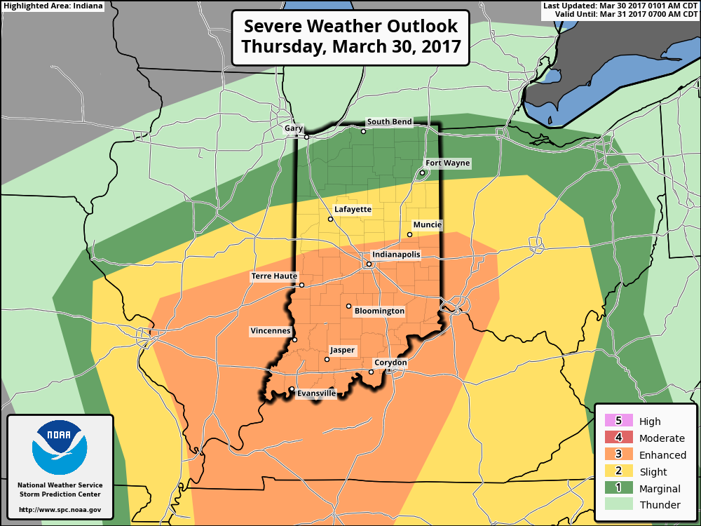
Latest severe risk area…all modes of severe weather are possible including damaging winds, isolated large hail and even tornadoes. The risk for tornadoes is highly dependent on how much sunshine we receive today…the less we see, the more likely this risk is reduced across the risk area.
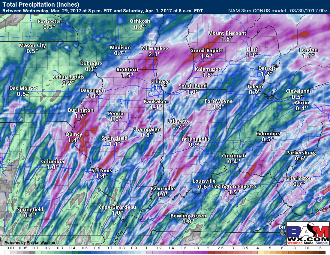
Latest thoughts on rainfall totals throughout this event…would not shock us to see isolated accumulations of 1.5-2.o”+ in heavier, stronger storms that may develop.
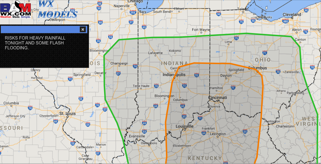
We mentioned above some isolated heavier rains are possible today into tonight, especially in the strong storms that form; here’s where we a believe a flash flooding threat exists given the current set-up.
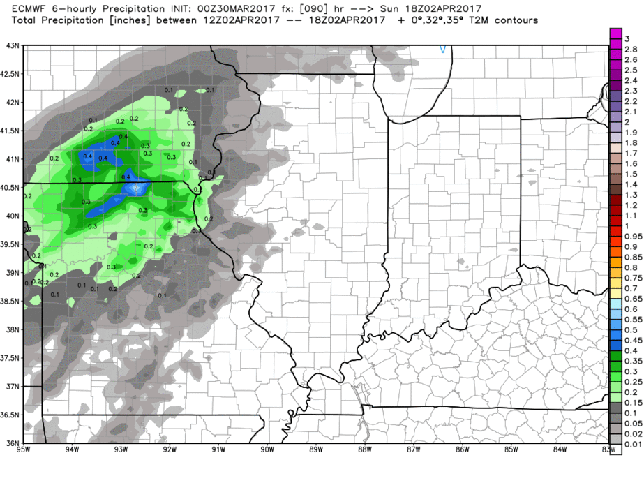
Next chance for showers comes late weekend into early next week as seen well by the European model below that we will be updating on in the coming forecasts. The pattern stays very active into April, that’s for sure.
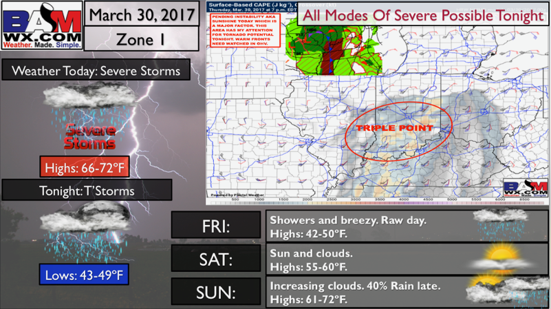
Zone 1 Quickcast…all modes of severe possible tonight.
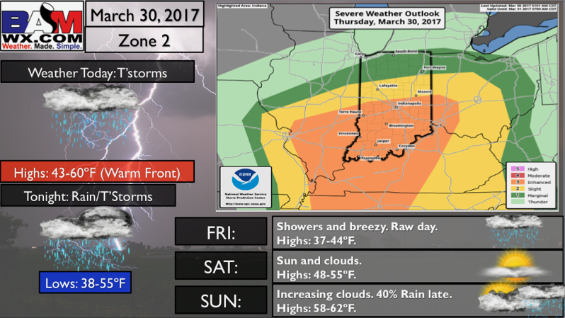
Zone 2 Quickcast…thunderstorms possible today, strong potential to the south.
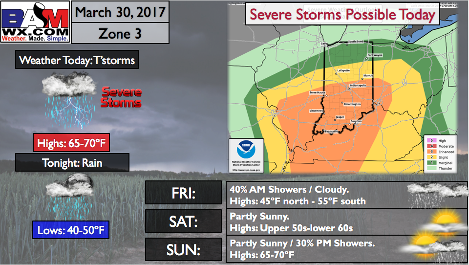
Zone 3 Quickcast…severe storms possible today, damaging winds, isolated large hail even isolated tornadoes.
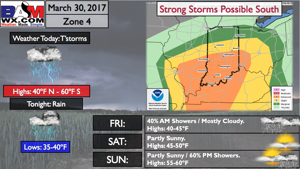
Zone 4 Quickcast…strong storms possible south today with cooler temps still north and warm south where the warm front sets up.
Confidence and Risk:
- High confidence showers and storms continue into the Midwest today into tonight.
- An enhanced risk for severe storms today given how heavily we are dependent on sunshine (instability).
- Above average confidence some heavier rainfall is possible in the stronger storms through Friday morning.
- Above average confidence the pattern stays active into April next week throughout the Zones, with multiple shower/storm chances as well.
Today’s video (7 min):