Key Points – Monday, March 20, 2017:
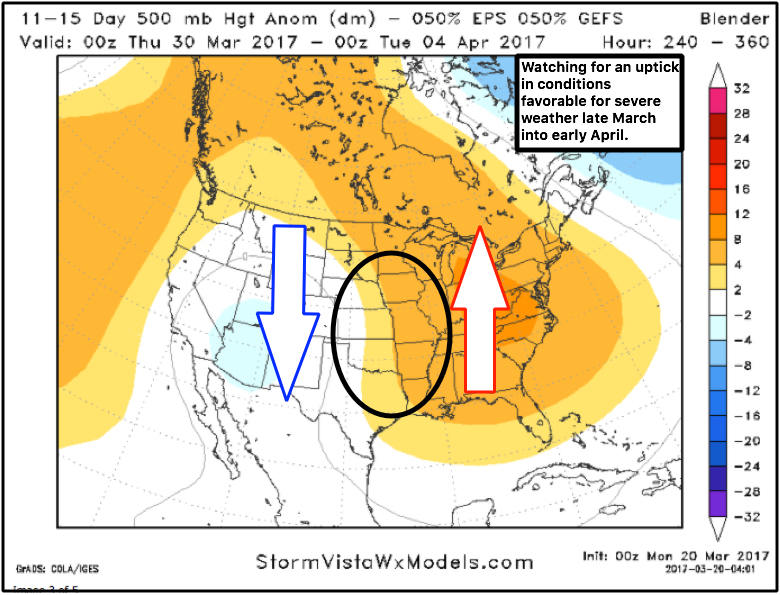
Synopsis: Good morning and welcome to a new season…Spring has sprung! In today’s video we discuss the very active pattern heading into late March and early April…we feel conditions are beginning to become more favorable for an uptick in severe weather and heavier rainfall…this is also a classic signal for roller coaster temperature swings so we highly encourage folks to watch each update! Have a great week!
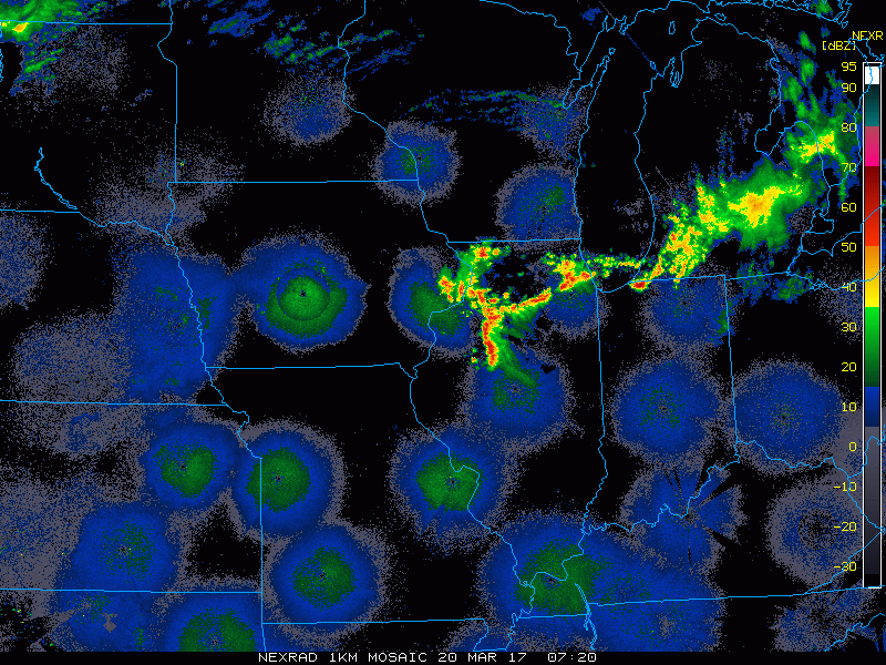
Current Radar…first wave of showers and storms with isolated large hail moving across IL into IN and OH this morning:
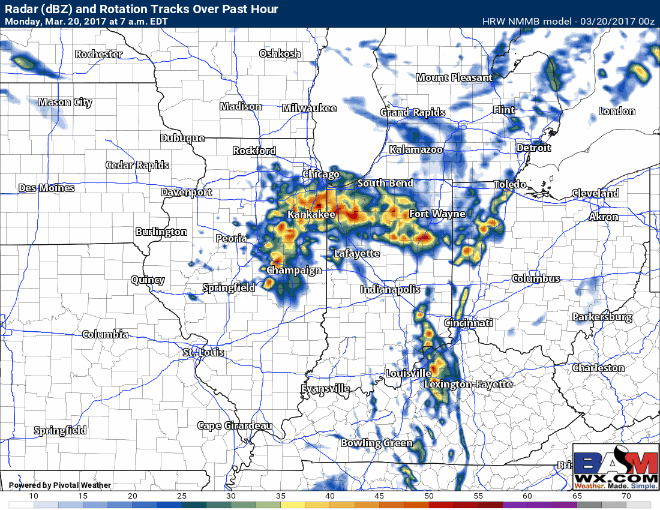
Simulated Radar…we time out the remaining storms during this first wave as it moves east into Indiana and Ohio…expecting another wave of storms to develop across eastern IL to IN this afternoon to evening and push into OH as well.
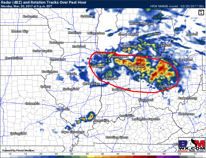
Here’s where I think some additional isolated large hail and gusty winds could set up once again today…wouldn’t be shocked to see a few stronger storms out of this as well.
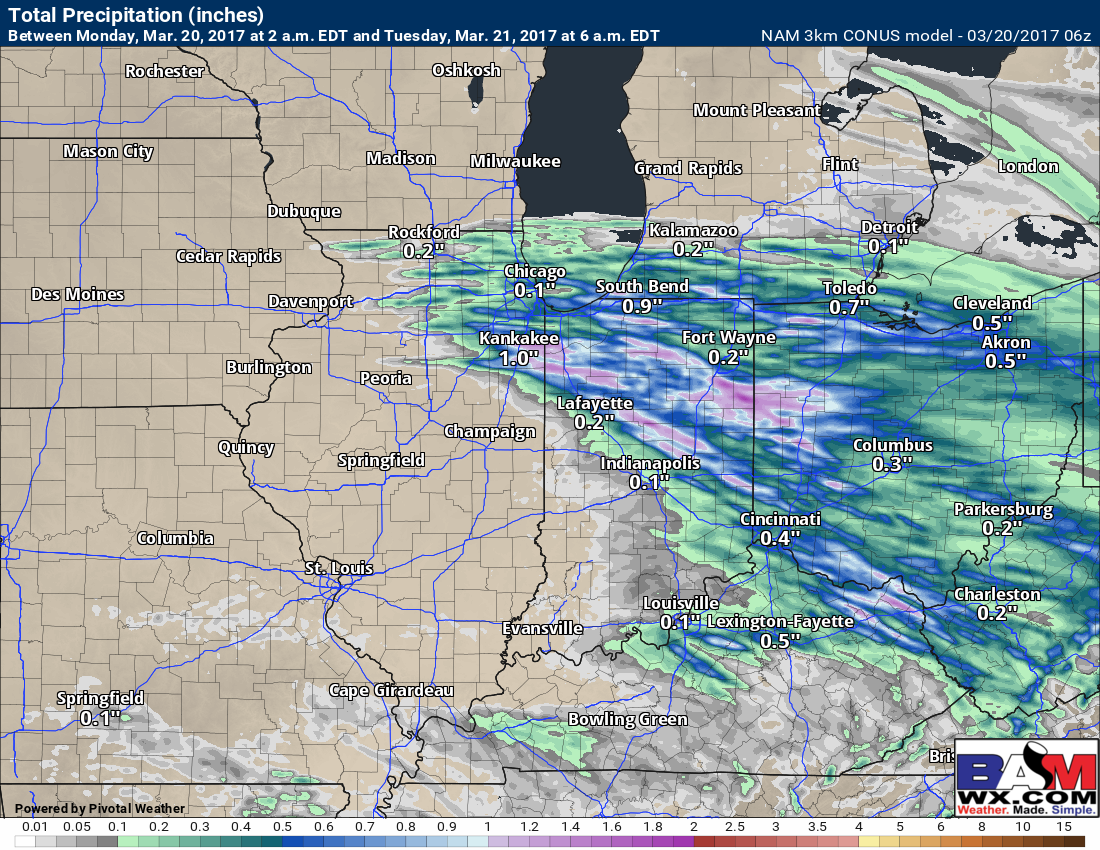
Expected remaining rainfall…some folks may see minimal rains, others may see 1.5″+ in isolated heavier storms…just the name of the game when it comes to scattered thunderstorms in spring.
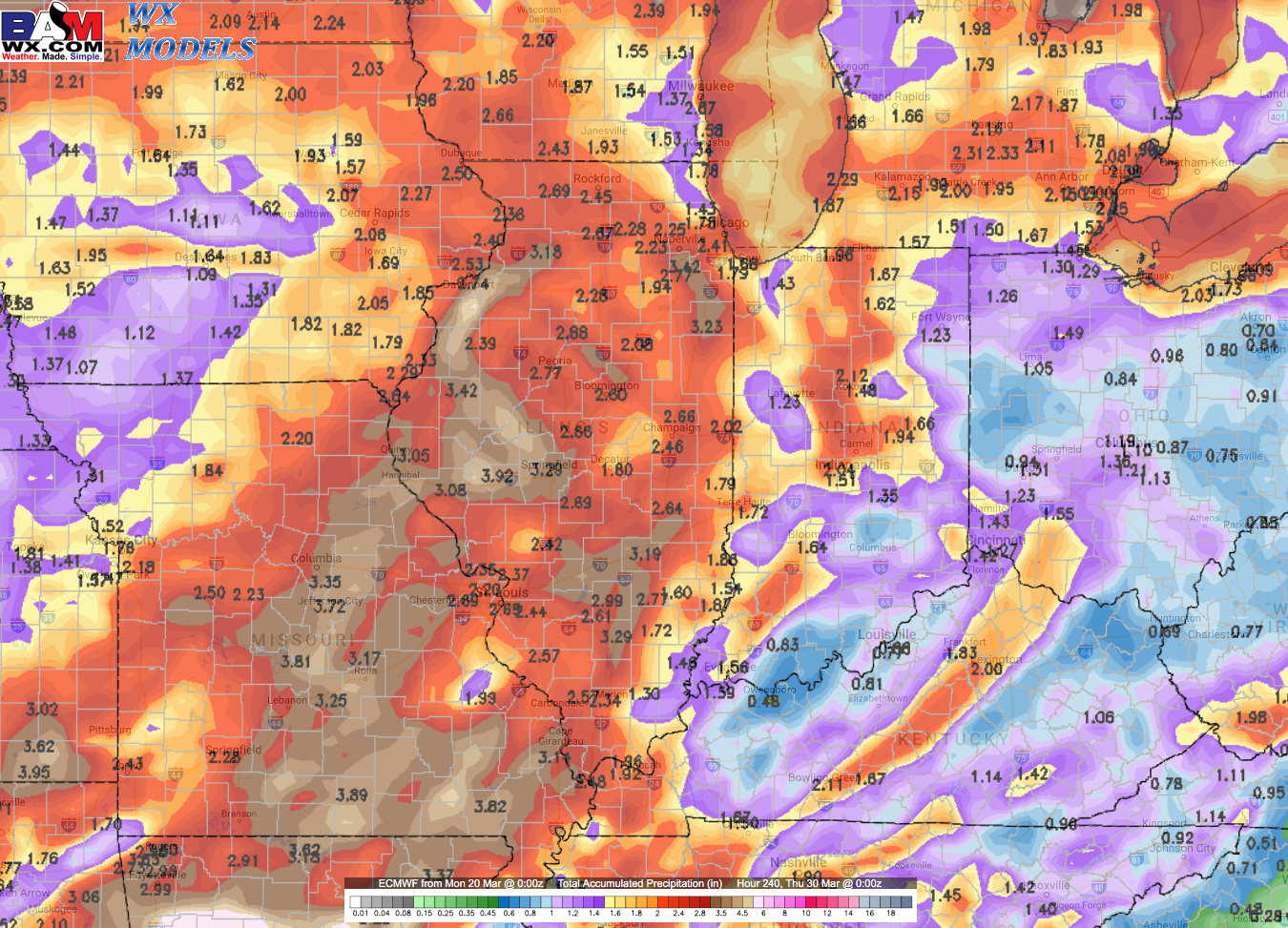
Very active over the next 10 days…check out these rainfall totals forecasted from the European! To see a widespread swath of 2″+ is a red flag that we need to watch things very closely…the GFS and Canadian models have a similar swaths of heavy rain as well.
An uptick in conditions favorable for severe weather is forecasted basically now through early April as discussed in the video…when you have clashing air masses, it’s where they come together severe weather will occur…watching this threat closely for the Midwest.
Confidence and Risk:
- High confidence additional showers and storms possible across the eastern Zones today into tonight.
- Increasing confidence of additional showers even storms late week/early weekend as a low pressure tracks into the Midwest.
- Above average confidence the next 10 days will be very active with heavier rains possible and roller coaster temp swings.
Today’s video (7 min):