Key Points – Wednesday, March 29, 2017:
Synopsis: Good Wednesday morning and thanks for checking out the latest forecast update! You’ll notice closer to the bottom a new feature we unveiled today called a “Quickcast”, which gives a good general forecast for your Zone over the next 3 days. Today we discuss our next system approaching the Midwest from the west that will move in today and gradually head east Thursday into early Friday before exiting; we also discuss the threat for strong to severe storms as well especially across the southern half of the Zones. A stretch of more “quiet weather” sets in the second half of Friday into Saturday before our next chance for rain comes late weekend into early next week. We count at least 3 disturbances over the next week bringing pretty robust rainfall totals as well. Temperatures from normal are largely above normal with the exception of the far northern locations of the Midwest. Have a wonderful Wednesday!
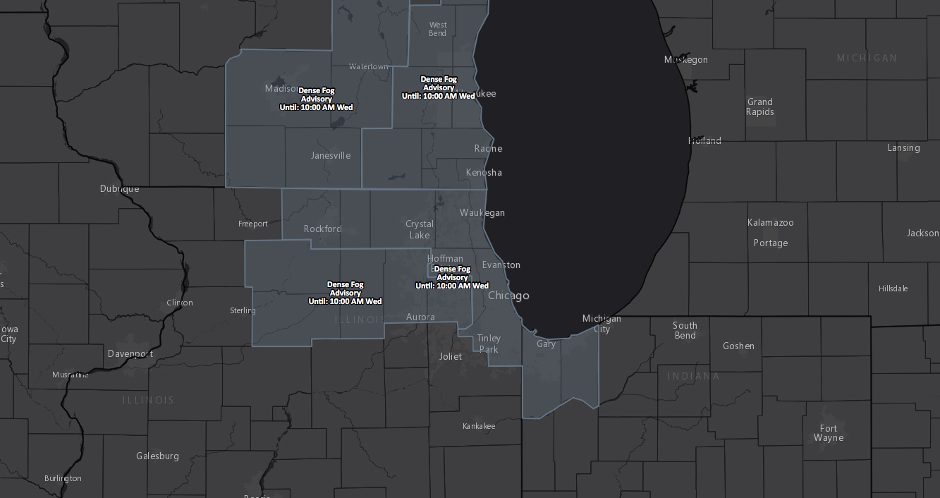
First things first, we mentioned a risk for some dense fog across northern IL in yesterday’s update, still see some lingering patchy fog this morning that is forecasted to burn off through the morning hours.
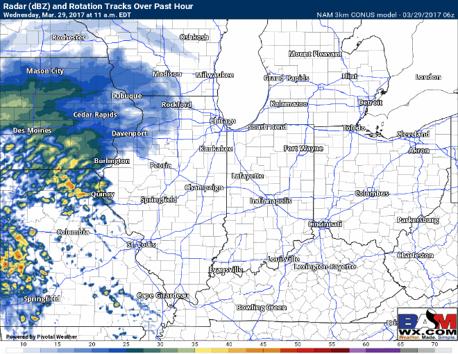
Cloud cover increases with a few peaks of sunshine (especially further east) possible today, but a large system continues to approach from the west. Showers and storms expand east today around lunch time across eastern Iowa into Illinois with ~50% coverage into tonight.
In terms of a strong storm risk late tonight, we could see some gusty winds to isolated hail across southern Illinois.

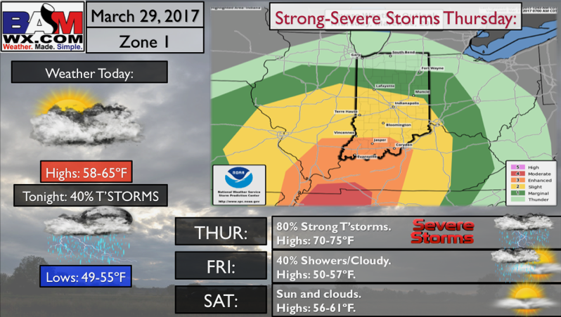
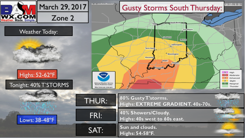
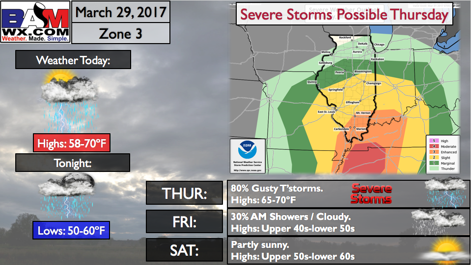
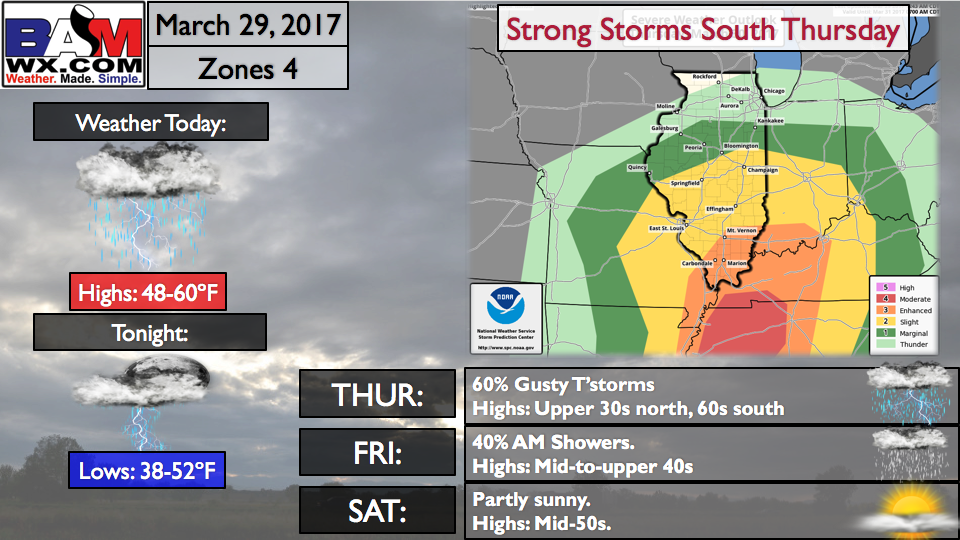
We have concern for strong to severe storms on Thursday, even a few supercells cannot be ruled out; this threat is largely dependent on how much instability (sunshine) we see on Thursday, which could hinder (or increase) how far this threat goes north. Coverage is expected to be 80% for thunderstorms on Thursday (details in the video). The showers decrease in coverage from west to east on Friday morning.
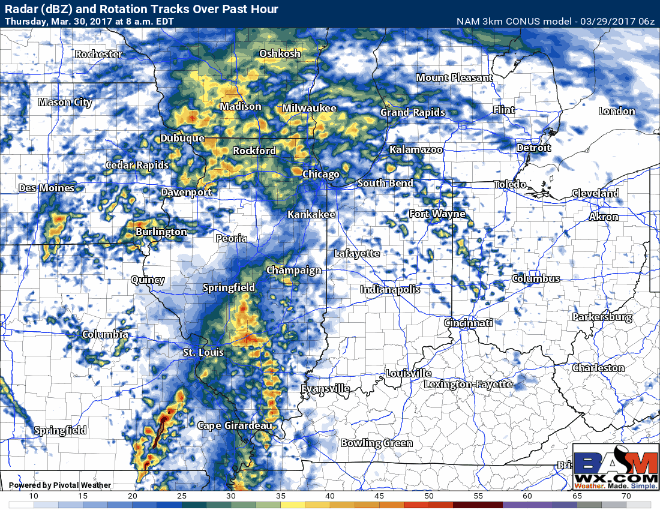
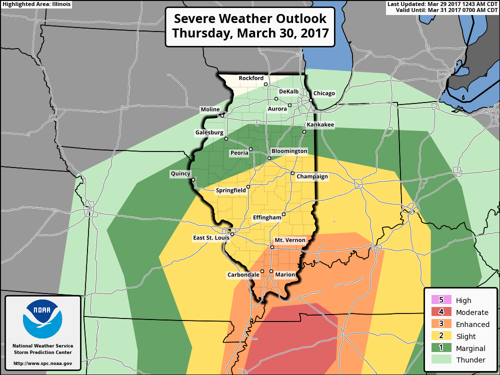
Strong storms risk area for Thursday mainly from I-70 south, with the threat for damaging winds and isolated large hail…although confidence is low, we cannot rule out an isolated tornado threat as well especially if we start seeing discrete supercells form. Watching this very closely.
We see a more dry stretch of weather later Friday into Saturday before our next chance for showers comes late weekend into early next week…the active pattern continues into April, that’s for sure. Here’s a look at rainfall totals through the next 10 days…2-3+” possible is the forecast right now.
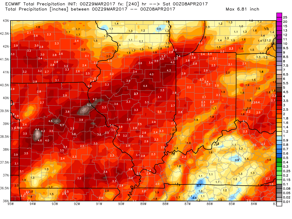
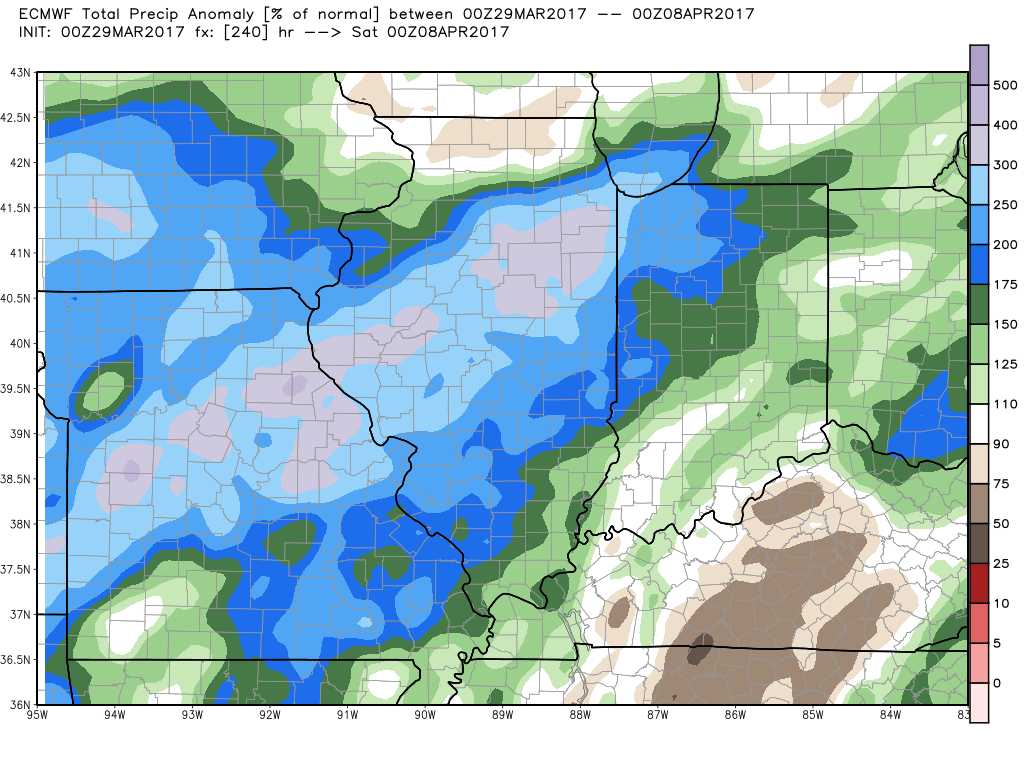
In terms of what this looks like in precipitation from normal, 2-300% is possible especially west across portions of Illinois over the next 10 days.
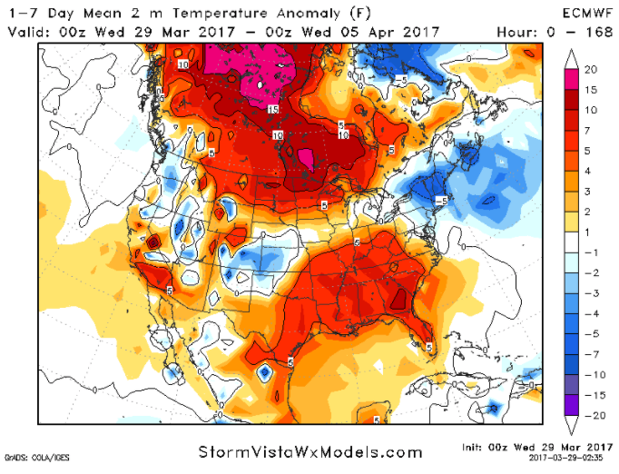
In regards to temperatures from normal over the next week, overall we continue to see above normal warmth with the exception of the farther northern Zone locations who remain more near-normal.
Zone 1 QuickCast…watching for strong storms Thursday.
Zone 2 QuickCast…gusty storms possible Thursday.
Zone 3 QuickCast…watching for strong storms on Thursday.
Zone 4 QuickCast…gusty storms possible Thursday.
Confidence and Risk:
- Above average confidence showers and storms increase later today into tonight especially across Illinois locations.
- High confidence of showers and storms overspreading the Zones by Thursday.
- Average risk strong storms push further north of I-70, limited sunshine could hinder this threat.
- Above average confidence we stay above normal in the temperature department over the next week with the exception of far northern Zone locations who are more normal.
- High confidence the pattern remains active over the next 7-10 days into April.
Today’s video (8 min):