Key Points – Wednesday, April 5, 2017
Synopsis: Good Thursday morning and thanks for checking out the latest forecast update! It’s important to pay close attention to updates this morning and throughout today, as things are still evolving and are not entirely set in stone. We do expect strong to severe storms to form later this afternoon into this evening from eastern Illinois through the southern half of Indiana and western Ohio. All modes of severe are possible today include large hail, tornadoes and isolated damaging winds in these storms…heavy rainfall will be possible as well in excess 2.0″+ in some locations. Very strong wind gusts will be possible later Wednesday into Thursday at 40-50+mph out of the northwest, along with some wintry mixed precipitation on Thursday that will keep the day pretty miserable. Good news though, we turn warm and sunny this weekend, even touching 70s by Sunday for most locations! Have a great day!
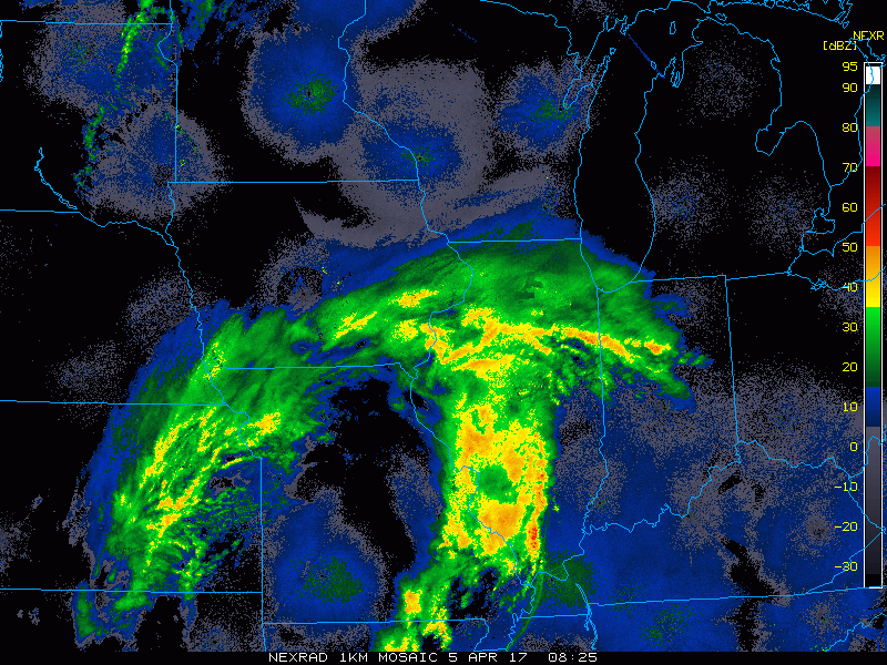
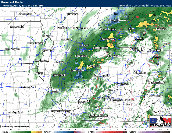
Current Radar…as these morning showers continue to move east, we believe they continue to weaken I-70 south…from I-70 north we are looking at showers maintaining most of the day.
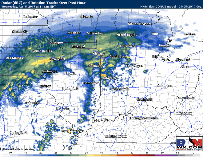
Simulated radar…south of I-70 we are looking at strong to severe storms today. Expecting those stronger storms to gear up I-70 south across southeastern Illinois into Indiana by ~4-5pmEDT and race east throughout the evening.
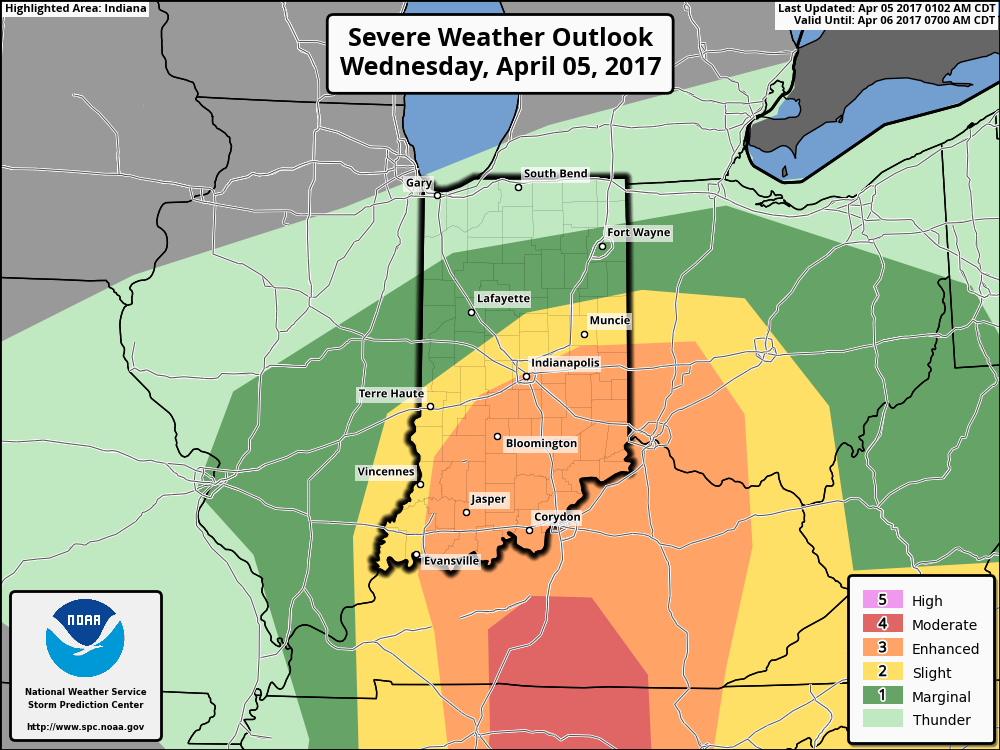
Here’s where the SPC currently has the risk…all modes of severe are in play today including very large hail, tornadoes and isolated damaging winds; heavy rainfall will also be a hazard.
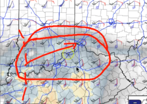
Here’s a screenshot from the video where we think the best potential is, this morning, for tornadoes today starting ~4-5pm racing east throughout the evening. This is still evolving, the risk in this is still above average to high.
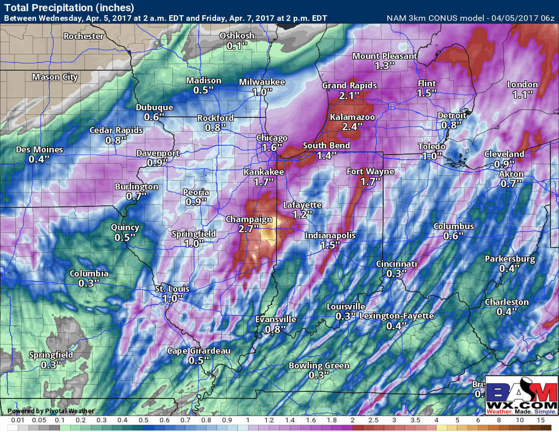
Total rainfall…largely many locations will see 1-2″ throughout this event, with isolated 3″+ amounts not out of the question.
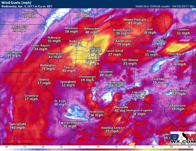
Wind gusts into Wednesday night into Thursday…we wouldn’t shocked to see a wind advisory or high wind warning as winds are forecasted to gust at 40-50, even a 60mph gust is not impossible out of the northwest.
Wintry mix possible into Thursday as temperatures crash on the backside of the low pressure…it will be a very raw day. Temperatures will be above freezing so we are not expecting accumulating wintry precipitation at this time. But with the wind and rain/snow mixing in it will be a pretty miserable day.
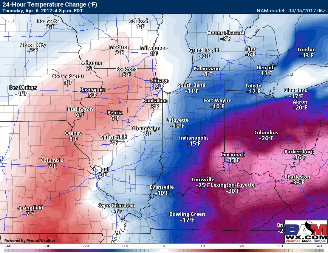
Here’s a look at 24 hour temp differences as the low pressure tracks east and ushers in much colder weather on the day on Thursday, some spots seeing a 30º+ difference! This is the equivalent of going from the 60s/70s to 30s/40s…it will be quite the quick transition.
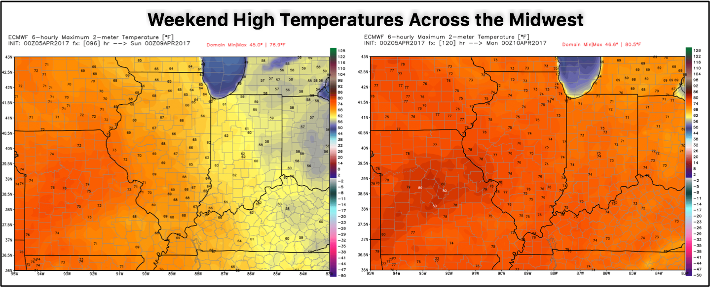
The disturbance clears east out of the Zones Friday morning, with mostly sunny skies expected to move in the second half of Friday into the weekend. Check out these weekend temps, will definitely warm up and be very nice!
The next chance for scattered showers and t’storms comes Monday into Tuesday next week.
Confidence and Risk:
- High confidence the Midwest sees continue showers and t’storms throughout the day.
- Still above average risk in severe storms, including tornadoes, as the severe threat is still evolving.
- Above average confidence some heavy rains will be possible in excess of 2.0″+ from this event.
- High confidence we will be very windy Wednesday into Thursday with gusts possible surpassing 50mph at times.
- Average to above average confidence some wintry precipitation works its way in on Thursday on the backside of the low.
- High confidence some sunshine and warmer temps move in this weekend, will be very welcomed.
Today’s Video (7 min):