Key Points – Friday, February 24, 2017
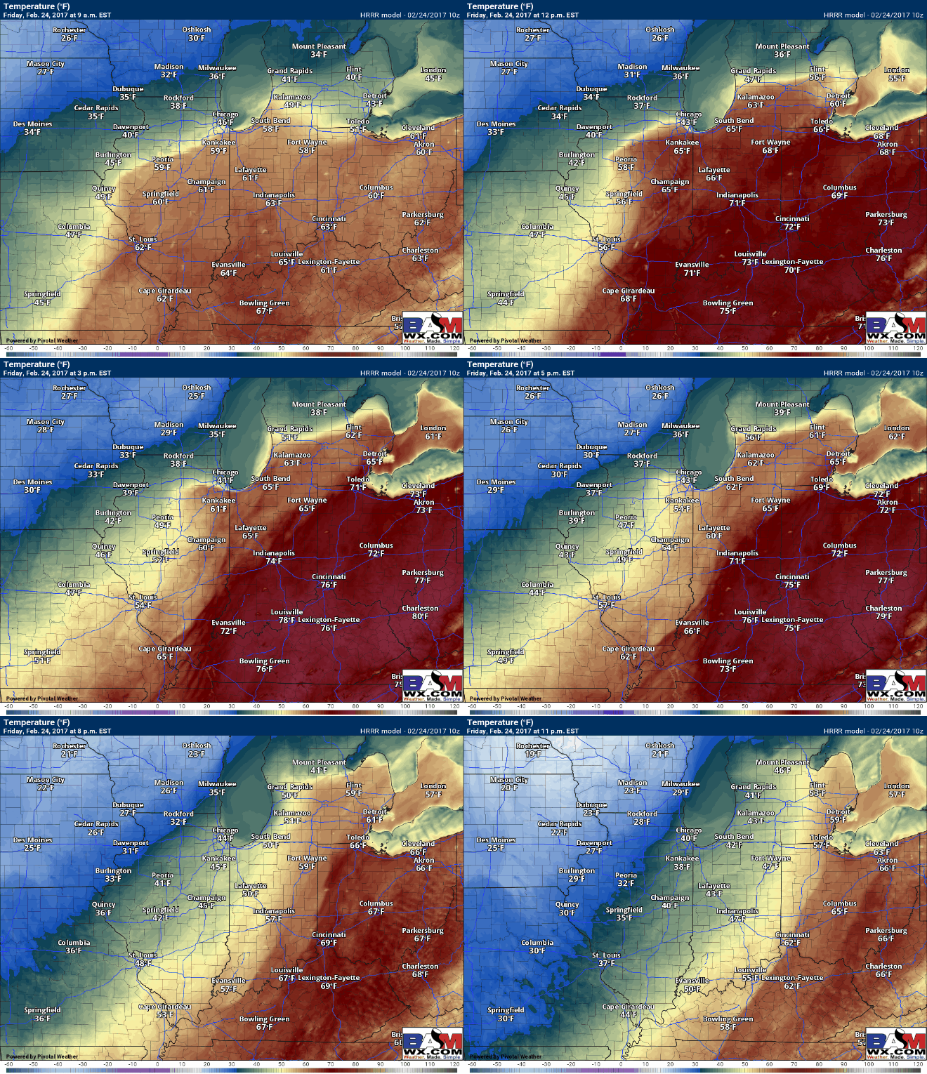
Synopsis: Good Friday morning and thanks for checking out our latest forecast update! A ton of details to discuss in the video today so we strongly urge you to watch until the very end as there’s still a lot at play in regards to severe weather. We are expecting another day of record-warmth across the Midwest, with some folks getting into the mid-70s even out ahead of the front this afternoon. Skies are relatively clear this morning with a few clouds streaming in from the west to east; we will be monitoring the cloud cover all day today as our severe threat is largely dependent on how much energy reaches the surface. The area with the greatest threat for strong to severe storms today has stayed largely unchanged, as have the risks for damaging winds, hail and isolated tornadoes out ahead or along the cold front as it progresses east…we time out everything in the video, but the main timeframe for severe storms looks to be ~4pm-2amEST from west to east. Temperatures drop off the table from Friday into Saturday, with some spots seeing 40ºF+ temp differences, which is like going from the 70s to the 30s! A few backside snow showers will ben possible as well on Saturday as the low pressure departs east and ushers in a “winter-like” feel.
Current radar across the Midwest shows mostly clear skies with a few high clouds moving west to east this morning.
Another day of record warmth expected today…some folks potentially even getting into the mid-70s out ahead of the cold front too!
Updated Severe Weather Outlook remains largely unchanged, with an Enhanced Risk for strong to severe storms focused across the eastern half of Indiana into southeast Michigan and the western half of Ohio. Now, this does not mean areas outside of this enhanced risk are “safe” from severe weather, weather is not confined to an “area” so we urge everyone to stay weather aware tonight and plan accordingly.
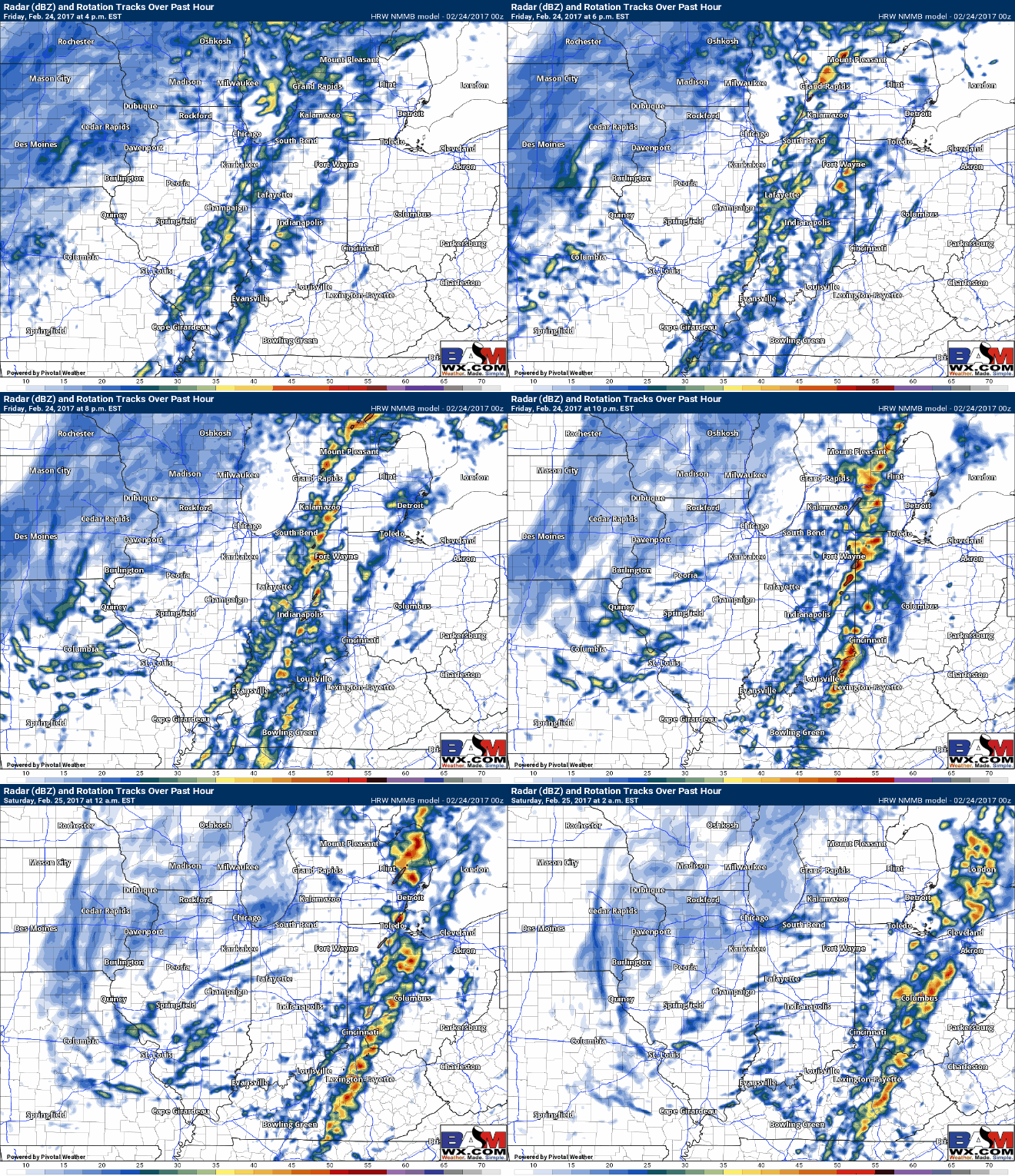
Below is a glance at simulated radar from the NMMB forecast model, which is handling current conditions fairly well so confidence is highest with its solution at this time. It’s possible a few super cellular storms form out ahead of the cold front which is what we would be concerned for isolated tornadoes and hail. Behind these pre-frontal storms will be a skinny line of storms that will have the risk for damaging winds. The main threat for severe storms will be from 4pm-2amEST as the cold front progresses east.
24-hour temp change graphic below…you can see how some areas have a 40ºF+ temperature difference over a span of 24 hrs! That’s equivalent to going from 60s/70s to the 20s/30s…or going from spring winter. We would not be surprised to see backside snow showers on Saturday as the low pressure departs east as well.
Confidence and Risk:
- Average confidence of strong to severe storms moving east today out ahead or along a strong cold front.
- Above average confidence of record-breaking heat once again today.
- High confidence of a major temperature difference from Friday to Saturday across the Midwest.
- Average confidence on backside snow showers Saturday as the low pressure moves off to the east across the Midwest.
Today’s video (7 min):


