Key Points – Thursday, April 20, 2017:
Synopsis: Good Thursday morning! Today’s discussion is focused on the strong to severe weather threat this afternoon as well as the heavy rain maker still forecasted to move through portions of the southern half of the Midwest this weekend. If you have any questions please don’t hesitate to reach out, have a blessed day!
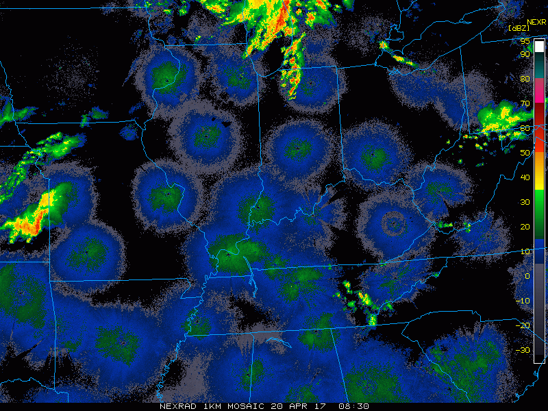
Current Radar:
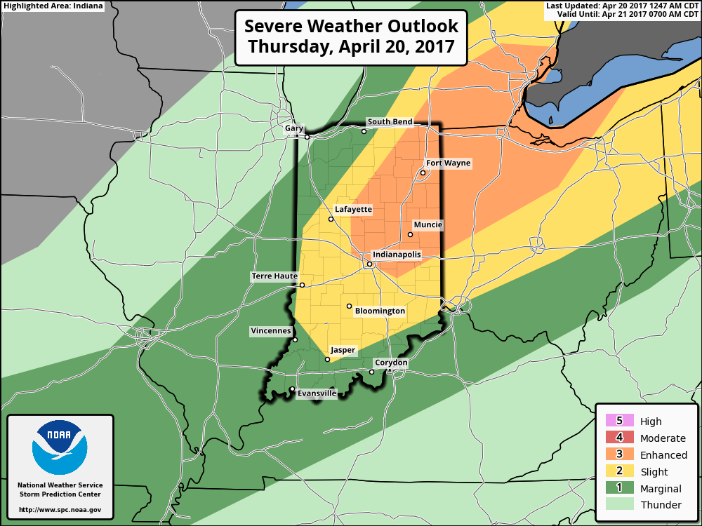
Current risk has been upgraded to an enhanced threat…the main threats will be damaging winds and isolated large hail, but an isolated tornado cannot be totally ruled out although confidence is low with this right now.
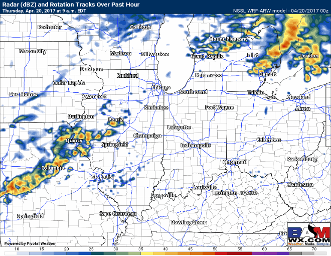
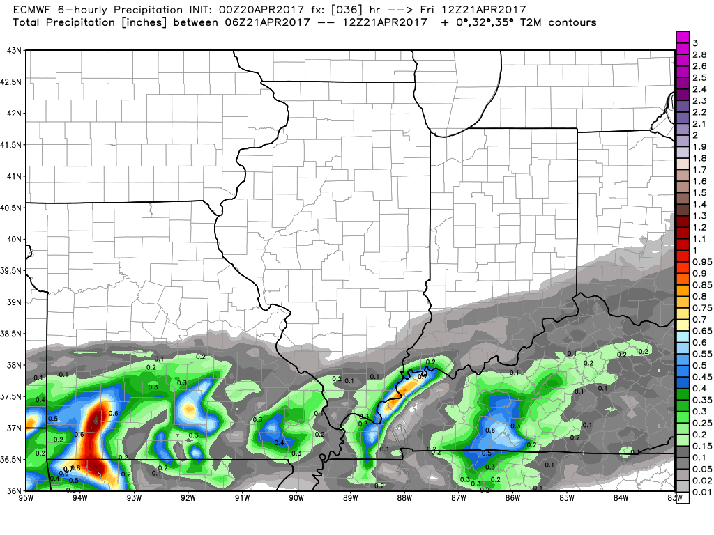
Simulated radar as the cold front advances east today…some scattered showers and storms possible across central IL this morning, the heating of the day starts to get going and by 2-3pm near the IL/IN border things really start to intensify. From ~5pm onward we start to see a little bit more organization pushing east. The main severe storms threat will be ~5-9pm across portions of Indiana, southern Michigan and western Ohio. A watch box is possible later as well if things come together as some of the data suggests.
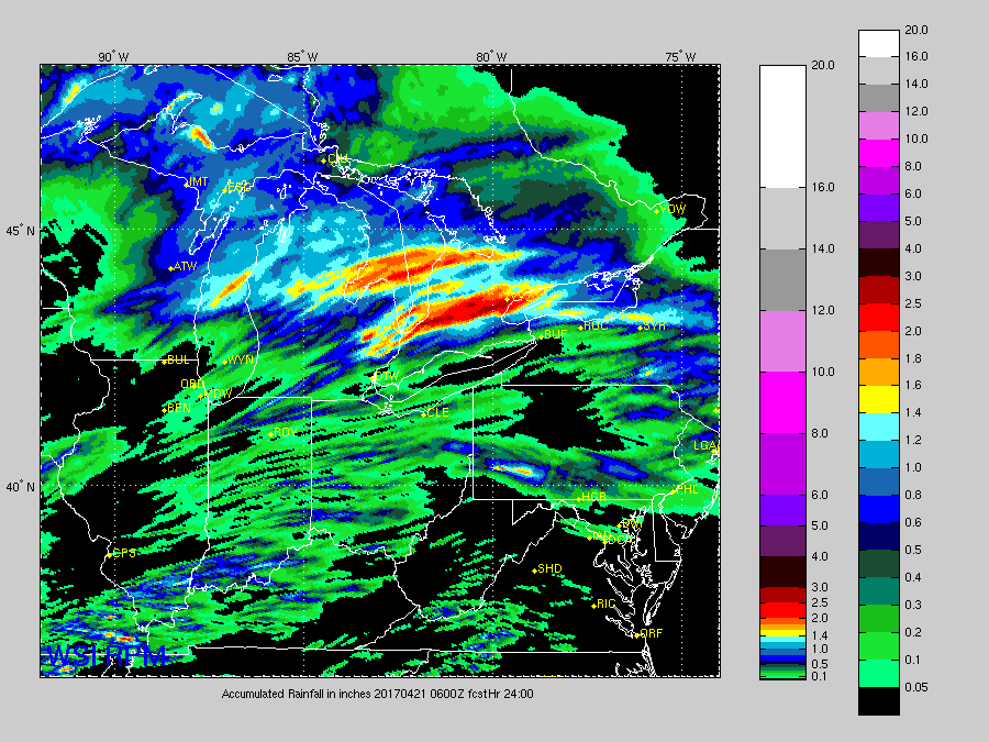
Total rainfall via the RPM model…you can see the void in precipitation further west across portions of Illinois where things will be more disorganized this morning. And the when we see that daytime heating later this afternoon is where the rain picks back up across Indiana further east. Around 0.25-0.5″ is forecasted, however localized higher amounts will be possible if a stronger storm should develop.
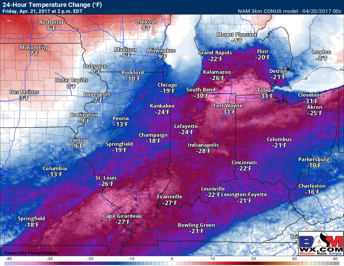
Temperature differences…we will be going from the 70s (even 80s?) to the 50s and lower 60s on Friday as the cold front passes. Some places seeing a difference of over 30ºF!
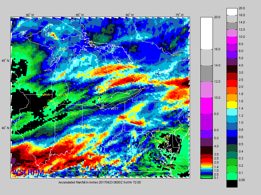
Weekend System via the latest European…we still have a heavy rain maker forecasted to move through the southern Midwest this weekend that could dump over 1.5″+ of rainfall as it moves east later Friday into Sunday morning before pushing weakening. This threat should stay I-70 south for the most part.
Total rain here via the RPM…as mentioned above the heavier rains should mostly stay I-70 south through the weekend, with some locations across southern IL and southern IN, even southwest OH seeing up to ~2.0″+ with isolated higher amounts not out of the question.
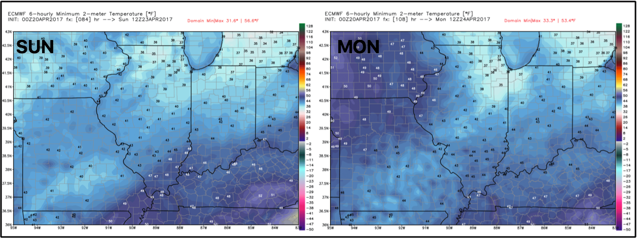
Another story is a couple chilly mornings ahead of us on Sunday and Monday mornings with some folks across the northern half of the Midwest seeing 30s.
Confidence and Risk:
- Above average a cold front tracks through the Midwest today bringing the potential for showers and storms headed east.
- Average risk for strong to severe storms today especially across portions of Indiana, southern Michigan into western Ohio.
- Above average confidence we turn more much cooler tomorrow versus what we will see for high temps today.
- Average confidence on the details of the weekend system moving through, but some heavy rainfall possible across the southern Midwest possible.
- Average risk for some temps dipping into the 30s by Sunday and Monday mornings as well.
Today’s video (7 min):