#ILwx #INwx #OHwx Strong storms possible next 3 days, detailed update here. K.
Synopsis: Good Wednesday afternoon! In today’s video we discuss the very gusty winds through Thursday AM, the strong storm threat tonight into the overnight as well as later on Thursday, even on the day on Friday…so the update is quite packed. If you have any questions please don’t hesitate to reach out to us.
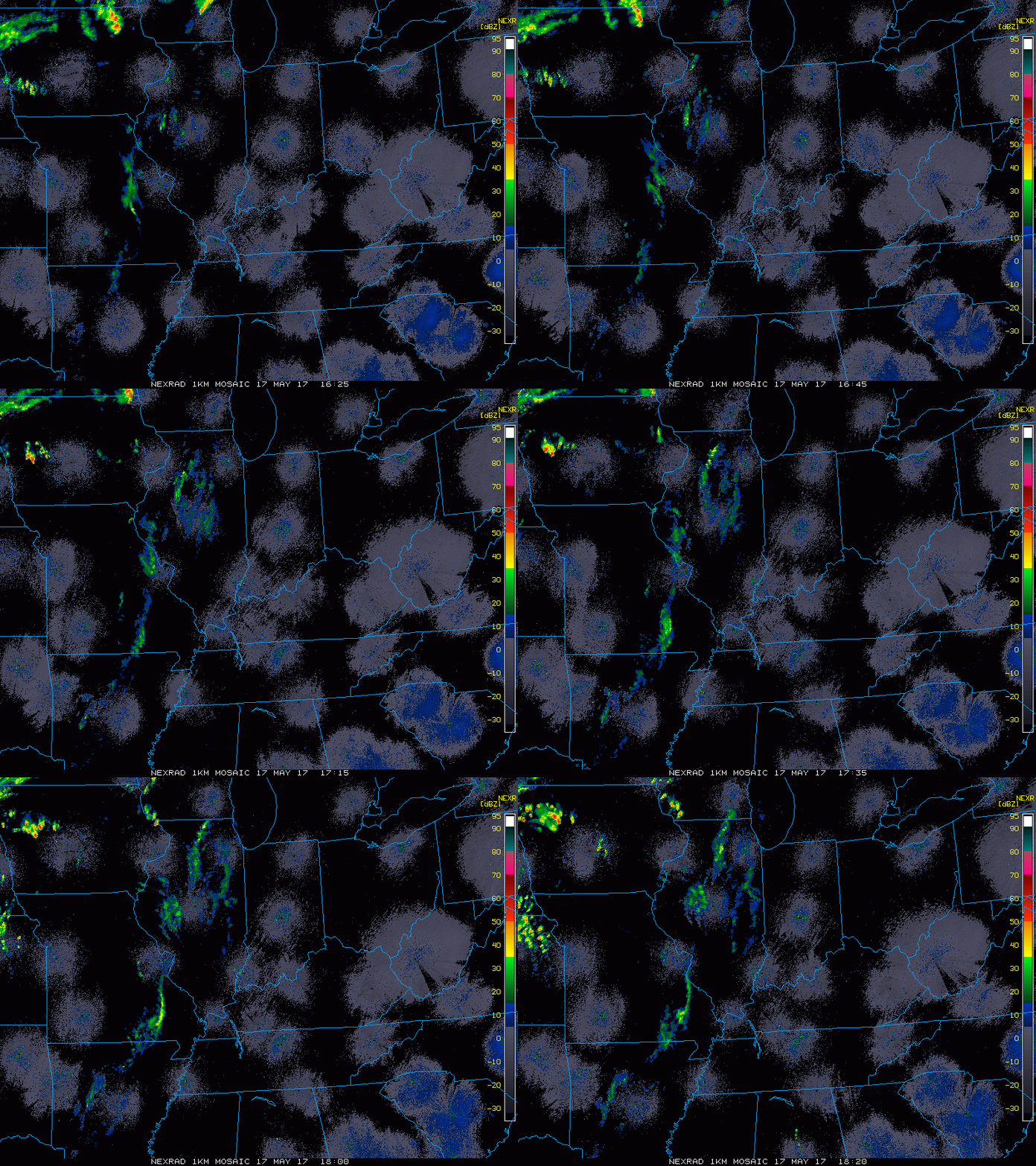
Current Radar:
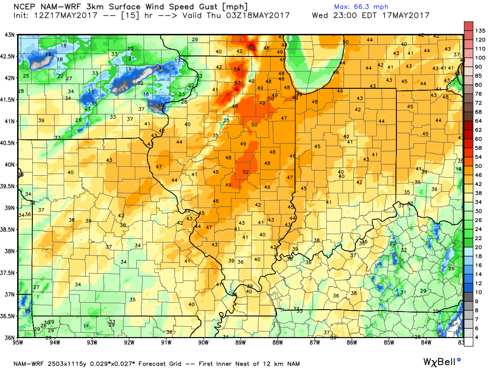
Will continue to be quite windy for the remainder of the day into Thursday morning. We still feel the wind advisory is warranted further east across eastern Indiana and western Ohio.
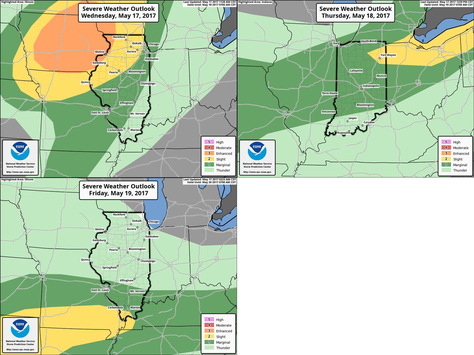
Strong to severe storms risk next 3 days. All modes of severe weather possible across eastern Iowa into northern Illinois tonight including isolated tornadoes; isolated damaging winds and large hail being the main threats Thurs/Fri.
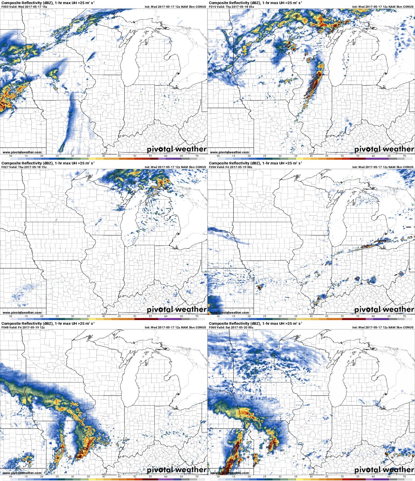
Simulated Radar next 60 hours…everything is timed out in the video. Watching for strong storms across eastern Iowa into northern Illinois tonight ~6-7pm heading east. Waking up to isolated showers across the southern half of the Midwest tomorrow, then storms start to develop along a frontal boundary later Thursday evening that have the potential to be strong as well. Friday, ANOTHER wave moves from west to east that likely has heavy to strong storms moving east…a lot going on here, guys.
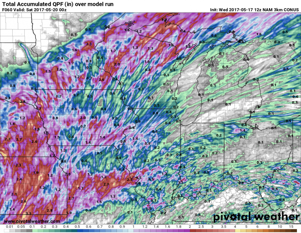
Total rainfall forecast next 2-3 days…some locations may not see a drop of rain, while others will see 1.5″+…all depends on where the strong storms develop.
Confidence and Risk:
- Average risk for severe storms across eastern Iowa into the northern half of Illinois tonight into the overnight.
- Average confidence of scattered showers waking up across the Midwest Thursday, before storms begin to intensify along a frontal boundary later tomorrow evening.
- Above average risk for strong storms on Thursday and Friday.
- Average risk for localized rainfall totals of 1.5″+ higher amounts in the stronger storms over the next 3 days.
Today’s video (6 min):
