Key Points – Wednesday, April 19, 2017:
Synopsis: Good Wednesday morning! We finally have our forecast models coming into somewhat of an agreement this morning. As we go throughout the day ~3-4pm showers and t’storms develop around northern IN and northwest OH, and then the main wave moving through later tonight across eastern Iowa and northern Illinois (watching for severe t’storms). By Thursday the cold front sweeps through bringing t’storms from northwest to southeast and colder temperatures behind it…can’t rule out gusty strong storms here as well. We also discuss a system late week as well as chilly overnight lows ahead. Have a blessed day.
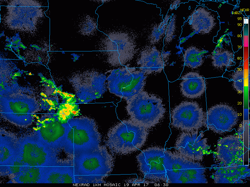
Current radar:
Simulated radar via the HRRR…looking like from 4-5pm through ~2am for storms (including heavy rainfall) across Northern Indiana, southeast Michigan and northern Ohio tonight. Can’t rule out isolated strong storms with localized large hail and gusty winds. Otherwise scattered showers and t’storms forecasted to move west to east across Illinois eastward.
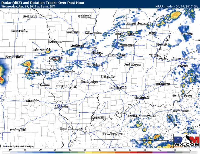
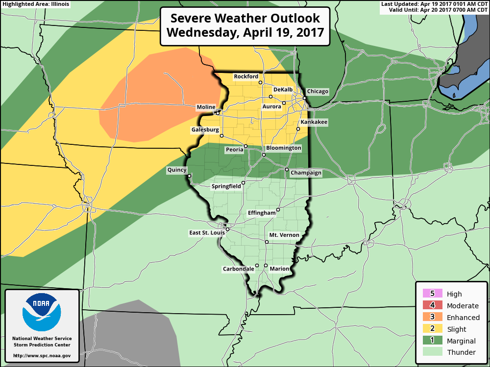
Today’s severe risk including damaging winds, isolated large hail…even a few tornadoes will be possible across eastern Iowa into northern Illinois for the threat later tonight as discussed in the video.
Simulated radar Thursday…we think the line of storms starts to develop by ~2-3pm and slowly pushes east throughout the Midwest.
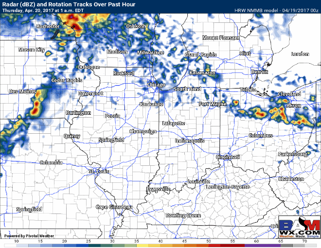
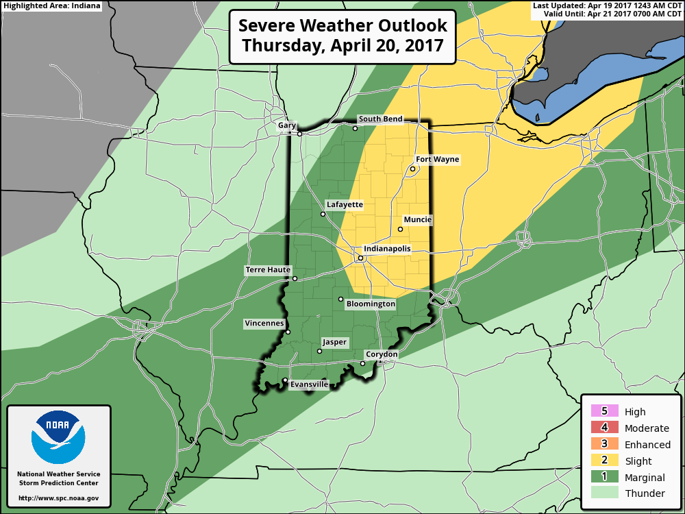
Thursday’s strong storm threat…the main risk being gusty winds and isolated large hail, as well as some localized heavier rainfall…cannot totally rule out an isolated tornado as well.
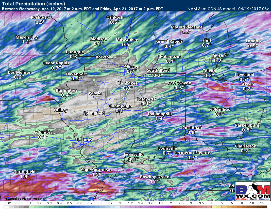
Total precipitation over the next 2 days…you can see some isolated heavy rainfall over 1.0″ will be possible, and then there will be some folks who will be missed by the storms all together.
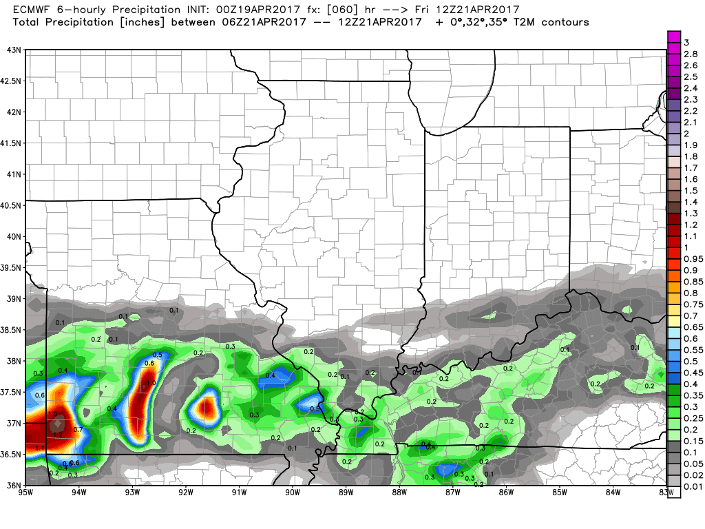
Next system moves through the Midwest Friday through Sunday as a robust low pressure tracks in from west to east. Some heavier rainfall will be possible here especially across the southern Midwest, something we are watching very closely.
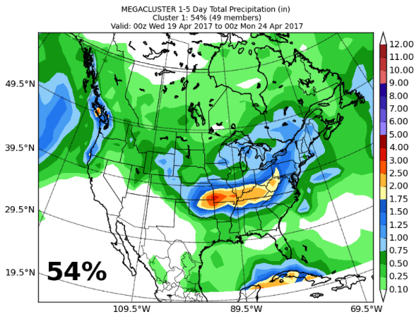
Megacluster 1-5 day precipitation data with a very impressive heavy rainfall signal over the next 5 days, picking up on this weekend system. To have a 2-2.5″ signal with 50 ensemble member supports is something that sets off red flags for us…keep close eyes on this.
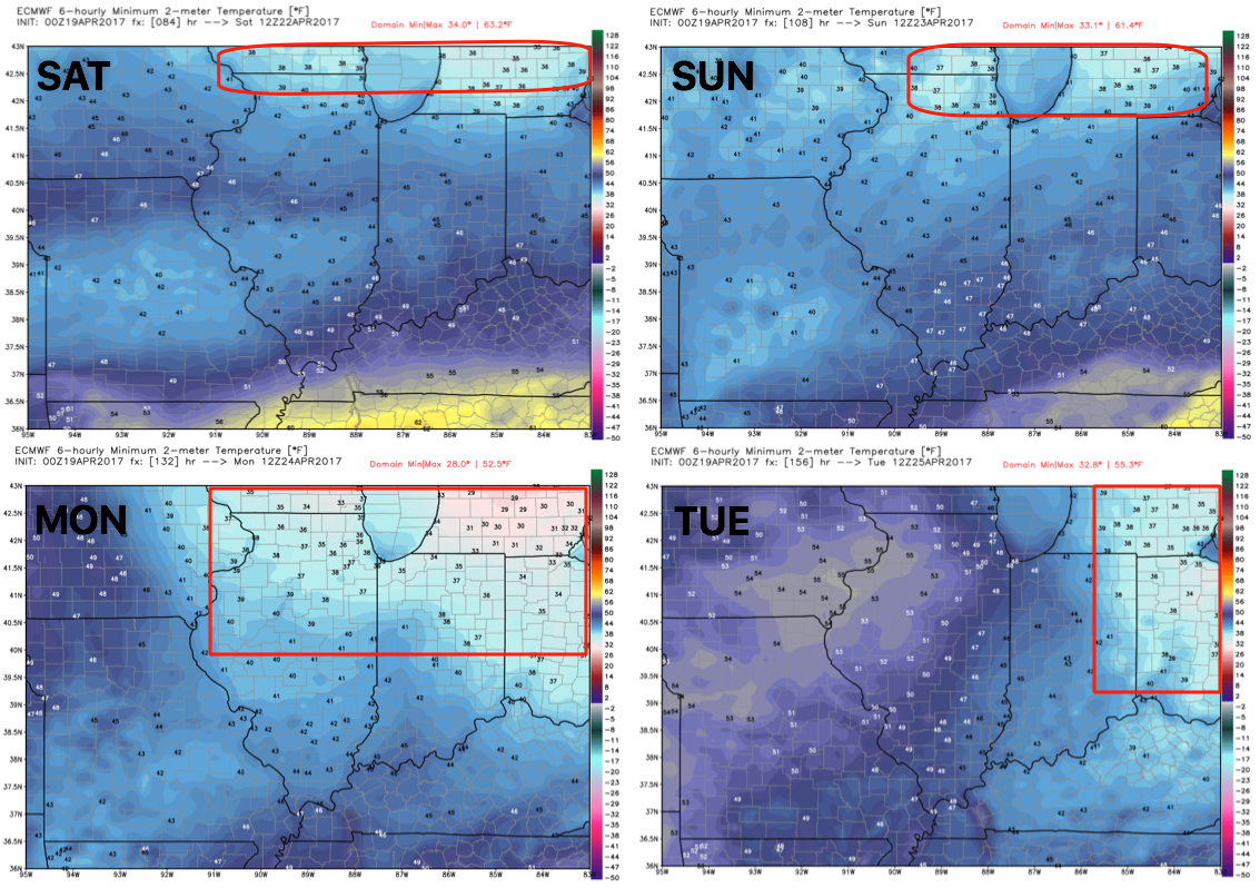
Sat-Tues overnight lows in the upper 30s…can’t rule out patchy frost threats here highlighted in the red below. This is that cool shot we’ve been mentioning…it doesn’t necessarily come in daytime highs, but comes in overnight lows that remain chilly.
Confidence and Risk:
- Above average confidence in the timing of our showers and t’storms moving west to east throughout the day.
- Average risk for some stronger storms today including gusty winds, heavier rainfall and isolated large hail.
- Average confidence a line of showers and storms move through eastern Iowa and to western Illinois late tonight that could bring some severe storms.
- Above average confidence the cold front brings in additional storms across the Midwest on Thursday.
- Average risk for strong storms from Indiana and Ohio on Thursday as well.
- Average confidence in the details of our weekend system…but data continues to suggest some heavier rainfall will be possible especially south.
- Average risk for overnight lows in the 30s this weekend into early next week…watching for patchy frost.
Today’s video (8 min):