Key Points – Tuesday, March 14, 2017:
Synopsis: Good Tuesday morning! A few snow showers linger across our western Zones this morning, with even a handful of lake effect advisories and warnings being issued this morning as well. We stay chilly today with highs in the 20s to 30s and a mix of sun and clouds…wind will be out of the north to northwest at 10-15 mph with gusts up to 25-30mph at times. We discuss the possibility for more lake enhanced snow showers into Wednesday as well as temperatures, and our next chance for rain (even storms?) late week! We also go into more detail on the long-range pattern via the new European Weeklies…with a stormy, active look late month into early April!
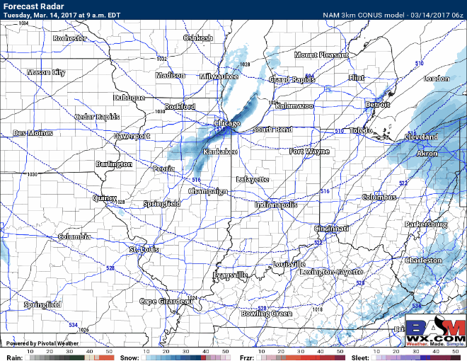
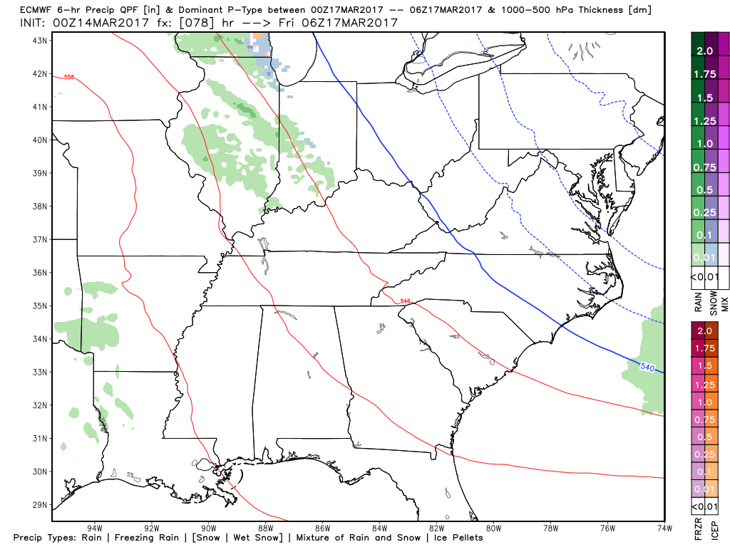
Snow squalls possible today across eastern Illinois into Indiana and western Ohio…these will be isolated in nature but a quick thump of snow and quickly reducing visibility will be possible into tonight.
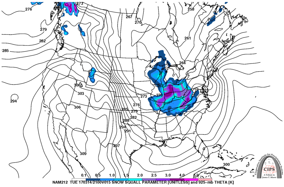
Our CIPS analog snow squall parameter is actually quite high today (the purple colors), which is also an indicator that conditions are more favorable for heavier bursts of snow.
Northern IL locations near Chicago are under a lake effect warning this morning with isolated 4″+ amounts possible, in areas further east where snow squalls do move through I think a quick 1.0″ possible…again, these are isolated, not everyone gets in on these. This could make for a few slick spots overnight as temps get down into the teens again.
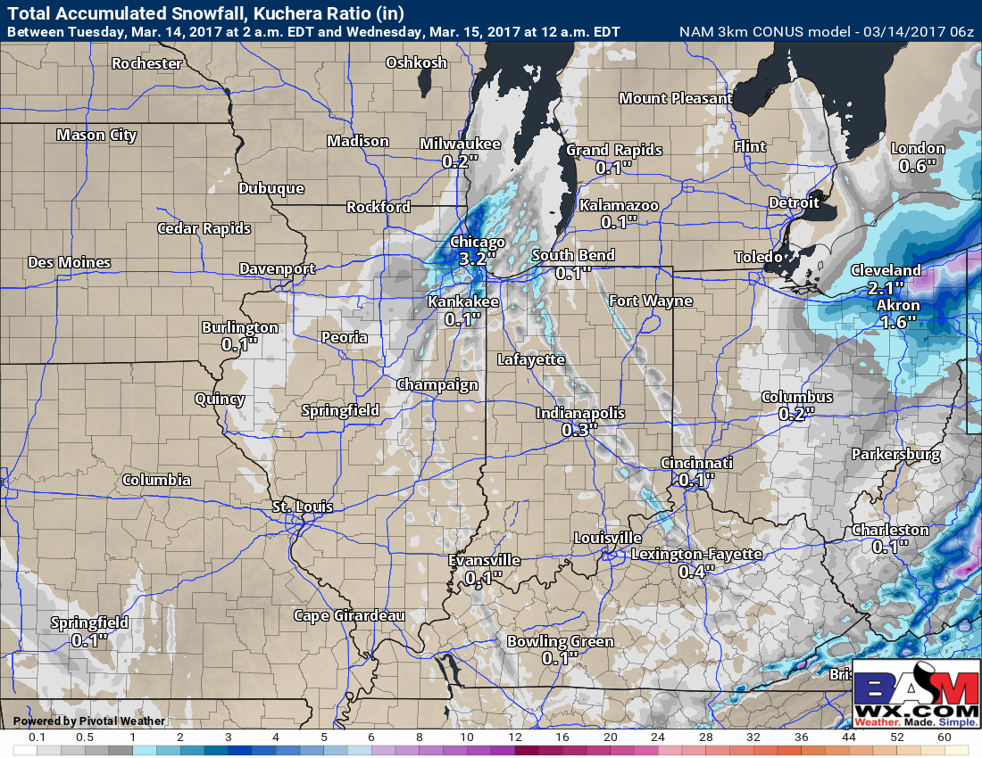
We continue to have residual energy left over across mainly southern Michigan, Indiana and western Ohio on Wednesday…expecting more of the same with some lake effect snow showers to snow squalls…these shift east by the evening and clear out.
Thursday remains fairly quiet across the Midwest with some sunshine expected, it’s really late Thursday night into Friday where we expect our next chance for showers and even a few storms and gusty winds. We also warm back up Friday with highs expected in the 40s and 50s…even a few 60s possible.
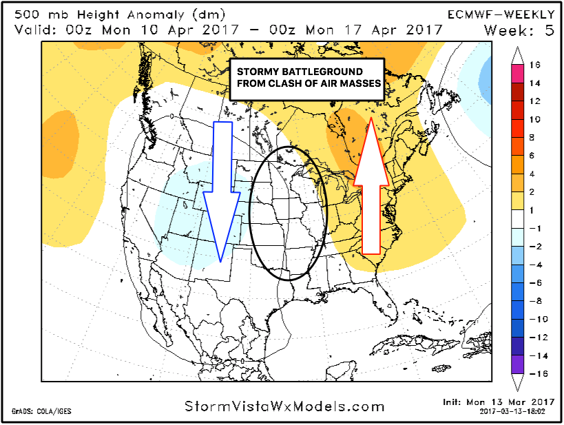
A new set of European weeklies were issued last night looking quite active and stormy later March into early April…wouldn’t be shocked to see an uptick in severe weather during this timeframe as well.
Confidence and Risk:
- Above average confidence snow showers continue across northern IL this morning and shift east into this afternoon…snow squalls possible across Zones 1/2 as well.
- High confidence we get down below freezing again tonight, freeze warnings issued across the southern Midwest.
- Average but increasing confidence of additional snow squalls possible Wednesday mainly across Zones 1/2.
- Above average confidence our next chance for showers and warmer temps comes Friday.
Today’s video (6 min):