Key Points – Monday, March 13, 2017
Synopsis: Good Monday morning! Since there is snow moving through the Midwest already today we wanted to get a post out as soon as possible so you are prepared for the day ahead into Tuesday. Snow showers continue across much of Iowa, Illinois into northwest Indiana and southern Michigan. Temperatures will be key today when discussing precipitation type and accumulations…we encourage you to watch today’s video through until the end.
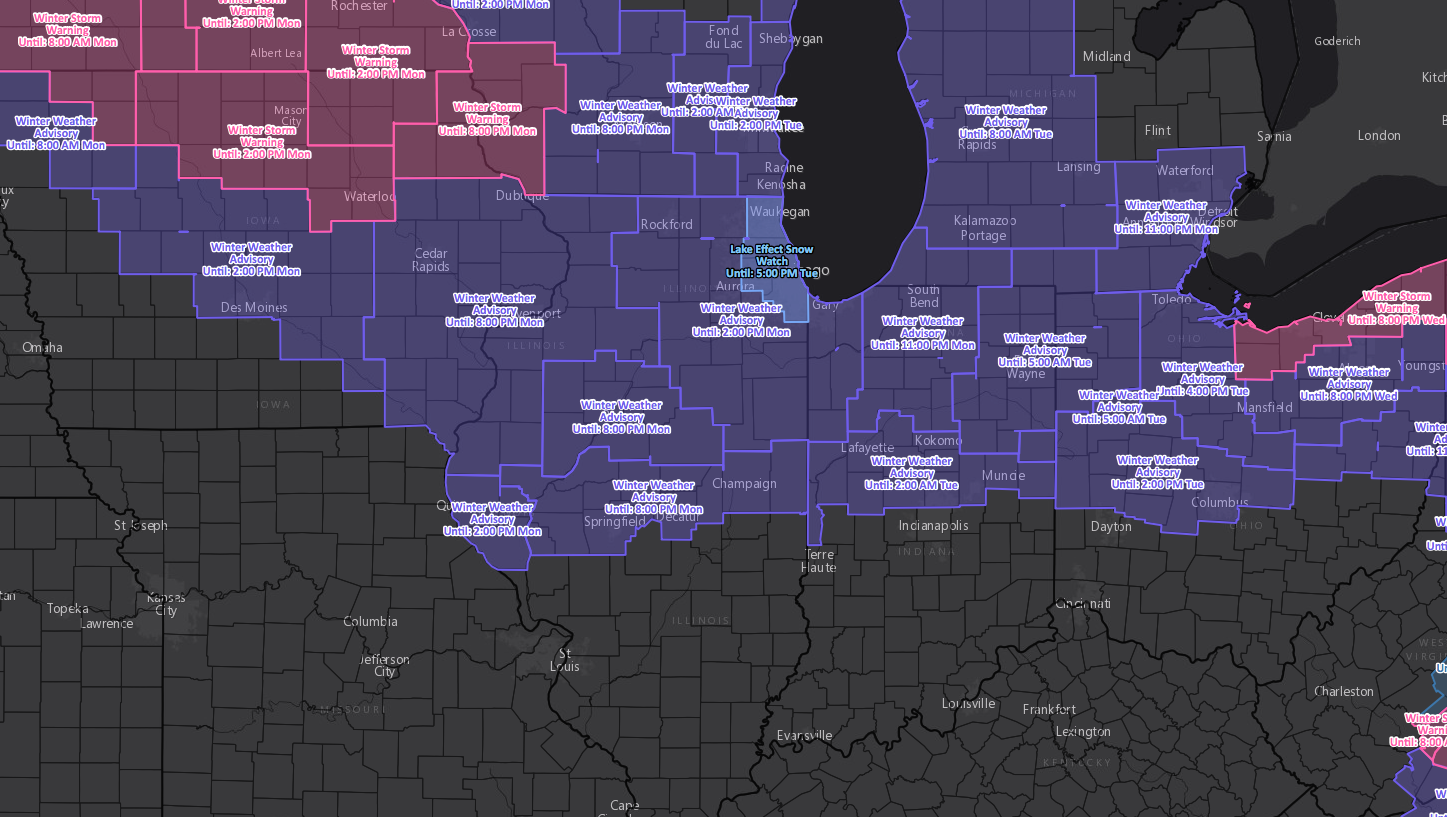
Current Winter Warnings and Advisories this morning:
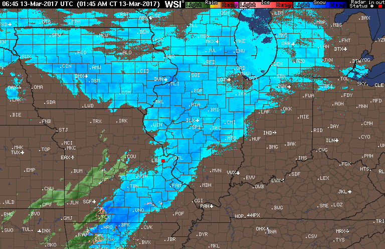
Latest Radar loop early this morning showing snow showers persisting east:
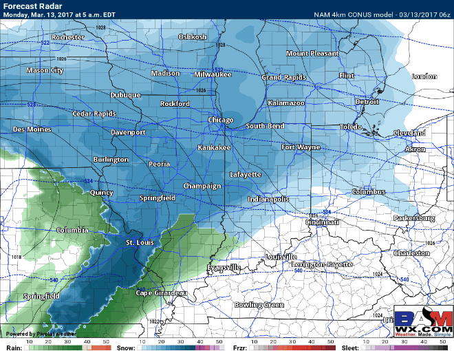
Latest glance and simulated radar of remaining wintry precipitation…everything is timed out in the video, you can see as temperatures warm today some mixing will be possible.
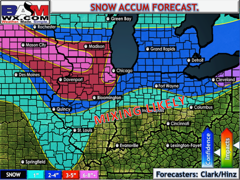
Final snowfall map…the highest totals concentrated across eastern Iowa and northern Illinois. We struggle to get much of any snow across the southern half of the Midwest given how warm it gets.
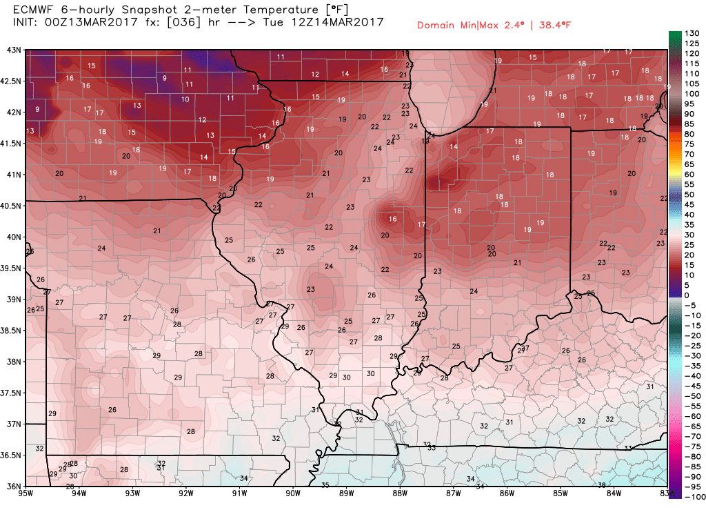
Temps overnight…refreeze possibility continues to increase given lows in the teens to 20s; we recommend keeping an eye on your lots and treating as necessary as slick spots will definitely be possible.
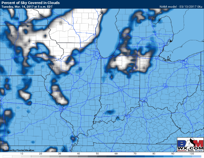
Cloud cover Tuesday loop below…expecting there to be a mix of sunshine and clouds across the Midwest that will allow for things to melt (even though it’s cold) given the angle of the sun this time of year.
Confidence and Risk:
- Above average confidence in the timing of the remaining wintry precipitation throughout the Midwest.
- Above average confidence in a refreeze concern overnight as temps dip down into the teens to 20s.
- Above average confidence we see a mix of sunshine and clouds Tuesday.
Today’s video (7 min):