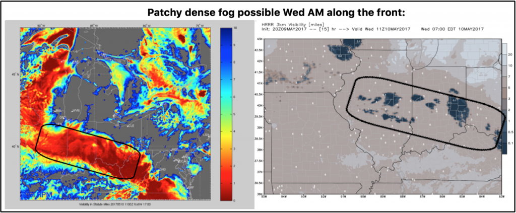
*Edit to original post…added mention for potential patchy dense fog along the warm front Wednesday morning.
#ILwx #INwx #OHwx Short-term: Sneaky storms overnight? More heavy rains next 2 days? K.
Synopsis: Good Tuesday afternoon! Today we discuss updated data regarding potential scattered showers and storms tonight and overnight along a warm front across the Midwest and the remaining rainfall (some heavy) through late week. Have a great day!
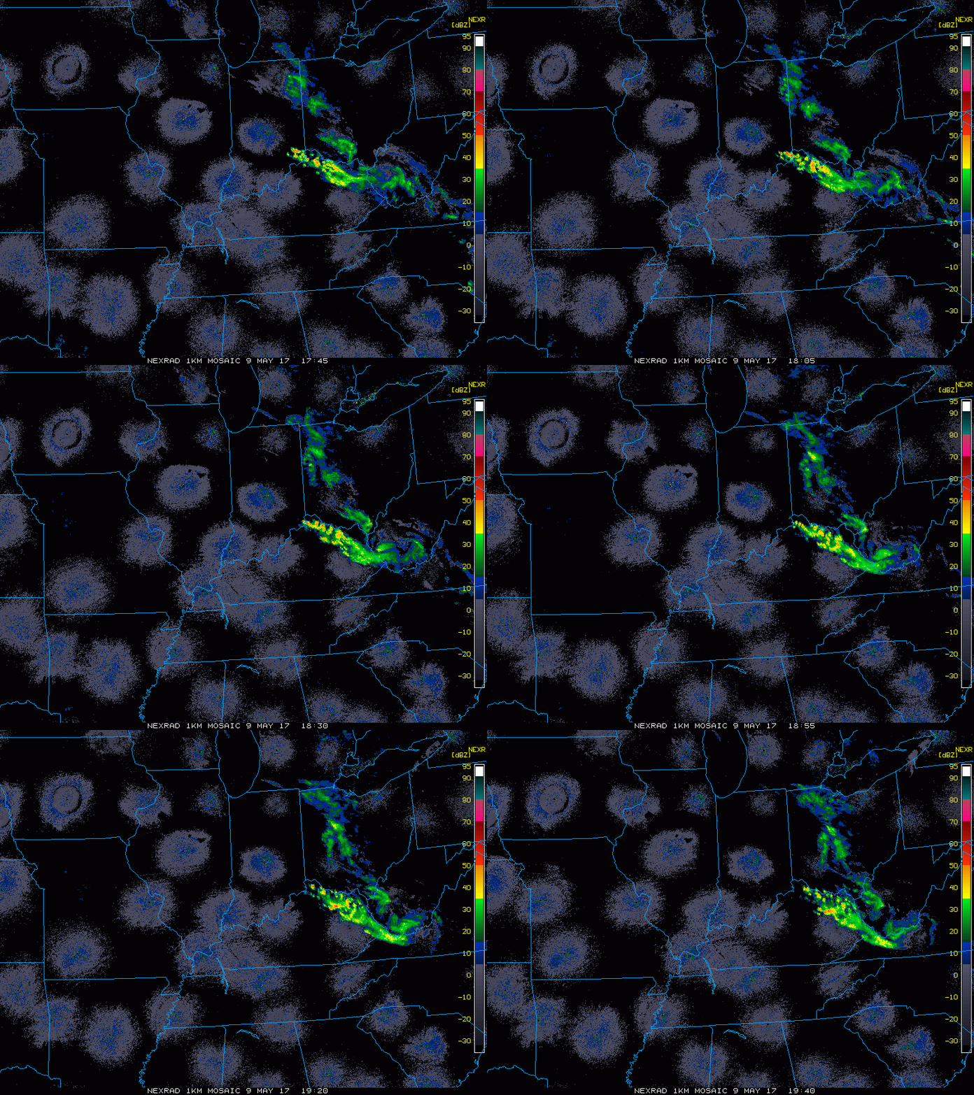
Current Radar…not much going on right now across the Midwest, but we are keeping an eye the warm front tonight for shower/storm initiation.
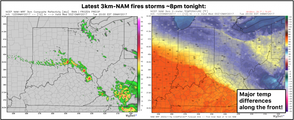
Based on the latest 3km-NAM data we are watching for around 7-8pm tonight for some potential shower and storm activity near the warm front as seen below…can’t rule out a localized heavy downpour.
***As mentioned above we wanted to add the mention for some patchy dense fog Wednesday AM along the warm front as some calm winds and a surface inversion looks possible.
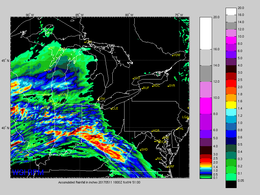
In the video we time out additional scattered showers and storms Wednesday into Thursday as well…the latest RPM puts down a pretty wide swath of 1-2″ rainfall totals with localized higher amounts from eastern Iowa through Illinois, Indiana into western Ohio. Not everyone will get in on the heavier rainfall, but where those heavy storms form there’s greater potential for bigger rains.
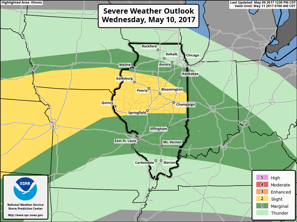
We will be watching for some strong storms Wednesday into Thursday as well across the Midwest mainly in the form of isolated damaging winds/large hail and localized flash flooding.
Confidence and Risk:
- Average risk showers and storms firing along the warm front tonight, as we do have some data that isn’t too excited about much forming.
- Average risk for some patchy dense fog along the warm front Wednesday AM
- Above average confidence we see additional showers and storms Wednesday into Thursday across the Midwest.
- Average risk for localized heavy rainfall and strong storms here as well.
Today’s video (5 min):
